Lineville is a city in Wayne County, Iowa, United States. The population was 195 at the time of the 2020 census.
| Name: | Lineville city |
|---|---|
| LSAD Code: | 25 |
| LSAD Description: | city (suffix) |
| State: | Iowa |
| County: | Wayne County |
| Elevation: | 1,089 ft (332 m) |
| Total Area: | 0.90 sq mi (2.33 km²) |
| Land Area: | 0.90 sq mi (2.33 km²) |
| Water Area: | 0.00 sq mi (0.00 km²) |
| Total Population: | 195 |
| Population Density: | 216.43/sq mi (83.59/km²) |
| ZIP code: | 50147 |
| Area code: | 641 |
| FIPS code: | 1945435 |
| GNISfeature ID: | 2395718 |
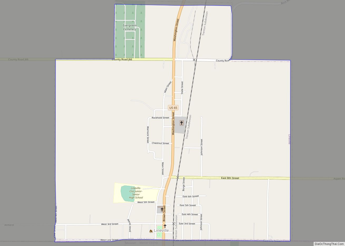
Online Interactive Map
Click on ![]() to view map in "full screen" mode.
to view map in "full screen" mode.
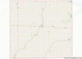
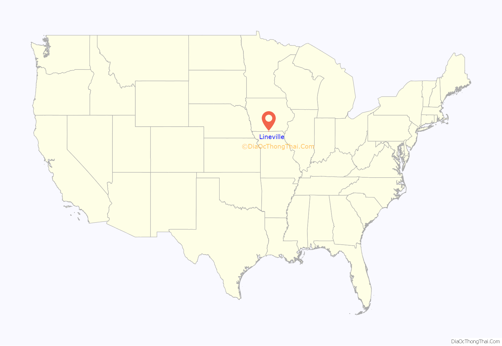
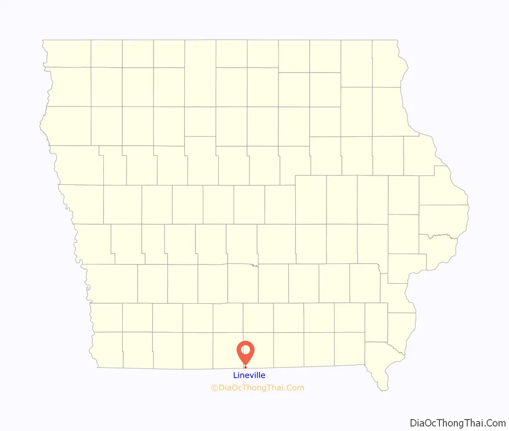
Lineville location map. Where is Lineville city?
History
Lineville has been called the oldest town in Wayne County, but was not noted on early maps or in the 1850 state line survey, and probably attracted settlers from a nearby short-lived community called Grand River after the state line dispute was settled. Lineville was platted in 1858.
Because part of the town is in Missouri and part in Iowa, it was named Lineville. The town square sits on the Iowa–Missouri border with the business on the south side of the square in South Lineville, Missouri. When Wayne County was dry, liquor by the drink could be purchased at the bars on the Missouri side of the square.
During the 1968 Illinois earthquake, the quake was felt as a long shaking in Lineville. The quake damaged the town’s water tower which began to leak 300 gallons of water an hour.
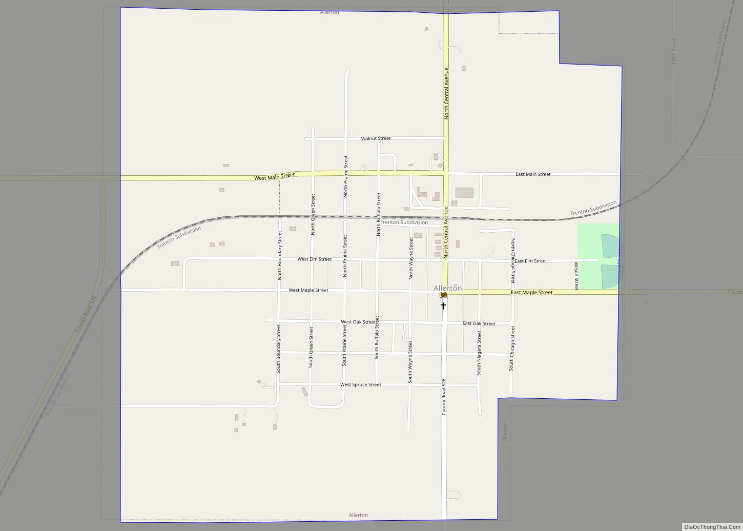
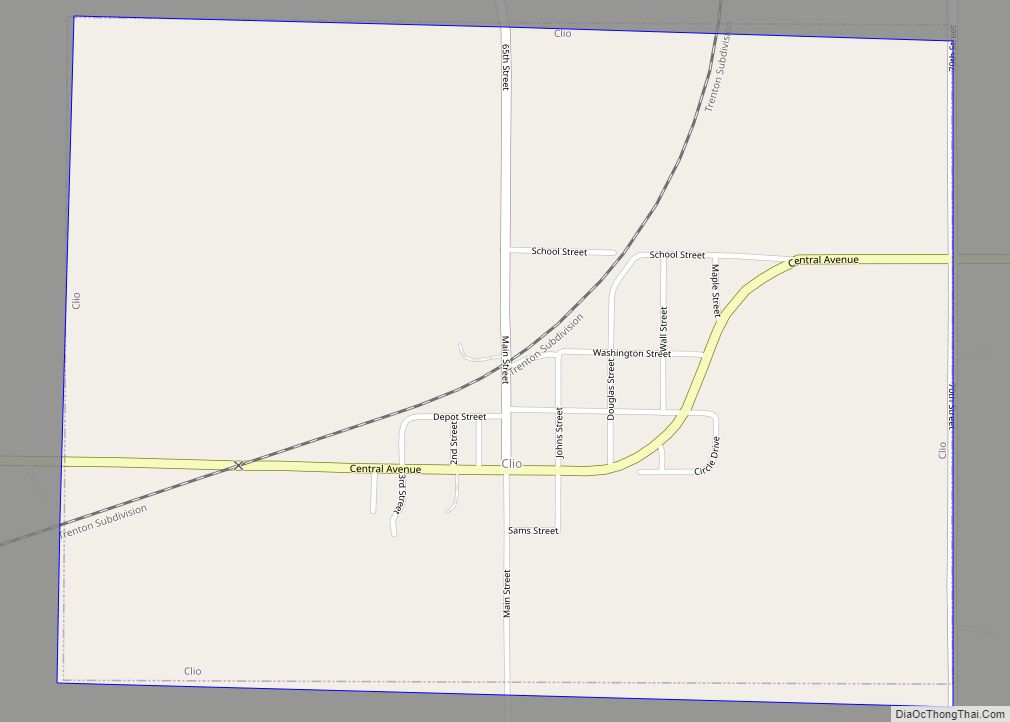
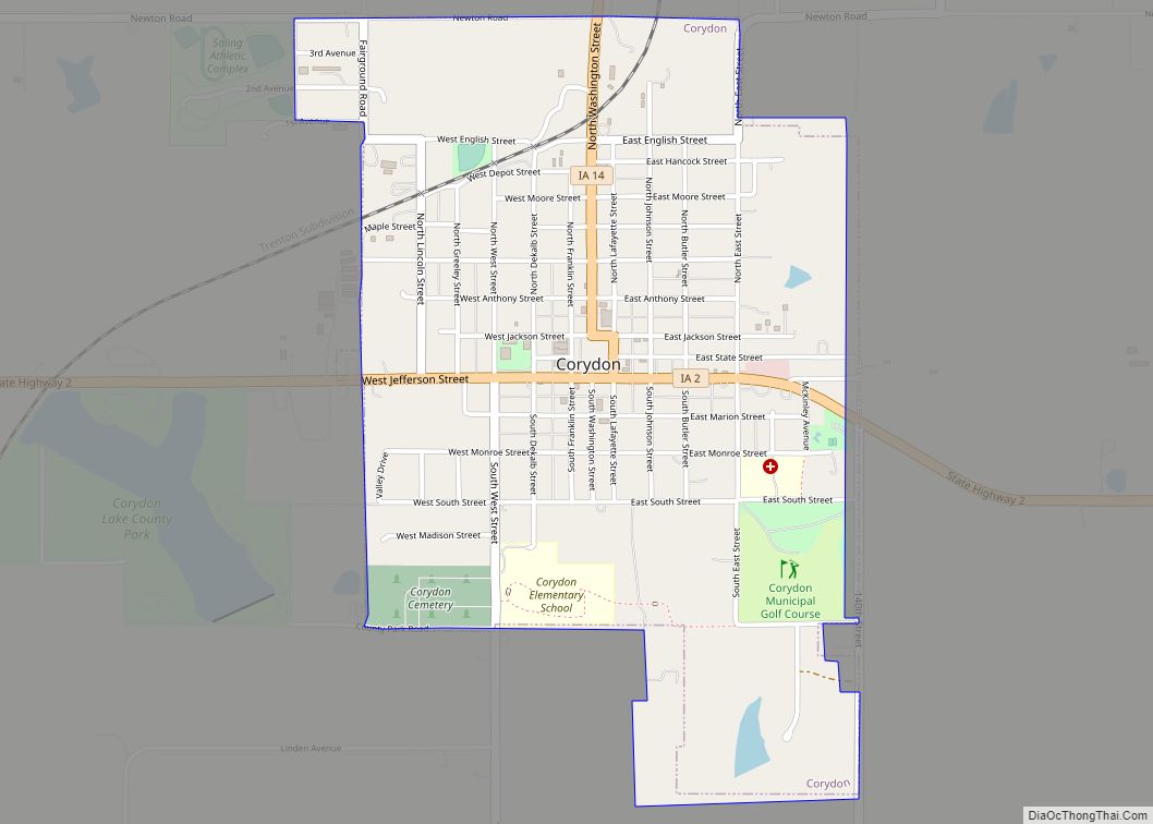
Lineville used to be part of ACL Community Schools for the three namesake towns of Allerton, Clio and Lineville until 1966 when Allerton voted to join with Cambria-Corydon Community Schools to form Wayne Community Schools. Lineville and Clio then formed Lineville–Clio which survived until 2010. All classes were held in Lineville. It was one of the smallest school districts in the state of Iowa. In 2010, the State of Iowa ordered Lineville–Clio closed as its small size and tax base made it impossible to meet State of Iowa educational standards. Lineville–Clio has since merged with Wayne Community Schools with all classes being held in Corydon (22 road miles away).
Lineville Road Map
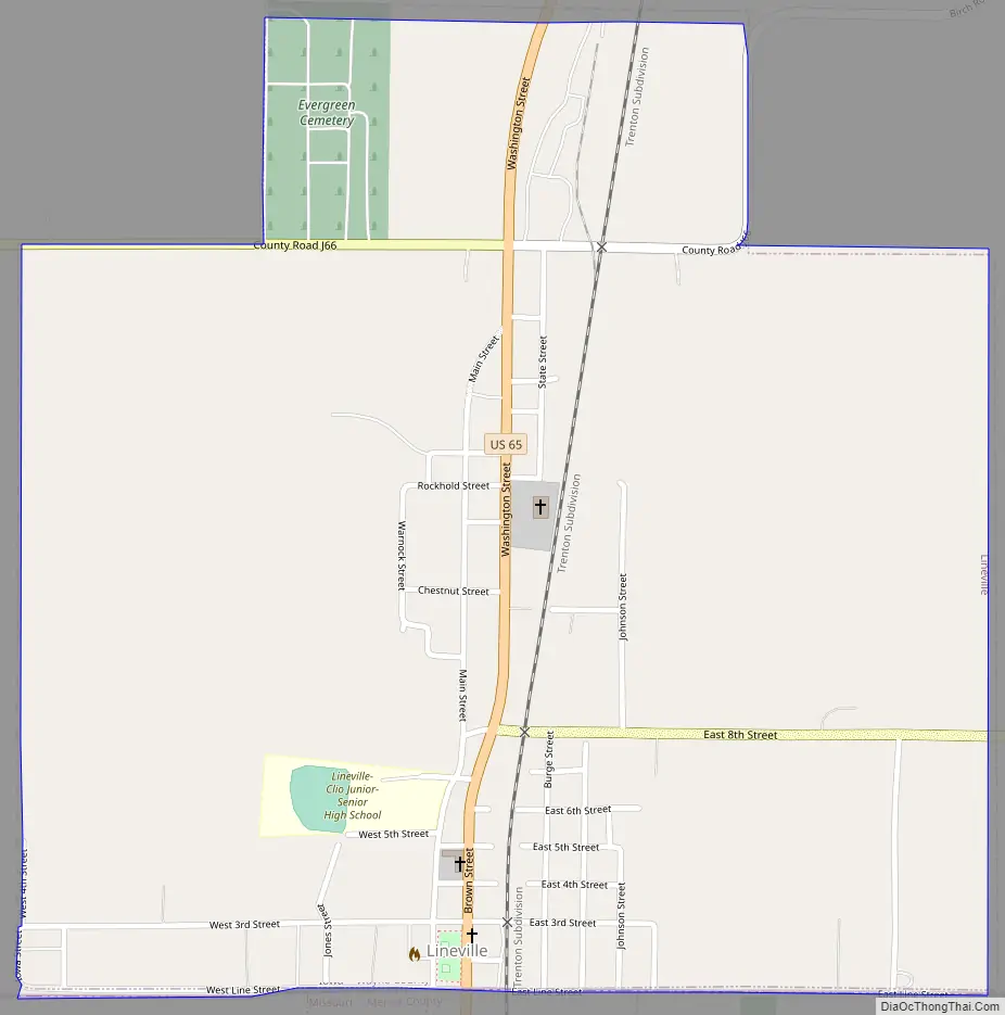
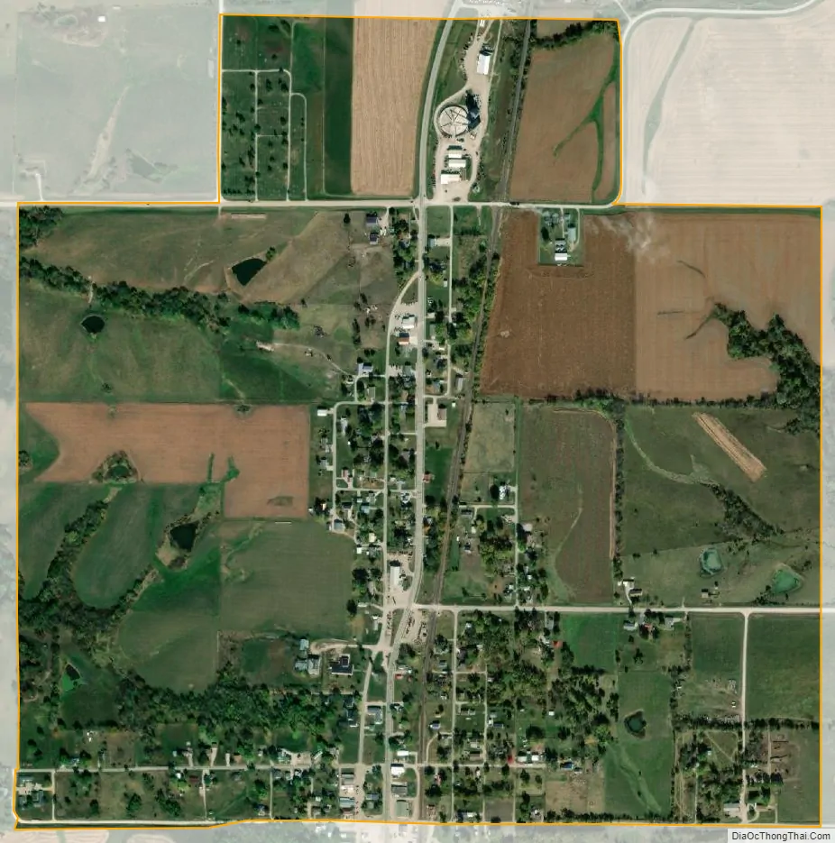
Lineville city Satellite Map
Geography
According to the United States Census Bureau, the city has a total area of 0.90 square miles (2.33 km), all land.
See also
Map of Iowa State and its subdivision:- Adair
- Adams
- Allamakee
- Appanoose
- Audubon
- Benton
- Black Hawk
- Boone
- Bremer
- Buchanan
- Buena Vista
- Butler
- Calhoun
- Carroll
- Cass
- Cedar
- Cerro Gordo
- Cherokee
- Chickasaw
- Clarke
- Clay
- Clayton
- Clinton
- Crawford
- Dallas
- Davis
- Decatur
- Delaware
- Des Moines
- Dickinson
- Dubuque
- Emmet
- Fayette
- Floyd
- Franklin
- Fremont
- Greene
- Grundy
- Guthrie
- Hamilton
- Hancock
- Hardin
- Harrison
- Henry
- Howard
- Humboldt
- Ida
- Iowa
- Jackson
- Jasper
- Jefferson
- Johnson
- Jones
- Keokuk
- Kossuth
- Lee
- Linn
- Louisa
- Lucas
- Lyon
- Madison
- Mahaska
- Marion
- Marshall
- Mills
- Mitchell
- Monona
- Monroe
- Montgomery
- Muscatine
- O'Brien
- Osceola
- Page
- Palo Alto
- Plymouth
- Pocahontas
- Polk
- Pottawattamie
- Poweshiek
- Ringgold
- Sac
- Scott
- Shelby
- Sioux
- Story
- Tama
- Taylor
- Union
- Van Buren
- Wapello
- Warren
- Washington
- Wayne
- Webster
- Winnebago
- Winneshiek
- Woodbury
- Worth
- Wright
- Alabama
- Alaska
- Arizona
- Arkansas
- California
- Colorado
- Connecticut
- Delaware
- District of Columbia
- Florida
- Georgia
- Hawaii
- Idaho
- Illinois
- Indiana
- Iowa
- Kansas
- Kentucky
- Louisiana
- Maine
- Maryland
- Massachusetts
- Michigan
- Minnesota
- Mississippi
- Missouri
- Montana
- Nebraska
- Nevada
- New Hampshire
- New Jersey
- New Mexico
- New York
- North Carolina
- North Dakota
- Ohio
- Oklahoma
- Oregon
- Pennsylvania
- Rhode Island
- South Carolina
- South Dakota
- Tennessee
- Texas
- Utah
- Vermont
- Virginia
- Washington
- West Virginia
- Wisconsin
- Wyoming