Lone Rock is a city in Kossuth County, Iowa, United States. The population was 146 at the time of the 2020 census. The city is named after a large boulder.
Lone Rock calls itself “The Neatest Little Town in Iowa.”
| Name: | Lone Rock city |
|---|---|
| LSAD Code: | 25 |
| LSAD Description: | city (suffix) |
| State: | Iowa |
| County: | Kossuth County |
| Elevation: | 1,201 ft (366 m) |
| Total Area: | 0.12 sq mi (0.30 km²) |
| Land Area: | 0.12 sq mi (0.30 km²) |
| Water Area: | 0.00 sq mi (0.00 km²) |
| Total Population: | 146 |
| Population Density: | 1,258.62/sq mi (487.18/km²) |
| ZIP code: | 50559 |
| Area code: | 515 |
| FIPS code: | 1946290 |
| GNISfeature ID: | 0458574 |
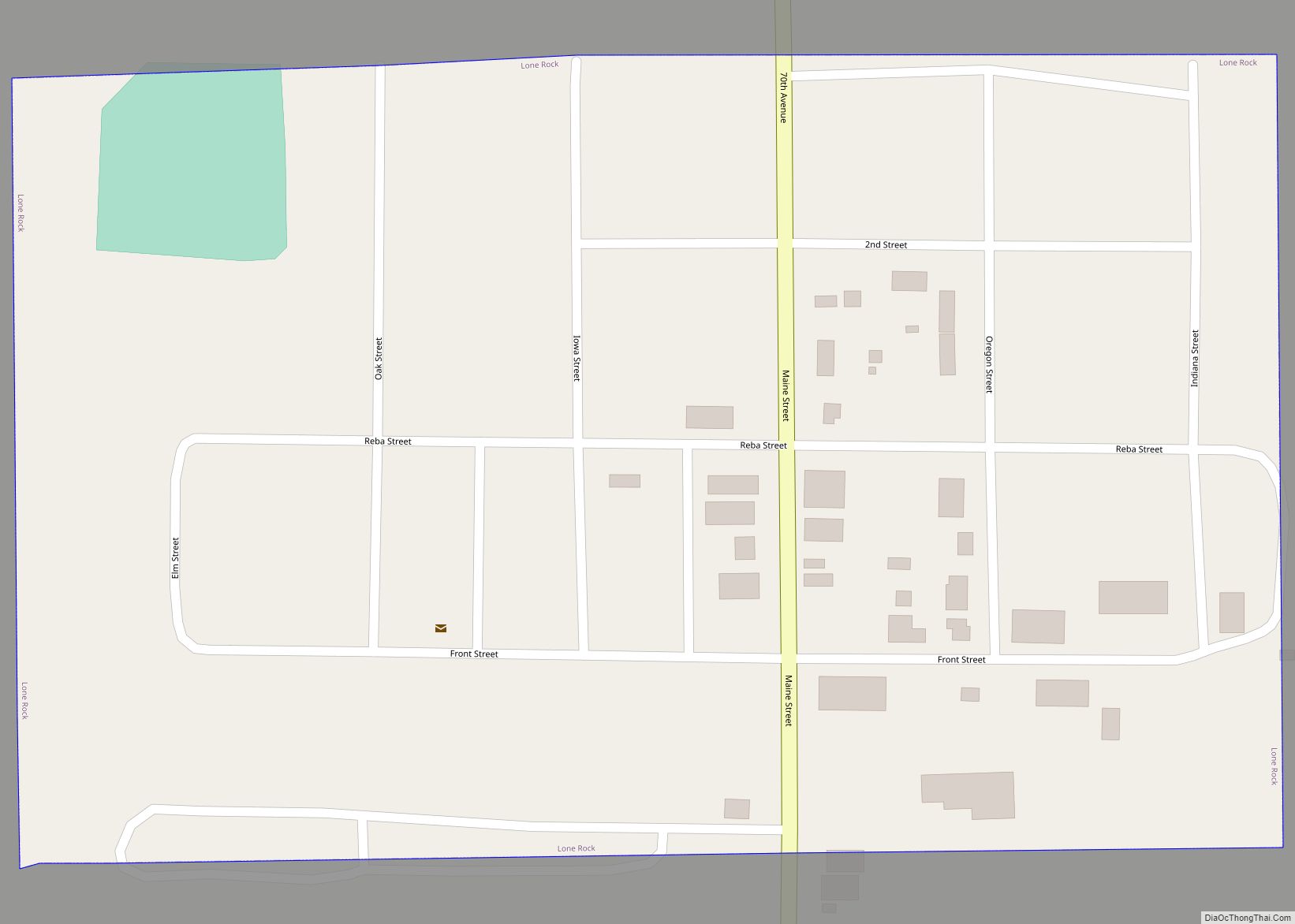
Online Interactive Map
Click on ![]() to view map in "full screen" mode.
to view map in "full screen" mode.
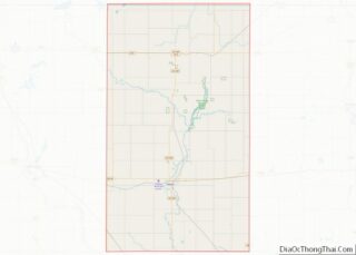
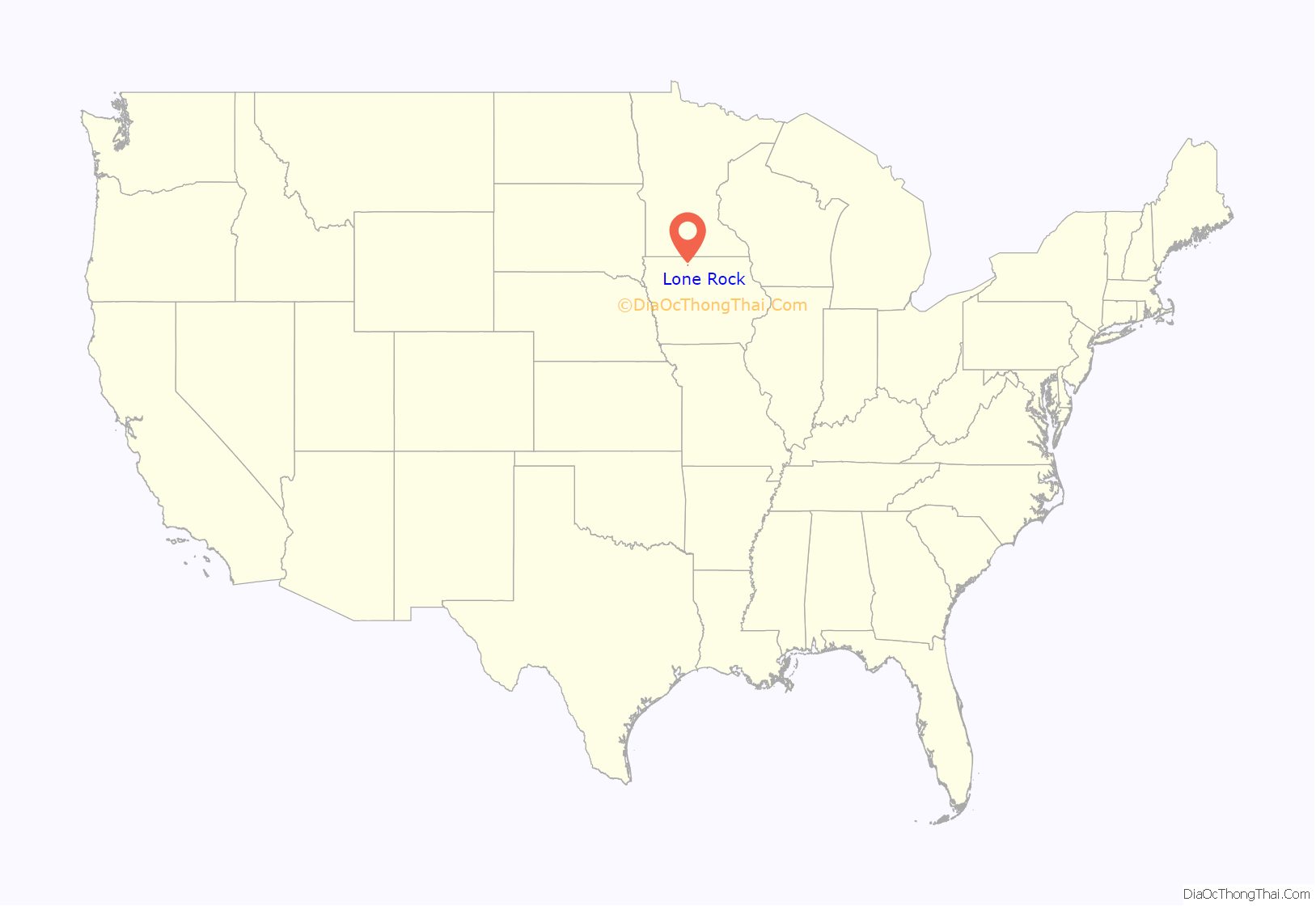
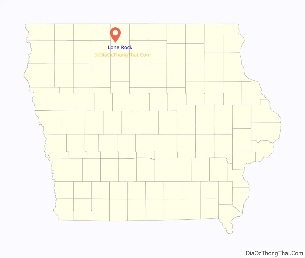
Lone Rock location map. Where is Lone Rock city?
History
Long before any settlement took place here, the unusual (175 ton) boulder was used as a landmark for travelers. Lone Rock was platted in 1899 when the railroad was being built through the neighborhood. In 1970, the lone rock was moved to the new location by blasting it into four pieces and reconstructing the pieces inside the community.
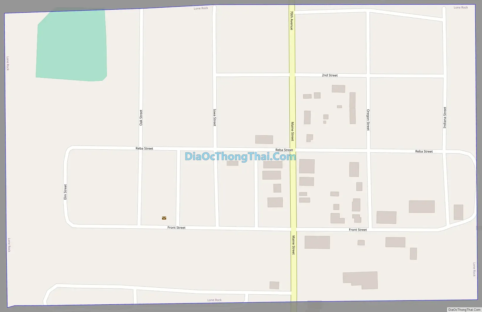
Lone Rock Road Map
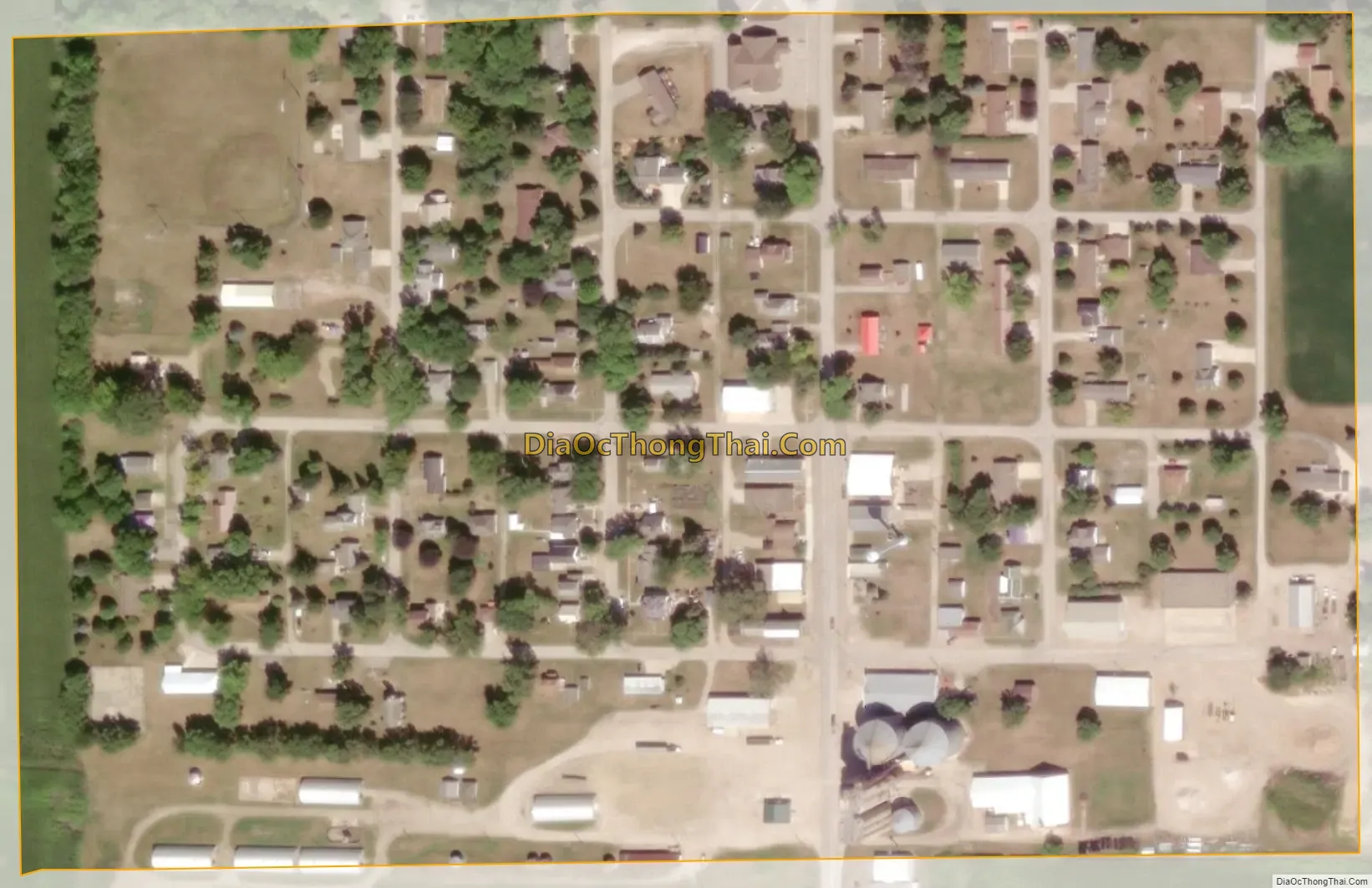
Lone Rock city Satellite Map
Geography
Lone Rock is located at 43°13′17″N 94°19′30″W / 43.22139°N 94.32500°W / 43.22139; -94.32500 (43.221359, -94.325090).
According to the United States Census Bureau, the city has a total area of 0.12 square miles (0.31 km), all land.
Lone Rock is north of Iowa Highway B19 and west of U.S. Route 169.
See also
Map of Iowa State and its subdivision:- Adair
- Adams
- Allamakee
- Appanoose
- Audubon
- Benton
- Black Hawk
- Boone
- Bremer
- Buchanan
- Buena Vista
- Butler
- Calhoun
- Carroll
- Cass
- Cedar
- Cerro Gordo
- Cherokee
- Chickasaw
- Clarke
- Clay
- Clayton
- Clinton
- Crawford
- Dallas
- Davis
- Decatur
- Delaware
- Des Moines
- Dickinson
- Dubuque
- Emmet
- Fayette
- Floyd
- Franklin
- Fremont
- Greene
- Grundy
- Guthrie
- Hamilton
- Hancock
- Hardin
- Harrison
- Henry
- Howard
- Humboldt
- Ida
- Iowa
- Jackson
- Jasper
- Jefferson
- Johnson
- Jones
- Keokuk
- Kossuth
- Lee
- Linn
- Louisa
- Lucas
- Lyon
- Madison
- Mahaska
- Marion
- Marshall
- Mills
- Mitchell
- Monona
- Monroe
- Montgomery
- Muscatine
- O'Brien
- Osceola
- Page
- Palo Alto
- Plymouth
- Pocahontas
- Polk
- Pottawattamie
- Poweshiek
- Ringgold
- Sac
- Scott
- Shelby
- Sioux
- Story
- Tama
- Taylor
- Union
- Van Buren
- Wapello
- Warren
- Washington
- Wayne
- Webster
- Winnebago
- Winneshiek
- Woodbury
- Worth
- Wright
- Alabama
- Alaska
- Arizona
- Arkansas
- California
- Colorado
- Connecticut
- Delaware
- District of Columbia
- Florida
- Georgia
- Hawaii
- Idaho
- Illinois
- Indiana
- Iowa
- Kansas
- Kentucky
- Louisiana
- Maine
- Maryland
- Massachusetts
- Michigan
- Minnesota
- Mississippi
- Missouri
- Montana
- Nebraska
- Nevada
- New Hampshire
- New Jersey
- New Mexico
- New York
- North Carolina
- North Dakota
- Ohio
- Oklahoma
- Oregon
- Pennsylvania
- Rhode Island
- South Carolina
- South Dakota
- Tennessee
- Texas
- Utah
- Vermont
- Virginia
- Washington
- West Virginia
- Wisconsin
- Wyoming