Luther is a city in Worth Township, Boone County, Iowa, United States. The population was 152 at the time of the 2020 census. It is part of the Boone, Iowa Micropolitan Statistical Area, which is a part of the larger Ames-Boone, Iowa Combined Statistical Area.
| Name: | Luther city |
|---|---|
| LSAD Code: | 25 |
| LSAD Description: | city (suffix) |
| State: | Iowa |
| County: | Boone County |
| Elevation: | 1,093 ft (333 m) |
| Total Area: | 0.59 sq mi (1.52 km²) |
| Land Area: | 0.59 sq mi (1.52 km²) |
| Water Area: | 0.00 sq mi (0.00 km²) |
| Total Population: | 152 |
| Population Density: | 258.50/sq mi (99.87/km²) |
| ZIP code: | 50152 |
| Area code: | 515 |
| FIPS code: | 1947280 |
| GNISfeature ID: | 0458684 |
| Website: | www.cityofluther.org |
Online Interactive Map
Click on ![]() to view map in "full screen" mode.
to view map in "full screen" mode.
Luther location map. Where is Luther city?


History
A post office has been in operation at Luther since 1883. Luther was laid out as a town in 1893. The community was named after Clark Luther, a local merchant.
On September 11, 2014, the Luther City Council accepted a petition from 58 residents asking that the city be discontinued. There are several steps in the discontinuation process, including approval or disapproval of the petition by the City Development Board. If the Board approves, a public referendum on discontinuation could be held in 2015. The discontinuance failed and the city continues to exist today. Since 2015 several new businesses have sprung up as well as a major expansion by the local co-op.
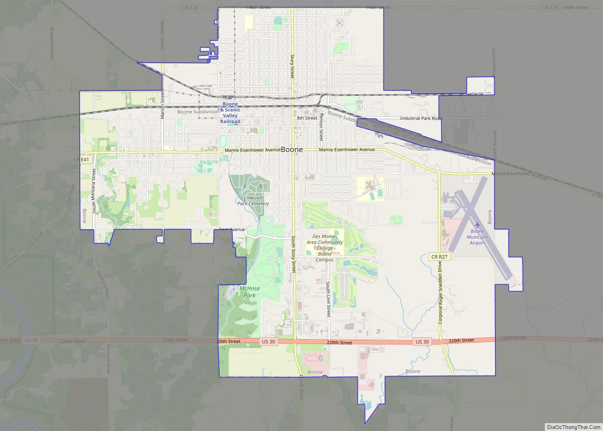
Luther Road Map

Luther city Satellite Map

Geography
Luther is located at 41°58′2″N 93°49′7″W / 41.96722°N 93.81861°W / 41.96722; -93.81861 (41.967125, -93.818747).
According to the United States Census Bureau, the city has a total area of 0.78 square miles (2.02 km), all land.
See also
Map of Iowa State and its subdivision:- Adair
- Adams
- Allamakee
- Appanoose
- Audubon
- Benton
- Black Hawk
- Boone
- Bremer
- Buchanan
- Buena Vista
- Butler
- Calhoun
- Carroll
- Cass
- Cedar
- Cerro Gordo
- Cherokee
- Chickasaw
- Clarke
- Clay
- Clayton
- Clinton
- Crawford
- Dallas
- Davis
- Decatur
- Delaware
- Des Moines
- Dickinson
- Dubuque
- Emmet
- Fayette
- Floyd
- Franklin
- Fremont
- Greene
- Grundy
- Guthrie
- Hamilton
- Hancock
- Hardin
- Harrison
- Henry
- Howard
- Humboldt
- Ida
- Iowa
- Jackson
- Jasper
- Jefferson
- Johnson
- Jones
- Keokuk
- Kossuth
- Lee
- Linn
- Louisa
- Lucas
- Lyon
- Madison
- Mahaska
- Marion
- Marshall
- Mills
- Mitchell
- Monona
- Monroe
- Montgomery
- Muscatine
- O'Brien
- Osceola
- Page
- Palo Alto
- Plymouth
- Pocahontas
- Polk
- Pottawattamie
- Poweshiek
- Ringgold
- Sac
- Scott
- Shelby
- Sioux
- Story
- Tama
- Taylor
- Union
- Van Buren
- Wapello
- Warren
- Washington
- Wayne
- Webster
- Winnebago
- Winneshiek
- Woodbury
- Worth
- Wright
- Alabama
- Alaska
- Arizona
- Arkansas
- California
- Colorado
- Connecticut
- Delaware
- District of Columbia
- Florida
- Georgia
- Hawaii
- Idaho
- Illinois
- Indiana
- Iowa
- Kansas
- Kentucky
- Louisiana
- Maine
- Maryland
- Massachusetts
- Michigan
- Minnesota
- Mississippi
- Missouri
- Montana
- Nebraska
- Nevada
- New Hampshire
- New Jersey
- New Mexico
- New York
- North Carolina
- North Dakota
- Ohio
- Oklahoma
- Oregon
- Pennsylvania
- Rhode Island
- South Carolina
- South Dakota
- Tennessee
- Texas
- Utah
- Vermont
- Virginia
- Washington
- West Virginia
- Wisconsin
- Wyoming