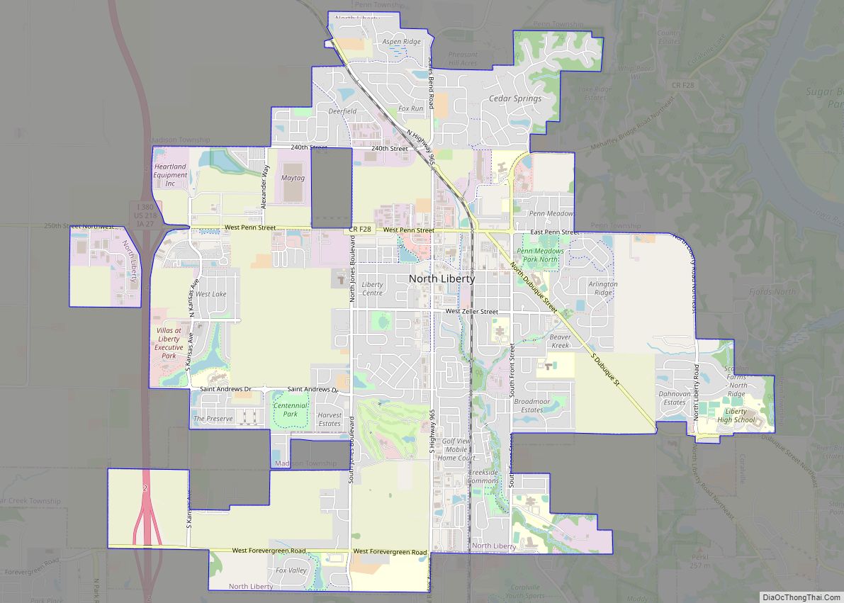
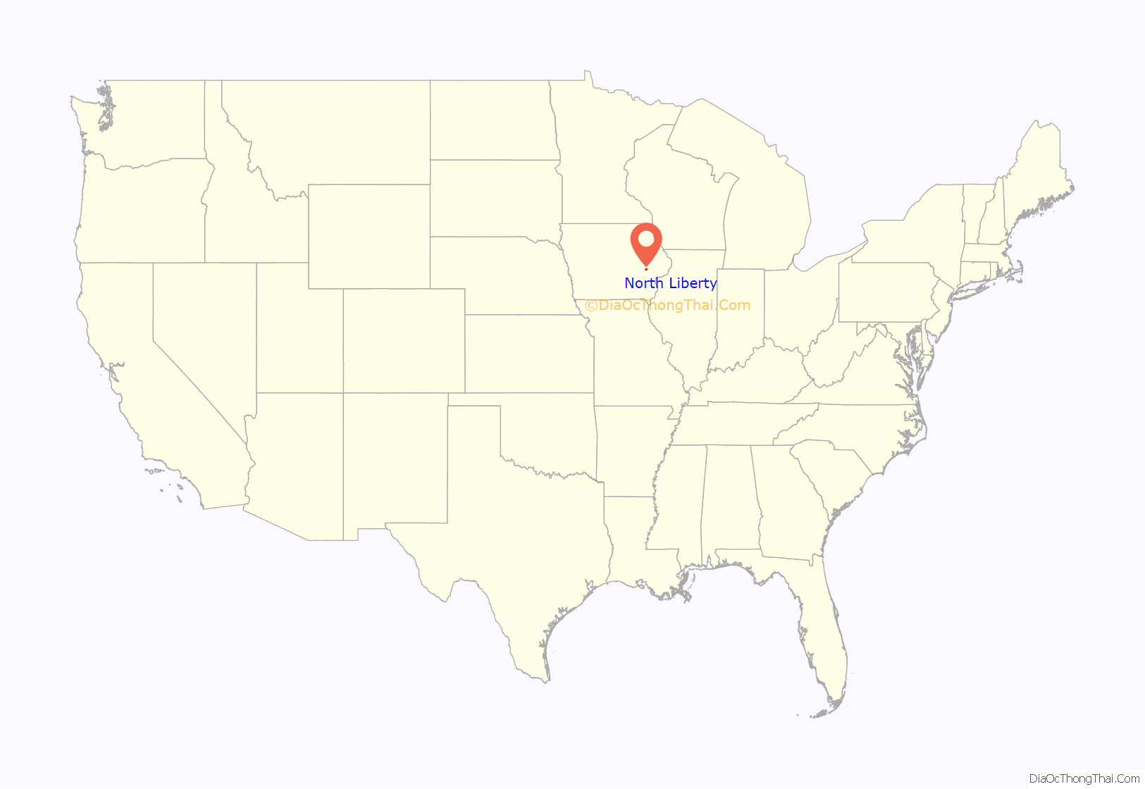
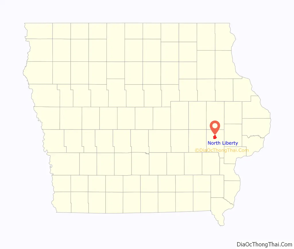
North Liberty is a city in Johnson County, Iowa, United States. It is a suburb of Iowa City and part of the Iowa City Metropolitan Statistical Area.
As of the 2020 census, the city population was 20,479. From 2000 to 2010, North Liberty was the second fastest-growing city in Iowa. A 2017 LendEDU poll named North Liberty the ninth most educated city in the United States and the most educated city in the Midwest.
| Name: | North Liberty city |
|---|---|
| LSAD Code: | 25 |
| LSAD Description: | city (suffix) |
| State: | Iowa |
| County: | Johnson County |
| Incorporated: | 1913 |
| Elevation: | 781 ft (238 m) |
| Total Area: | 9.12 sq mi (23.62 km²) |
| Land Area: | 9.12 sq mi (23.62 km²) |
| Water Area: | 0.00 sq mi (0.00 km²) |
| Total Population: | 20,479 |
| Population Density: | 2,245.26/sq mi (866.88/km²) |
| ZIP code: | 52317 |
| Area code: | 319 |
| FIPS code: | 1957360 |
| GNISfeature ID: | 0465945 |
| Website: | http://www.northlibertyiowa.org/ |
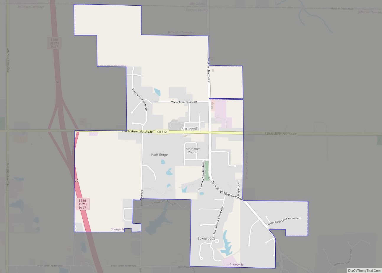
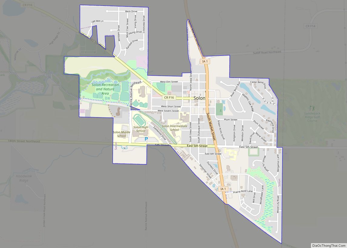
Online Interactive Map
Click on ![]() to view map in "full screen" mode.
to view map in "full screen" mode.
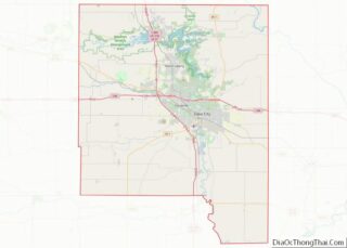
North Liberty location map. Where is North Liberty city?
History
The North Liberty area was first settled in 1838 by John Gaylor and Alonzo C. Dennison. It was originally known as “Big Bottom” or “North Bend” (in reference to its location near the bend of the Iowa River) by its earliest settlers and was later known as “Squash Bend” before the city was platted as North Liberty in 1857.
North Liberty incorporated on November 10, 1913, at which time its population was approximately 190. Population growth accelerated in the 1960s, and the Iowa City Community School District opened Penn Elementary there in 1961. A 1967 special census placed the city’s population at 782, and by 1980 the population had grown to over 2,000. In 1984, in response to the population growth, the North Liberty Community Library [1] was founded, and Penn Meadows Park, the city’s largest, was opened. By 2000, the population of the city was over 5,000. The city had established its own police and fire departments and built a community center with library and aquatic park, as well as a city administration building. The city has since continued to grow, with a population of 7,224 in a 2004 special census. In 2007, the population was estimated to be 10,982, making North Liberty the second fastest-growing city in Iowa. According to the 2010 U.S. census the population of North Liberty had increased to 13,374.
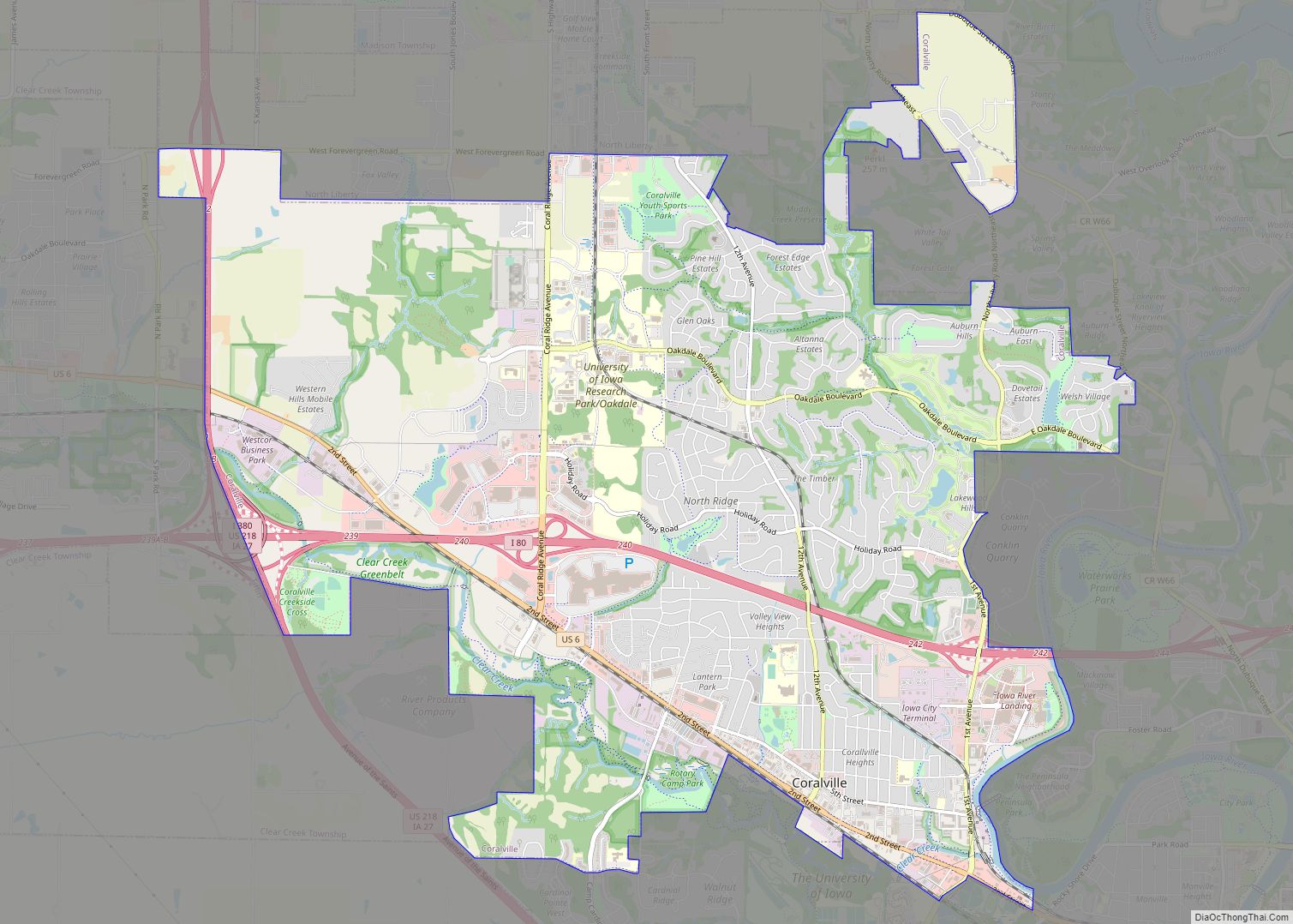
North Liberty Road Map

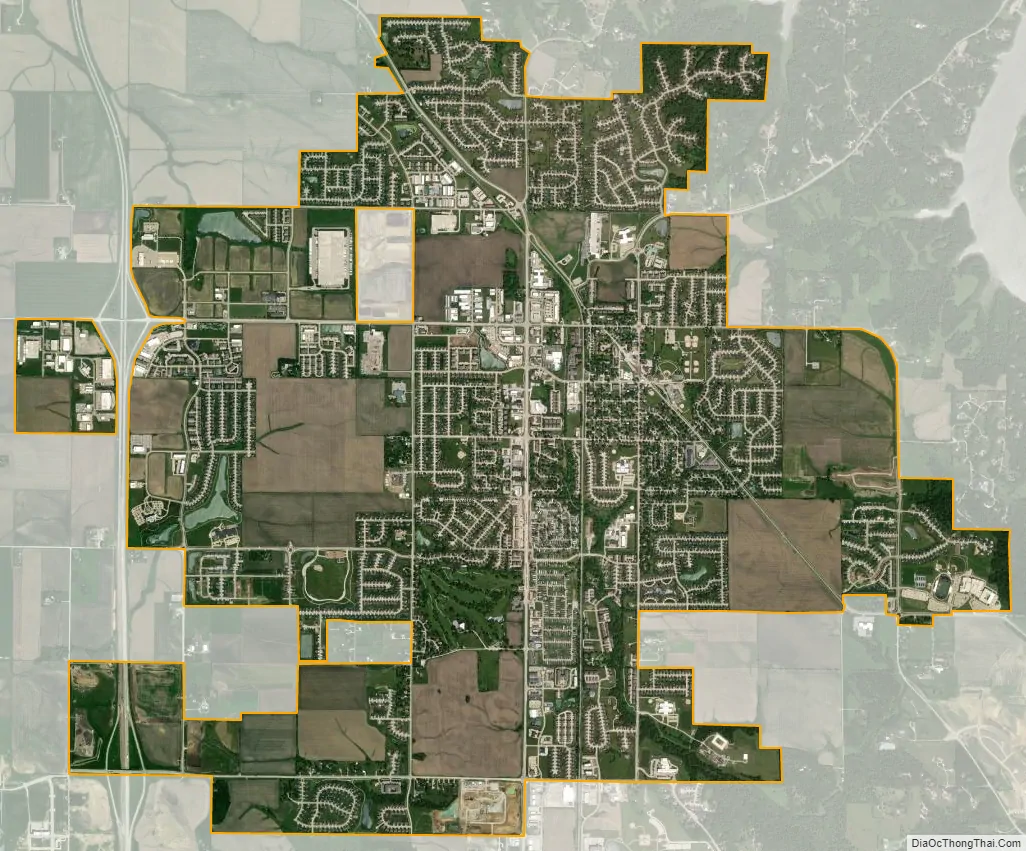
North Liberty city Satellite Map
Geography
North Liberty is located at 41°44′35″N 91°36′28″W / 41.74306°N 91.60778°W / 41.74306; -91.60778 (41.743029, -91.607807).
According to the United States Census Bureau, the city has a total area of 7.83 square miles (20.28 km), all land.
North Liberty is located on the Iowan erosion surface. Drivers on I-380 experience an abrupt transition from the muted topography of the Iowan surface to the rolling hills of the Southern Iowa drift plain, four miles south of North Liberty.
See also
Map of Iowa State and its subdivision:- Adair
- Adams
- Allamakee
- Appanoose
- Audubon
- Benton
- Black Hawk
- Boone
- Bremer
- Buchanan
- Buena Vista
- Butler
- Calhoun
- Carroll
- Cass
- Cedar
- Cerro Gordo
- Cherokee
- Chickasaw
- Clarke
- Clay
- Clayton
- Clinton
- Crawford
- Dallas
- Davis
- Decatur
- Delaware
- Des Moines
- Dickinson
- Dubuque
- Emmet
- Fayette
- Floyd
- Franklin
- Fremont
- Greene
- Grundy
- Guthrie
- Hamilton
- Hancock
- Hardin
- Harrison
- Henry
- Howard
- Humboldt
- Ida
- Iowa
- Jackson
- Jasper
- Jefferson
- Johnson
- Jones
- Keokuk
- Kossuth
- Lee
- Linn
- Louisa
- Lucas
- Lyon
- Madison
- Mahaska
- Marion
- Marshall
- Mills
- Mitchell
- Monona
- Monroe
- Montgomery
- Muscatine
- O'Brien
- Osceola
- Page
- Palo Alto
- Plymouth
- Pocahontas
- Polk
- Pottawattamie
- Poweshiek
- Ringgold
- Sac
- Scott
- Shelby
- Sioux
- Story
- Tama
- Taylor
- Union
- Van Buren
- Wapello
- Warren
- Washington
- Wayne
- Webster
- Winnebago
- Winneshiek
- Woodbury
- Worth
- Wright
- Alabama
- Alaska
- Arizona
- Arkansas
- California
- Colorado
- Connecticut
- Delaware
- District of Columbia
- Florida
- Georgia
- Hawaii
- Idaho
- Illinois
- Indiana
- Iowa
- Kansas
- Kentucky
- Louisiana
- Maine
- Maryland
- Massachusetts
- Michigan
- Minnesota
- Mississippi
- Missouri
- Montana
- Nebraska
- Nevada
- New Hampshire
- New Jersey
- New Mexico
- New York
- North Carolina
- North Dakota
- Ohio
- Oklahoma
- Oregon
- Pennsylvania
- Rhode Island
- South Carolina
- South Dakota
- Tennessee
- Texas
- Utah
- Vermont
- Virginia
- Washington
- West Virginia
- Wisconsin
- Wyoming