Coralville is a city in Johnson County, Iowa, United States. It is a suburb of Iowa City and part of the Iowa City Metropolitan Statistical Area. The population was 22,318 at the 2020 census.
| Name: | Coralville city |
|---|---|
| LSAD Code: | 25 |
| LSAD Description: | city (suffix) |
| State: | Iowa |
| County: | Johnson County |
| Incorporated: | 1873 |
| Elevation: | 682 ft (208 m) |
| Total Area: | 12.67 sq mi (32.82 km²) |
| Land Area: | 12.60 sq mi (32.64 km²) |
| Water Area: | 0.07 sq mi (0.18 km²) |
| Total Population: | 22,318 |
| Population Density: | 1,771.13/sq mi (683.83/km²) |
| ZIP code: | 52241 |
| Area code: | 319 |
| FIPS code: | 1916230 |
| GNISfeature ID: | 0455624 |
| Website: | www.coralville.org |
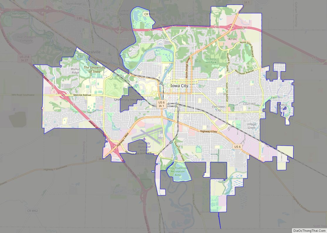
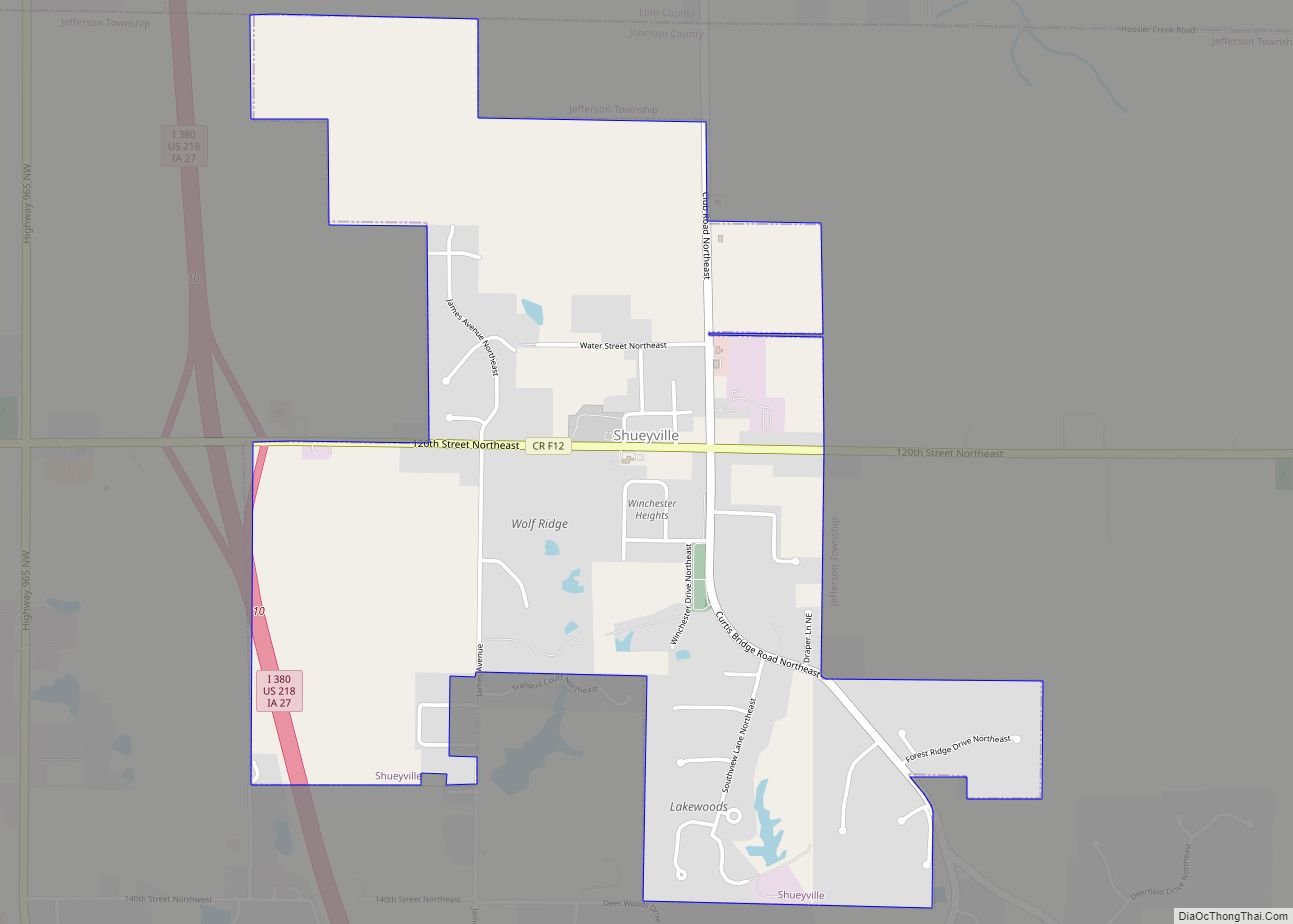
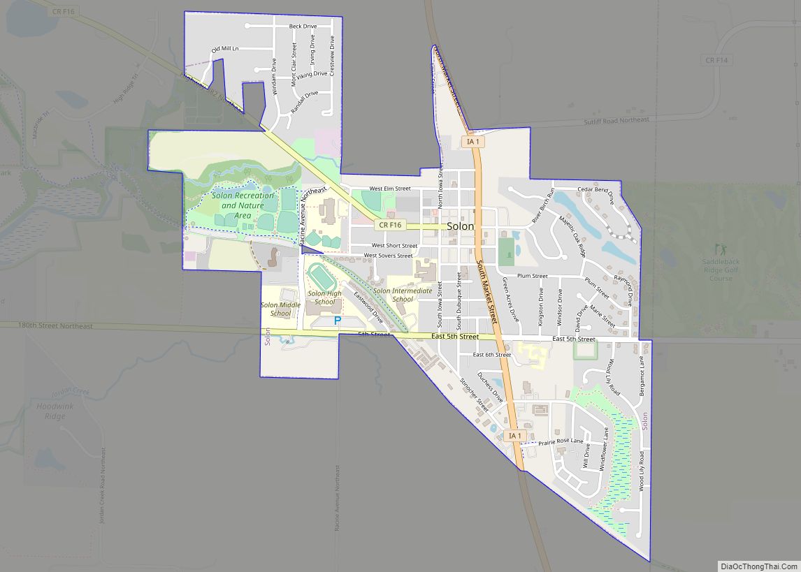
Online Interactive Map
Click on ![]() to view map in "full screen" mode.
to view map in "full screen" mode.
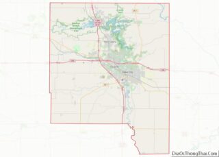
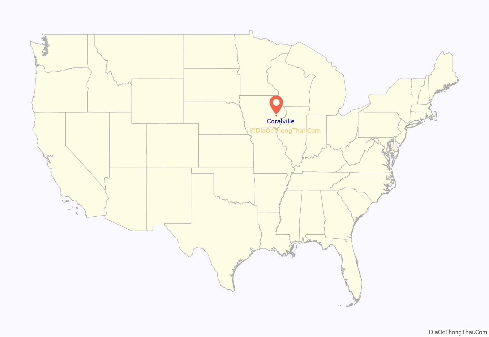
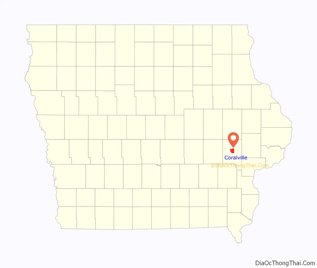
Coralville location map. Where is Coralville city?
History
Coralville is the location of the Edgewater Park Site, a 3,800-year-old archaeological site along the Iowa River. Edgewater is the oldest site in Iowa with evidence of domesticated plant use.
Coralville incorporated as a city on June 1, 1857. The city’s name is derived from the fossils that are found in the limestone along the Iowa River. In 1864, Louis Agassiz, a Harvard University zoologist, gave a lecture at the nearby University of Iowa titled “The Coral Reefs of Iowa City”. During the lecture, he presented local samples of fossilized Devonian period coral. The lecture was well received and helped raise public interest in the local fossils. In 1866, more corals were discovered at the site of a new mill, inspiring the citizens of the area to name the settlement “Coralville”. The first mill at Coralville was built in 1844, and in the years that followed, a number of watermills were powered by the Coralville mill dam along the Iowa River, but all of the mills had closed by 1900, except for a low-head hydroelectric plant that remained in operation until the mid 20th century.
Coralville is also the location where some 1300 Mormon immigrants stopped to make camp in their migration of 1856 after having traveled west by rail to Iowa City, which was the westernmost rail terminus at the time. They built handcarts out of native woods during their encampment so that an adult could haul a 600–700 pound load and cover about 15 miles per day on foot in their continuing trek to Salt Lake City. A historical marker commemorating the Mormon Handcart Brigade was erected in 1936 by the Iowa Society DAR, with members of the Pilgrim Chapter present. Originally placed just south of 5th Street and west of 10th Street, it was moved in 1998 to S. T. Morrison Park and rededicated by the Nathaniel Fellows Chapter, placed near the entrance and pond. Today, the Mormon Handcart Park and Nature Preserve commemorates the site. There is also a street, Mormon Trek Blvd, named for the Mormons who went through that area.
After World War II, Coralville began to grow as many university students began to make their homes there. It had only 433 people in 1940, but by 1970 Coralville’s population had jumped to 6,130. The construction of Interstate 80 in the 1960s brought several motels, fast-food restaurants, and gas stations to Coralville.
By the mid-1960s, the independent school district of Coralville was annexed by the Iowa City Community School District. Junior and senior high school students rode buses into Iowa City. Elementary (K-6) students attended Central Elementary School. Kirkwood Elementary school was opened in the fall of 1964, giving the growing town its second school. By the fall of 1968, all high school students from Coralville began attending the newly opened West High School. In 1971, the district built Northwest Junior High on property just to the south of Kirkwood Elementary, which then began handling seventh and eighth graders who lived west of the Iowa River. In 1997, Wickham Elementary School was opened.
In 1958, the United States Army Corps of Engineers completed Coralville Dam along the Iowa River, four miles (6 km) north of the city, creating Coralville Lake. Except for the Great Flood of 1993 and the Great Iowa flood of 2008, the dam has helped prevent serious flooding in the city. From June through August 1993, all three of Coralville’s main transportation links with Iowa City were submerged. The economic impact that year was severe, but the city had almost fully recovered within two years. The 2008 flood proved to be more costly as the Iowa River surpassed the 1993 record crest at over 31.5 feet (9.6 m).
The First Methodist Church was built in 1963 to the designs by architect Thomas Patrick Reilly of Crites & McConnell, 860 17th Street S.E, of Cedar Rapids, Iowa.
On July 29, 1998, the Coral Ridge Mall opened with more than 100 stores, then the largest shopping center in the state. Around that time a “city center” area was created along the U.S. Route 6 “strip” near its intersection with 12th Avenue. Coral Ridge Mall’s opening would usher in a new era of retail development as big box stores such as Costco Wholesale, Wal-Mart, Kohl’s, and Lowe’s opened in the area surrounding the mall. This has helped boost taxable sales in Coralville from $155.3 million in 1996 to $549.7 million in 2006.
Xtream Arena, a 5,100-seat venue, opened in 2020 in the city’s Iowa River Landing neighborhood. Xtream Arena is home to the Iowa Heartlanders ECHL professional hockey team, proud affiliates of the Minnesota Wild and Iowa Wild.
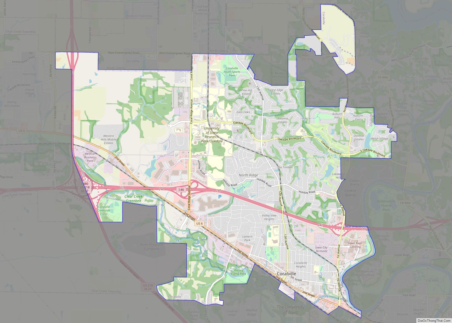
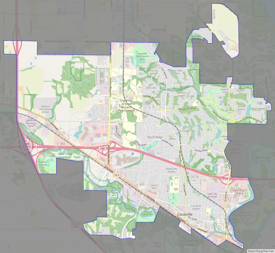
Coralville Road Map
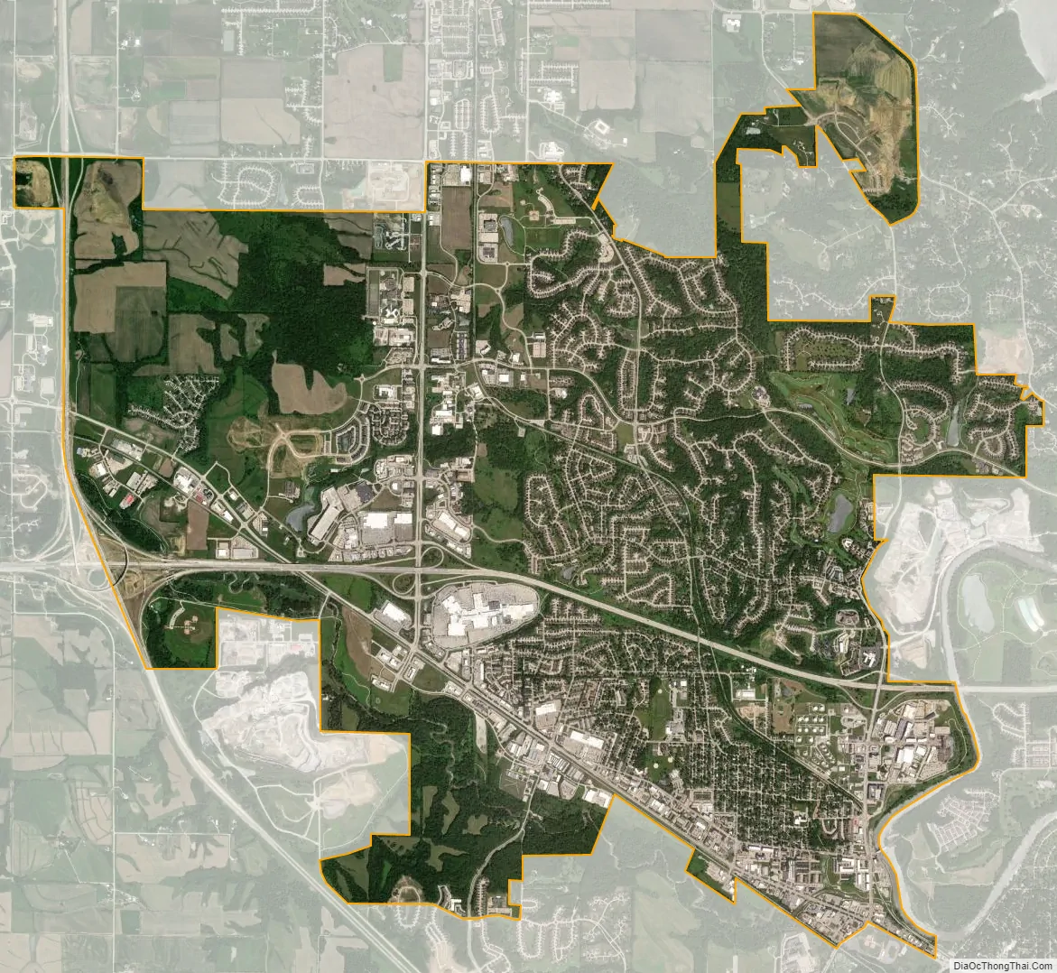
Coralville city Satellite Map
Geography
Coralville is located in Johnson County at 41°41′18″N 91°35′12″W / 41.68833°N 91.58667°W / 41.68833; -91.58667 (41.688215, -91.586764).
According to the United States Census Bureau, the city has a total area of 12.05 square miles (31.21 km), of which 12.01 square miles (31.11 km) is land and 0.04 square miles (0.10 km) is water.
The Iowa River runs along the east edge of Coralville and forms part of the boundary with Iowa City. Interstate 80 runs east–west through Coralville, and most of the city’s newer housing subdivisions are located north of I-80. U.S. Route 6 runs along Coralville’s south edge, while Interstate 380, U.S. Route 218, and Iowa Highway 27 (the Avenue of the Saints) run along the city’s west edge. The cloverleaf interchange of I-80 and I-380/U.S. 218/Iowa 27 is divided between the city limits of Coralville and neighboring Tiffin after recent annexations.
See also
Map of Iowa State and its subdivision:- Adair
- Adams
- Allamakee
- Appanoose
- Audubon
- Benton
- Black Hawk
- Boone
- Bremer
- Buchanan
- Buena Vista
- Butler
- Calhoun
- Carroll
- Cass
- Cedar
- Cerro Gordo
- Cherokee
- Chickasaw
- Clarke
- Clay
- Clayton
- Clinton
- Crawford
- Dallas
- Davis
- Decatur
- Delaware
- Des Moines
- Dickinson
- Dubuque
- Emmet
- Fayette
- Floyd
- Franklin
- Fremont
- Greene
- Grundy
- Guthrie
- Hamilton
- Hancock
- Hardin
- Harrison
- Henry
- Howard
- Humboldt
- Ida
- Iowa
- Jackson
- Jasper
- Jefferson
- Johnson
- Jones
- Keokuk
- Kossuth
- Lee
- Linn
- Louisa
- Lucas
- Lyon
- Madison
- Mahaska
- Marion
- Marshall
- Mills
- Mitchell
- Monona
- Monroe
- Montgomery
- Muscatine
- O'Brien
- Osceola
- Page
- Palo Alto
- Plymouth
- Pocahontas
- Polk
- Pottawattamie
- Poweshiek
- Ringgold
- Sac
- Scott
- Shelby
- Sioux
- Story
- Tama
- Taylor
- Union
- Van Buren
- Wapello
- Warren
- Washington
- Wayne
- Webster
- Winnebago
- Winneshiek
- Woodbury
- Worth
- Wright
- Alabama
- Alaska
- Arizona
- Arkansas
- California
- Colorado
- Connecticut
- Delaware
- District of Columbia
- Florida
- Georgia
- Hawaii
- Idaho
- Illinois
- Indiana
- Iowa
- Kansas
- Kentucky
- Louisiana
- Maine
- Maryland
- Massachusetts
- Michigan
- Minnesota
- Mississippi
- Missouri
- Montana
- Nebraska
- Nevada
- New Hampshire
- New Jersey
- New Mexico
- New York
- North Carolina
- North Dakota
- Ohio
- Oklahoma
- Oregon
- Pennsylvania
- Rhode Island
- South Carolina
- South Dakota
- Tennessee
- Texas
- Utah
- Vermont
- Virginia
- Washington
- West Virginia
- Wisconsin
- Wyoming