Sioux City (/suː/) is a city in Woodbury and Plymouth counties in the northwestern part of the U.S. state of Iowa. The population was 85,797 in the 2020 census, making it the fourth-largest city in Iowa. The bulk of the city is in Woodbury County, of which it is the county seat, though a small portion is in Plymouth County. Sioux City is located at the navigational head of the Missouri River. The city is home to several cultural points of interest including the Sioux City Public Museum, Sioux City Art Center and Sergeant Floyd Monument, which is a National Historic Landmark. The city is also home to Chris Larsen Park, commonly referred to as “the Riverfront”, which includes the Anderson Dance Pavilion, Sergeant Floyd Riverboat Museum and Lewis and Clark Interpretive Center. Sioux City is the primary city of the five-county Sioux City, IA–NE–SD Metropolitan Statistical Area (MSA), with a population of 149,940 in the 2020 census. The Sioux City–Vermillion, IA–NE–SD Combined Statistical Area had a population of 175,638 as of 2020.
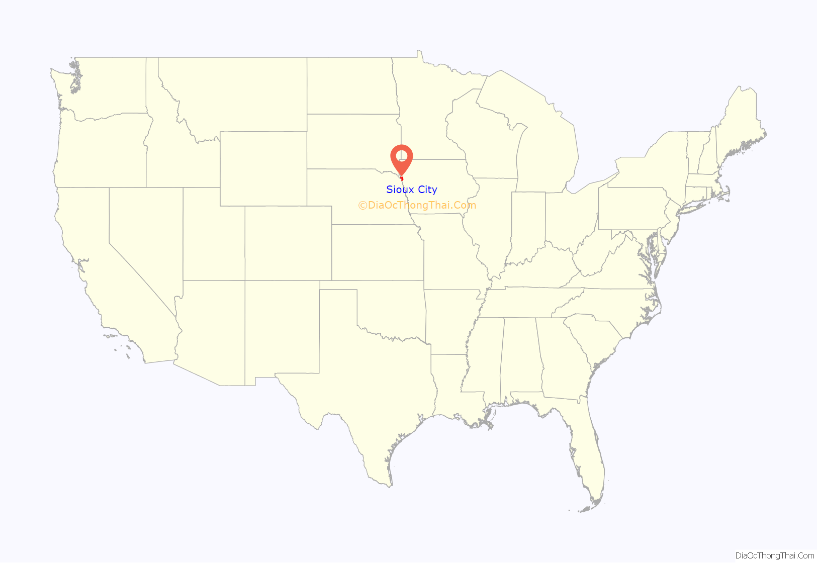
Sioux City is at the navigational head, or the furthest upstream point to which general cargo ships can travel, of the Missouri River, approximately 95 mi (153 km) north of the Omaha–Council Bluffs metropolitan area. Sioux City and the surrounding areas of northwestern Iowa, northeastern Nebraska and southeastern South Dakota are sometimes referred to as Siouxland, especially by local media and residents.
| Name: | Sioux City city |
|---|---|
| LSAD Code: | 25 |
| LSAD Description: | city (suffix) |
| State: | Iowa |
| County: | Plymouth County, Woodbury County |
| Founded: | 1854 |
| Incorporated: | 1857 |
| Elevation: | 1,201 ft (366 m) |
| Land Area: | 58.46 sq mi (151.4 km²) |
| Water Area: | 1.165 sq mi (3.02 km²) |
| Population Density: | 1,467.6/sq mi (566.65/km²) |
| Area code: | 712 |
| FIPS code: | 1973335 |
| GNISfeature ID: | 0461653 |
| Website: | sioux-city.org |
Online Interactive Map
Click on ![]() to view map in "full screen" mode.
to view map in "full screen" mode.
Sioux City location map. Where is Sioux City city?
History
Iowa is in the tallgrass prairie of the North American Great Plains, historically inhabited by speakers of Siouan languages. The area of Sioux City was inhabited by Yankton Sioux when it was first reached by Spanish and French furtrappers in the 18th century. The first documented US citizens to record their travels through this area were Meriwether Lewis and William Clark during the summer of 1804. Sergeant Charles Floyd, a member of the Lewis and Clark Expedition, died here on August 20, 1804, the only death during the two and a half-year expedition.
Sioux City was laid out in the winter of 1854–1855. It became a major transportation hub to the western Plains, including Mormons heading to Salt Lake City and speculators heading to Wyoming goldfields.
In 1891, the Sioux City Elevated Railway was opened and became the third steam-powered elevated rapid transit system in the world, and later the first electric-powered elevated railway in the world after conversion in 1892. However, the system fell into bankruptcy and closed within a decade.
The city gained the nickname “Little Chicago” during the Prohibition era due to its reputation for being a purveyor of alcoholic beverages.
On 19 July 1989, United Airlines Flight 232 crash-landed at Sioux Gateway Airport, killing 111 people, but 184 survived the crash and ensuing fire due to outstandingly quick performances by fire and emergency local teams.
According to a 2015 University of Iowa study for the Iowa Initiative for Sustainable Communities, blight and disinvestment are serious problems in the downtown core as investment has shifted to suburbs.
Sioux City Road Map
Sioux City city Satellite Map
Geography
Sioux City borders two states, South Dakota to the west-northwest and Nebraska to the west.
According to the United States Census Bureau, the city has a total area of 59.63 sq mi (154.44 km), of which 58.46 sq mi (151.41 km) is land and 1.165 sq mi (3.02 km) is water.
City neighborhoods
Climate
As is typical of Iowa, Sioux City has a humid continental climate, with very warm, humid summers, cold, dry winters, and wide temperature extremes; it is part of USDA Hardiness zone 5a. The normal monthly mean temperature ranges from 20.0 °F (−6.7 °C) in January to 74.2 °F (23.4 °C) in July. On average, there are 25 days that reach 90 °F (32 °C) or higher, 52 days that do not climb above freezing, and 17 days with a low of 0 °F (−18 °C) or below annually. The average window for freezing temperatures is October 1 through April 26, allowing a growing season of 157 days. Extreme temperatures officially range from −35 °F (−37 °C) on 12 January 1912 up to 111 °F (44 °C) on 4 July 1936 and 17 July 1936, as well as 11 July 1939; the record cold daily maximum is −22 °F (−30 °C) on 8 February 1899, while, conversely, the record warm daily minimum is 86 °F (30 °C) on 18 August 1936.
Precipitation is greatest in May and June and averages 29.27 in (743 mm) annually, but has ranged from 14.33 in (364 mm) in 1976 to 41.10 in (1,044 mm) in 1903. Snowfall averages 36.0 in (91 cm) per season, and has historically ranged from 6.9 in (18 cm) in 1895–1896 to 65.9 in (167 cm) in 1961–1962; the average window for measurable (≥0.1 in or 0.25 cm) snowfall is November 8 through April 7, although snow in October occurs several times per decade. On 14 May 2013, the high temperature reached 106 °F (41 °C), setting a new all-time May record high, along with a 77 °F (43 °C) rise from the morning of the 12th.
See also
Map of Iowa State and its subdivision:- Adair
- Adams
- Allamakee
- Appanoose
- Audubon
- Benton
- Black Hawk
- Boone
- Bremer
- Buchanan
- Buena Vista
- Butler
- Calhoun
- Carroll
- Cass
- Cedar
- Cerro Gordo
- Cherokee
- Chickasaw
- Clarke
- Clay
- Clayton
- Clinton
- Crawford
- Dallas
- Davis
- Decatur
- Delaware
- Des Moines
- Dickinson
- Dubuque
- Emmet
- Fayette
- Floyd
- Franklin
- Fremont
- Greene
- Grundy
- Guthrie
- Hamilton
- Hancock
- Hardin
- Harrison
- Henry
- Howard
- Humboldt
- Ida
- Iowa
- Jackson
- Jasper
- Jefferson
- Johnson
- Jones
- Keokuk
- Kossuth
- Lee
- Linn
- Louisa
- Lucas
- Lyon
- Madison
- Mahaska
- Marion
- Marshall
- Mills
- Mitchell
- Monona
- Monroe
- Montgomery
- Muscatine
- O'Brien
- Osceola
- Page
- Palo Alto
- Plymouth
- Pocahontas
- Polk
- Pottawattamie
- Poweshiek
- Ringgold
- Sac
- Scott
- Shelby
- Sioux
- Story
- Tama
- Taylor
- Union
- Van Buren
- Wapello
- Warren
- Washington
- Wayne
- Webster
- Winnebago
- Winneshiek
- Woodbury
- Worth
- Wright
- Alabama
- Alaska
- Arizona
- Arkansas
- California
- Colorado
- Connecticut
- Delaware
- District of Columbia
- Florida
- Georgia
- Hawaii
- Idaho
- Illinois
- Indiana
- Iowa
- Kansas
- Kentucky
- Louisiana
- Maine
- Maryland
- Massachusetts
- Michigan
- Minnesota
- Mississippi
- Missouri
- Montana
- Nebraska
- Nevada
- New Hampshire
- New Jersey
- New Mexico
- New York
- North Carolina
- North Dakota
- Ohio
- Oklahoma
- Oregon
- Pennsylvania
- Rhode Island
- South Carolina
- South Dakota
- Tennessee
- Texas
- Utah
- Vermont
- Virginia
- Washington
- West Virginia
- Wisconsin
- Wyoming
