Swea City is a city in Kossuth County, Iowa, United States. The population was 566 at the time of the 2020 census.
| Name: | Swea City city |
|---|---|
| LSAD Code: | 25 |
| LSAD Description: | city (suffix) |
| State: | Iowa |
| County: | Kossuth County |
| Elevation: | 1,181 ft (360 m) |
| Total Area: | 0.77 sq mi (1.99 km²) |
| Land Area: | 0.77 sq mi (1.99 km²) |
| Water Area: | 0.00 sq mi (0.00 km²) |
| Total Population: | 566 |
| Population Density: | 737.94/sq mi (285.04/km²) |
| ZIP code: | 50590 |
| Area code: | 515 |
| FIPS code: | 1976755 |
| GNISfeature ID: | 0461494 |
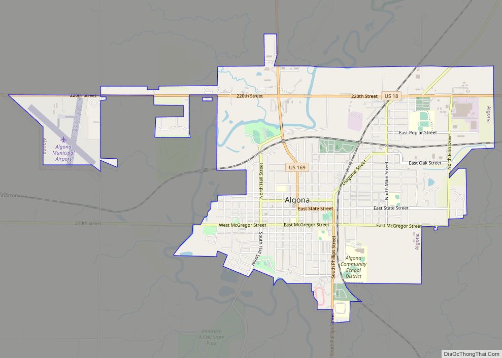
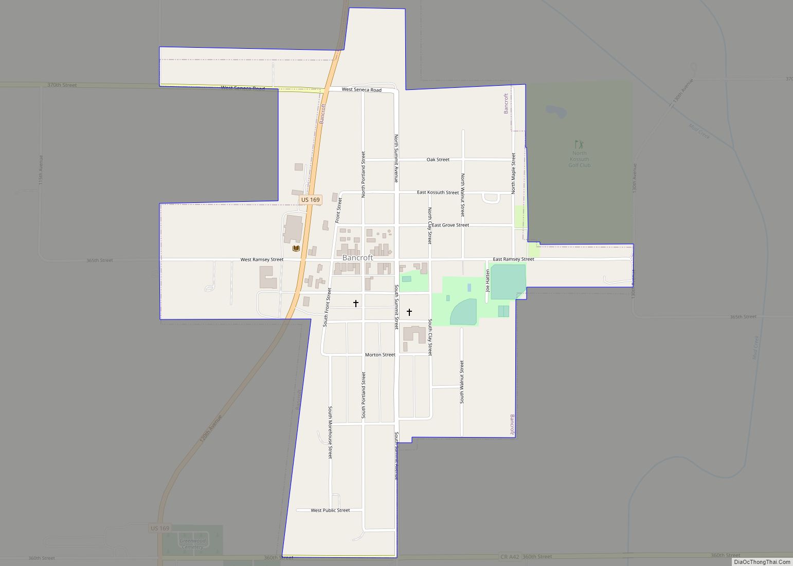
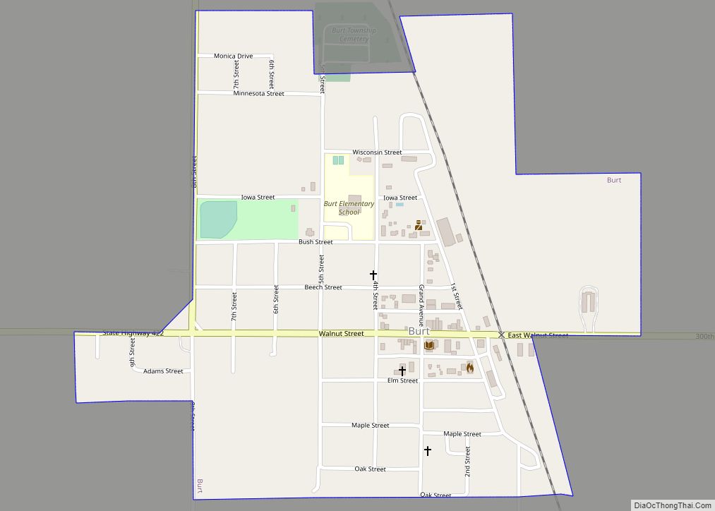
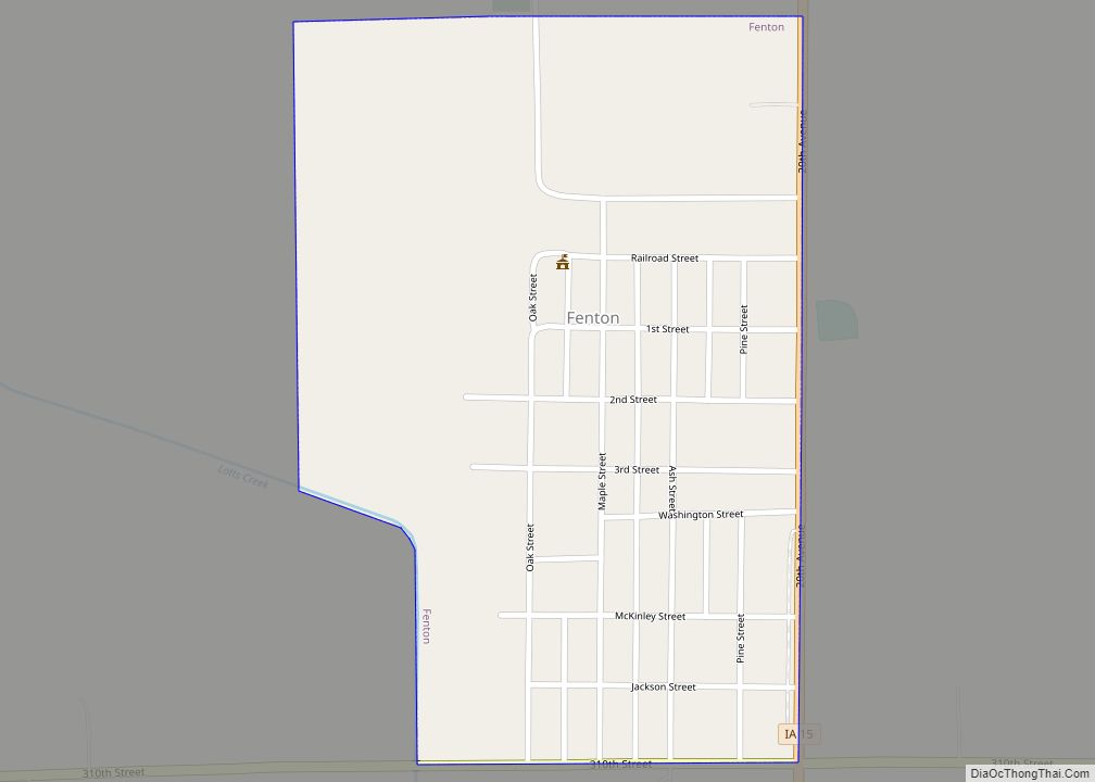
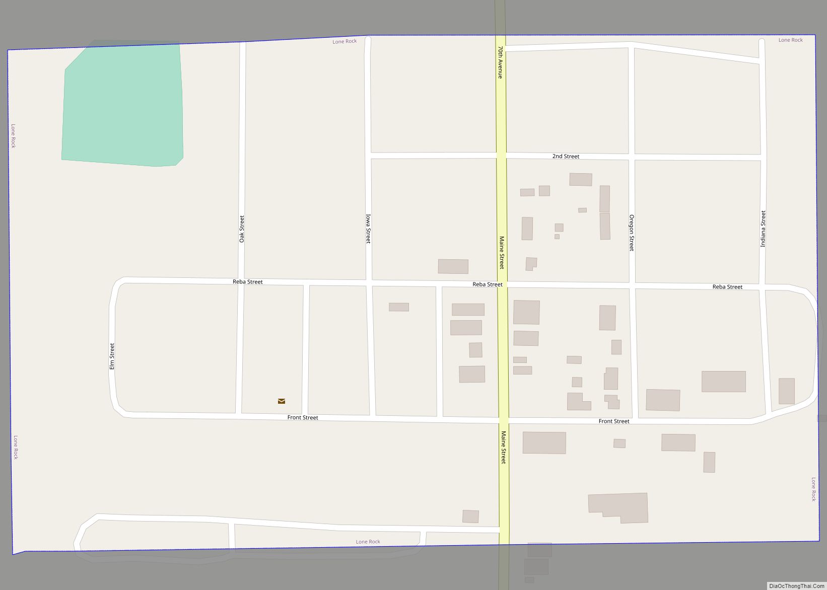
Online Interactive Map
Click on ![]() to view map in "full screen" mode.
to view map in "full screen" mode.
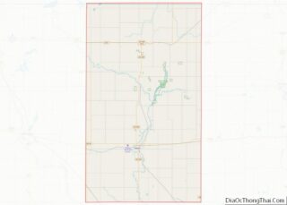
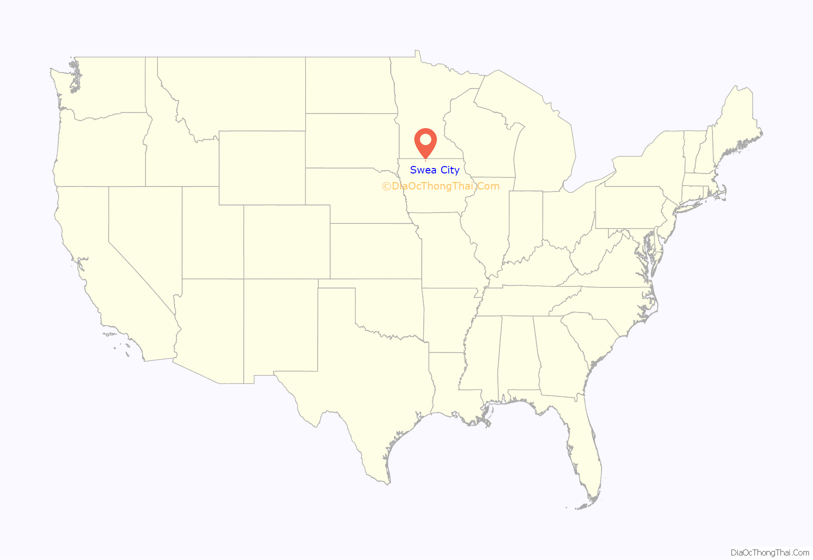
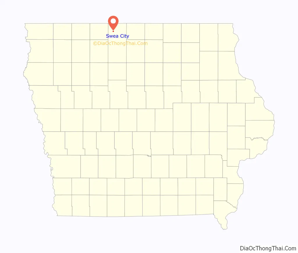
Swea City location map. Where is Swea City city?
History
Swea City was platted in 1892; it was then called Reynolds. In February 1893, the name was officially changed to Swea City. Swea City was petitioned for incorporation on December 11, 1894 with a population of 161. Several objections were filed with the reasons for objection listed as, “One, the judges of the election administered the oath to themselves swearing in each other; and Two, the words ‘for incorporation’ were written on one ballot while ‘against corporation’ was written on another ballot.” It was implied that the choice needed to be available on a single ballot in order to be valid. Later a second petition was filed this time on April 19, 1895 and the election was held at a schoolhouse. Each ballot had “For incorporation” and “Against incorporation” printed on them. The vote was 34 in favor of incorporation and 1 against, and the city was incorporated.
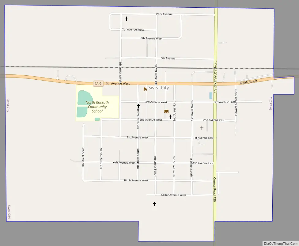
Swea City Road Map
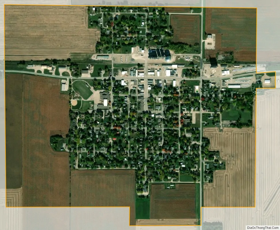
Swea City city Satellite Map
Geography
Swea City is located at 43°23′1″N 94°18′33″W / 43.38361°N 94.30917°W / 43.38361; -94.30917 (43.383677, -94.309177).
According to the United States Census Bureau, the city has a total area of 0.74 square miles (1.92 km), all land.
See also
Map of Iowa State and its subdivision:- Adair
- Adams
- Allamakee
- Appanoose
- Audubon
- Benton
- Black Hawk
- Boone
- Bremer
- Buchanan
- Buena Vista
- Butler
- Calhoun
- Carroll
- Cass
- Cedar
- Cerro Gordo
- Cherokee
- Chickasaw
- Clarke
- Clay
- Clayton
- Clinton
- Crawford
- Dallas
- Davis
- Decatur
- Delaware
- Des Moines
- Dickinson
- Dubuque
- Emmet
- Fayette
- Floyd
- Franklin
- Fremont
- Greene
- Grundy
- Guthrie
- Hamilton
- Hancock
- Hardin
- Harrison
- Henry
- Howard
- Humboldt
- Ida
- Iowa
- Jackson
- Jasper
- Jefferson
- Johnson
- Jones
- Keokuk
- Kossuth
- Lee
- Linn
- Louisa
- Lucas
- Lyon
- Madison
- Mahaska
- Marion
- Marshall
- Mills
- Mitchell
- Monona
- Monroe
- Montgomery
- Muscatine
- O'Brien
- Osceola
- Page
- Palo Alto
- Plymouth
- Pocahontas
- Polk
- Pottawattamie
- Poweshiek
- Ringgold
- Sac
- Scott
- Shelby
- Sioux
- Story
- Tama
- Taylor
- Union
- Van Buren
- Wapello
- Warren
- Washington
- Wayne
- Webster
- Winnebago
- Winneshiek
- Woodbury
- Worth
- Wright
- Alabama
- Alaska
- Arizona
- Arkansas
- California
- Colorado
- Connecticut
- Delaware
- District of Columbia
- Florida
- Georgia
- Hawaii
- Idaho
- Illinois
- Indiana
- Iowa
- Kansas
- Kentucky
- Louisiana
- Maine
- Maryland
- Massachusetts
- Michigan
- Minnesota
- Mississippi
- Missouri
- Montana
- Nebraska
- Nevada
- New Hampshire
- New Jersey
- New Mexico
- New York
- North Carolina
- North Dakota
- Ohio
- Oklahoma
- Oregon
- Pennsylvania
- Rhode Island
- South Carolina
- South Dakota
- Tennessee
- Texas
- Utah
- Vermont
- Virginia
- Washington
- West Virginia
- Wisconsin
- Wyoming