Thompson is a city in Winnebago County, Iowa, United States. The population was 495 at the time of the 2020 census.
Thompson is home to the Winnebago County Fair, held annually, various agricultural businesses, a public outdoor swimming pool, the Thompson Museum, the Heartland Power Cooperative, and Bethany Lutheran Church, built in 1902.
Businesses serving travelers include the Branding Iron Restaurant, Bucket’s Bar and Grill, Hometown Market, and a car wash.
| Name: | Thompson city |
|---|---|
| LSAD Code: | 25 |
| LSAD Description: | city (suffix) |
| State: | Iowa |
| County: | Winnebago County |
| Elevation: | 1,270 ft (387 m) |
| Total Area: | 0.86 sq mi (2.22 km²) |
| Land Area: | 0.86 sq mi (2.22 km²) |
| Water Area: | 0.00 sq mi (0.00 km²) |
| Total Population: | 495 |
| Population Density: | 577.60/sq mi (223.04/km²) |
| ZIP code: | 50478 |
| Area code: | 641 |
| FIPS code: | 1977745 |
| GNISfeature ID: | 0462216 |
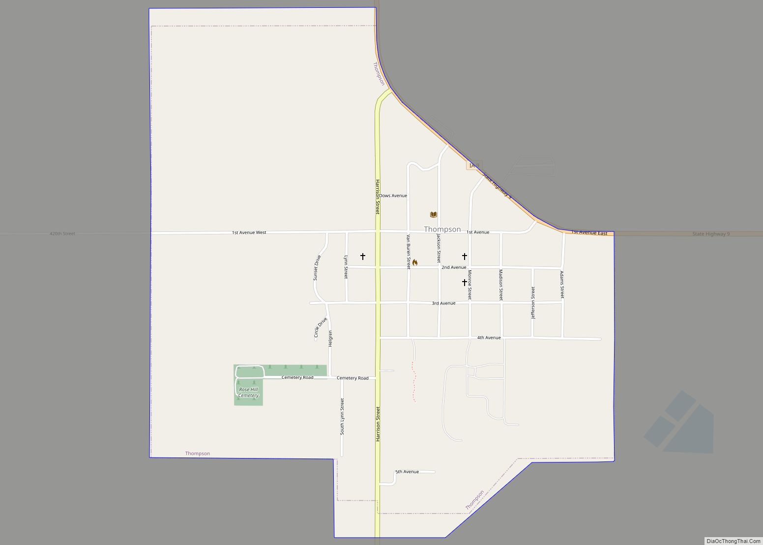
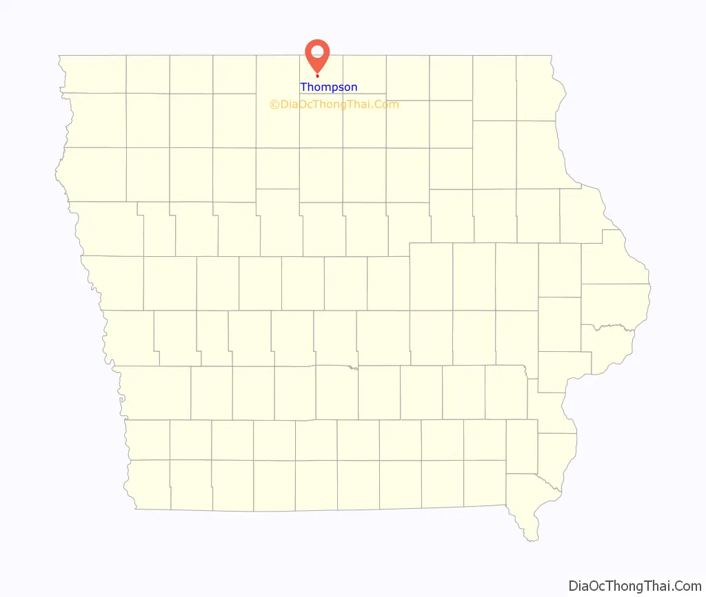
Online Interactive Map
Click on ![]() to view map in "full screen" mode.
to view map in "full screen" mode.
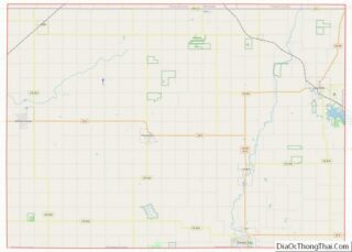
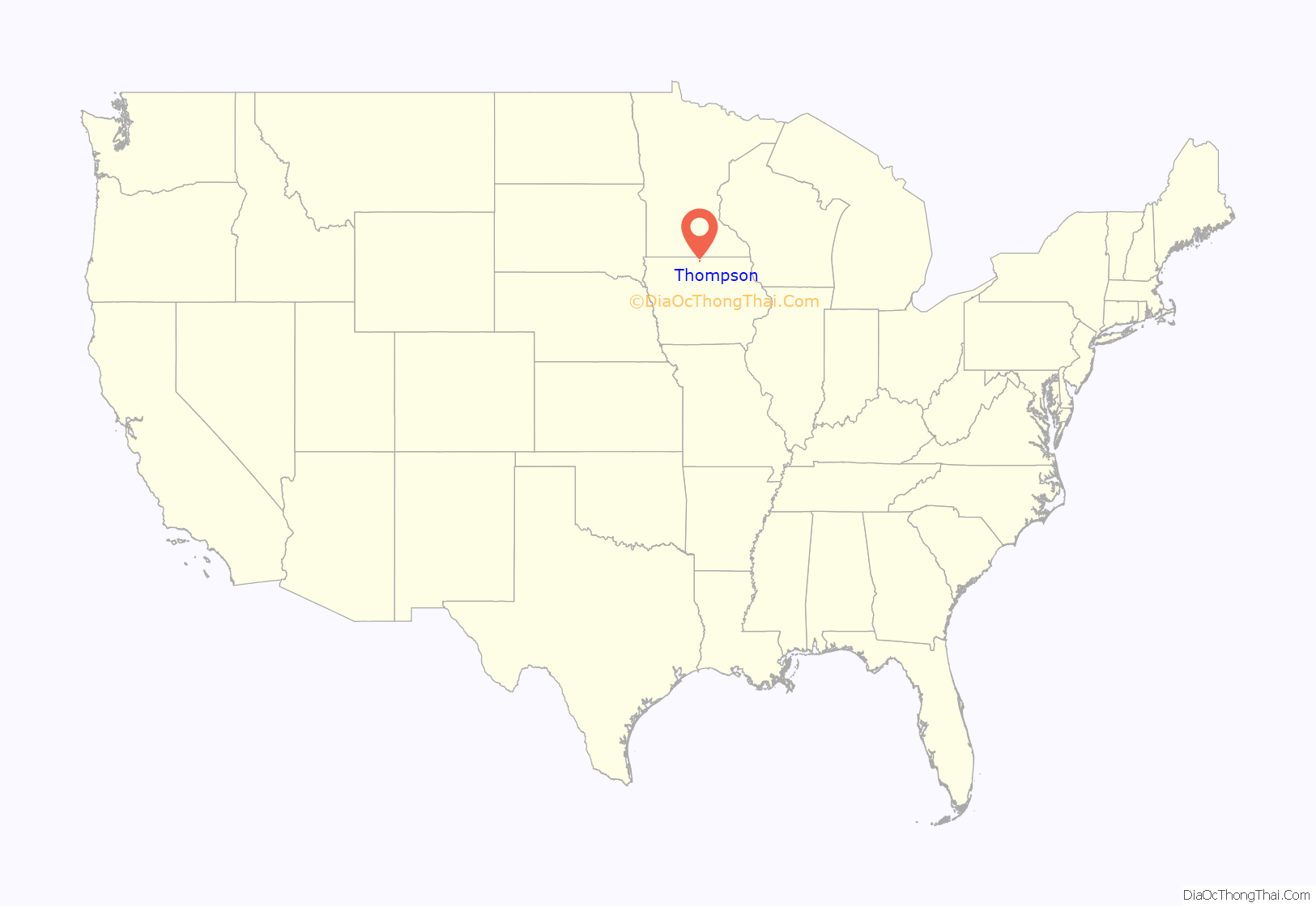
Thompson location map. Where is Thompson city?
History
Thompson was platted in 1892. It was incorporated as a city in 1894.
A post office opened in 1890, and rural carrier service was established in 1904.
The Thompson Courier began publication in 1894, and is still in business. In 1938, the paper expanded operations with the purchase of the Rake Register, becoming the Thompson Courier and Rake Register.
Thompson’s first telephone switchboard was installed in the home of Dr. G.M. Lee in 1894. Groups of farmers joined together to establish their own small phone companies, and 12 systems shared the town’s joint switchboard and party lines. By the 1940s, the Switchboard Company had purchased its own building, and the Thompson Telephone Company and Thompson Telephone Cooperative were formed. In 1951, the local Rural Electrification Association released a movie featuring several Thompson residents, who described the struggles for adequate phone service in Winnebago County, until a federal Rural Electrification Administrationtelephone loan finally enabled the Winnebago Cooperative Telephone Association to provide modern dial service.
The Thompson Cooperative Creamery was chartered in 1897. The creamery consolidated the earlier milk station operations at Amund corner, Vinje, and three other locations, which used large volume separators to skim off cream. Cooling and churning were powered by a steam boiler until electricity was installed.
The Farmers Cooperative Elevator Company formed in 1907, as farmers were dissatisfied with the prices received at the three independent grain elevators.
The Thompson Fire Department built its fire hall in 1925.
Thompson was without a bank for over a year after the First National Bank shut its doors on June 26, 1932, and the State Bank of Thompson and First National Bank of Thompson failed. The Peoples State Bank opened in Thompson on August 1, 1933.
The Thompson Public Library was established in 1937-1938, as a civic improvement project by the Thompson Study Club. The library was located in the Town Hall for 45 years. The library moved into a remodeled section of the fire station in 1983.
In 1938, the Winnebago Rural Electric Cooperative was established. The first section of lines was energized on January 3, 1940.
A large cement grain elevator was built in 1950, and an even larger cement elevator in 1967.
The landmark Chicago, Rock Island and Pacific Railroad depot on Main Street burned to the ground on February 26, 1963. The railroad brought in a small structure which served as its replacement until the line shut down in 1980.
On October 30, 1974, Peoples State Bank was robbed by three unmasked men. An abandoned getaway car was found on a gravel road about six miles from town, but the robbers were never apprehended.
One of the worst fires in Thompson’s history occurred on December 22, 1980, and destroyed about half of the Main Street business block, including the Branding Iron Supper Club, which moved into a new building.
In 1983, one of the cement grain elevators ruptured, and was demolished.
During the 2020 Covid pandemic, 79 Thompson area businesses received CARES Act Paycheck Protection Program loans.
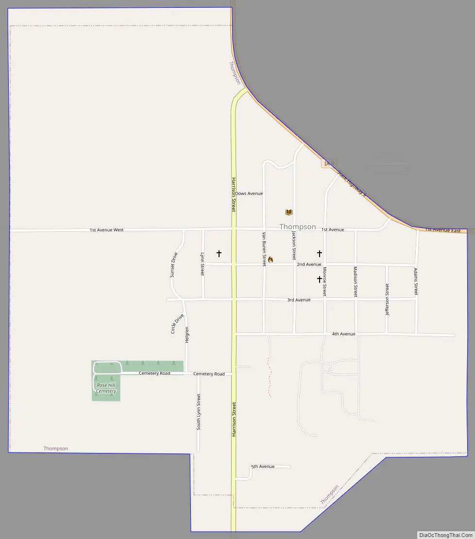
Thompson Road Map
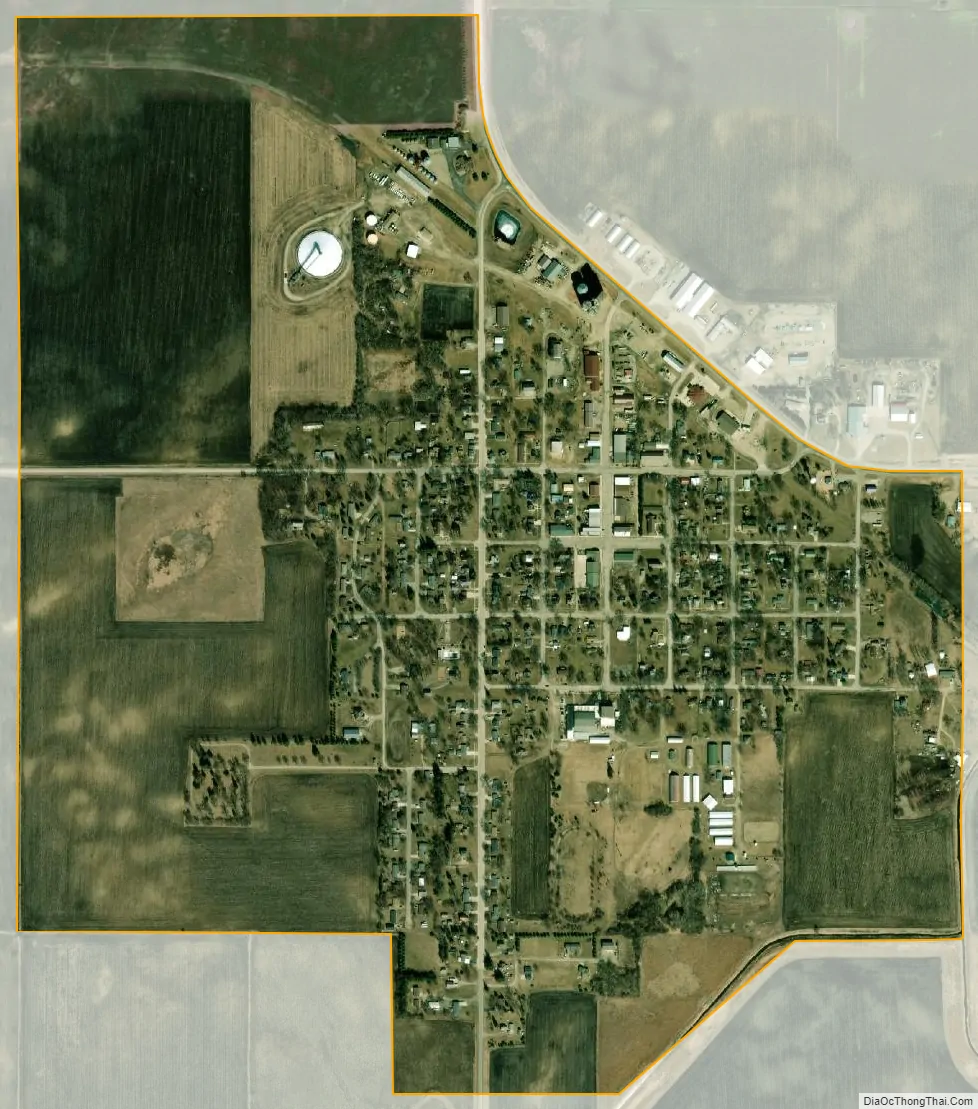
Thompson city Satellite Map
Geography
Thompson is located at 43°22′10″N 93°46′18″W / 43.36944°N 93.77167°W / 43.36944; -93.77167 (43.369562, -93.771765).
According to the United States Census Bureau, the city has a total area of 0.88 square miles (2.28 km), all land.
See also
Map of Iowa State and its subdivision:- Adair
- Adams
- Allamakee
- Appanoose
- Audubon
- Benton
- Black Hawk
- Boone
- Bremer
- Buchanan
- Buena Vista
- Butler
- Calhoun
- Carroll
- Cass
- Cedar
- Cerro Gordo
- Cherokee
- Chickasaw
- Clarke
- Clay
- Clayton
- Clinton
- Crawford
- Dallas
- Davis
- Decatur
- Delaware
- Des Moines
- Dickinson
- Dubuque
- Emmet
- Fayette
- Floyd
- Franklin
- Fremont
- Greene
- Grundy
- Guthrie
- Hamilton
- Hancock
- Hardin
- Harrison
- Henry
- Howard
- Humboldt
- Ida
- Iowa
- Jackson
- Jasper
- Jefferson
- Johnson
- Jones
- Keokuk
- Kossuth
- Lee
- Linn
- Louisa
- Lucas
- Lyon
- Madison
- Mahaska
- Marion
- Marshall
- Mills
- Mitchell
- Monona
- Monroe
- Montgomery
- Muscatine
- O'Brien
- Osceola
- Page
- Palo Alto
- Plymouth
- Pocahontas
- Polk
- Pottawattamie
- Poweshiek
- Ringgold
- Sac
- Scott
- Shelby
- Sioux
- Story
- Tama
- Taylor
- Union
- Van Buren
- Wapello
- Warren
- Washington
- Wayne
- Webster
- Winnebago
- Winneshiek
- Woodbury
- Worth
- Wright
- Alabama
- Alaska
- Arizona
- Arkansas
- California
- Colorado
- Connecticut
- Delaware
- District of Columbia
- Florida
- Georgia
- Hawaii
- Idaho
- Illinois
- Indiana
- Iowa
- Kansas
- Kentucky
- Louisiana
- Maine
- Maryland
- Massachusetts
- Michigan
- Minnesota
- Mississippi
- Missouri
- Montana
- Nebraska
- Nevada
- New Hampshire
- New Jersey
- New Mexico
- New York
- North Carolina
- North Dakota
- Ohio
- Oklahoma
- Oregon
- Pennsylvania
- Rhode Island
- South Carolina
- South Dakota
- Tennessee
- Texas
- Utah
- Vermont
- Virginia
- Washington
- West Virginia
- Wisconsin
- Wyoming