Wellman is a city in Washington County, Iowa, United States. It is part of the Iowa City, Iowa Metropolitan Statistical Area. The population was 1,524 at the time of the 2020 census.
| Name: | Wellman city |
|---|---|
| LSAD Code: | 25 |
| LSAD Description: | city (suffix) |
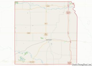
| State: | Iowa |
| County: | Washington County |
| Elevation: | 699 ft (213 m) |
| Total Area: | 1.07 sq mi (2.78 km²) |
| Land Area: | 1.07 sq mi (2.78 km²) |
| Water Area: | 0.00 sq mi (0.00 km²) |
| Total Population: | 1,524 |
| Population Density: | 1,421.64/sq mi (548.93/km²) |
| ZIP code: | 52356 |
| Area code: | 319 |
| FIPS code: | 1983280 |
| GNISfeature ID: | 0462787 |
| Website: | www.cityofwellman.com |
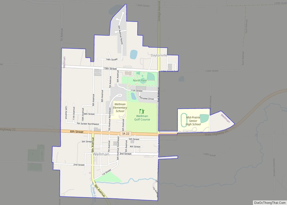
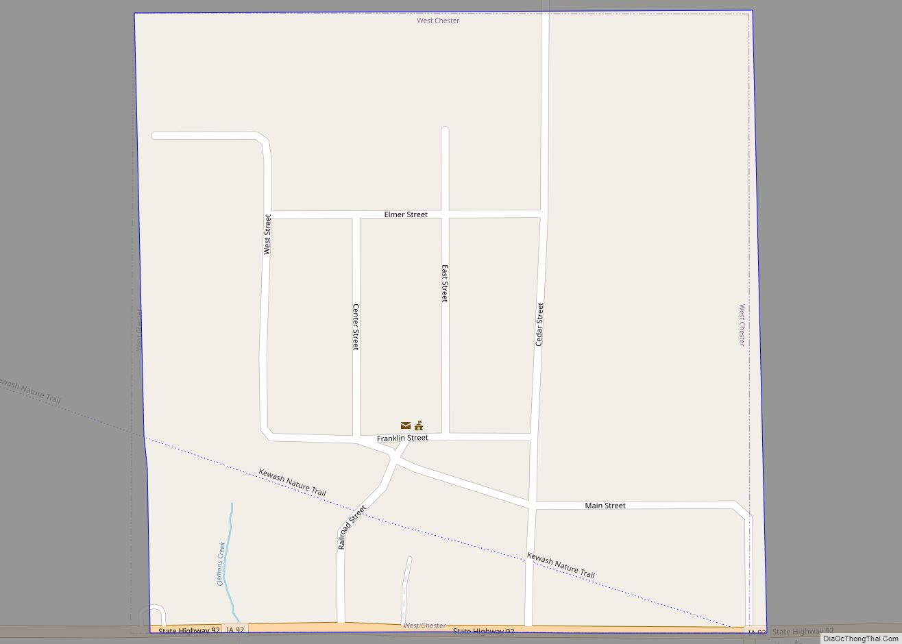
Online Interactive Map
Click on ![]() to view map in "full screen" mode.
to view map in "full screen" mode.
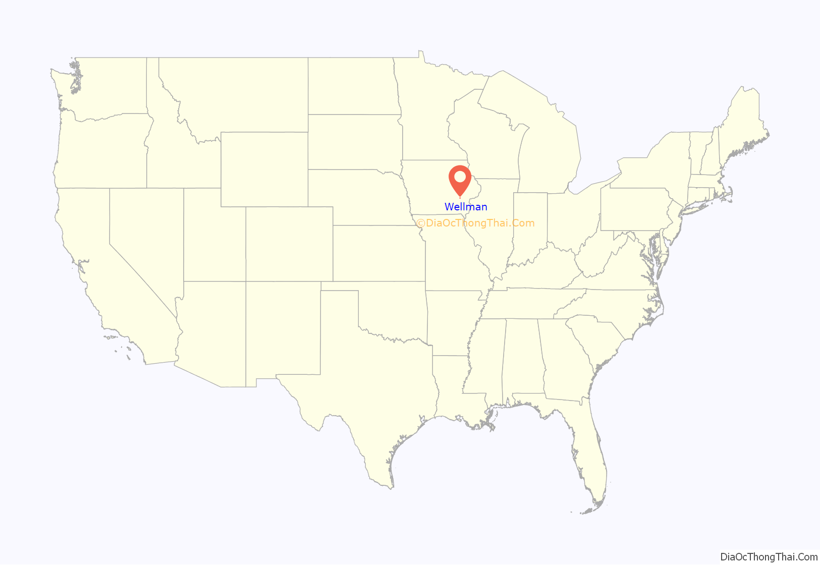
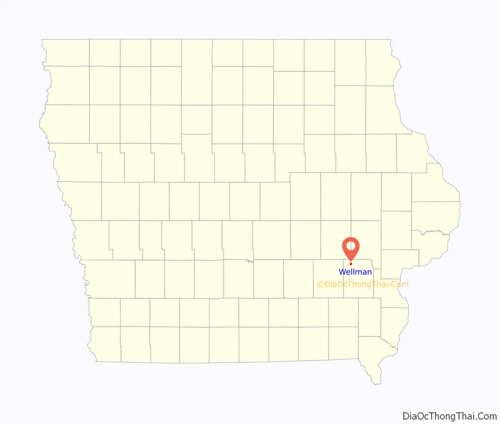
Wellman location map. Where is Wellman city?
History
Wellman is named for Joseph Edward Wellman, who in July, 1879, provided 40 acres (160,000 m) of his farmland for railroad construction including lots for development near the depot. Mr. Wellman was born in Lawrence County, Kentucky on 12 May 1824, acquired his farm in 1859, and died in Wellman on 14 January 1901.
Original European settlement of the area occurred in 1839 on the north side of the English River north of Wellman. A gristmill began operation in 1842, and the community of Wassonville was surveyed and platted in 1848. The Wassonville ferry served a major territorial road from Iowa City to Oskaloosa and the western frontier. A roadhouse had been constructed by 1850 and population grew to 300. Wassonville residents discouraged by frequent flood damage from the English River established the replacement village of Dayton on higher ground south of Wassonville in 1855. Dayton was the main trading point of the area from about 1860 to 1880, and the name was changed to Daytonville by the United States Post Office in 1878.
Construction of the Burlington, Cedar Rapids and Northern Railway depot shifted the focus of trade south to Wellman. The City of Wellman was incorporated in 1885, and a city water system was completed in 1896. The volunteer fire department established in 1893 was challenged by a fire which destroyed the east side of Main Street in February, 1902. The railway became part of the Chicago, Rock Island and Pacific Railroad in 1903. The first concrete sidewalk was built in front of the Wellman Savings Bank in 1904 and main street was paved in 1927. The first sewage treatment plant was built in 1940. The first fire truck went into service in August, 1946. Natural gas became available from the Wellman Municipal Gas System in 1963.
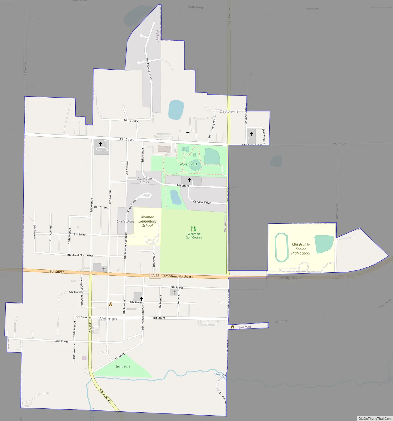
Wellman Road Map
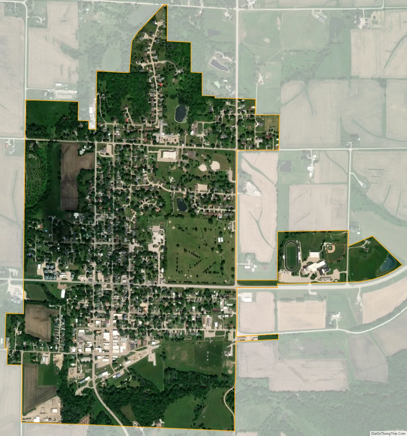
Wellman city Satellite Map
Geography
Wellman is located at 41°28′2″N 91°50′9″W / 41.46722°N 91.83583°W / 41.46722; -91.83583 (41.467118, -91.835956), in the northwestern corner of the county and in the southeastern part of the state.
According to the United States Census Bureau, the city has a total area of 1.14 square miles (2.95 km), all of it land.
See also
Map of Iowa State and its subdivision:- Adair
- Adams
- Allamakee
- Appanoose
- Audubon
- Benton
- Black Hawk
- Boone
- Bremer
- Buchanan
- Buena Vista
- Butler
- Calhoun
- Carroll
- Cass
- Cedar
- Cerro Gordo
- Cherokee
- Chickasaw
- Clarke
- Clay
- Clayton
- Clinton
- Crawford
- Dallas
- Davis
- Decatur
- Delaware
- Des Moines
- Dickinson
- Dubuque
- Emmet
- Fayette
- Floyd
- Franklin
- Fremont
- Greene
- Grundy
- Guthrie
- Hamilton
- Hancock
- Hardin
- Harrison
- Henry
- Howard
- Humboldt
- Ida
- Iowa
- Jackson
- Jasper
- Jefferson
- Johnson
- Jones
- Keokuk
- Kossuth
- Lee
- Linn
- Louisa
- Lucas
- Lyon
- Madison
- Mahaska
- Marion
- Marshall
- Mills
- Mitchell
- Monona
- Monroe
- Montgomery
- Muscatine
- O'Brien
- Osceola
- Page
- Palo Alto
- Plymouth
- Pocahontas
- Polk
- Pottawattamie
- Poweshiek
- Ringgold
- Sac
- Scott
- Shelby
- Sioux
- Story
- Tama
- Taylor
- Union
- Van Buren
- Wapello
- Warren
- Washington
- Wayne
- Webster
- Winnebago
- Winneshiek
- Woodbury
- Worth
- Wright
- Alabama
- Alaska
- Arizona
- Arkansas
- California
- Colorado
- Connecticut
- Delaware
- District of Columbia
- Florida
- Georgia
- Hawaii
- Idaho
- Illinois
- Indiana
- Iowa
- Kansas
- Kentucky
- Louisiana
- Maine
- Maryland
- Massachusetts
- Michigan
- Minnesota
- Mississippi
- Missouri
- Montana
- Nebraska
- Nevada
- New Hampshire
- New Jersey
- New Mexico
- New York
- North Carolina
- North Dakota
- Ohio
- Oklahoma
- Oregon
- Pennsylvania
- Rhode Island
- South Carolina
- South Dakota
- Tennessee
- Texas
- Utah
- Vermont
- Virginia
- Washington
- West Virginia
- Wisconsin
- Wyoming