Oskaloosa is a city in, and the county seat of, Mahaska County, Iowa, United States. In the late nineteenth and early twentieth century, Oskaloosa was a national center of bituminous coal mining. The population was 11,558 in the 2020 U.S. Census, an increase from 10,938 in 2000.
| Name: | Oskaloosa city |
|---|---|
| LSAD Code: | 25 |
| LSAD Description: | city (suffix) |
| State: | Iowa |
| County: | Mahaska County |
| Incorporated: | February 4, 1875 |
| Elevation: | 840 ft (256 m) |
| Total Area: | 8.04 sq mi (20.81 km²) |
| Land Area: | 8.02 sq mi (20.77 km²) |
| Water Area: | 0.01 sq mi (0.04 km²) |
| Total Population: | 11,558 |
| Population Density: | 1,440.97/sq mi (556.38/km²) |
| ZIP code: | 52577 |
| Area code: | 641 |
| FIPS code: | 1959925 |
| GNISfeature ID: | 0459908 |
| Website: | www.oskaloosaiowa.org |
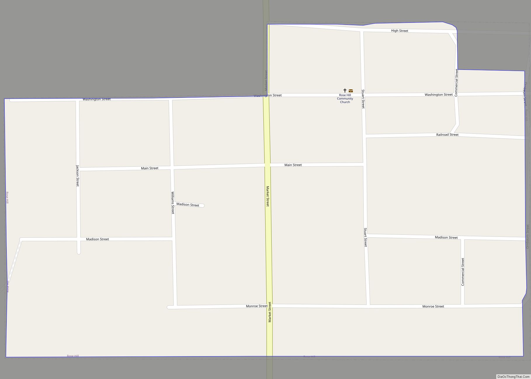
Online Interactive Map
Click on ![]() to view map in "full screen" mode.
to view map in "full screen" mode.
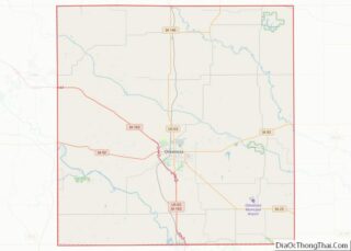
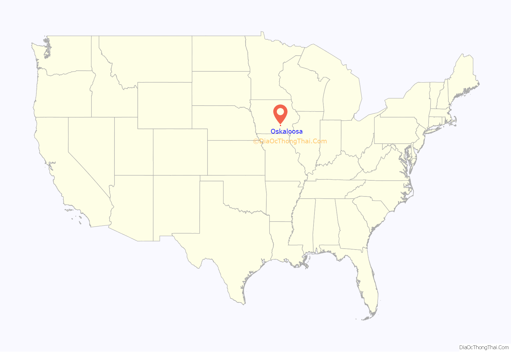
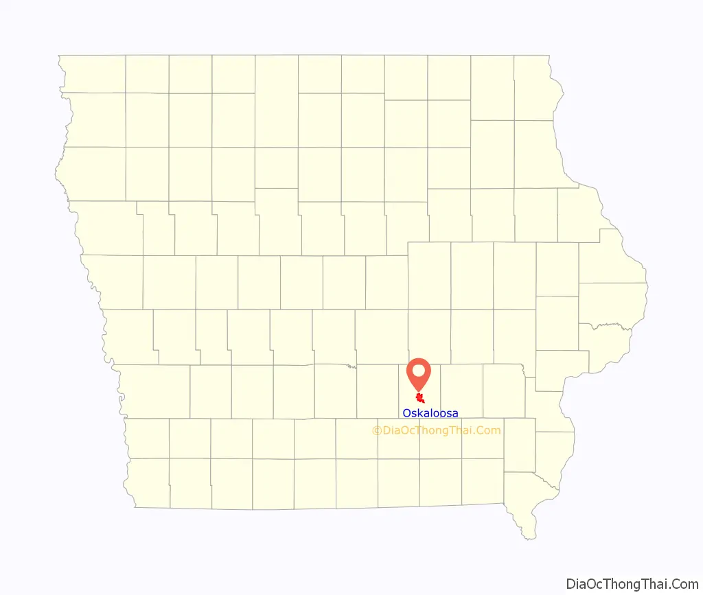
Oskaloosa location map. Where is Oskaloosa city?
History
Oskaloosa derives its name from Ouscaloosa who, according to town lore, was a Creek princess who married Seminole chief Osceola. A local tradition was that her name meant “last of the beautiful.” (This interpretation of “last of the beautiful” is not correct. “Oskaloosa” in the Mvskoke-Creek language means “black rain,” from the Mvskoke words “oske” (rain) and “lvste” (black). “loosa” is an English corruption of the Mvskoke word “lvste”. See for example the Wikipedia entry for Tuskaloosa, eponym of the town of Tuscaloosa, Alabama. In addition the Mvskoke word “Ouscaloosa” means “Black Water”). The first European-American settlers arrived in 1835, led by Nathan Boone, youngest son of frontiersman Daniel Boone. Acting on instructions from Stephen W. Kearny, he selected this as the first site of Fort Des Moines, located on a high ridge between the Skunk and Des Moines rivers. The ridge was originally called the Narrows.
The town was formally platted in 1844 when William Canfield moved his trading post from the Des Moines River to Oskaloosa. The town was designated by the legislature as the county seat in the same year.
The Des Moines Valley Railroad built north from Eddyville, Iowa through Oskaloosa to Pella, Iowa in 1864. In 1873, this became the Keokuk and Des Moines Railroad, and in 1887, it was leased by the Chicago, Rock Island and Pacific Railroad. The Central Iowa Railway followed, which became the Iowa Central Railway in 1888 and was absorbed by the Minneapolis and St. Louis Railway in 1901. In 1883, the Burlington and Western Railway reached Oskaloosa; this was a narrow gauge line that was widened to Standard Gauge in 1902 and then merged with the Chicago, Burlington and Quincy Railroad.
On January 6, 1882, most of the buildings in the north half of Oskaloosa were severely damaged and most of the plate glass windows in the area were broken by an explosion. Three boys were killed in the explosion. The boys had been seen shooting at the A. L. Spencer gunpowder magazine half a mile north of the town center.
The first bituminous coal mine in the area was opened shortly after 1853 by Robert Seevers, who drove a drift into a 4-foot coalbed in an exposed creek bank east of town. Initially, coal was mined entirely for local consumption, but with the arrival of the railroads, coal from the region was shipped widely. In the 1880s, more than one million tons of was mined in the county from 38 mines. By 1887, the report of the state mine inspector listed 11 coal mines in or very close to Oskaloosa. By 1895 the coal output of Mahaska County surpassed that of all other Iowa counties, and production had reached more than one million tons per year. In 1911, coal mining was reported to be the primary industry in the region. In 1914, the Carbon Block Coal Company of Centerville produced more than 100,000 tons of coal, ranking among the top 24 coal producers in the state.
Several major coal-mining camps were located in the Oskaloosa area. Muchakinock was about 5 miles south of town, on the banks of the Muchakinock Creek. Lost Creek was a company town and post office with a population of about 500 in 1905, located about 10 miles south of town. On January 24, 1902, there was a mine explosion in the Lost Creek No. 2 mine. This was one of only two major mine disasters in Iowa between 1888 and 1913. A miner setting shots to blast coal from the coal face re-used a hole left over from a previous failed shot, and the result was a coal dust explosion that detonated barrels of gunpowder stored in the mine. 20 men died on the site and 14 more were badly injured. The explosion sparked a statewide miner’s strike. As a result, in April 1903, the legislature enacted a law to regulate blasting in coal mines.
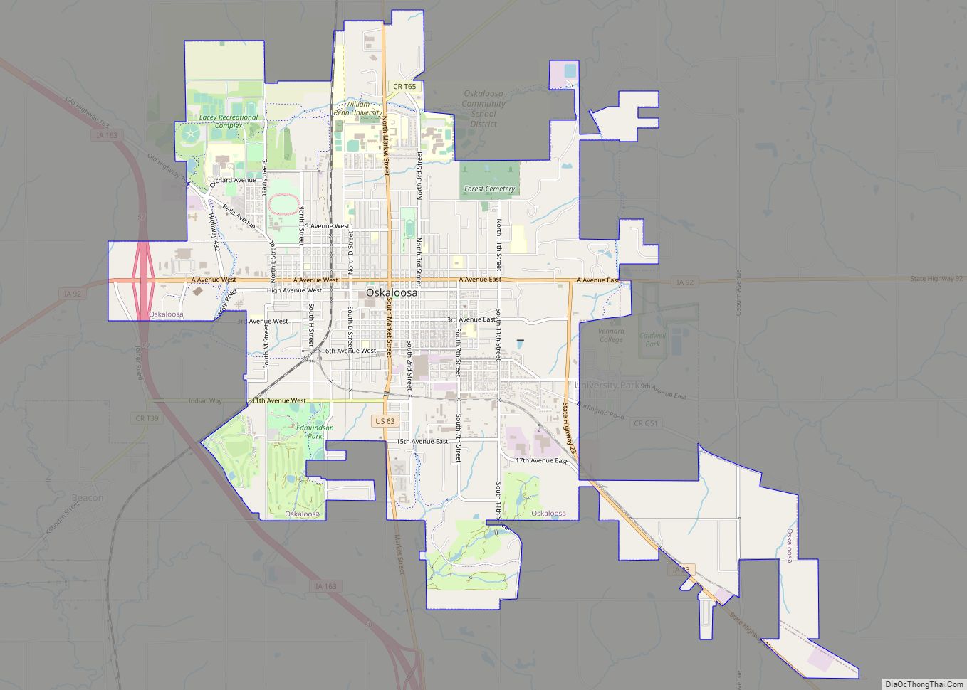
Oskaloosa Road Map
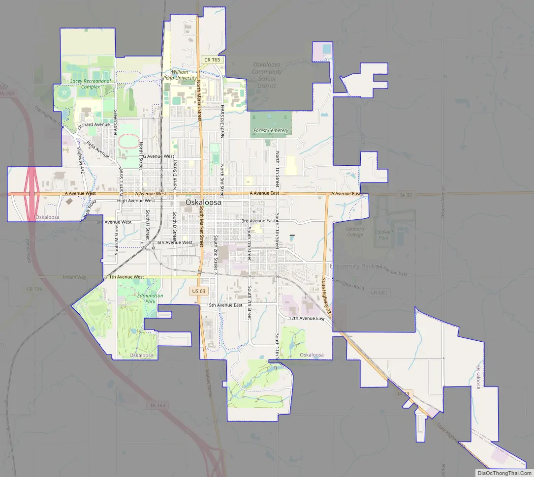
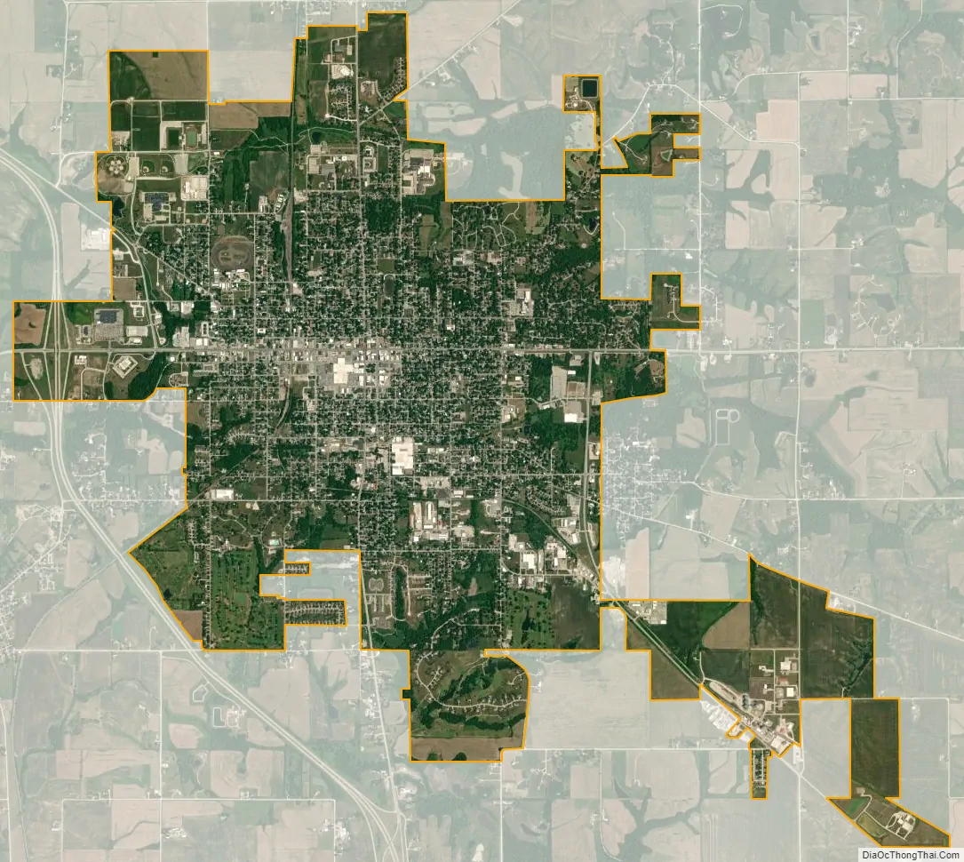
Oskaloosa city Satellite Map
Geography
According to the United States Census Bureau, the city has a total area of 7.45 square miles (19.30 km), of which 7.43 square miles (19.24 km) is land and 0.02 square miles (0.05 km) is water.
See also
Map of Iowa State and its subdivision:- Adair
- Adams
- Allamakee
- Appanoose
- Audubon
- Benton
- Black Hawk
- Boone
- Bremer
- Buchanan
- Buena Vista
- Butler
- Calhoun
- Carroll
- Cass
- Cedar
- Cerro Gordo
- Cherokee
- Chickasaw
- Clarke
- Clay
- Clayton
- Clinton
- Crawford
- Dallas
- Davis
- Decatur
- Delaware
- Des Moines
- Dickinson
- Dubuque
- Emmet
- Fayette
- Floyd
- Franklin
- Fremont
- Greene
- Grundy
- Guthrie
- Hamilton
- Hancock
- Hardin
- Harrison
- Henry
- Howard
- Humboldt
- Ida
- Iowa
- Jackson
- Jasper
- Jefferson
- Johnson
- Jones
- Keokuk
- Kossuth
- Lee
- Linn
- Louisa
- Lucas
- Lyon
- Madison
- Mahaska
- Marion
- Marshall
- Mills
- Mitchell
- Monona
- Monroe
- Montgomery
- Muscatine
- O'Brien
- Osceola
- Page
- Palo Alto
- Plymouth
- Pocahontas
- Polk
- Pottawattamie
- Poweshiek
- Ringgold
- Sac
- Scott
- Shelby
- Sioux
- Story
- Tama
- Taylor
- Union
- Van Buren
- Wapello
- Warren
- Washington
- Wayne
- Webster
- Winnebago
- Winneshiek
- Woodbury
- Worth
- Wright
- Alabama
- Alaska
- Arizona
- Arkansas
- California
- Colorado
- Connecticut
- Delaware
- District of Columbia
- Florida
- Georgia
- Hawaii
- Idaho
- Illinois
- Indiana
- Iowa
- Kansas
- Kentucky
- Louisiana
- Maine
- Maryland
- Massachusetts
- Michigan
- Minnesota
- Mississippi
- Missouri
- Montana
- Nebraska
- Nevada
- New Hampshire
- New Jersey
- New Mexico
- New York
- North Carolina
- North Dakota
- Ohio
- Oklahoma
- Oregon
- Pennsylvania
- Rhode Island
- South Carolina
- South Dakota
- Tennessee
- Texas
- Utah
- Vermont
- Virginia
- Washington
- West Virginia
- Wisconsin
- Wyoming