West Liberty is a city in Muscatine County, Iowa, United States. The population was 3,858 at the time of the 2020 census. It is part of the Muscatine micropolitan area.
West Liberty is located five miles south of Interstate 80 on Historic Highway 6. The city is home to the West Liberty Raceway, located in the Muscatine County Fairgrounds. The Muscatine County Fair takes place in West Liberty in July of each year.
| Name: | West Liberty city |
|---|---|
| LSAD Code: | 25 |
| LSAD Description: | city (suffix) |
| State: | Iowa |
| County: | Muscatine County |
| Elevation: | 676 ft (206 m) |
| Total Area: | 1.77 sq mi (4.58 km²) |
| Land Area: | 1.77 sq mi (4.58 km²) |
| Water Area: | 0.00 sq mi (0.00 km²) |
| Total Population: | 3,858 |
| Population Density: | 2,183.36/sq mi (842.97/km²) |
| ZIP code: | 52776 |
| Area code: | 319 |
| FIPS code: | 1984315 |
| GNISfeature ID: | 0462879 |
| Website: | cityofwestlibertyia.org |
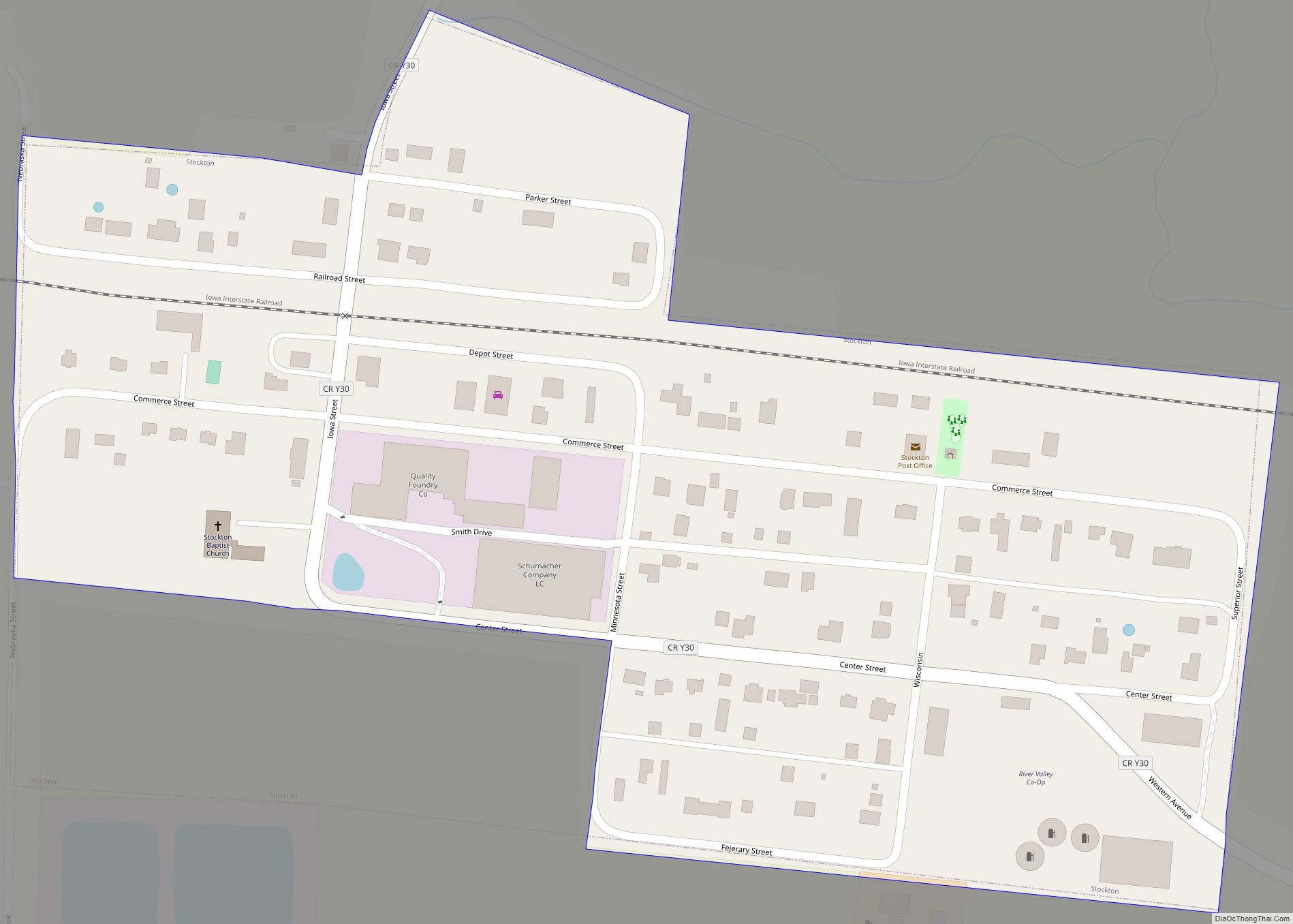
Online Interactive Map
Click on ![]() to view map in "full screen" mode.
to view map in "full screen" mode.
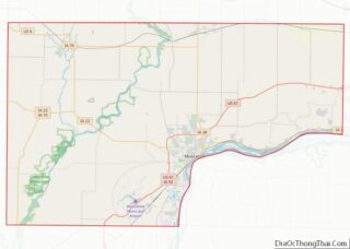
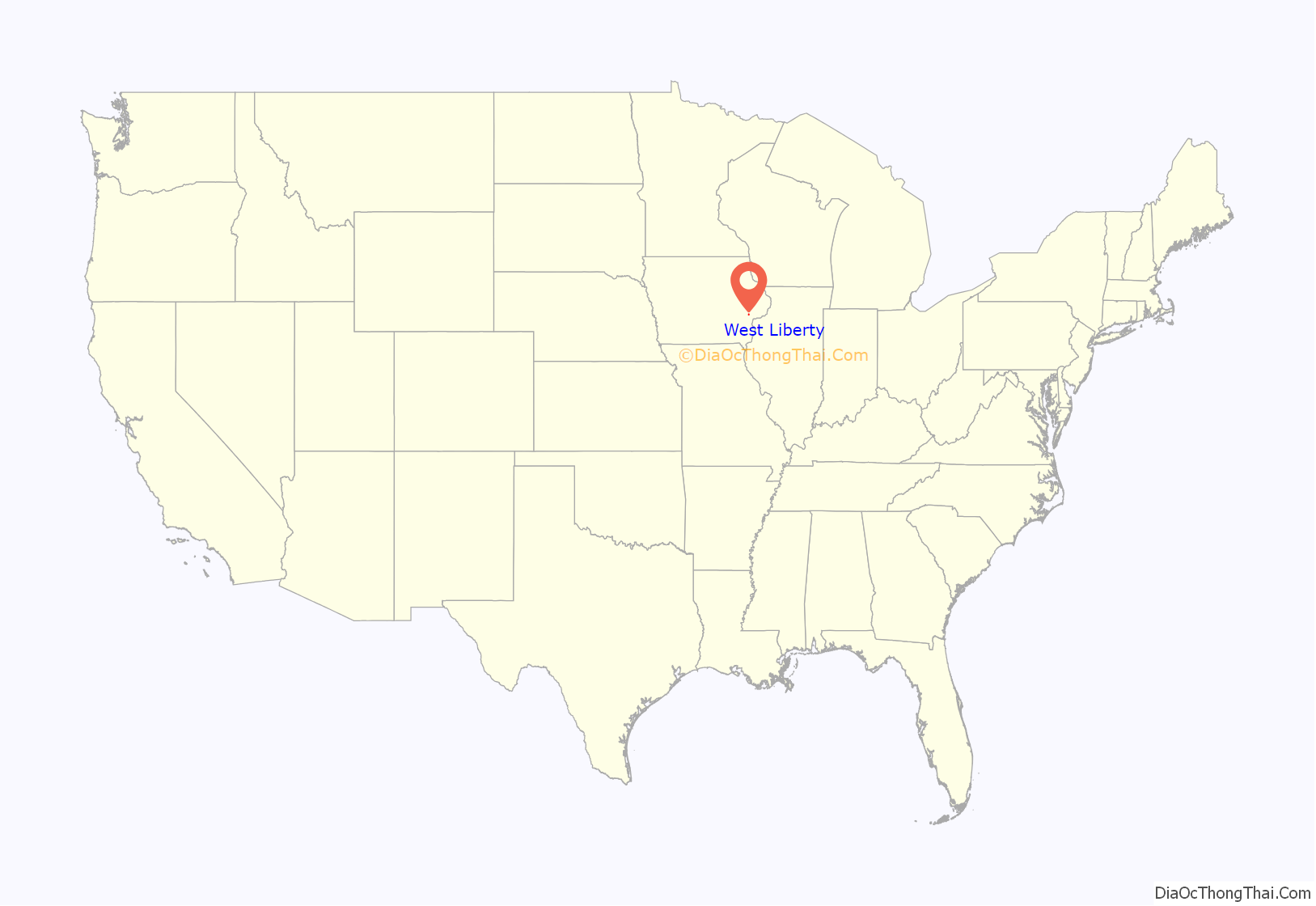
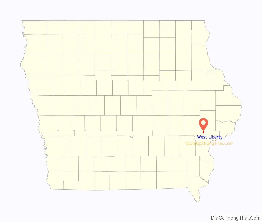
West Liberty location map. Where is West Liberty city?
History
West Liberty was incorporated in 1868, at the junction of the Chicago, Rock Island and Pacific and Burlington, Cedar Rapids and Northern Railroads. Prior to incorporation, the town stood about a half-mile north of its current location, but was relocated to be closer to the railway. The settlement was originally called Wapsinonoc Township, which means smooth surfaced, meandering creek or stream. The name change to Liberty (after Liberty, Ohio, the former home of many of its settlers) is attributed to the wife of the township’s first postmaster, Simeon A. Bagley. It is believed that the name was changed after the relocation.
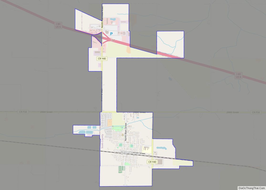
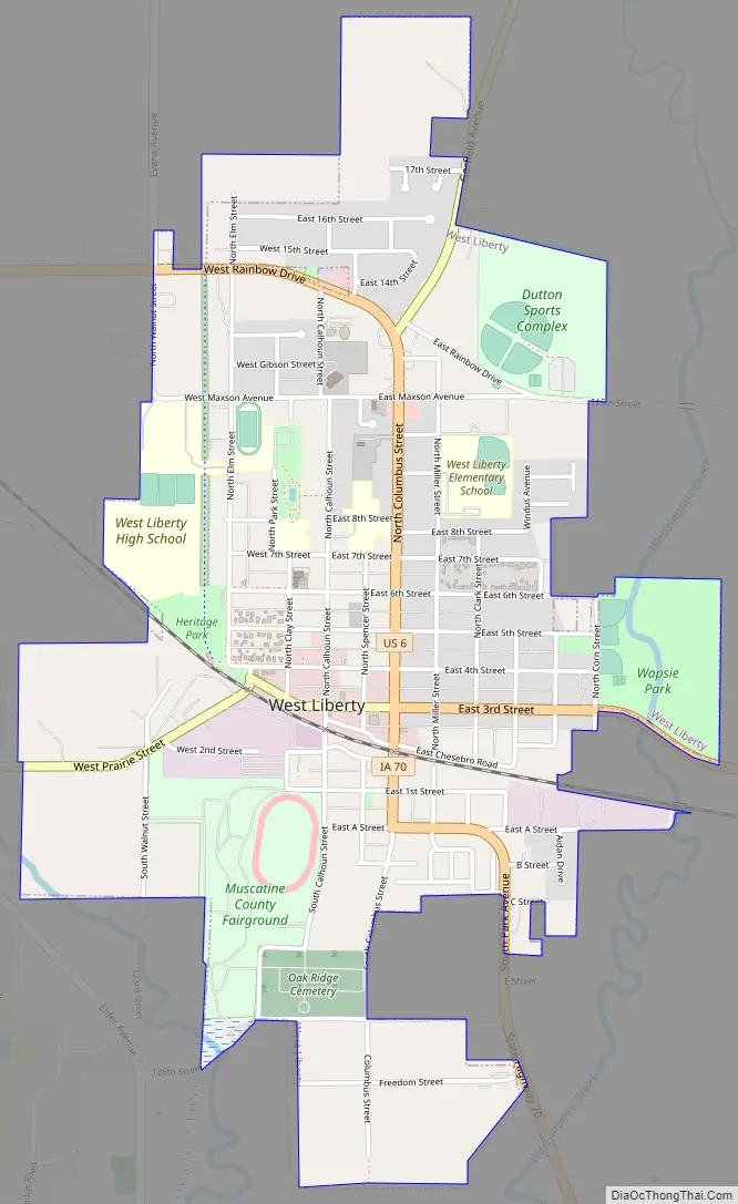
West Liberty Road Map
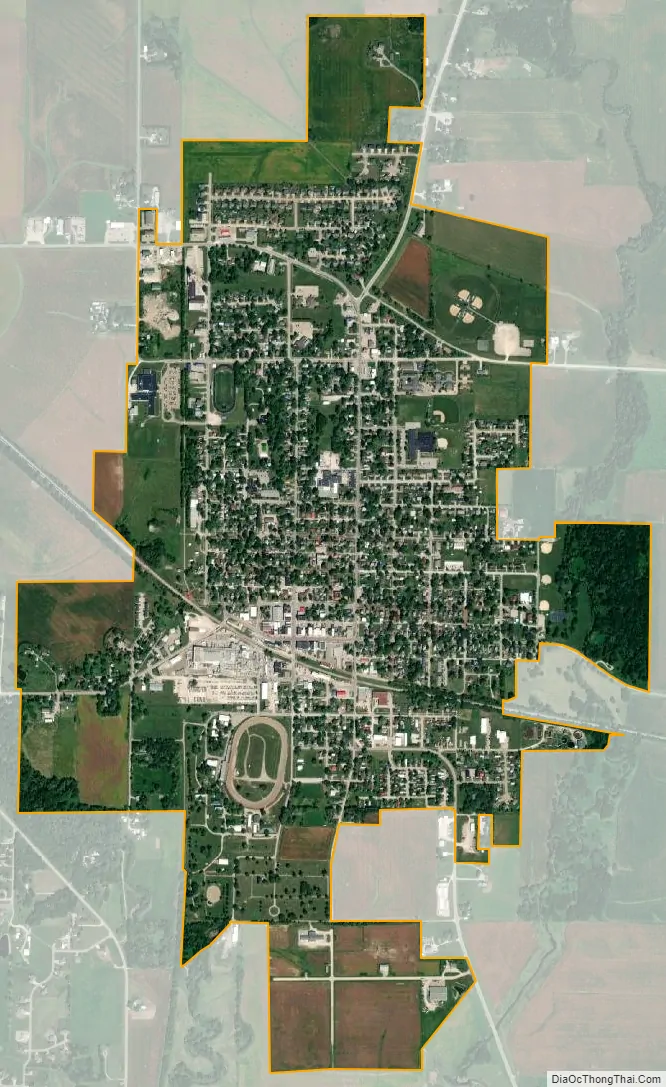
West Liberty city Satellite Map
Geography
West Liberty is located at 41°34′17″N 91°15′40″W / 41.571517°N 91.261229°W / 41.571517; -91.261229 (41.571517, -91.261229).
According to the United States Census Bureau, the city has a total area of 1.74 square miles (4.51 km), all land.
See also
Map of Iowa State and its subdivision:- Adair
- Adams
- Allamakee
- Appanoose
- Audubon
- Benton
- Black Hawk
- Boone
- Bremer
- Buchanan
- Buena Vista
- Butler
- Calhoun
- Carroll
- Cass
- Cedar
- Cerro Gordo
- Cherokee
- Chickasaw
- Clarke
- Clay
- Clayton
- Clinton
- Crawford
- Dallas
- Davis
- Decatur
- Delaware
- Des Moines
- Dickinson
- Dubuque
- Emmet
- Fayette
- Floyd
- Franklin
- Fremont
- Greene
- Grundy
- Guthrie
- Hamilton
- Hancock
- Hardin
- Harrison
- Henry
- Howard
- Humboldt
- Ida
- Iowa
- Jackson
- Jasper
- Jefferson
- Johnson
- Jones
- Keokuk
- Kossuth
- Lee
- Linn
- Louisa
- Lucas
- Lyon
- Madison
- Mahaska
- Marion
- Marshall
- Mills
- Mitchell
- Monona
- Monroe
- Montgomery
- Muscatine
- O'Brien
- Osceola
- Page
- Palo Alto
- Plymouth
- Pocahontas
- Polk
- Pottawattamie
- Poweshiek
- Ringgold
- Sac
- Scott
- Shelby
- Sioux
- Story
- Tama
- Taylor
- Union
- Van Buren
- Wapello
- Warren
- Washington
- Wayne
- Webster
- Winnebago
- Winneshiek
- Woodbury
- Worth
- Wright
- Alabama
- Alaska
- Arizona
- Arkansas
- California
- Colorado
- Connecticut
- Delaware
- District of Columbia
- Florida
- Georgia
- Hawaii
- Idaho
- Illinois
- Indiana
- Iowa
- Kansas
- Kentucky
- Louisiana
- Maine
- Maryland
- Massachusetts
- Michigan
- Minnesota
- Mississippi
- Missouri
- Montana
- Nebraska
- Nevada
- New Hampshire
- New Jersey
- New Mexico
- New York
- North Carolina
- North Dakota
- Ohio
- Oklahoma
- Oregon
- Pennsylvania
- Rhode Island
- South Carolina
- South Dakota
- Tennessee
- Texas
- Utah
- Vermont
- Virginia
- Washington
- West Virginia
- Wisconsin
- Wyoming