Greenville is a city in Bond County, Illinois, United States, 51 miles (82 km) east of St. Louis. The population as of the 2020 census was 7,083, up from 7,000 at the 2010 census. It is the county seat of Bond County.
Greenville is part of the St. Louis Metropolitan Statistical Area. It is also considered part of the Metro East region of Illinois.
Greenville celebrated its Bicentennial in 2015 as one of the oldest communities in Illinois. It is home to Greenville University, the Richard Bock Museum, the American Farm Heritage Museum, the Armed Forces Museum and the Demoulin Museum and a federal prison, Federal Correctional Institution, Greenville (FCI Greenville). It is also home to internationally known companies, including Nevco Scoreboard, the largest privately owned scoreboard company in the world, and DeMoulin Brothers, the world’s oldest and largest manufacturer of band uniforms.
| Name: | Greenville city |
|---|---|
| LSAD Code: | 25 |
| LSAD Description: | city (suffix) |
| State: | Illinois |
| County: | Bond County |
| Founded: | Municipal corporation, 1872 |
| Elevation: | 577 ft (176 m) |
| Total Area: | 6.31 sq mi (16.34 km²) |
| Land Area: | 6.31 sq mi (16.34 km²) |
| Water Area: | 0.00 sq mi (0.00 km²) 0% |
| Total Population: | 7,083 |
| Population Density: | 1,122.68/sq mi (433.49/km²) |
| FIPS code: | 1731589 |
| GNISfeature ID: | 2394995 |
| Website: | www.greenvilleillinois.com |
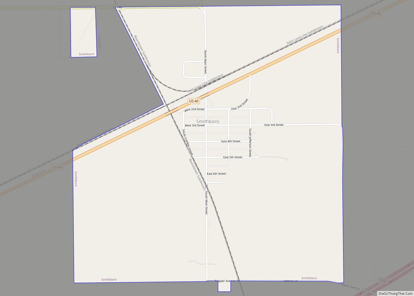
Online Interactive Map
Click on ![]() to view map in "full screen" mode.
to view map in "full screen" mode.
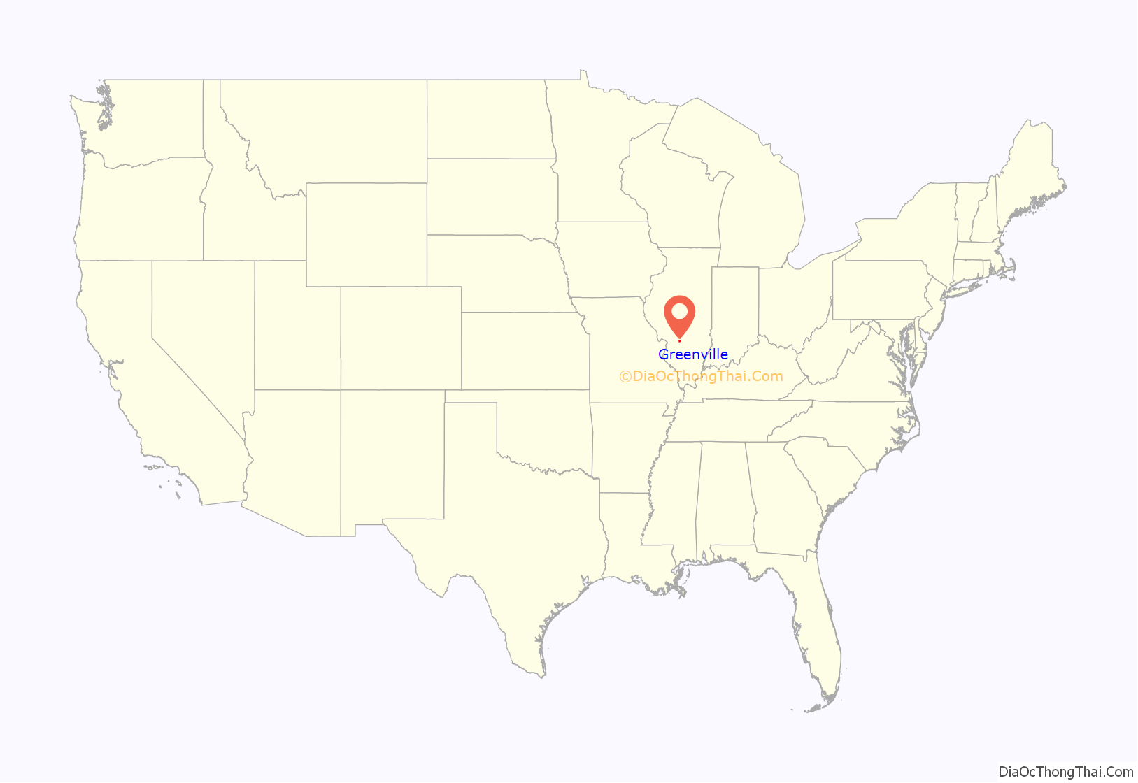
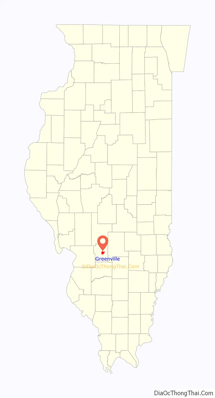
Greenville location map. Where is Greenville city?
History
Greenville was founded by George Davidson in 1815 in what was then the Illinois Territory, when he purchased 160 acres (65 ha) along the bluff overlooking Little Shoal Creek, in what was then still part of Madison County. Davidson built a tavern near the present-day intersection of Main and Sixth streets, and by 1816 he was selling individual lots. The federal government established its first federal post office in Greenville in 1819. It was incorporated as a town in 1855 and as a city in 1872. At one time, it had neighborhoods called New Jerusalem, Piety Hill, Cobtown, and Buzzard Roost. A few possible reasons have been put forth for the naming of the town. Some think the town was named after Greenville, North Carolina, which had been named after Revolutionary War general Nathanael Greene. Others say that Greenville was named by early settler Thomas White because it was “so green and nice”. A third possibility is that Greenville was named after Green P. Rice, the town’s first merchant.
Greenville became the county seat of Bond County in 1821. The earlier seat of Perryville was annexed into Fayette County when it was formed from part of Bond County, requiring the naming of a new seat. Davidson offered to give the county government land around the present-day town square. His offer was accepted, and a courthouse was built in 1821 on the site of the current courthouse.
During the 1840s, some Bond County residents conducted slaves to freedom on the Underground Railroad. Slaves were often spirited from Missouri, sometimes through Carlyle to Bond County. Rev. John Leeper was able to disguise his Underground Railroad activities due to his milling business. Dr. Henry Perrine practiced medicine near Greenville and helped with the secret railroad activities. Rev. George Denny’s house was found in the 1930s to conceal a secret chamber that had been used in the Railroad.
Greenville University was founded as Almira College, a women’s college, in 1855. Former GU history professor Donald Jordahl has written that Almira College was “one of the earliest extensions westward of an eastern idea favorable toward female education, an early step in the women’s suffrage and liberation movement.” In 1941, college president H.J. Long “declared the founding of Almira and Greenville ran parallel, for both were founded on prayer.” Women in Bond County could vote for the first time in 1914.
When Abraham Lincoln and Stephen Douglas gave speeches in Greenville in 1858 during a campaign for the United States Senate, Douglas said: “Ladies and gentlemen, it gives me great and supreme gratification and pleasure to see this vast concourse of people assembled to hear me upon this my first visit to Old Bond.” The Illinois State Register reported of the occasion: “I’ve seen many gatherings in Old Bond county but I never saw anything equal to this and I never expect to.”
On November 21, 1915, the Liberty Bell passed through Greenville on its nationwide tour returning to Pennsylvania from the Panama–Pacific International Exposition in San Francisco. After that trip, the Liberty Bell returned to Pennsylvania and will not be moved again.
The Greenville Public Library was established as a Carnegie library and is on the National Register of Historic Places. Hogue Hall at Greenville College also appeared on the National Register (it was demolished in 2008).
On April 18, 1934, during the Great Depression, a group of 500 protesters marched to the Illinois Emergency Relief Commission to lodge complaints about the delivery of emergency supplies from the state and federal governments.
Illinois native Ronald Reagan visited Greenville on the campaign trail in 1980 and gave a speech on the street in front of the courthouse; his visit is commemorated by a plaque. Barack Obama visited Greenville while campaigning for his Senate seat in 2004, in a visit hosted by the Bond County Democrats.
Historic businesses
While Greenville once hosted three newspapers, The Item, The Sun, and The Advocate, it now has only the twice-weekly Greenville Advocate. The Advocate is the oldest business in Bond County and one of the oldest newspapers in Illinois. Original Advocate owner Jediah Alexander was friends with Abraham Lincoln and instrumental in bringing Lincoln to Greenville for a visit.
Historic Greenville businesses also include the Helvetia Milk Condensing Company, which later became the Pet Milk Company. The condensing plant, built in 1899, was the oldest in the world for many years until it was torn down in the early 1990s. Pet also maintained its research and testing center in Greenville. Many products. including Instant Pet, Pet-Ritz pies, Sego diet foods, and Old El Paso products were developed there, along with the first use of food irradiation to increase the Vitamin D content of milk. The remaining research buildings and warehouses were sold to Mallinckrodt Pharmaceuticals in the 1990s, which continues to operate there today.
Other historic businesses in Greenville included shoe manufacturer Mayer and Bannister, cigar manufacturers Thomas D. Scheske and H.H. Wirz, and a glove factory, the Greenville Glove Manufacturing Co. In the early 1900s, Greenville had its own power company, Greenville Electric Gas and Power Company, which later was bought by Illinois Power and Light Service.
The Watson family operated a pharmacy in Greenville for over 125 years, since 1881; it was sold in 2006, but still maintains the name Watson’s Drug Store. Greenville once had a silent movie theatre, the Lyric, and now has a first-run movie theatre, the Globe.
Bradford National Bank was founded in 1867 by James Bradford and his son Samuel and was originally known as the Banking House of Bradford and Sons. In 1910, the bank received its national charter to become Bradford National Bank. In 2017, the bank celebrated its 150th anniversary and is the 10th oldest bank in Illinois.
Today, the bank has locations in Greenville, Highland, and Marine, Illinois.
Greenville Road Map
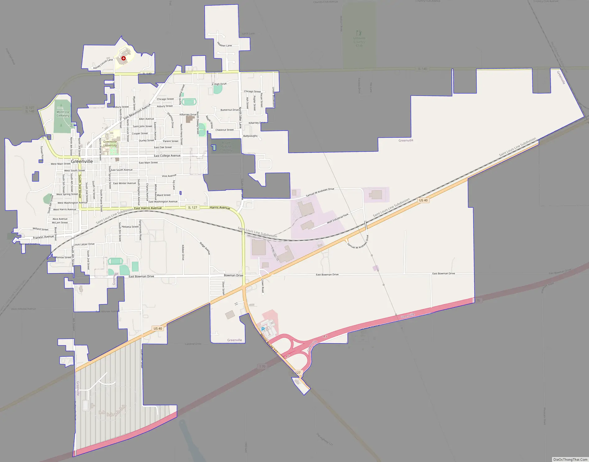
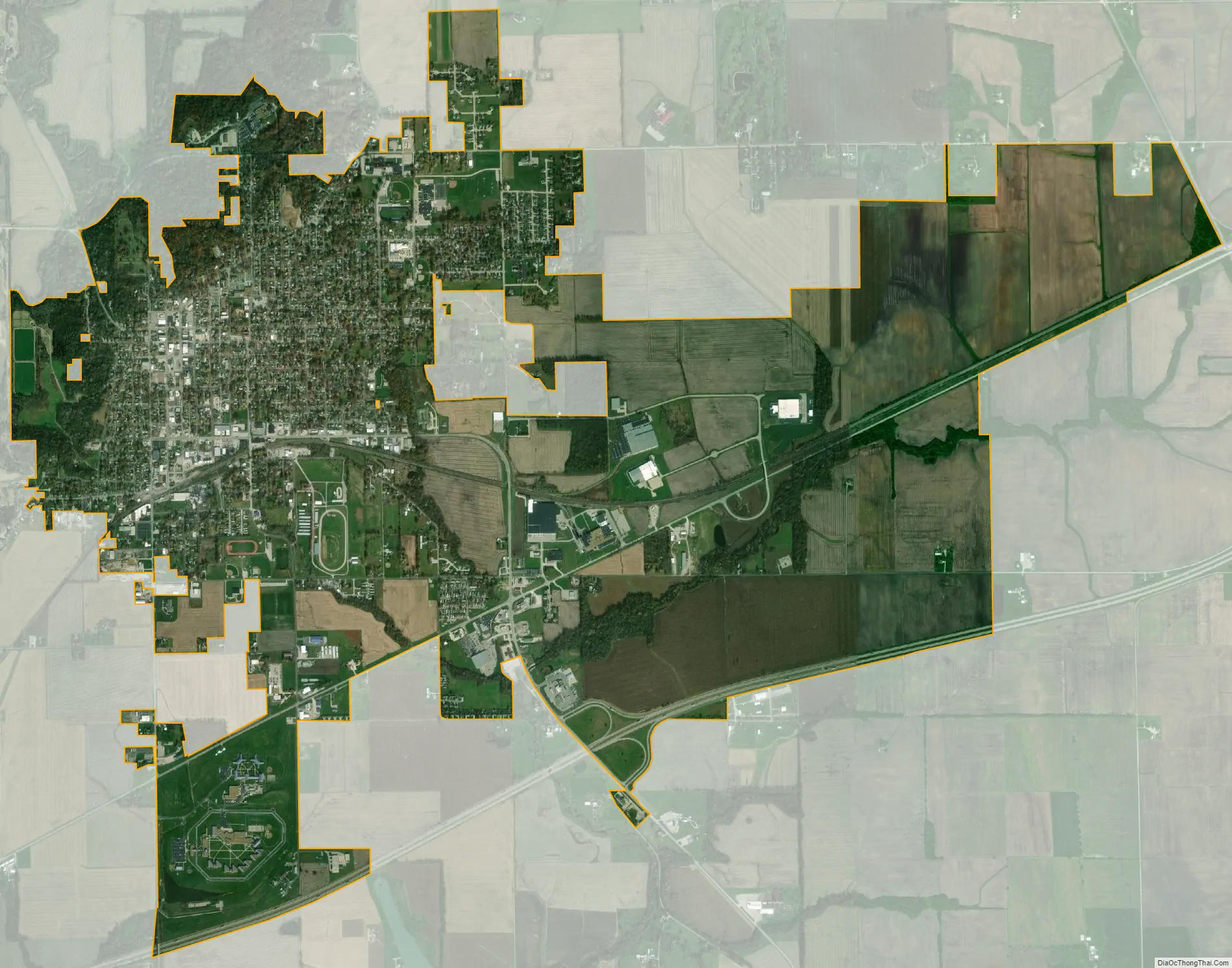
Greenville city Satellite Map
Geography
Greenville is located near the center of Bond County. U.S. Route 40 and Interstate 70 pass to the south of downtown, both highways leading west 49 miles (79 km) to St. Louis and east 19 miles (31 km) to Vandalia.
Greenville is also located on Illinois Route 127, which is a major north-south route connecting Southern Illinois to Springfield.
The National Road passes through Greenville. East of Greenville it follows Illinois Route 140, and west it follows U.S. Route 40. Its route west of town was the source of a historic controversy. Original plans were to connect Greenville to St. Louis. However, the Illinois General Assembly preferred a route to Alton to favor an Illinois city directly on the Mississippi River. When federal money for the road ran out in 1840 at Vandalia, 19 miles east of Greenville, the State Legislature refused to fund it further. Residents of Greenville, Highland, Troy, and Collinsville paid to complete the road to East St. Louis. The “State Policy” of favoring Alton over St. Louis remained a major political issue in Illinois until the Civil War.
According to the 2021 census gazetteer files, Greenville has a total area of 6.31 square miles (16.34 km), all land.
See also
Map of Illinois State and its subdivision:- Adams
- Alexander
- Bond
- Boone
- Brown
- Bureau
- Calhoun
- Carroll
- Cass
- Champaign
- Christian
- Clark
- Clay
- Clinton
- Coles
- Cook
- Crawford
- Cumberland
- De Kalb
- De Witt
- Douglas
- Dupage
- Edgar
- Edwards
- Effingham
- Fayette
- Ford
- Franklin
- Fulton
- Gallatin
- Greene
- Grundy
- Hamilton
- Hancock
- Hardin
- Henderson
- Henry
- Iroquois
- Jackson
- Jasper
- Jefferson
- Jersey
- Jo Daviess
- Johnson
- Kane
- Kankakee
- Kendall
- Knox
- La Salle
- Lake
- Lake Michigan
- Lawrence
- Lee
- Livingston
- Logan
- Macon
- Macoupin
- Madison
- Marion
- Marshall
- Mason
- Massac
- McDonough
- McHenry
- McLean
- Menard
- Mercer
- Monroe
- Montgomery
- Morgan
- Moultrie
- Ogle
- Peoria
- Perry
- Piatt
- Pike
- Pope
- Pulaski
- Putnam
- Randolph
- Richland
- Rock Island
- Saint Clair
- Saline
- Sangamon
- Schuyler
- Scott
- Shelby
- Stark
- Stephenson
- Tazewell
- Union
- Vermilion
- Wabash
- Warren
- Washington
- Wayne
- White
- Whiteside
- Will
- Williamson
- Winnebago
- Woodford
- Alabama
- Alaska
- Arizona
- Arkansas
- California
- Colorado
- Connecticut
- Delaware
- District of Columbia
- Florida
- Georgia
- Hawaii
- Idaho
- Illinois
- Indiana
- Iowa
- Kansas
- Kentucky
- Louisiana
- Maine
- Maryland
- Massachusetts
- Michigan
- Minnesota
- Mississippi
- Missouri
- Montana
- Nebraska
- Nevada
- New Hampshire
- New Jersey
- New Mexico
- New York
- North Carolina
- North Dakota
- Ohio
- Oklahoma
- Oregon
- Pennsylvania
- Rhode Island
- South Carolina
- South Dakota
- Tennessee
- Texas
- Utah
- Vermont
- Virginia
- Washington
- West Virginia
- Wisconsin
- Wyoming