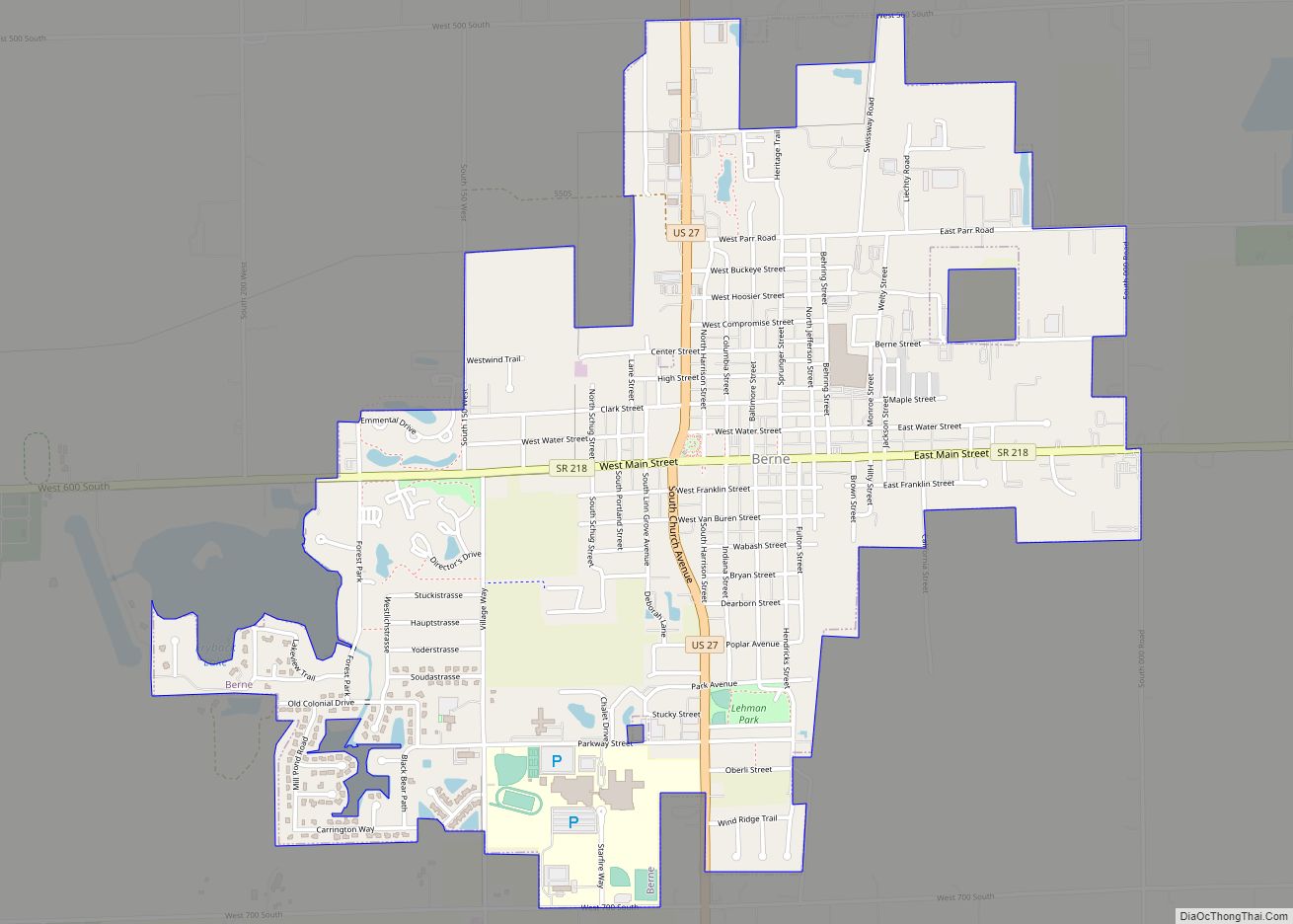
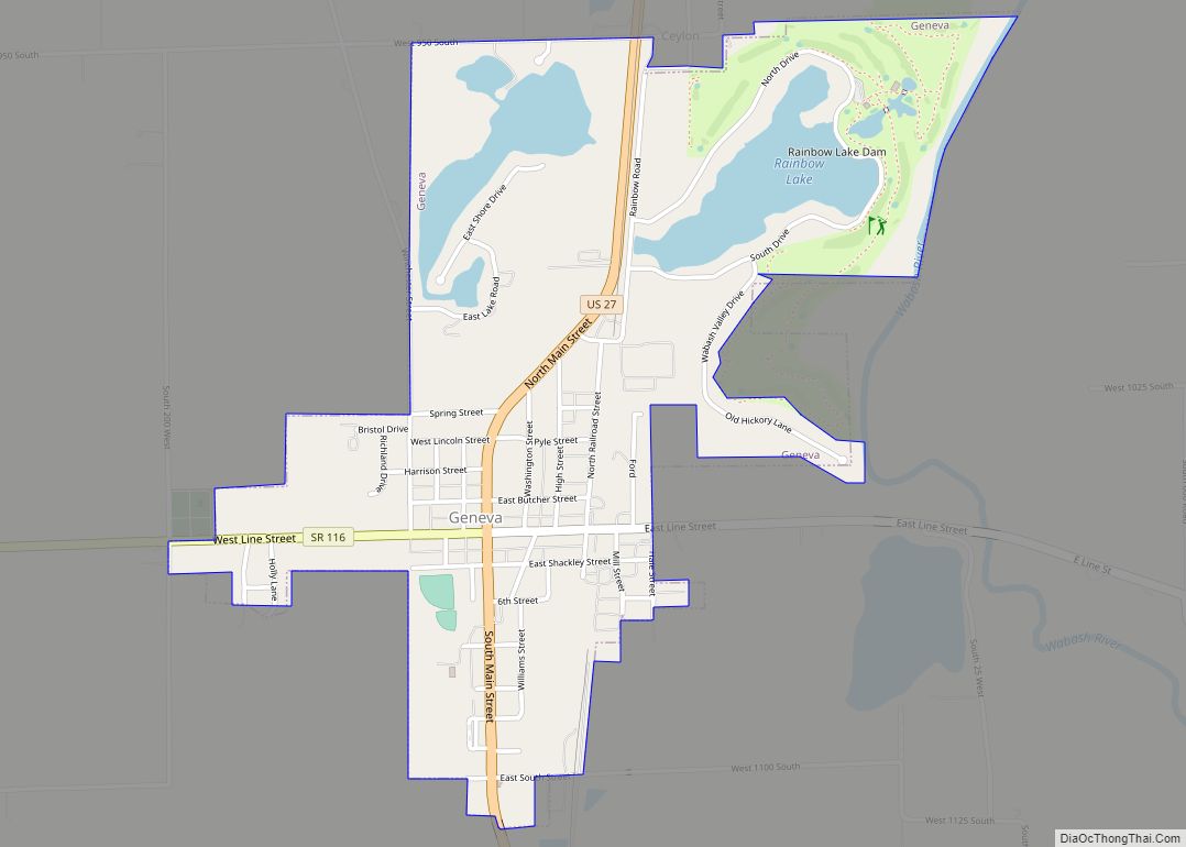
Geneva is a town in Wabash Township, Adams County, Indiana. The population was 1,293 at the time of the 2010 census. Geneva is the location of the Limberlost Cabin, the home of writer and naturalist Gene Stratton-Porter from 1895-1913.
| Name: | Geneva town |
|---|---|
| LSAD Code: | 43 |
| LSAD Description: | town (suffix) |
| State: | Indiana |
| County: | Adams County |
| Elevation: | 850 ft (259 m) |
| Total Area: | 1.24 sq mi (3.22 km²) |
| Land Area: | 1.10 sq mi (2.86 km²) |
| Water Area: | 0.14 sq mi (0.36 km²) |
| Total Population: | 1,257 |
| Population Density: | 1,138.59/sq mi (439.76/km²) |
| ZIP code: | 46740 |
| Area code: | 260 |
| FIPS code: | 1827216 |
| GNISfeature ID: | 0435014 |
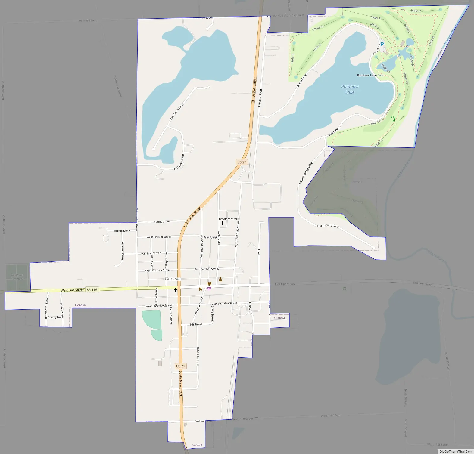
Online Interactive Map
Click on ![]() to view map in "full screen" mode.
to view map in "full screen" mode.
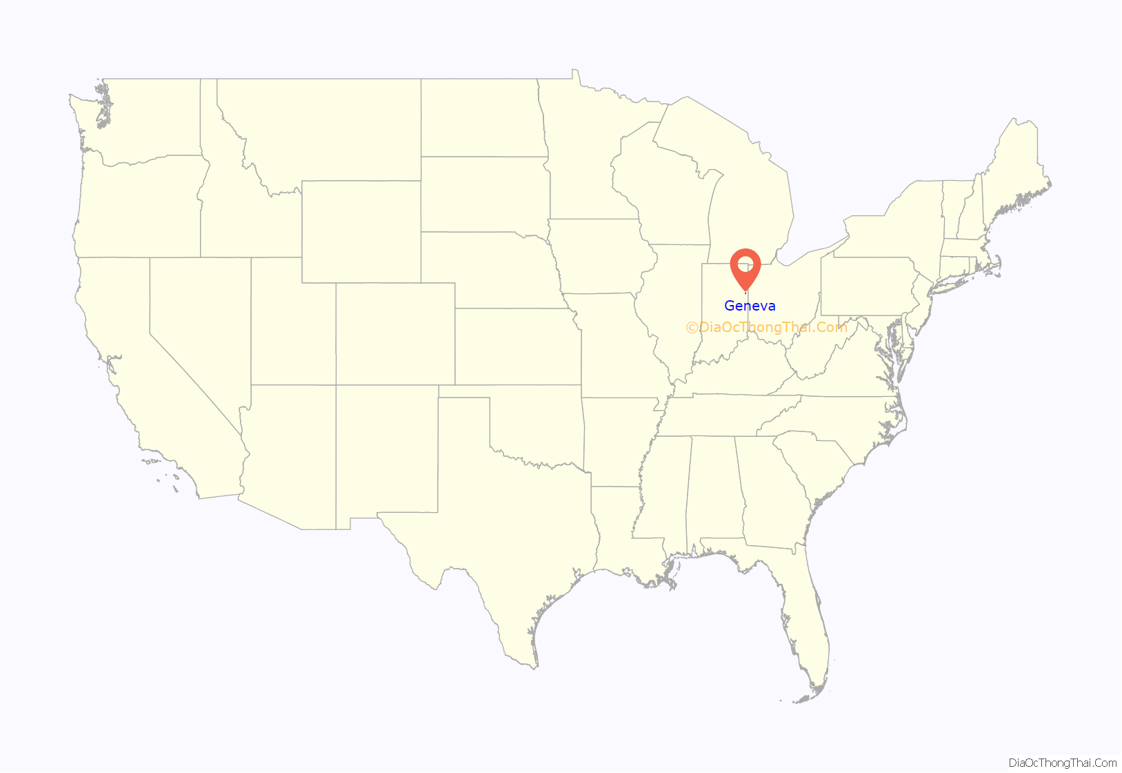
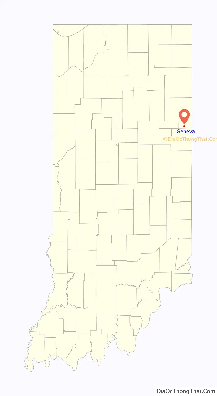
Geneva location map. Where is Geneva town?
History
Geneva had its start in 1871 when the rival towns of Alexander and Buffalo merged. It was named after Geneva, in Switzerland. The first post office in Geneva was established in 1872.
The Town of Geneva benefited greatly from the Indiana Gas Boom of the late 19th and early 20th centuries. Oil was found near Geneva and production began in 1892. This brought many new settlers to the area and skyrocketed local land prices. At its height in November 1895, one company – the Buckeye Pipe Line Company, had 160 oil wells in the Geneva field producing 24,362 barrels a month. Production fell off after 1907. Charles D. Porter and his famous wife, Gene Stratton-Porter, who lived in Geneva from 1886-1913, owned roughly 30 oil wells in the area, and used the proceeds to build Limberlost Cabin in 1895.
Geneva Road Map
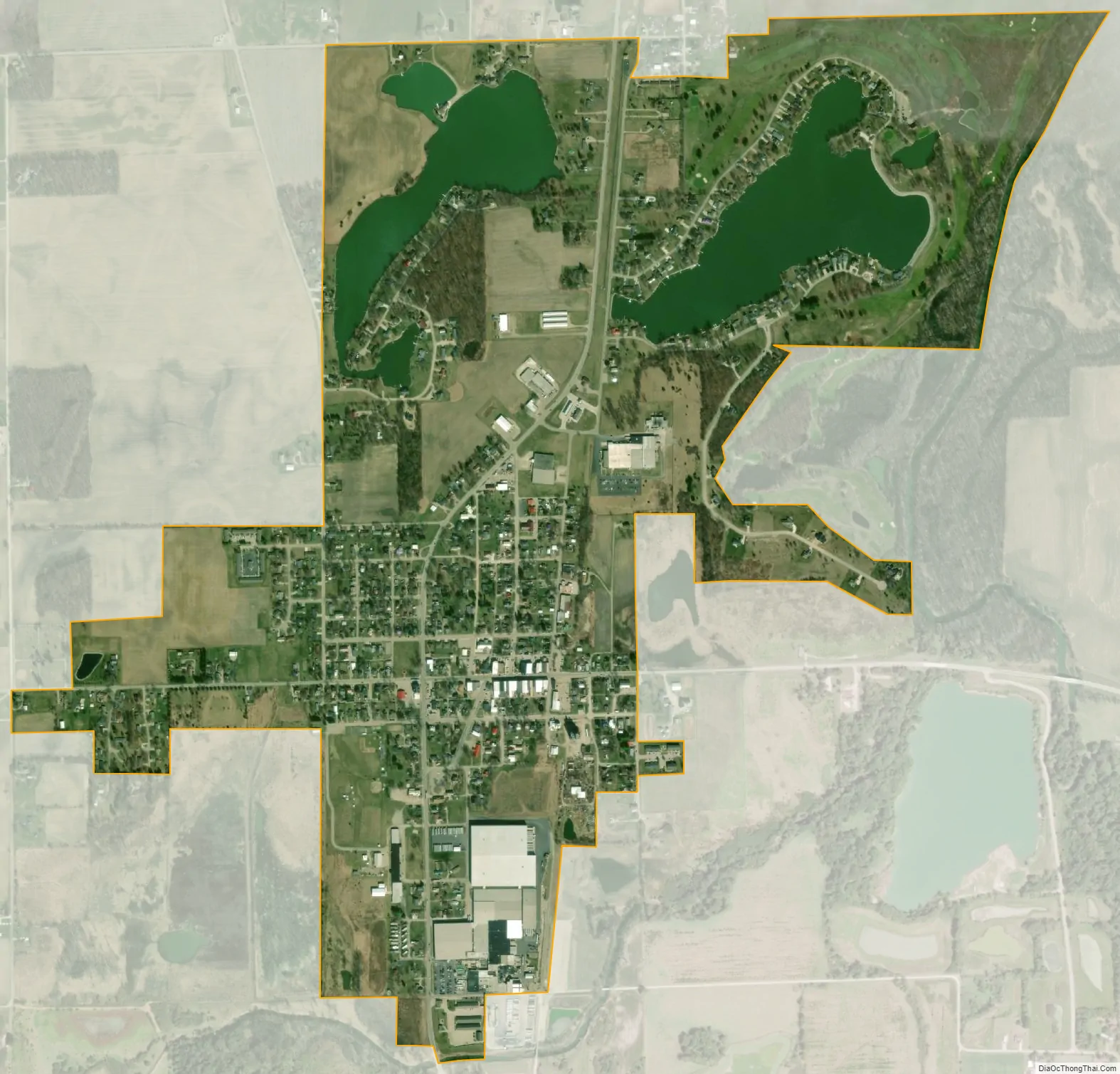
Geneva city Satellite Map
Geography
Geneva is located at 40°35′33″N 84°57′36″W / 40.59250°N 84.96000°W / 40.59250; -84.96000 (40.592401, -84.960054).
According to the 2010 census, Geneva has a total area of 1.23 square miles (3.19 km), of which 1.09 square miles (2.82 km) (or 88.62%) is land and 0.14 square miles (0.36 km) (or 11.38%) is water.
See also
Map of Indiana State and its subdivision:- Adams
- Allen
- Bartholomew
- Benton
- Blackford
- Boone
- Brown
- Carroll
- Cass
- Clark
- Clay
- Clinton
- Crawford
- Daviess
- De Kalb
- Dearborn
- Decatur
- Delaware
- Dubois
- Elkhart
- Fayette
- Floyd
- Fountain
- Franklin
- Fulton
- Gibson
- Grant
- Greene
- Hamilton
- Hancock
- Harrison
- Hendricks
- Henry
- Howard
- Huntington
- Jackson
- Jasper
- Jay
- Jefferson
- Jennings
- Johnson
- Knox
- Kosciusko
- LaGrange
- Lake
- Lake Michigan
- LaPorte
- Lawrence
- Madison
- Marion
- Marshall
- Martin
- Miami
- Monroe
- Montgomery
- Morgan
- Newton
- Noble
- Ohio
- Orange
- Owen
- Parke
- Perry
- Pike
- Porter
- Posey
- Pulaski
- Putnam
- Randolph
- Ripley
- Rush
- Saint Joseph
- Scott
- Shelby
- Spencer
- Starke
- Steuben
- Sullivan
- Switzerland
- Tippecanoe
- Tipton
- Union
- Vanderburgh
- Vermillion
- Vigo
- Wabash
- Warren
- Warrick
- Washington
- Wayne
- Wells
- White
- Whitley
- Alabama
- Alaska
- Arizona
- Arkansas
- California
- Colorado
- Connecticut
- Delaware
- District of Columbia
- Florida
- Georgia
- Hawaii
- Idaho
- Illinois
- Indiana
- Iowa
- Kansas
- Kentucky
- Louisiana
- Maine
- Maryland
- Massachusetts
- Michigan
- Minnesota
- Mississippi
- Missouri
- Montana
- Nebraska
- Nevada
- New Hampshire
- New Jersey
- New Mexico
- New York
- North Carolina
- North Dakota
- Ohio
- Oklahoma
- Oregon
- Pennsylvania
- Rhode Island
- South Carolina
- South Dakota
- Tennessee
- Texas
- Utah
- Vermont
- Virginia
- Washington
- West Virginia
- Wisconsin
- Wyoming