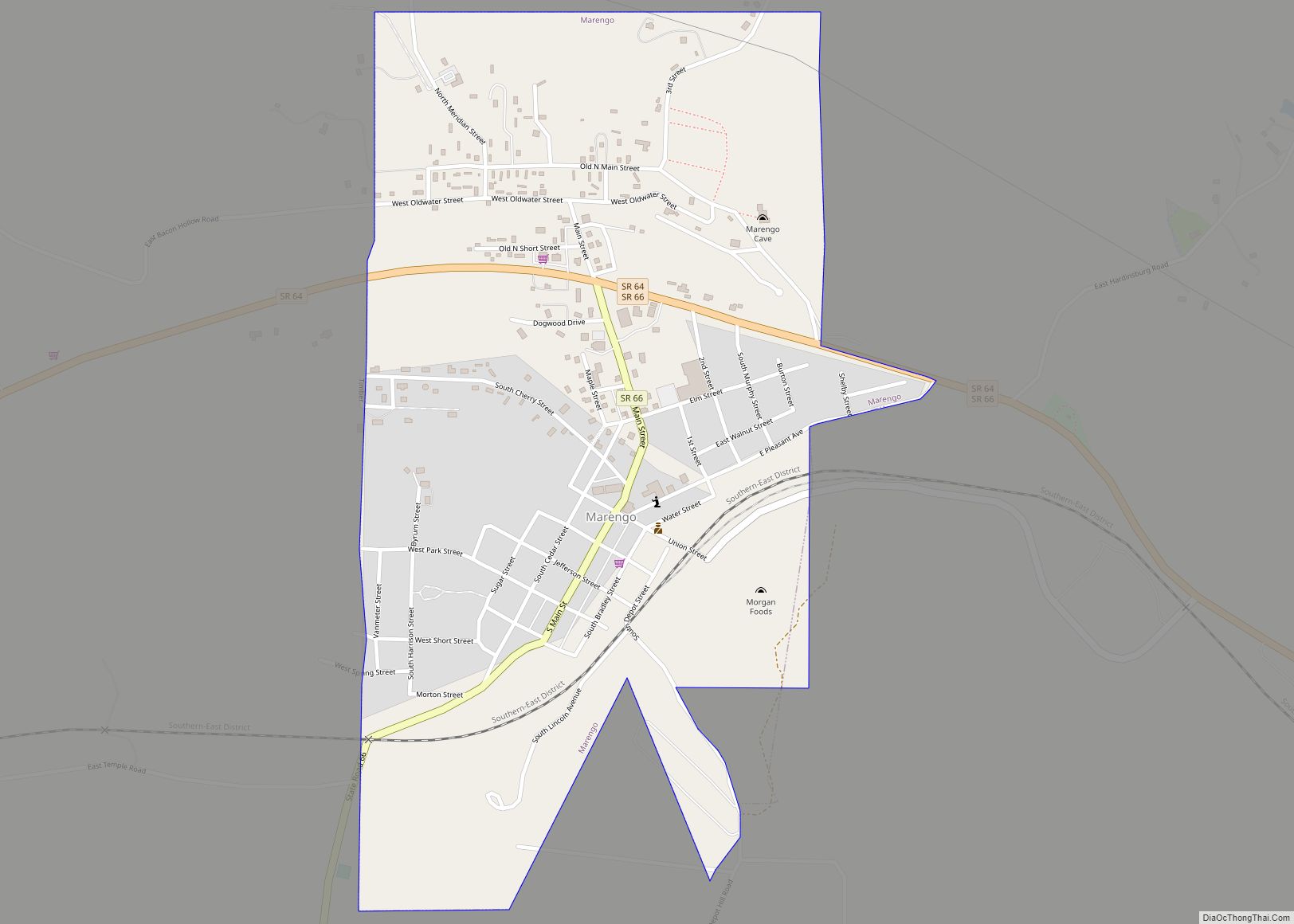
Marengo is a town in Liberty Township, Crawford County, Indiana, United States. The population was 829 at the 2020 census. One of the tourist attractions and sources of revenue for the town is Marengo Cave, a U.S. National Landmark. Originally discovered in 1883 by two schoolchildren, today it offers guided tours.
| Name: | Marengo town |
|---|---|
| LSAD Code: | 43 |
| LSAD Description: | town (suffix) |
| State: | Indiana |
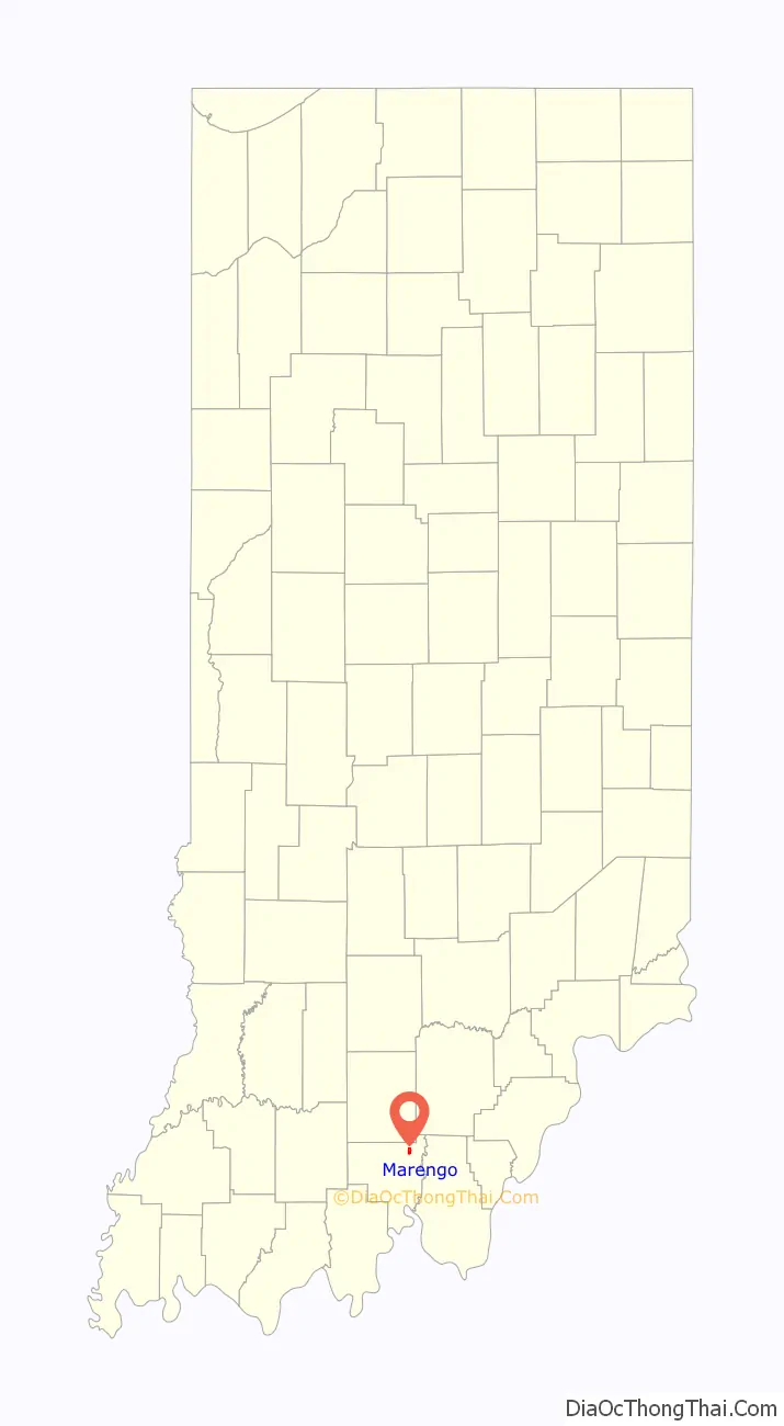
| County: | Crawford County |
| Elevation: | 597 ft (182 m) |
| Total Area: | 0.77 sq mi (2.01 km²) |
| Land Area: | 0.77 sq mi (2.01 km²) |
| Water Area: | 0.00 sq mi (0.00 km²) |
| Total Population: | 829 |
| Population Density: | 1,071.06/sq mi (413.32/km²) |
| ZIP code: | 47140 |
| Area code: | 812 |
| FIPS code: | 1846746 |
| GNISfeature ID: | 0451197 |
Online Interactive Map
Click on ![]() to view map in "full screen" mode.
to view map in "full screen" mode.
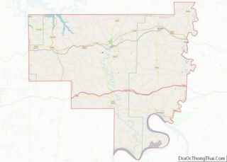
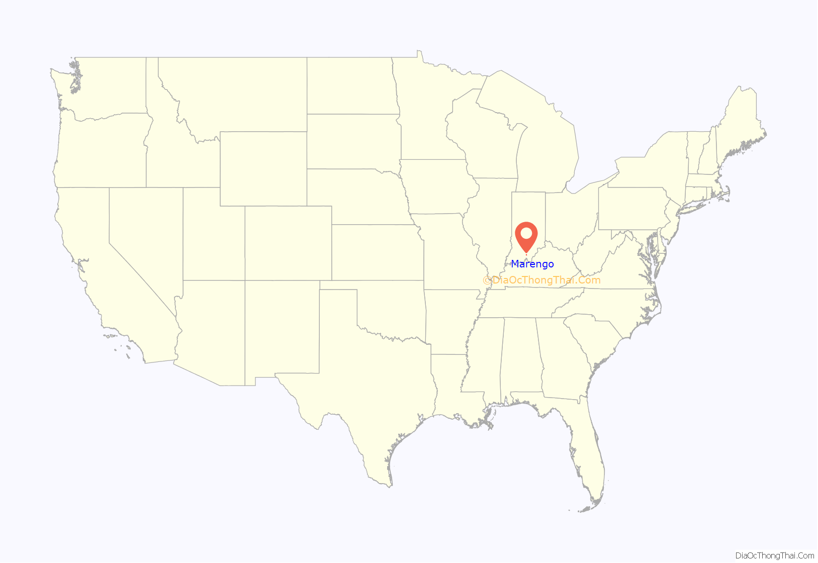
Marengo location map. Where is Marengo town?
History
Marengo was originally called Big Springs, and under the latter name was platted in 1839.
The name Marengo commemorates the Battle of Marengo.
Marengo was devastated by an F3 tornado in 2004, resulting in damage to nearly 75 percent of the town and the death of one resident.
Marengo High School was located in Marengo until the consolidation of the schools into Crawford County High School.
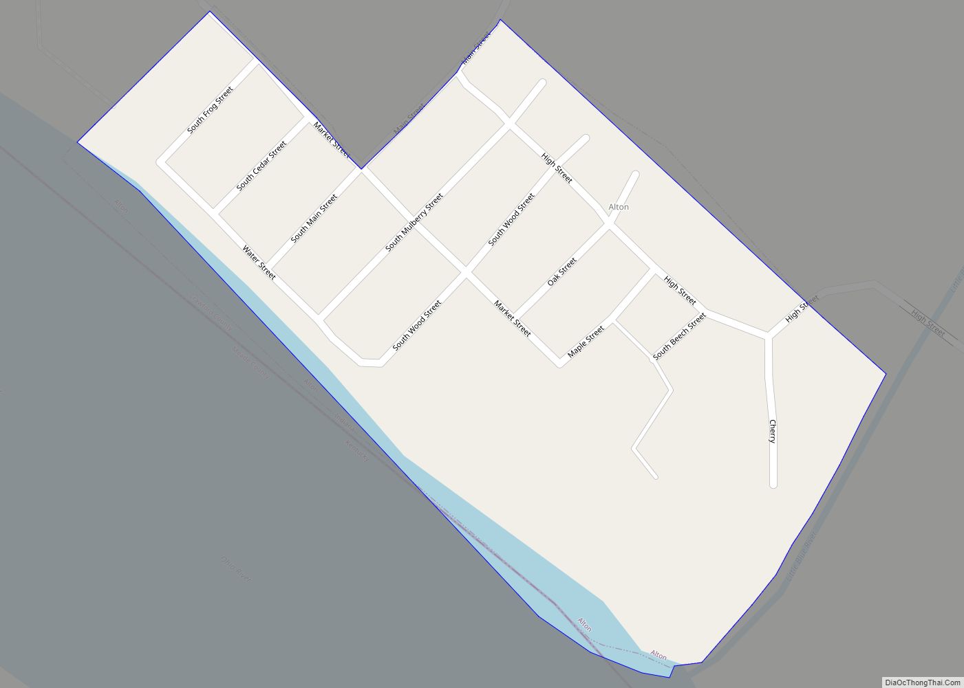
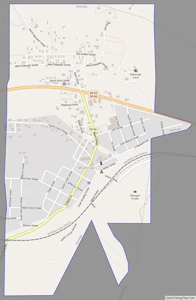
Marengo Road Map
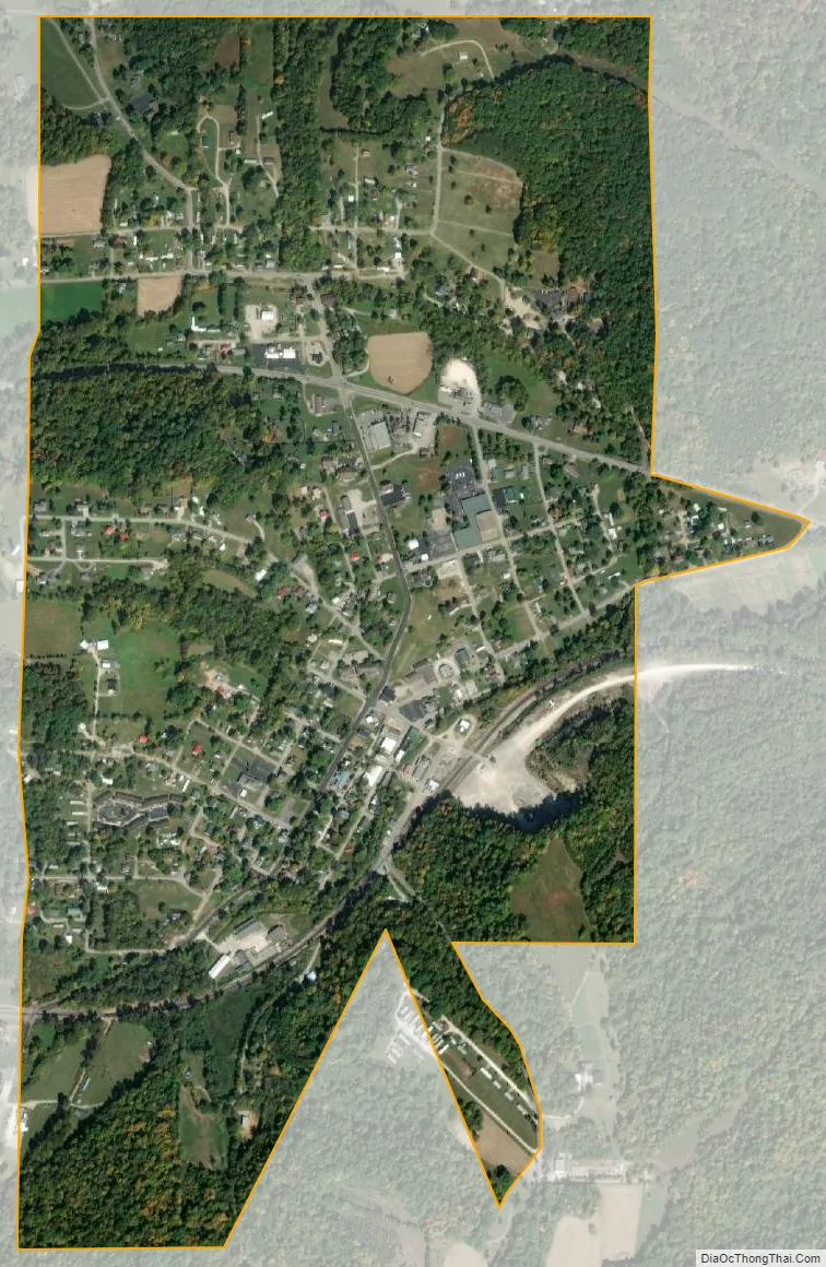
Marengo city Satellite Map
Geography
Marengo is located at 38°22′14″N 86°20′36″W / 38.37056°N 86.34333°W / 38.37056; -86.34333 (38.370579, -86.343425).
According to the 2010 census, Marengo has a total area of 0.77 square miles (1.99 km), all land.
See also
Map of Indiana State and its subdivision:- Adams
- Allen
- Bartholomew
- Benton
- Blackford
- Boone
- Brown
- Carroll
- Cass
- Clark
- Clay
- Clinton
- Crawford
- Daviess
- De Kalb
- Dearborn
- Decatur
- Delaware
- Dubois
- Elkhart
- Fayette
- Floyd
- Fountain
- Franklin
- Fulton
- Gibson
- Grant
- Greene
- Hamilton
- Hancock
- Harrison
- Hendricks
- Henry
- Howard
- Huntington
- Jackson
- Jasper
- Jay
- Jefferson
- Jennings
- Johnson
- Knox
- Kosciusko
- LaGrange
- Lake
- Lake Michigan
- LaPorte
- Lawrence
- Madison
- Marion
- Marshall
- Martin
- Miami
- Monroe
- Montgomery
- Morgan
- Newton
- Noble
- Ohio
- Orange
- Owen
- Parke
- Perry
- Pike
- Porter
- Posey
- Pulaski
- Putnam
- Randolph
- Ripley
- Rush
- Saint Joseph
- Scott
- Shelby
- Spencer
- Starke
- Steuben
- Sullivan
- Switzerland
- Tippecanoe
- Tipton
- Union
- Vanderburgh
- Vermillion
- Vigo
- Wabash
- Warren
- Warrick
- Washington
- Wayne
- Wells
- White
- Whitley
- Alabama
- Alaska
- Arizona
- Arkansas
- California
- Colorado
- Connecticut
- Delaware
- District of Columbia
- Florida
- Georgia
- Hawaii
- Idaho
- Illinois
- Indiana
- Iowa
- Kansas
- Kentucky
- Louisiana
- Maine
- Maryland
- Massachusetts
- Michigan
- Minnesota
- Mississippi
- Missouri
- Montana
- Nebraska
- Nevada
- New Hampshire
- New Jersey
- New Mexico
- New York
- North Carolina
- North Dakota
- Ohio
- Oklahoma
- Oregon
- Pennsylvania
- Rhode Island
- South Carolina
- South Dakota
- Tennessee
- Texas
- Utah
- Vermont
- Virginia
- Washington
- West Virginia
- Wisconsin
- Wyoming