Alton is a city in Osborne County, Kansas, United States. As of the 2020 census, the population of the city was 100.
| Name: | Alton city |
|---|---|
| LSAD Code: | 25 |
| LSAD Description: | city (suffix) |
| State: | Kansas |
| County: | Osborne County |
| Founded: | 1870 (Bull City) |
| Incorporated: | 1885 |
| Elevation: | 1,650 ft (500 m) |
| Total Area: | 0.31 sq mi (0.80 km²) |
| Land Area: | 0.31 sq mi (0.80 km²) |
| Water Area: | 0.00 sq mi (0.00 km²) |
| Total Population: | 100 |
| Population Density: | 320/sq mi (130/km²) |
| ZIP code: | 67623 |
| Area code: | 785 |
| FIPS code: | 2001600 |
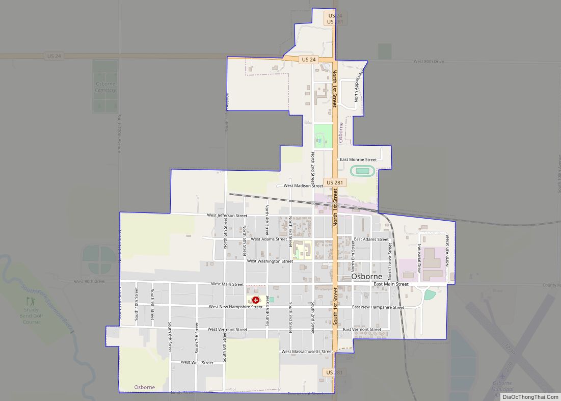
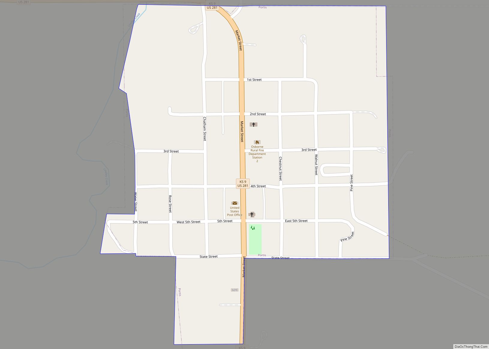
Online Interactive Map
Click on ![]() to view map in "full screen" mode.
to view map in "full screen" mode.
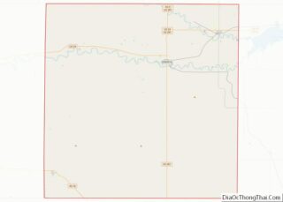
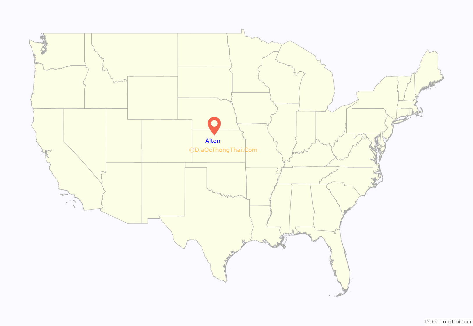
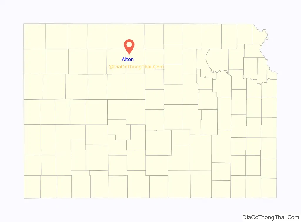
Alton location map. Where is Alton city?
History
Alton was founded in 1870 as Bull City, and was named in honor of Hiram C. Bull. It was renamed Alton in 1885, after the city of Alton, Illinois because female residents didn’t like the former name.
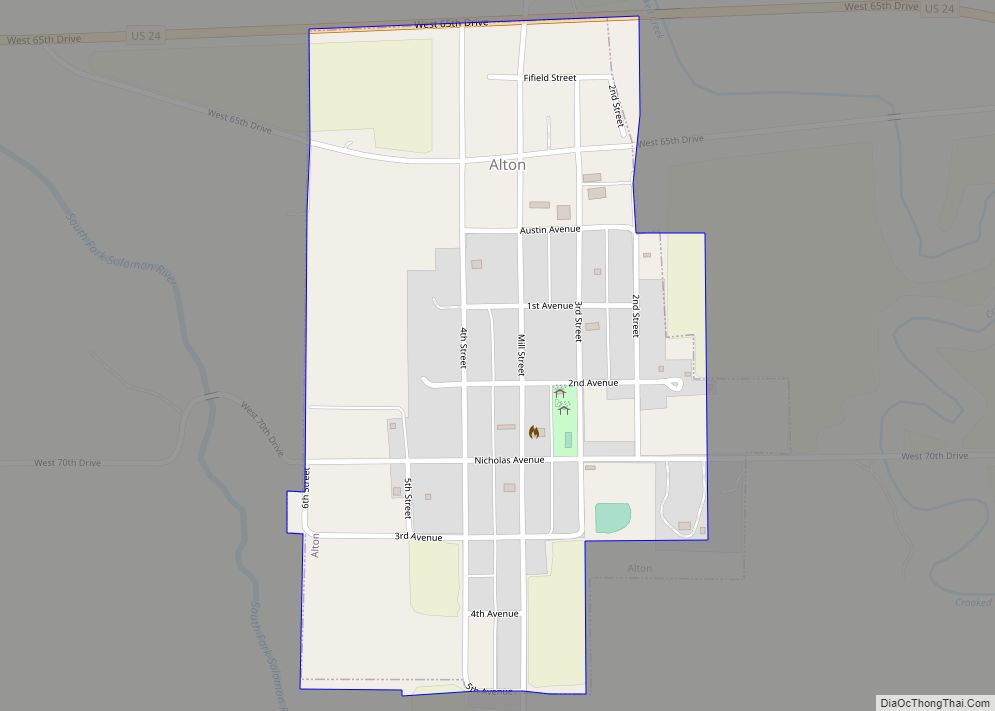
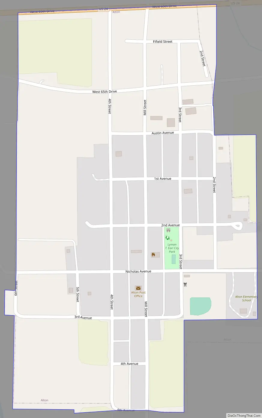
Alton Road Map
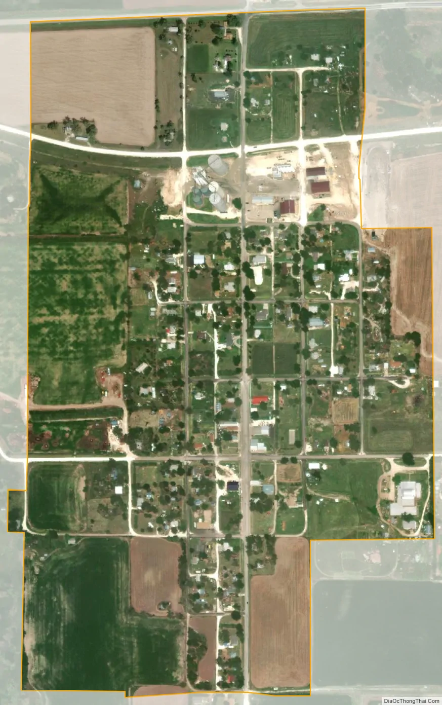
Alton city Satellite Map
Geography
Alton is located at 39°28′6″N 98°56′50″W / 39.46833°N 98.94722°W / 39.46833; -98.94722 (39.468196, −98.947360). According to the United States Census Bureau, the city has a total area of 0.31 square miles (0.80 km), all of it land.
Climate
Alton has a humid continental (Dfa) climate typical for the central Great Plains. Summers are hot and often very humid, with heavy rain from thunderstorms not uncommon, whilst tornadoes are a frequent hazard and are often followed by heavy rainfall. Winter weather varies greatly from warm or even hot weather due to chinook winds to extreme cold when a North American High with very cold air moves southwards from Canada. The coldest temperature recorded in Alton has been −31 °F or −35 °C on December 23, 1989.
One of the highest recorded temperatures in American history (and the highest in Kansas’ recorded history) was recorded near Alton on July 24, 1936. On that day, the temperature maxed out at 121 °F or 49.4 °C. Only four states — California, Arizona, New Mexico and Nevada — have seen higher record temperatures. Alton’s record April temperature of 106 °F or 41.1 °C on April 23 of 1989 has been exceeded only by California, Arizona and Texas. Temperatures over 100 °F or 37.8 °C are expected on 15.9 each year and 90 °F or 32.2 °C on an average of 64.5 days per year.
The lowest temperature ever recorded in Kansas was measured in Lebanon, which sits in the adjacent Smith County, only about 35 miles away.
See also
Map of Kansas State and its subdivision:- Allen
- Anderson
- Atchison
- Barber
- Barton
- Bourbon
- Brown
- Butler
- Chase
- Chautauqua
- Cherokee
- Cheyenne
- Clark
- Clay
- Cloud
- Coffey
- Comanche
- Cowley
- Crawford
- Decatur
- Dickinson
- Doniphan
- Douglas
- Edwards
- Elk
- Ellis
- Ellsworth
- Finney
- Ford
- Franklin
- Geary
- Gove
- Graham
- Grant
- Gray
- Greeley
- Greenwood
- Hamilton
- Harper
- Harvey
- Haskell
- Hodgeman
- Jackson
- Jefferson
- Jewell
- Johnson
- Kearny
- Kingman
- Kiowa
- Labette
- Lane
- Leavenworth
- Lincoln
- Linn
- Logan
- Lyon
- Marion
- Marshall
- McPherson
- Meade
- Miami
- Mitchell
- Montgomery
- Morris
- Morton
- Nemaha
- Neosho
- Ness
- Norton
- Osage
- Osborne
- Ottawa
- Pawnee
- Phillips
- Pottawatomie
- Pratt
- Rawlins
- Reno
- Republic
- Rice
- Riley
- Rooks
- Rush
- Russell
- Saline
- Scott
- Sedgwick
- Seward
- Shawnee
- Sheridan
- Sherman
- Smith
- Stafford
- Stanton
- Stevens
- Sumner
- Thomas
- Trego
- Wabaunsee
- Wallace
- Washington
- Wichita
- Wilson
- Woodson
- Wyandotte
- Alabama
- Alaska
- Arizona
- Arkansas
- California
- Colorado
- Connecticut
- Delaware
- District of Columbia
- Florida
- Georgia
- Hawaii
- Idaho
- Illinois
- Indiana
- Iowa
- Kansas
- Kentucky
- Louisiana
- Maine
- Maryland
- Massachusetts
- Michigan
- Minnesota
- Mississippi
- Missouri
- Montana
- Nebraska
- Nevada
- New Hampshire
- New Jersey
- New Mexico
- New York
- North Carolina
- North Dakota
- Ohio
- Oklahoma
- Oregon
- Pennsylvania
- Rhode Island
- South Carolina
- South Dakota
- Tennessee
- Texas
- Utah
- Vermont
- Virginia
- Washington
- West Virginia
- Wisconsin
- Wyoming