Basehor is a city in Leavenworth County, Kansas, United States which is included statistically in the Kansas City metropolitan area. As of the 2020 census, the population of the city was 6,896. However, incumbent mayor Dick Drennon has stated that Basehor’s population is around 7,500 people.
As of April 2023, Basehor is the 2nd fastest-growing community in the State of Kansas, behind the suburb of Maize in Sedgwick County.
| Name: | Basehor city |
|---|---|
| LSAD Code: | 25 |
| LSAD Description: | city (suffix) |
| State: | Kansas |
| County: | Leavenworth County |
| Founded: | 1889 |
| Incorporated: | 1965 |
| Elevation: | 984 ft (300 m) |
| Total Area: | 7.24 sq mi (18.74 km²) |
| Land Area: | 7.14 sq mi (18.50 km²) |
| Water Area: | 0.09 sq mi (0.24 km²) |
| Total Population: | 6,896 |
| Population Density: | 950/sq mi (370/km²) |
| ZIP code: | 66007 |
| Area code: | 913 |
| FIPS code: | 2004400 |
| Website: | cityofbasehor.org |
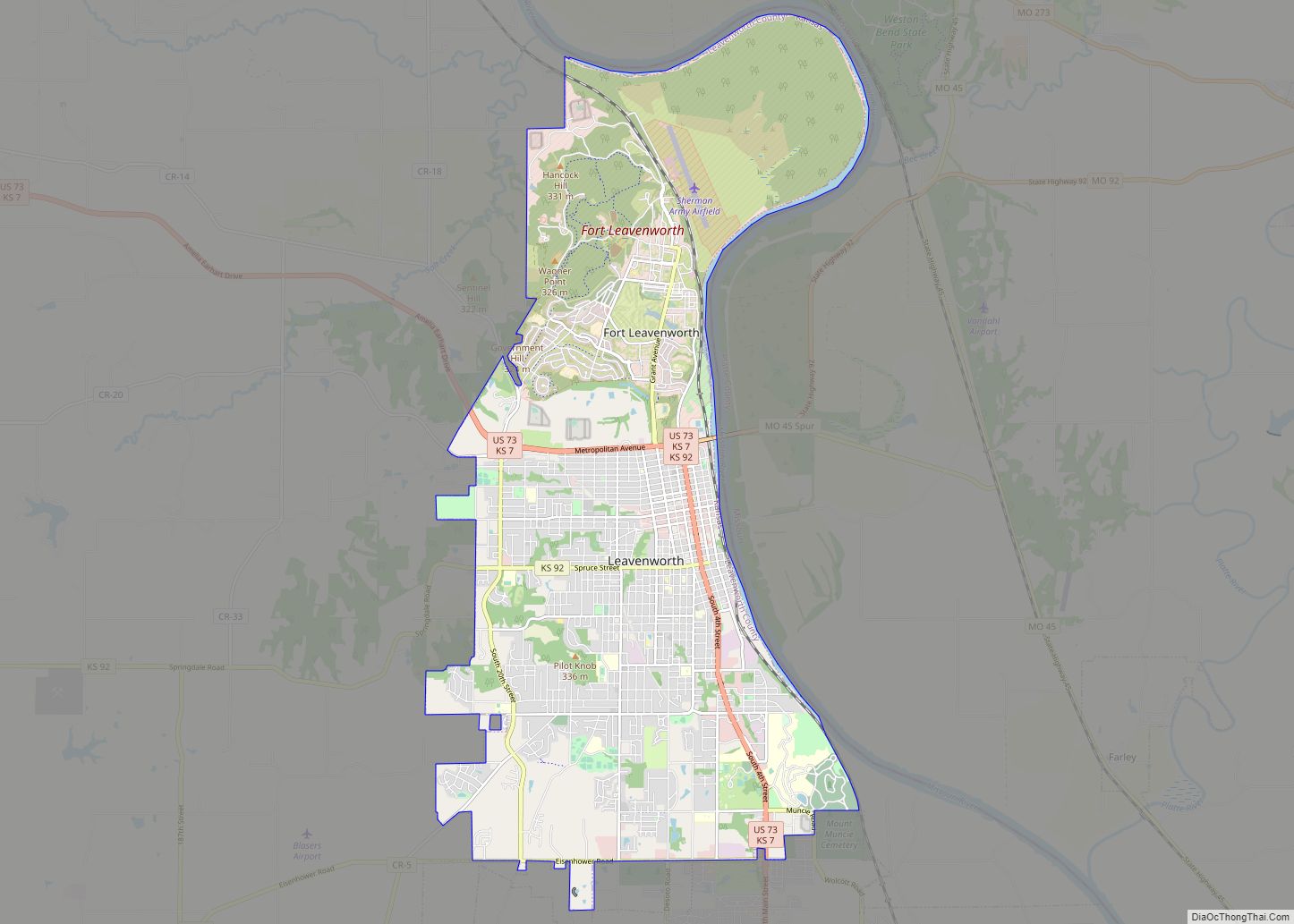
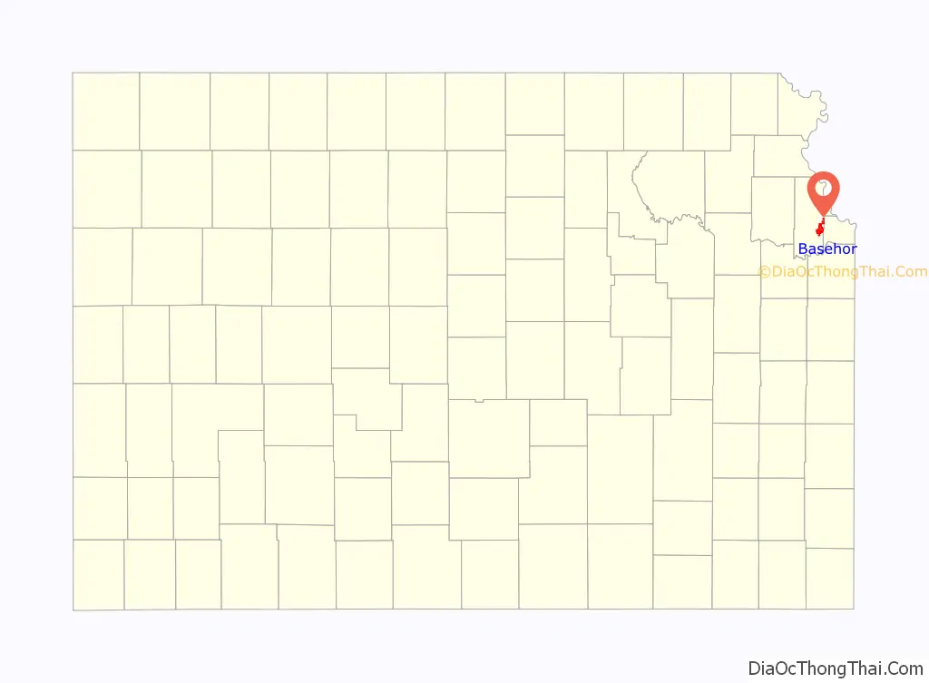
Online Interactive Map
Click on ![]() to view map in "full screen" mode.
to view map in "full screen" mode.
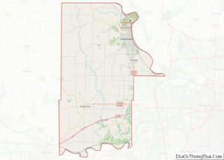
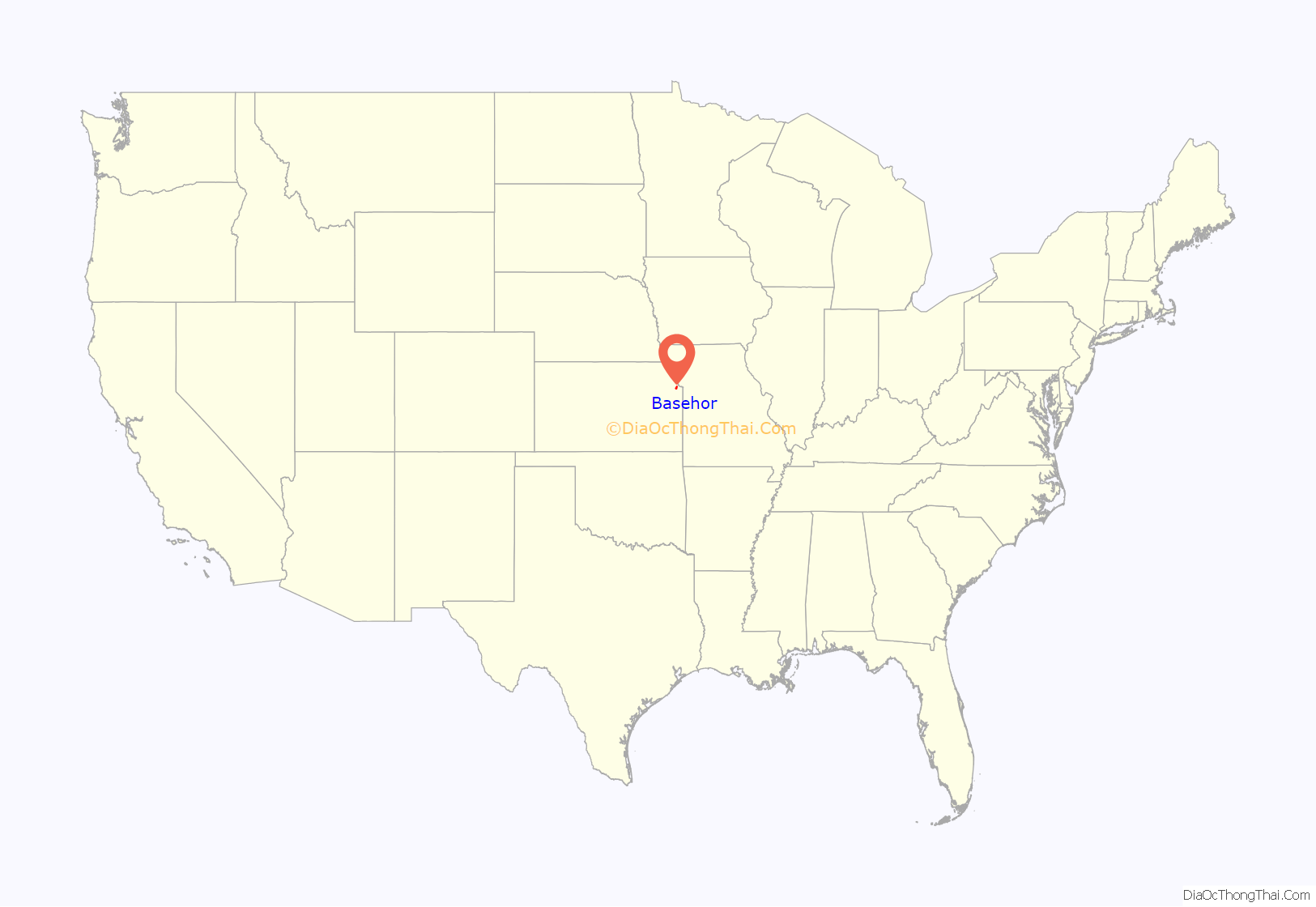
Basehor location map. Where is Basehor city?
History
In exchange for extensive Delaware holdings in the state of Indiana, on September 24, 1829, the United States government ceded a large tract of land to the Delaware Indians. Basehor is built on a small part of this tract. The Delawares held this land, or at least parts of it, until the 1860s. On July 4, 1866, the Secretary of the Interior of the United States was offered for sale what was left of the Delaware lands, then referred to as the Delaware Diminished Reserve, for not less than $2.50 per acre. The Leavenworth, Pawnee, and Western Railroad Company subsequently bought all of the remaining land on January 7, 1886.
The first individuals to own the land upon which Basehor now stands were Thomas Salem and Mary Z. Towne (though William Henery Lewis, who surveyed for the railroad, bought an extensive plot of land to the northeast of Basehor around 1861 and homesteaded it right after the Civil War). The couple bought it from the railroad in 1873 and mortgaged it to Ephraim Basehor the same year. On January 9, 1874, the Townes sold the 160 acres (0.65 km) to Basehor. Ephriam and Reuben’s nephew William Mast later moved to Basehor and in 1896 married Margaret Towne, the daughter of the couple from whom they had purchased the land.
Basehor was founded in 1889 by Reuben Basehor and his brother Ephraim. They both were of Pennsylvania Dutch descent and came to Kansas in 1854. After living in Lawrence for a time, Ephraim began working as a hired hand for an area farmer. He eventually bought the farm and other land holdings in the area.
In 1889, the railroad was completed, and Ephraim plotted his land and began building the town site. It was dedicated on November 30, 1889, and was named after Basehor.
Ephraim Basehor donated the land for the schoolhouse around 1900. The old grade school was located north of town and was originally called the Prairie Garden District #32. The first high school classes in the community met in 1905 above the Kemler-Hammond General Store. In 1906, a building was erected to house the high school and grade school. It was built for K–12 on the southeast corner of 155th Street and Leavenworth Road. The high school was upstairs, and K–8 was located in the three classrooms downstairs. In 1929, five students graduated.
Reuben Basehor donated $1,000 to the school to build a library. With this donation, a concrete structure was built east of the old school. After many years of disuse, the library building was moved to the city park in June, 2016. A new two-story brick high school was built as a WPA project in 1938. The grade-school classes continued to be held in the old building until a new grade school was built in 1955. By 1963, a new high school was built, and the older building was taken over by the top two grades of the grade school. In 2008, the community built a new library on 158th St.
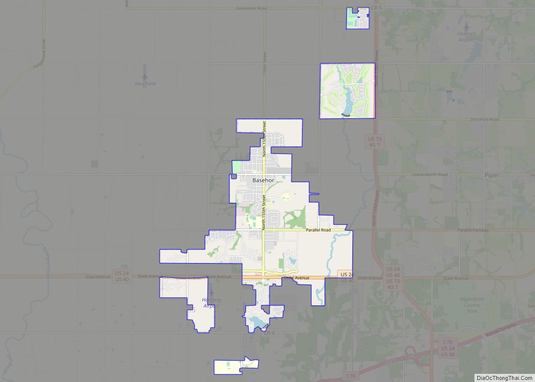
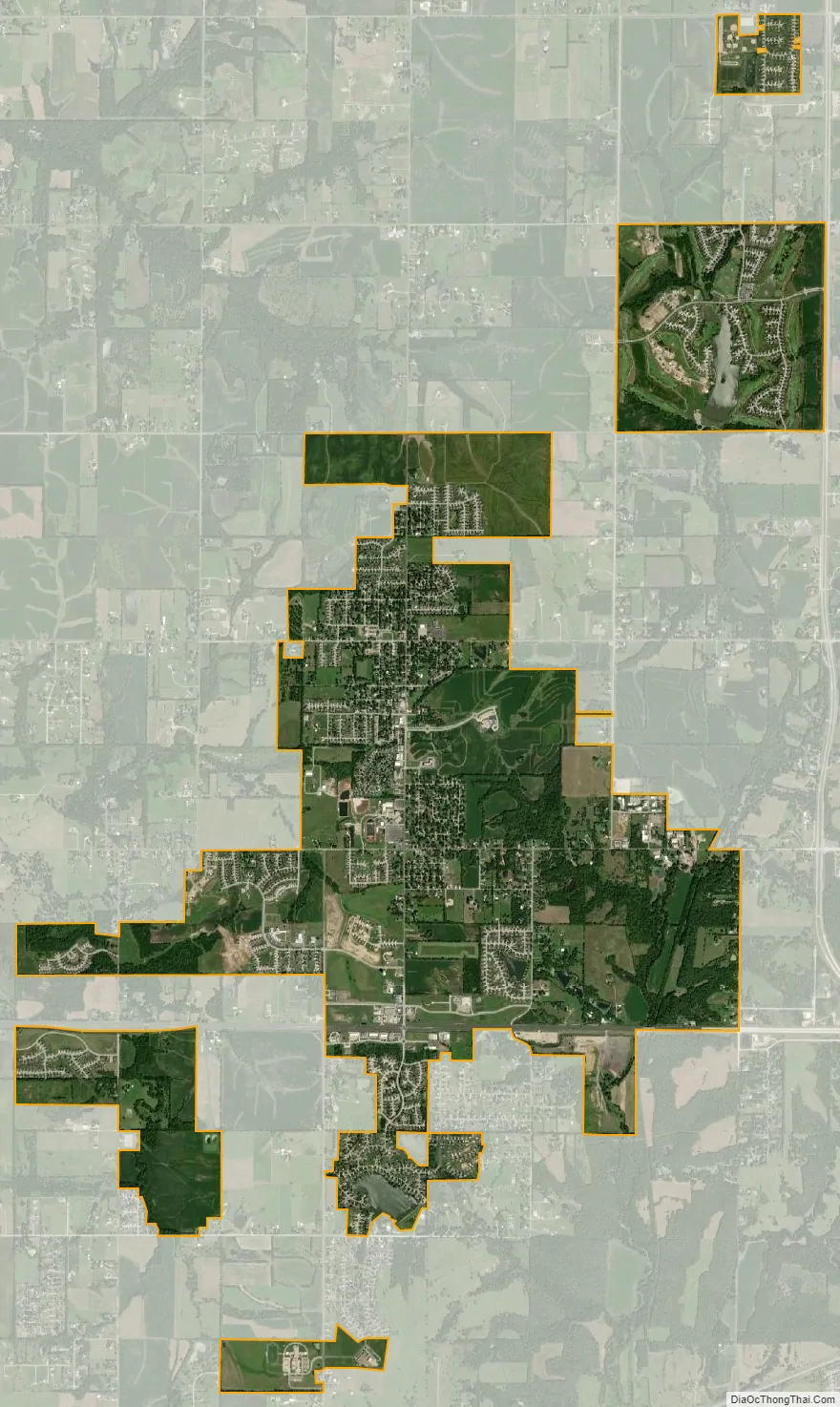
Basehor Road Map

Basehor city Satellite Map
Geography
Basehor is located at 39°8′18″N 94°56′19″W / 39.13833°N 94.93861°W / 39.13833; -94.93861 (39.138469, −94.938735). According to the United States Census Bureau, the city has a total area of 6.75 square miles (17.48 km), of which 0.07 square miles (0.18 km) is covered by water.
See also
Map of Kansas State and its subdivision:- Allen
- Anderson
- Atchison
- Barber
- Barton
- Bourbon
- Brown
- Butler
- Chase
- Chautauqua
- Cherokee
- Cheyenne
- Clark
- Clay
- Cloud
- Coffey
- Comanche
- Cowley
- Crawford
- Decatur
- Dickinson
- Doniphan
- Douglas
- Edwards
- Elk
- Ellis
- Ellsworth
- Finney
- Ford
- Franklin
- Geary
- Gove
- Graham
- Grant
- Gray
- Greeley
- Greenwood
- Hamilton
- Harper
- Harvey
- Haskell
- Hodgeman
- Jackson
- Jefferson
- Jewell
- Johnson
- Kearny
- Kingman
- Kiowa
- Labette
- Lane
- Leavenworth
- Lincoln
- Linn
- Logan
- Lyon
- Marion
- Marshall
- McPherson
- Meade
- Miami
- Mitchell
- Montgomery
- Morris
- Morton
- Nemaha
- Neosho
- Ness
- Norton
- Osage
- Osborne
- Ottawa
- Pawnee
- Phillips
- Pottawatomie
- Pratt
- Rawlins
- Reno
- Republic
- Rice
- Riley
- Rooks
- Rush
- Russell
- Saline
- Scott
- Sedgwick
- Seward
- Shawnee
- Sheridan
- Sherman
- Smith
- Stafford
- Stanton
- Stevens
- Sumner
- Thomas
- Trego
- Wabaunsee
- Wallace
- Washington
- Wichita
- Wilson
- Woodson
- Wyandotte
- Alabama
- Alaska
- Arizona
- Arkansas
- California
- Colorado
- Connecticut
- Delaware
- District of Columbia
- Florida
- Georgia
- Hawaii
- Idaho
- Illinois
- Indiana
- Iowa
- Kansas
- Kentucky
- Louisiana
- Maine
- Maryland
- Massachusetts
- Michigan
- Minnesota
- Mississippi
- Missouri
- Montana
- Nebraska
- Nevada
- New Hampshire
- New Jersey
- New Mexico
- New York
- North Carolina
- North Dakota
- Ohio
- Oklahoma
- Oregon
- Pennsylvania
- Rhode Island
- South Carolina
- South Dakota
- Tennessee
- Texas
- Utah
- Vermont
- Virginia
- Washington
- West Virginia
- Wisconsin
- Wyoming