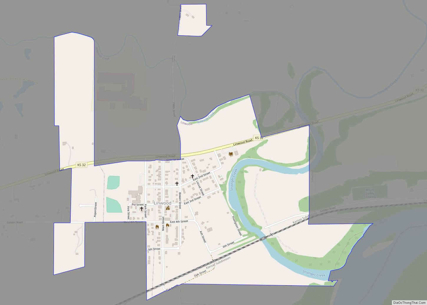
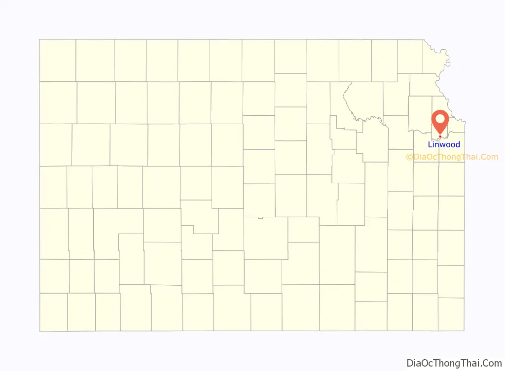
Linwood is a city in Leavenworth County, Kansas, United States, and part of the Kansas City metropolitan area. As of the 2020 census, the population of the city was 415. It is located along K-32 highway between Lawrence and Bonner Springs.
| Name: | Linwood city |
|---|---|
| LSAD Code: | 25 |
| LSAD Description: | city (suffix) |
| State: | Kansas |
| County: | Leavenworth County |
| Founded: | 1860s |
| Incorporated: | 1895 |
| Elevation: | 804 ft (245 m) |
| Total Area: | 0.60 sq mi (1.56 km²) |
| Land Area: | 0.58 sq mi (1.51 km²) |
| Water Area: | 0.02 sq mi (0.05 km²) |
| Total Population: | 415 |
| Population Density: | 690/sq mi (270/km²) |
| ZIP code: | 66052 |
| Area code: | 913 |
| FIPS code: | 2041475 |
| Website: | cityoflinwood.org |
Online Interactive Map
Click on ![]() to view map in "full screen" mode.
to view map in "full screen" mode.
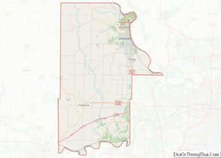
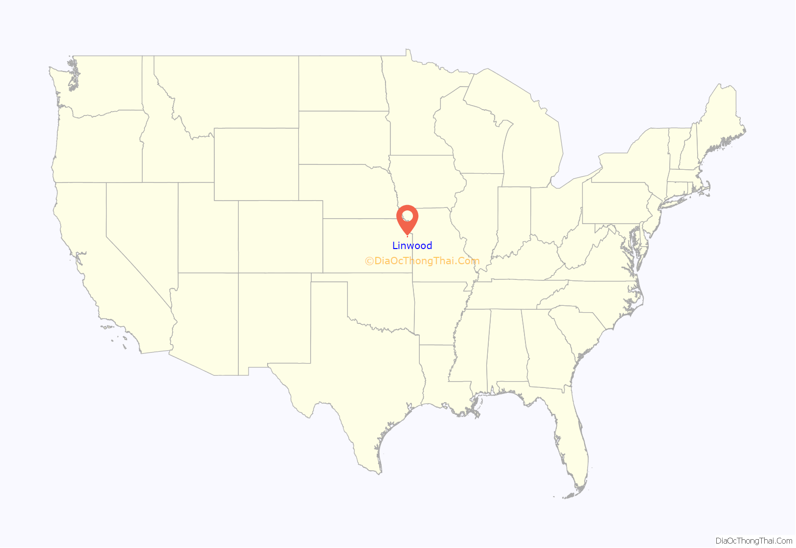
Linwood location map. Where is Linwood city?
History
Beginnings
Linwood was founded as Journeycake, named after Charles Journeycake, the last Delaware chief. People occasionally made fun of the name Journeycake by calling it “Johnny Cake.” The community was platted on both sides of Stranger Creek, near the creek’s mouth at the Kansas River.
In May 1860, a treaty was signed at Sarcoxieville, 3 miles (4.8 km) northeast of Linwood, by Chief Sarcoxie of the Delaware and by the United States. After the treaty’s signature, each member of the tribe was assigned a parcel of land, and the balance of the tribe’s territories were sold to the predecessor of the Union Pacific Railroad. Meanwhile, the U.S. government established a trading post near Stranger Creek until the tribe was moved to the Indian Territory in 1867. Located beside the Union Pacific Railroad tracks, the trading post became the first school in the community.
Union Pacific Railroad
In September 1863, the Union Pacific Railroad began building the main line westward across the Great Plains from Kansas City, Kansas, to Denver, Colorado. This was the long-line railroad in Kansas for 2–3 years. The first 40 miles (64 km) were opened in 1864 from Wyandotte (now a suburb of Kansas City) to Lawrence. William A. Harris moved to Kansas in 1865 employed as a civil engineer for the Union Pacific Railroad. In 1868 it became the Kansas Pacific Railroad .
Name change
The original community of Journeycake was officially platted as Stranger on July 11, 1867, and recorded at the Leavenworth County Courthouse. When the name Stranger became a problem for the Postal Service. who confused Stranger with a nearby community also named Stranger (referred to as “Big” Stranger), it was renamed Linwood on December 20, 1877. Legend has it that one day when the citizens were cutting wood for the church, Colonel Loring suggested they change the name to Linwood, because of the many linden trees that grew in the area. But, according to the Kansas Historical Collections, the community of Stranger had its name changed to Linwood by Senator William A. Harris because of his great appreciation for the linwood trees that were abundant in the vicinity of Stranger Creek.
Senator Harris
William A. Harris moved to Kansas in 1865 and worked as a civil engineer for the Union Pacific Railroad until 1868, when he moved to Lawrence, Kansas. He was appointed agent for the railroad companies in the sale of the Delaware Reservation and other lands. In 1884, Harris became a prominent citizen of Linwood, where he engaged in agricultural pursuits and stock raising. He bought about 100 acres (400,000 m) of land just west of Linwood. On a high hill within sight of city he built a modest two story mansion with fifteen rooms, the Harris House. Harris was elected as a Democratic Congressman to the Fifty-third Congress (1893–1895) and as a Populist to the U.S. Senate (1897–1903). He was an unsuccessful candidate for Governor of Kansas in 1906. Harris died in 1909, and is buried in Lawrence, Kansas.
Relocation
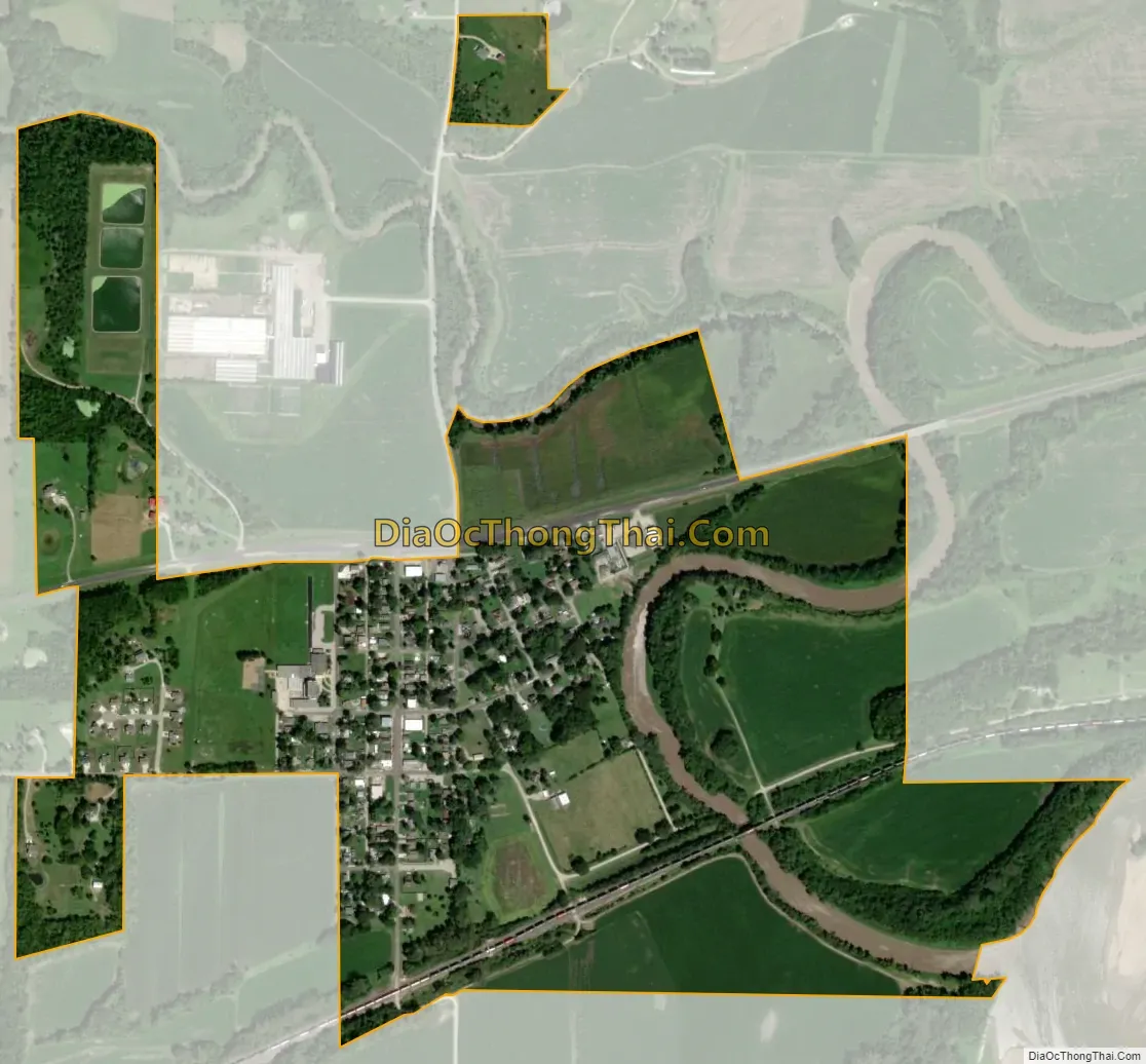
Much of Linwood’s commerce came from the saw mills on the river, as the city had grown very near the banks of the Kansas River (known as the “Kaw” River) that flows eastward to the Missouri. After the 1903 flood damaged and endangered much of Linwood, the city was relocated about one mile (1.6 km) north to its present location out of “the bottoms” (as they are still known today) near the river.
21st century
Present day Linwood is a small city which is accessed solely off of K-32, as the Golden Road bridge over Stranger Creek collapsed in the early 2000s and has never been rebuilt. Currently, the city has less than 400 people. In just the last couple of years, numerous new homes have been built drawing new families. Linwood has several businesses including a gas station, tavern, landscaping company, salsa plant and a Dollar General retail store. Linwood is home to one of the Basehor-Linwood Elementary Schools, while the Basehor-Linwood Middle and High Schools are located in Basehor.
2019 tornado
On May 28, 2019, an EF4 tornado with Doppler windspeed measurements of over 187 mph struck the outlying areas of the city and severely damaged homes. At least 13 injuries were reported due to the storm. The city itself was spared any major damage, with just the occasional roof damage and loss of trees and fencing.
Linwood Road Map

Linwood city Satellite Map
Geography
Linwood is located at 39°0′3″N 95°2′14″W / 39.00083°N 95.03722°W / 39.00083; -95.03722 (39.000722, -95.037199). According to the United States Census Bureau, the city has a total area of 0.73 square miles (1.89 km), of which 0.71 square miles (1.84 km) are land and 0.02 square miles (0.05 km) are water. Linwood is situated along the north bank of the Kansas River.
See also
Map of Kansas State and its subdivision:- Allen
- Anderson
- Atchison
- Barber
- Barton
- Bourbon
- Brown
- Butler
- Chase
- Chautauqua
- Cherokee
- Cheyenne
- Clark
- Clay
- Cloud
- Coffey
- Comanche
- Cowley
- Crawford
- Decatur
- Dickinson
- Doniphan
- Douglas
- Edwards
- Elk
- Ellis
- Ellsworth
- Finney
- Ford
- Franklin
- Geary
- Gove
- Graham
- Grant
- Gray
- Greeley
- Greenwood
- Hamilton
- Harper
- Harvey
- Haskell
- Hodgeman
- Jackson
- Jefferson
- Jewell
- Johnson
- Kearny
- Kingman
- Kiowa
- Labette
- Lane
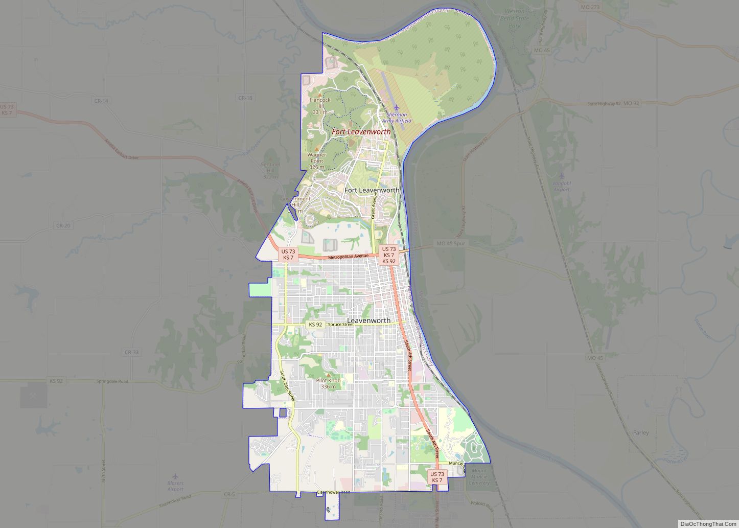
- Leavenworth
- Lincoln
- Linn
- Logan
- Lyon
- Marion
- Marshall
- McPherson
- Meade
- Miami
- Mitchell
- Montgomery
- Morris
- Morton
- Nemaha
- Neosho
- Ness
- Norton
- Osage
- Osborne
- Ottawa
- Pawnee
- Phillips
- Pottawatomie
- Pratt
- Rawlins
- Reno
- Republic
- Rice
- Riley
- Rooks
- Rush
- Russell
- Saline
- Scott
- Sedgwick
- Seward
- Shawnee
- Sheridan
- Sherman
- Smith
- Stafford
- Stanton
- Stevens
- Sumner
- Thomas
- Trego
- Wabaunsee
- Wallace
- Washington
- Wichita
- Wilson
- Woodson
- Wyandotte
- Alabama
- Alaska
- Arizona
- Arkansas
- California
- Colorado
- Connecticut
- Delaware
- District of Columbia
- Florida
- Georgia
- Hawaii
- Idaho
- Illinois
- Indiana
- Iowa
- Kansas
- Kentucky
- Louisiana
- Maine
- Maryland
- Massachusetts
- Michigan
- Minnesota
- Mississippi
- Missouri
- Montana
- Nebraska
- Nevada
- New Hampshire
- New Jersey
- New Mexico
- New York
- North Carolina
- North Dakota
- Ohio
- Oklahoma
- Oregon
- Pennsylvania
- Rhode Island
- South Carolina
- South Dakota
- Tennessee
- Texas
- Utah
- Vermont
- Virginia
- Washington
- West Virginia
- Wisconsin
- Wyoming