Natoma is a city in Osborne County, Kansas, United States. As of the 2020 census, the population of the city was 302.
| Name: | Natoma city |
|---|---|
| LSAD Code: | 25 |
| LSAD Description: | city (suffix) |
| State: | Kansas |
| County: | Osborne County |
| Founded: | 1888 |
| Incorporated: | 1905 |
| Elevation: | 1,834 ft (559 m) |
| Total Area: | 0.42 sq mi (1.09 km²) |
| Land Area: | 0.42 sq mi (1.09 km²) |
| Water Area: | 0.00 sq mi (0.00 km²) |
| Total Population: | 302 |
| Population Density: | 720/sq mi (280/km²) |
| ZIP code: | 67651 |
| Area code: | 785 |
| FIPS code: | 2049425 |
| Website: | cityofnatoma.com |
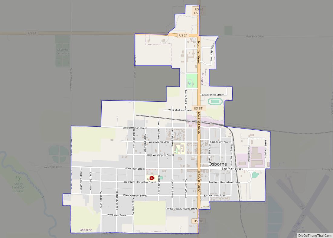
Online Interactive Map
Click on ![]() to view map in "full screen" mode.
to view map in "full screen" mode.
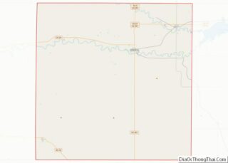
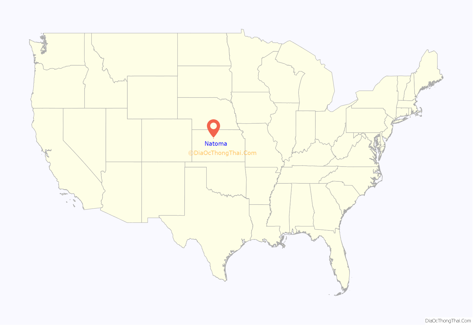
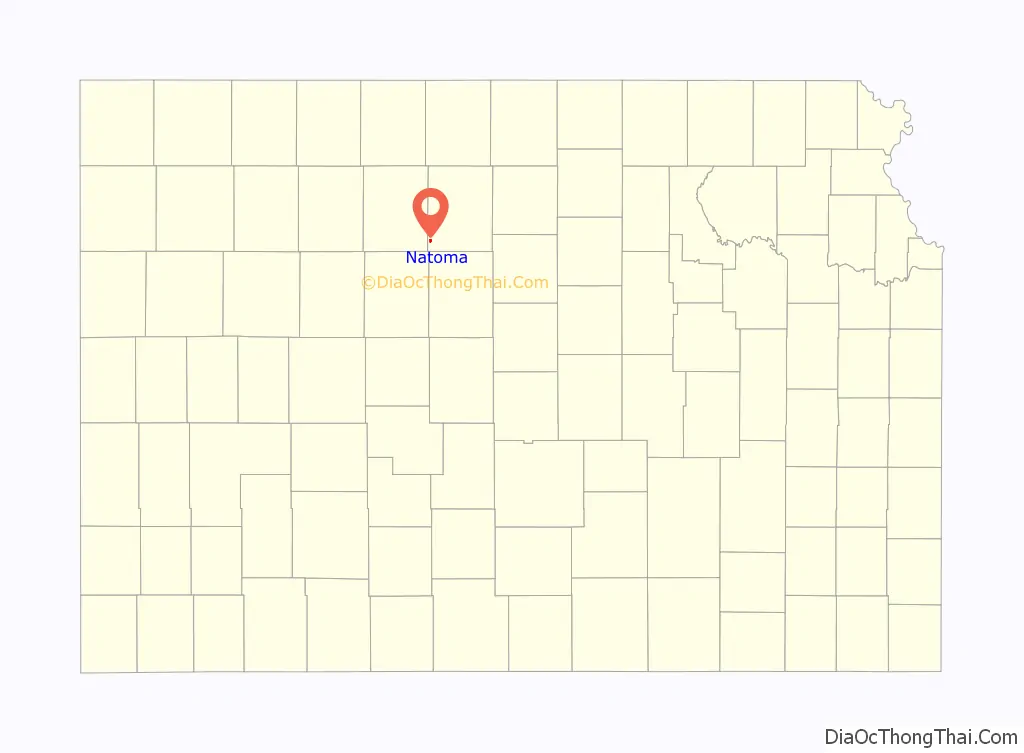
Natoma location map. Where is Natoma city?
History
Natoma was established in 1888, named after an American Indian railroad employee by a railroad officer. The name means “new born”. The first post office had opened under the name Tapley in December 1878, but changed its name to Natoma in July 1890. Natoma was incorporated as a city in 1905.
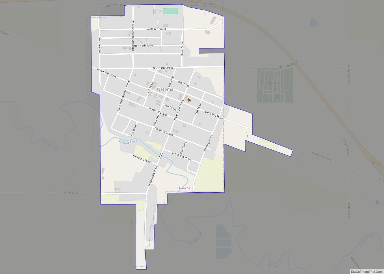
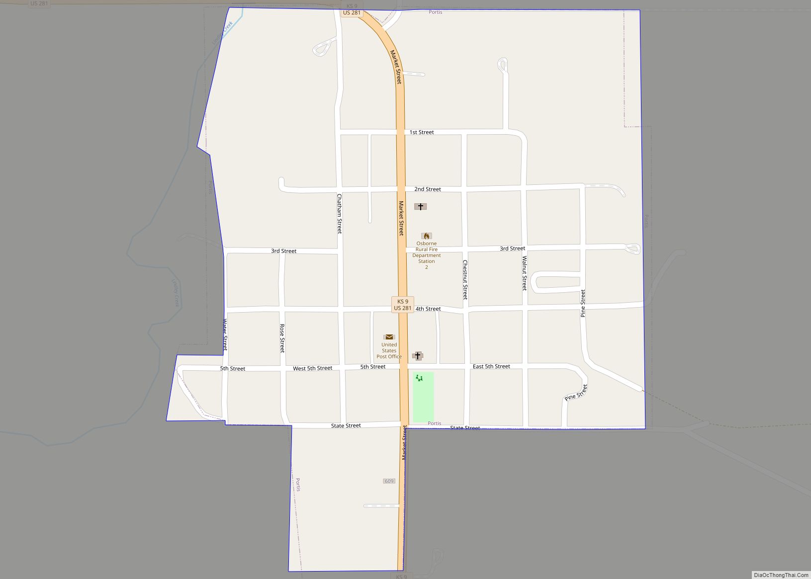
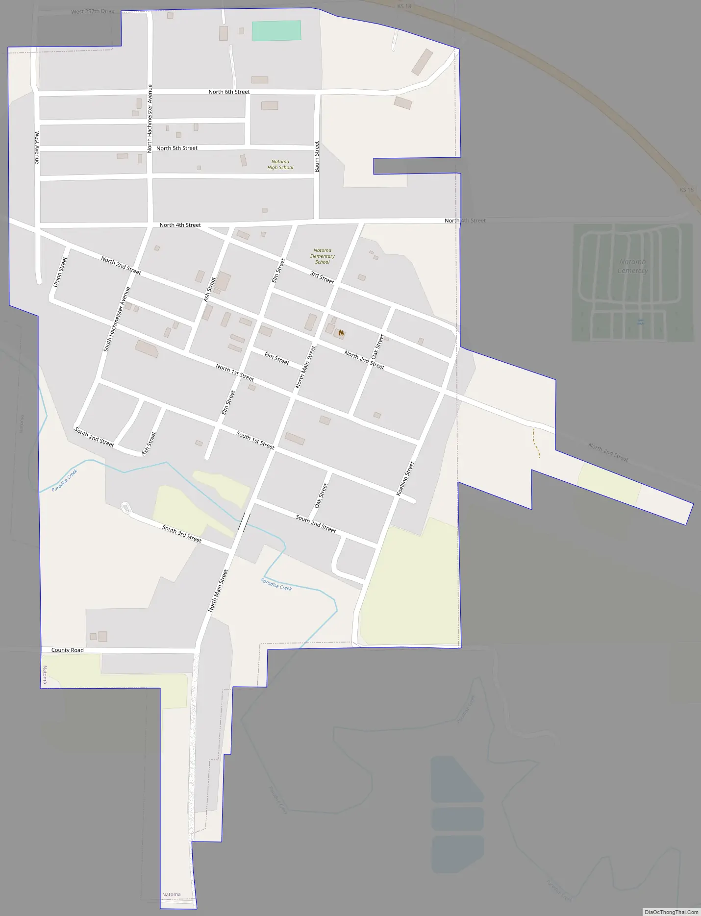
Natoma Road Map
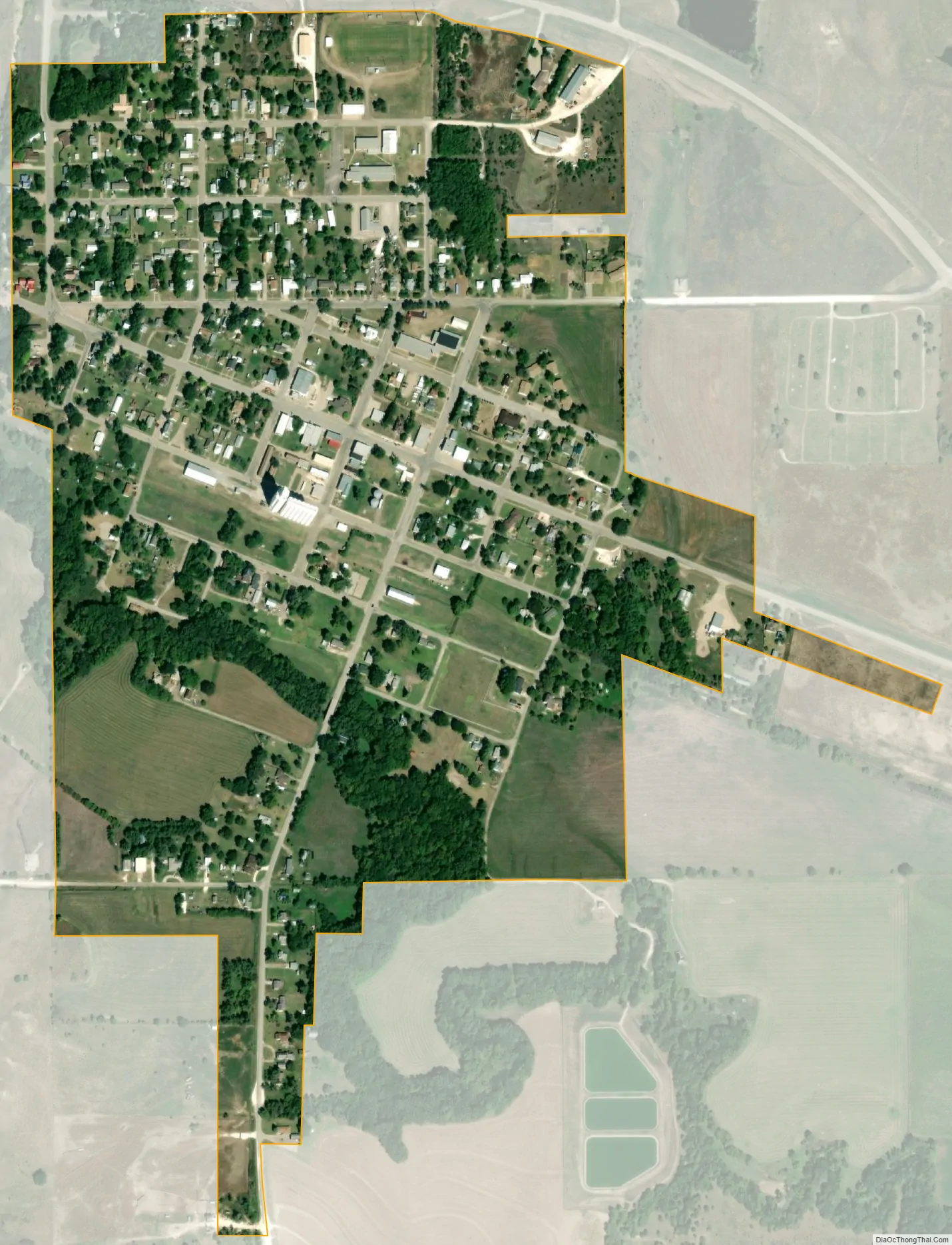
Natoma city Satellite Map
Geography
Natoma is located at 39°11′21″N 99°1′29″W / 39.18917°N 99.02472°W / 39.18917; -99.02472 (39.189054, -99.024832) at an elevation of 1,834 feet (559 m). It lies in the Smoky Hills region of the Great Plains approximately 9 miles (14 km) north of the Saline River. Paradise Creek, a tributary of the Saline, flows southeast along the southern edge of the city. Natoma is in north-central Kansas approximately 135 miles (217 km) northwest of Wichita and 230 miles (370 km) west of Kansas City. Located on K-18, it is roughly 25 miles (40 km) southwest of Osborne, the county seat.
According to the United States Census Bureau, the city has a total area of 0.41 square miles (1.06 km), all of it land.
See also
Map of Kansas State and its subdivision:- Allen
- Anderson
- Atchison
- Barber
- Barton
- Bourbon
- Brown
- Butler
- Chase
- Chautauqua
- Cherokee
- Cheyenne
- Clark
- Clay
- Cloud
- Coffey
- Comanche
- Cowley
- Crawford
- Decatur
- Dickinson
- Doniphan
- Douglas
- Edwards
- Elk
- Ellis
- Ellsworth
- Finney
- Ford
- Franklin
- Geary
- Gove
- Graham
- Grant
- Gray
- Greeley
- Greenwood
- Hamilton
- Harper
- Harvey
- Haskell
- Hodgeman
- Jackson
- Jefferson
- Jewell
- Johnson
- Kearny
- Kingman
- Kiowa
- Labette
- Lane
- Leavenworth
- Lincoln
- Linn
- Logan
- Lyon
- Marion
- Marshall
- McPherson
- Meade
- Miami
- Mitchell
- Montgomery
- Morris
- Morton
- Nemaha
- Neosho
- Ness
- Norton
- Osage
- Osborne
- Ottawa
- Pawnee
- Phillips
- Pottawatomie
- Pratt
- Rawlins
- Reno
- Republic
- Rice
- Riley
- Rooks
- Rush
- Russell
- Saline
- Scott
- Sedgwick
- Seward
- Shawnee
- Sheridan
- Sherman
- Smith
- Stafford
- Stanton
- Stevens
- Sumner
- Thomas
- Trego
- Wabaunsee
- Wallace
- Washington
- Wichita
- Wilson
- Woodson
- Wyandotte
- Alabama
- Alaska
- Arizona
- Arkansas
- California
- Colorado
- Connecticut
- Delaware
- District of Columbia
- Florida
- Georgia
- Hawaii
- Idaho
- Illinois
- Indiana
- Iowa
- Kansas
- Kentucky
- Louisiana
- Maine
- Maryland
- Massachusetts
- Michigan
- Minnesota
- Mississippi
- Missouri
- Montana
- Nebraska
- Nevada
- New Hampshire
- New Jersey
- New Mexico
- New York
- North Carolina
- North Dakota
- Ohio
- Oklahoma
- Oregon
- Pennsylvania
- Rhode Island
- South Carolina
- South Dakota
- Tennessee
- Texas
- Utah
- Vermont
- Virginia
- Washington
- West Virginia
- Wisconsin
- Wyoming