Paradise is a city in Russell County, Kansas, United States. As of the 2020 census, the population of the city was 35.
| Name: | Paradise city |
|---|---|
| LSAD Code: | 25 |
| LSAD Description: | city (suffix) |
| State: | Kansas |
| County: | Russell County |
| Founded: | 1887 |
| Incorporated: | 1924 |
| Elevation: | 1,693 ft (516 m) |
| Total Area: | 0.25 sq mi (0.64 km²) |
| Land Area: | 0.25 sq mi (0.64 km²) |
| Water Area: | 0.00 sq mi (0.00 km²) |
| Total Population: | 35 |
| Population Density: | 140/sq mi (55/km²) |
| ZIP code: | 67658 |
| Area code: | 785 |
| FIPS code: | 2054325 |
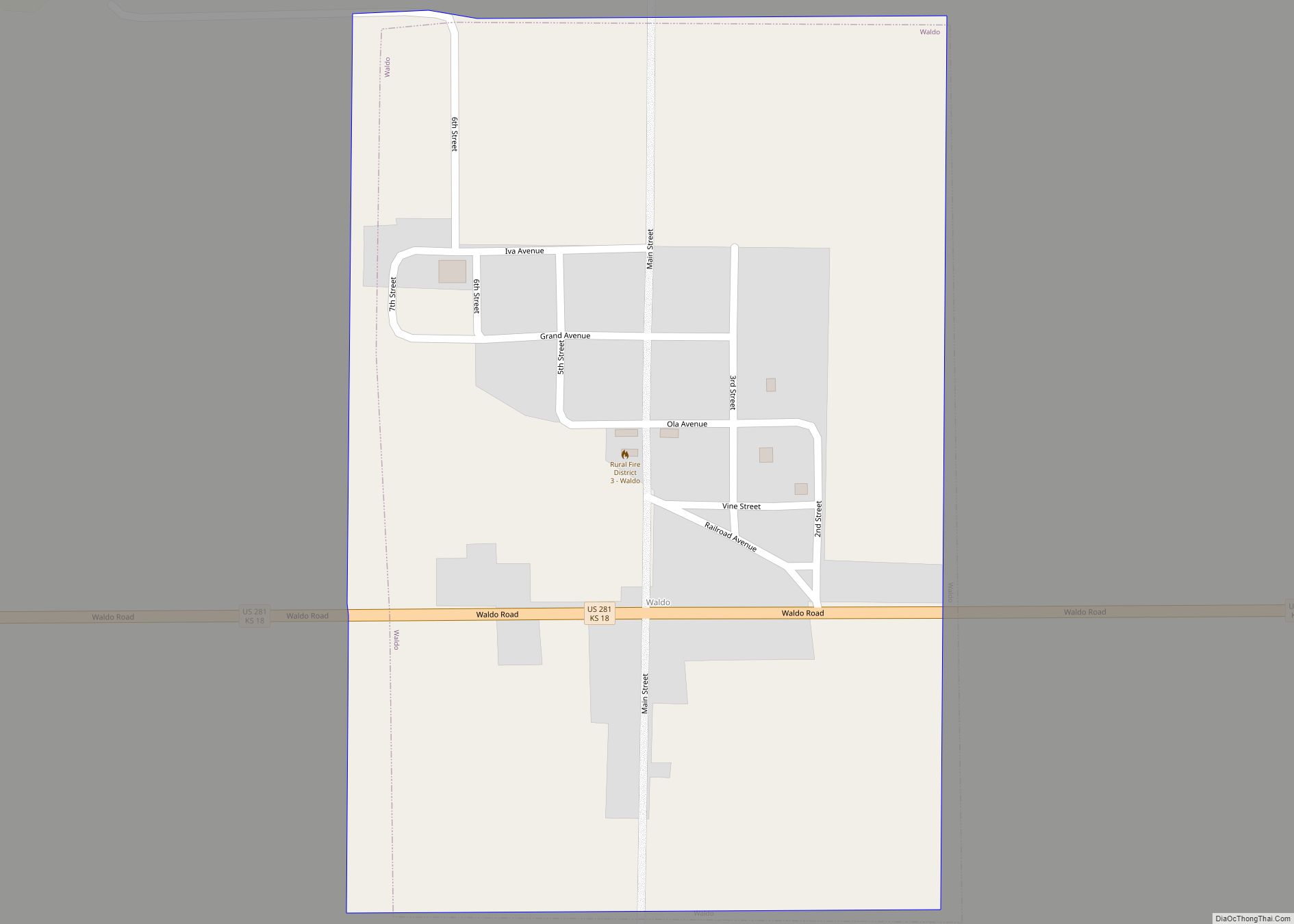
Online Interactive Map
Click on ![]() to view map in "full screen" mode.
to view map in "full screen" mode.
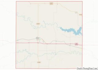
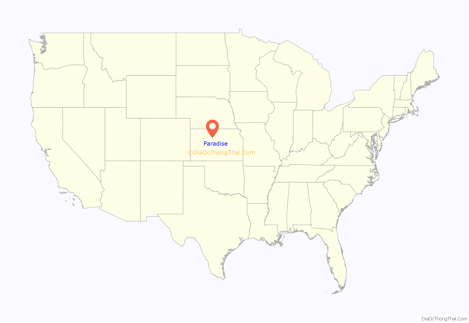
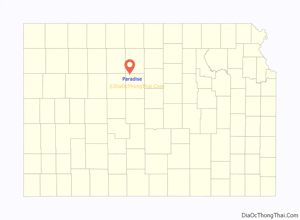
Paradise location map. Where is Paradise city?
History
In 1859, a hunting party explored the area, including a small tributary of the Saline River which led them to a site abundant in water, timber, and bison. One of the hunters, James R. Mead, described the site as paradise, and the tributary subsequently became known as Paradise Creek. The first post office in the area opened under the name Paradise in 1875. In 1887, the Union Townsite Company established a town on the north side of the creek northwest of the post office, naming it Ivamar after Iva Marr, the daughter of a local rancher. The Paradise post office relocated to Ivamar the next year, but kept its name. As a result, the town came to be known by both names; in 1891, the Union Pacific Railroad listed its rail stop there as Paradise with Ivamar in parentheses. The community grew through the 1890s to include a school, downtown businesses, and railroad facilities, reaching a population of 200 by 1910. Ivamar incorporated in 1924 and finally changed its name to Paradise. The population of the community has gradually declined since the 1930s.
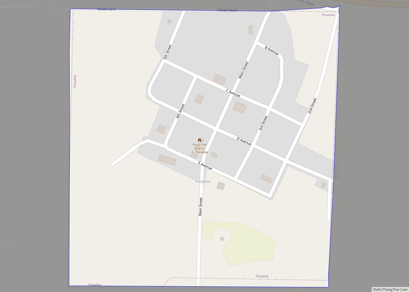
Paradise Road Map
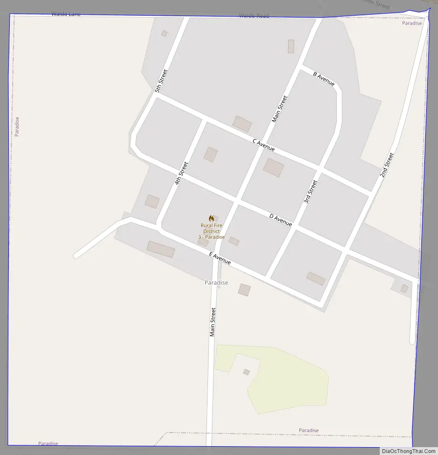
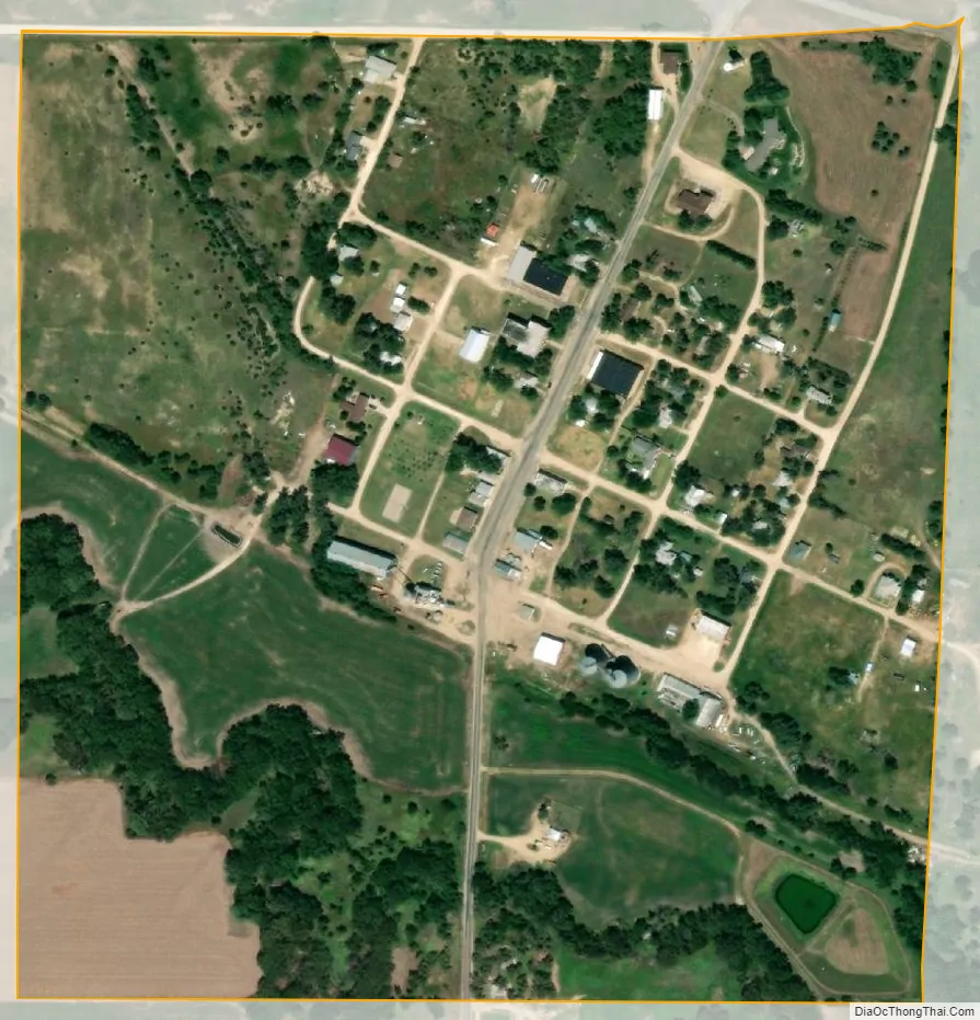
Paradise city Satellite Map
Geography
Paradise is located at 39°6′56″N 98°55′3″W / 39.11556°N 98.91750°W / 39.11556; -98.91750 (39.115445, -98.917428) at an elevation of 1,693 feet (516 m). Located in north-central Kansas 3.5 miles (5.6 km) west of U.S. Route 281 on Kansas Highway 18 (K-18), Paradise is 127 miles (204 km) northwest of Wichita, 233 miles (375 km) west of Kansas City, and 15 miles (24 km) north-northwest of Russell, the county seat.
Paradise sits on the north bank of Paradise Creek, a tributary of the Saline River, in the Smoky Hills region of the Great Plains. Eagle Creek, a tributary of Paradise Creek, flows south along the community’s east side.
According to the United States Census Bureau, the city has a total area of 0.25 square miles (0.65 km), all of it land.
See also
Map of Kansas State and its subdivision:- Allen
- Anderson
- Atchison
- Barber
- Barton
- Bourbon
- Brown
- Butler
- Chase
- Chautauqua
- Cherokee
- Cheyenne
- Clark
- Clay
- Cloud
- Coffey
- Comanche
- Cowley
- Crawford
- Decatur
- Dickinson
- Doniphan
- Douglas
- Edwards
- Elk
- Ellis
- Ellsworth
- Finney
- Ford
- Franklin
- Geary
- Gove
- Graham
- Grant
- Gray
- Greeley
- Greenwood
- Hamilton
- Harper
- Harvey
- Haskell
- Hodgeman
- Jackson
- Jefferson
- Jewell
- Johnson
- Kearny
- Kingman
- Kiowa
- Labette
- Lane
- Leavenworth
- Lincoln
- Linn
- Logan
- Lyon
- Marion
- Marshall
- McPherson
- Meade
- Miami
- Mitchell
- Montgomery
- Morris
- Morton
- Nemaha
- Neosho
- Ness
- Norton
- Osage
- Osborne
- Ottawa
- Pawnee
- Phillips
- Pottawatomie
- Pratt
- Rawlins
- Reno
- Republic
- Rice
- Riley
- Rooks
- Rush
- Russell
- Saline
- Scott
- Sedgwick
- Seward
- Shawnee
- Sheridan
- Sherman
- Smith
- Stafford
- Stanton
- Stevens
- Sumner
- Thomas
- Trego
- Wabaunsee
- Wallace
- Washington
- Wichita
- Wilson
- Woodson
- Wyandotte
- Alabama
- Alaska
- Arizona
- Arkansas
- California
- Colorado
- Connecticut
- Delaware
- District of Columbia
- Florida
- Georgia
- Hawaii
- Idaho
- Illinois
- Indiana
- Iowa
- Kansas
- Kentucky
- Louisiana
- Maine
- Maryland
- Massachusetts
- Michigan
- Minnesota
- Mississippi
- Missouri
- Montana
- Nebraska
- Nevada
- New Hampshire
- New Jersey
- New Mexico
- New York
- North Carolina
- North Dakota
- Ohio
- Oklahoma
- Oregon
- Pennsylvania
- Rhode Island
- South Carolina
- South Dakota
- Tennessee
- Texas
- Utah
- Vermont
- Virginia
- Washington
- West Virginia
- Wisconsin
- Wyoming