Victoria is a city in Ellis County, Kansas, United States. As of the 2020 census, the population of the city was 1,129.
| Name: | Victoria city |
|---|---|
| LSAD Code: | 25 |
| LSAD Description: | city (suffix) |
| State: | Kansas |
| County: | Ellis County |
| Founded: | 1873 |
| Incorporated: | 1913 |
| Elevation: | 1,926 ft (587 m) |
| Total Area: | 0.60 sq mi (1.55 km²) |
| Land Area: | 0.60 sq mi (1.55 km²) |
| Water Area: | 0.00 sq mi (0.00 km²) |
| Total Population: | 1,129 |
| Population Density: | 1,900/sq mi (730/km²) |
| ZIP code: | 67671 |
| Area code: | 785 |
| FIPS code: | 2073775 |
| Website: | victoriaks.com |
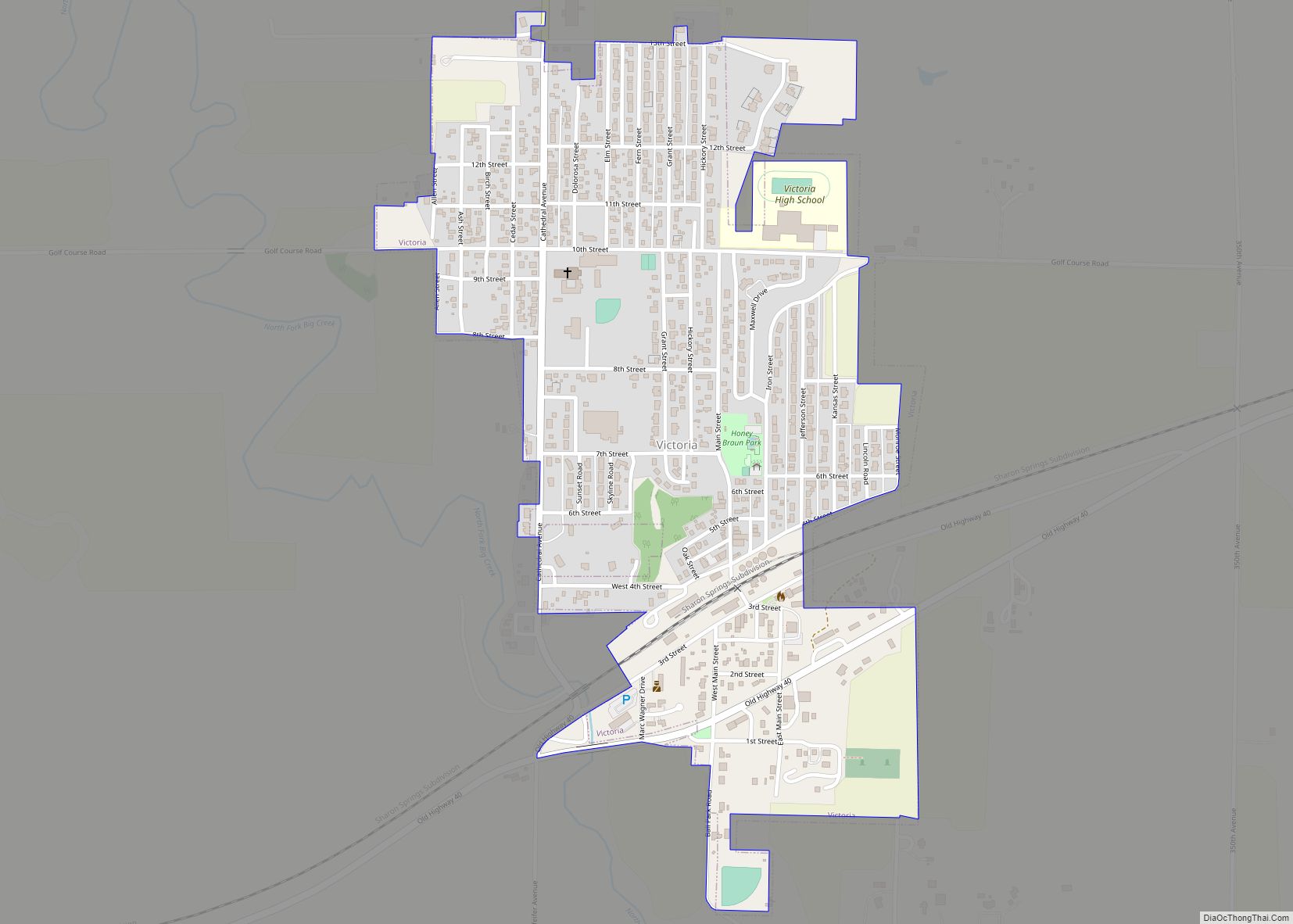
Online Interactive Map
Click on ![]() to view map in "full screen" mode.
to view map in "full screen" mode.
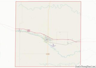
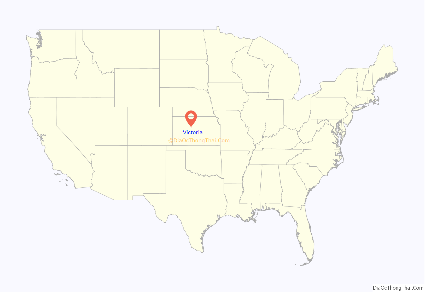
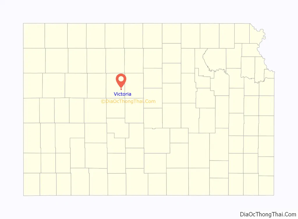
Victoria location map. Where is Victoria city?
History
A group of British colonists led by a Scotsman named George Grant founded Victoria in 1873 on land he had purchased from the Kansas Pacific Railway. They named the settlement after Queen Victoria. Grant intended for Victoria to be a ranching community and was purportedly responsible for bringing the first Aberdeen Angus cattle to the United States. Most of the colonists, however, were remittance men more interested in sports and dancing than in raising livestock. Their families soon learned of this and reduced the remittances, driving most of the colonists to leave by 1880. Some returned to Britain; others left for South America.
In 1876, Volga Germans from villages near Saratov, Russia established the settlement of Herzog one half mile north of Victoria. Herzog’s Roman Catholic settlers built a series of churches which culminated in the construction of St. Fidelis Catholic Church, known as “The Cathedral of the Plains,” in 1911. Herzog grew rapidly and later absorbed Victoria, eventually adopting the older settlement’s name. Herzog was officially renamed Victoria in 1913.
In 1942, the U.S. Army built Walker Army Airfield 3 miles northeast of Victoria. During World War II, thousands were stationed at the airfield, most for training in operation of the Boeing B-29 Superfortress bomber aircraft. The military closed the base in 1946.
In 1966, construction of Interstate 70 reached Victoria, passing north of the city.
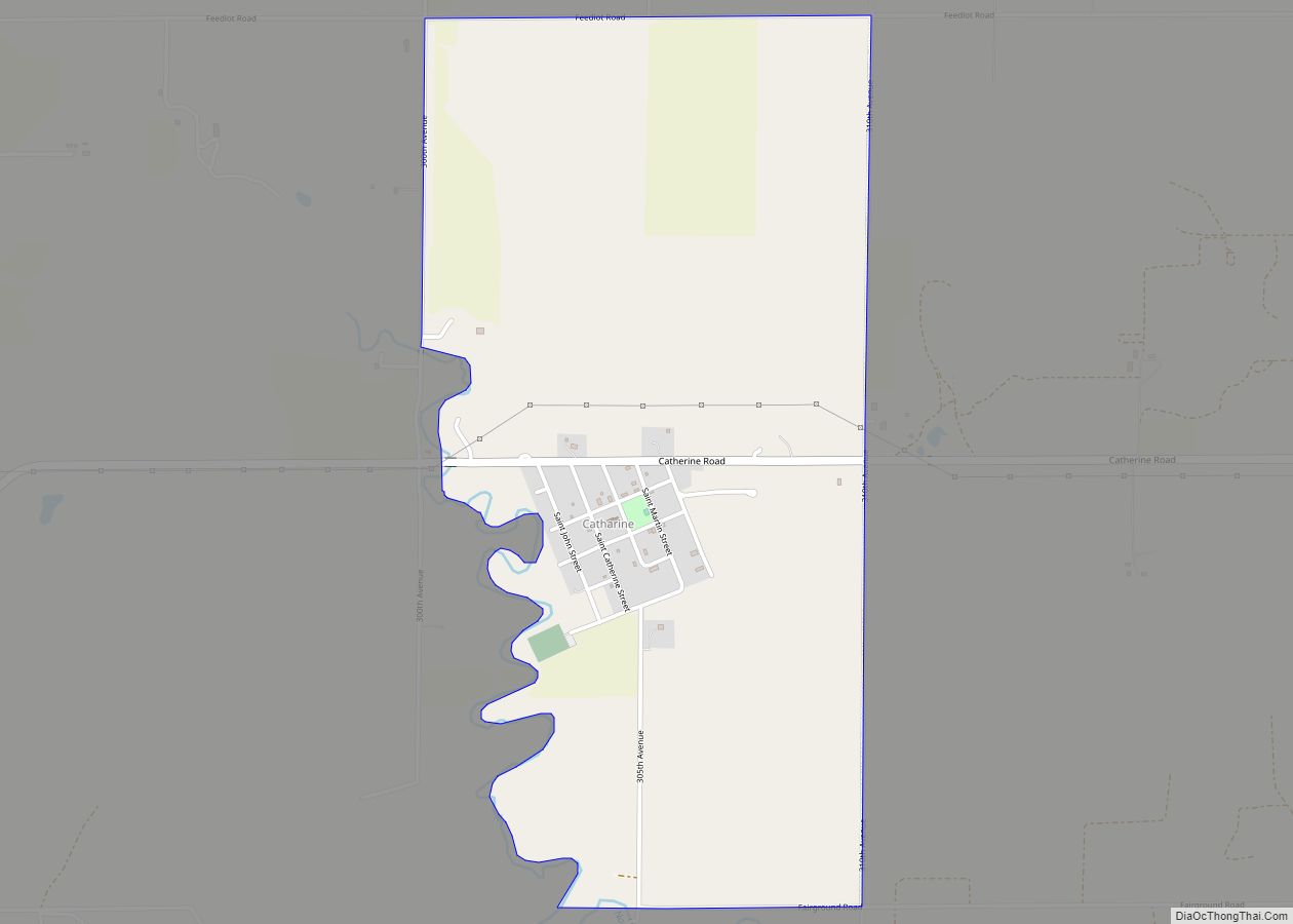
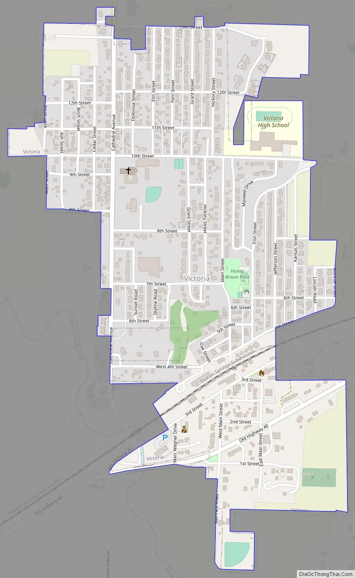
Victoria Road Map
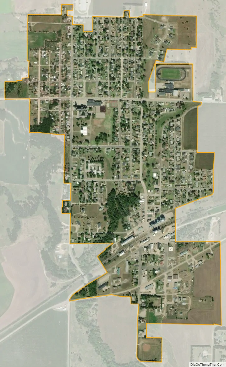
Victoria city Satellite Map
Geography
Victoria is located at 38°51′13″N 99°8′51″W / 38.85361°N 99.14750°W / 38.85361; -99.14750 (38.853588, -99.147456) at an elevation of 1,926 feet (587 m). Located on Kansas Highway 255 (K-255) 1-mile (1.6 km) south of Interstate 70 in northwestern Kansas, Victoria is approximately 9 miles (14 km) east of Hays (the county seat), 129 miles (208 km) northwest of Wichita, and 243 miles (391 km) west of Kansas City.
The city lies roughly 9 miles (14 km) north of the Smoky Hill River in the Smoky Hills region of the Great Plains. The city sits on the east side of the North Fork of Big Creek, part of the Smoky Hill River watershed.
According to the United States Census Bureau, the city has a total area of 0.59 square miles (1.53 km), all of it land.
See also
Map of Kansas State and its subdivision:- Allen
- Anderson
- Atchison
- Barber
- Barton
- Bourbon
- Brown
- Butler
- Chase
- Chautauqua
- Cherokee
- Cheyenne
- Clark
- Clay
- Cloud
- Coffey
- Comanche
- Cowley
- Crawford
- Decatur
- Dickinson
- Doniphan
- Douglas
- Edwards
- Elk
- Ellis
- Ellsworth
- Finney
- Ford
- Franklin
- Geary
- Gove
- Graham
- Grant
- Gray
- Greeley
- Greenwood
- Hamilton
- Harper
- Harvey
- Haskell
- Hodgeman
- Jackson
- Jefferson
- Jewell
- Johnson
- Kearny
- Kingman
- Kiowa
- Labette
- Lane
- Leavenworth
- Lincoln
- Linn
- Logan
- Lyon
- Marion
- Marshall
- McPherson
- Meade
- Miami
- Mitchell
- Montgomery
- Morris
- Morton
- Nemaha
- Neosho
- Ness
- Norton
- Osage
- Osborne
- Ottawa
- Pawnee
- Phillips
- Pottawatomie
- Pratt
- Rawlins
- Reno
- Republic
- Rice
- Riley
- Rooks
- Rush
- Russell
- Saline
- Scott
- Sedgwick
- Seward
- Shawnee
- Sheridan
- Sherman
- Smith
- Stafford
- Stanton
- Stevens
- Sumner
- Thomas
- Trego
- Wabaunsee
- Wallace
- Washington
- Wichita
- Wilson
- Woodson
- Wyandotte
- Alabama
- Alaska
- Arizona
- Arkansas
- California
- Colorado
- Connecticut
- Delaware
- District of Columbia
- Florida
- Georgia
- Hawaii
- Idaho
- Illinois
- Indiana
- Iowa
- Kansas
- Kentucky
- Louisiana
- Maine
- Maryland
- Massachusetts
- Michigan
- Minnesota
- Mississippi
- Missouri
- Montana
- Nebraska
- Nevada
- New Hampshire
- New Jersey
- New Mexico
- New York
- North Carolina
- North Dakota
- Ohio
- Oklahoma
- Oregon
- Pennsylvania
- Rhode Island
- South Carolina
- South Dakota
- Tennessee
- Texas
- Utah
- Vermont
- Virginia
- Washington
- West Virginia
- Wisconsin
- Wyoming