Brooklyn Center is a first-ring suburban city in Hennepin County, Minnesota, United States in the Minneapolis–Saint Paul metropolitan area. In 1911, the area became a village formed from parts of Brooklyn Township and Crystal Lake Township. In 1966, Brooklyn Center became a charter city. The city has commercial and industrial development. The majority of land use is single-family homes. The population was 33,782 at the 2020 census, and the city has become the most ethnically diverse community in the state.
| Name: | Brooklyn Center city |
|---|---|
| LSAD Code: | 25 |
| LSAD Description: | city (suffix) |
| State: | Minnesota |
| County: | Hennepin County |
| Elevation: | 853 ft (260 m) |
| Land Area: | 8.00 sq mi (20.73 km²) |
| Water Area: | 0.38 sq mi (0.98 km²) |
| Population Density: | 4,221.17/sq mi (1,629.76/km²) |
| Area code: | 763 |
| FIPS code: | 2707948 |
| GNISfeature ID: | 0640508 |
| Website: | ci.brooklyn-center.mn.us |
Online Interactive Map
Click on ![]() to view map in "full screen" mode.
to view map in "full screen" mode.
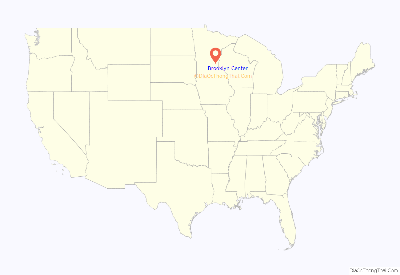
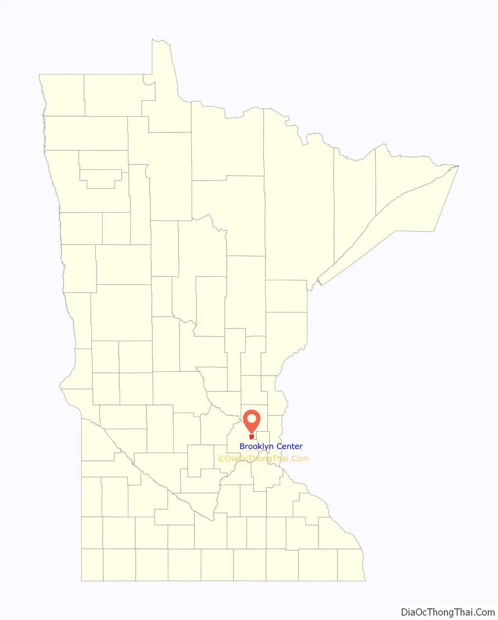
Brooklyn Center location map. Where is Brooklyn Center city?
History
Pioneers organized town governments for Brooklyn Township and Crystal Lake Township when Minnesota became a state in 1858. Osseo Road was a main thoroughfare that brought settlers to an area centered around their school, post office, store, meeting hall, and Baptist and Methodist churches. That location thrived as a market gardening community. It abutted the encroaching development of Minneapolis to the south.
Steps were taken to protect the area from annexation by Minneapolis and to retain “simpler public business methods, and extra police protection” by incorporation. The Hennepin County Board of Commissioners accepted a petition to incorporate the Village of Brooklyn Center on January 16, 1911. An election followed, the boundaries were set, and documents filed with the state on February 18, 1911. P.W. Reidhead was the first president. The population was 500.
By 1940, the village saw a need for more organized planning to deal with issues such as sewage and traffic. In 1942, a Planning Commission was established. Farmers were selling their valuable land to housing developers. The decade saw unprecedented population growth, reaching 4,000 by 1950. Brookdale, a new shopping concept by Dayton’s, was constructed in 1960 when the population had grown to over 24,000. In 1963, even more new opportunities for commercial development were presented with the estate of Earle Brown, deceased, the heir of Captain John Martin who had been one of the wealthiest men in Minneapolis.
Earle Brown Heritage Center, was the former Cap Martin country estate, built in 1878 and willed to his grandson Earle Brown in 1901. The buildings included the family home, office and garage, housing for the workers, a pump house, multiple barns, a hippodrome, an antique carriage collection, and a restored lumber bunkhouse and cook shanty. It is now a historic site in Brooklyn Center owned by the city and developed into a conference and event center.
Mound Cemetery of Brooklyn Center has been owned and managed by a not-for-profit organization since 1862. Its mission is to provide cemetery and perpetual care services to the public, and to preserve the historical burial grounds of the founding families of Brooklyn Township.
The Brooklyn Historical Society, is a 501(c3) nonprofit all-volunteer organization founded in 1970. Its mission is to research, preserve, and provide access to historical information about Brooklyn Township – yesterday, today, and tomorrow. The Society has historical displays at the city halls of Brooklyn Center and Brooklyn Park, and the Earle Brown Heritage Center. Its facility is in Brooklyn Park.
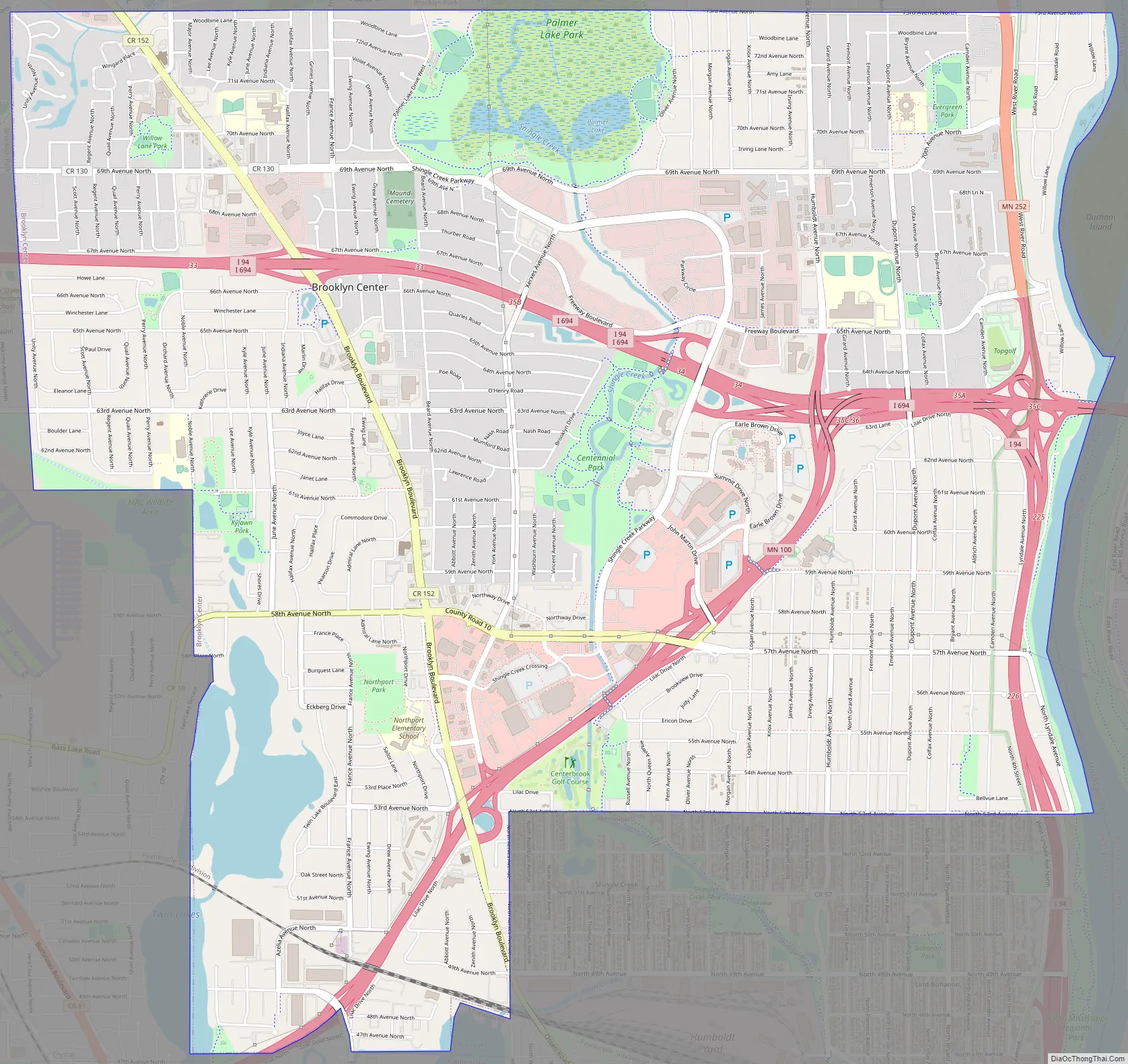
Brooklyn Center Road Map
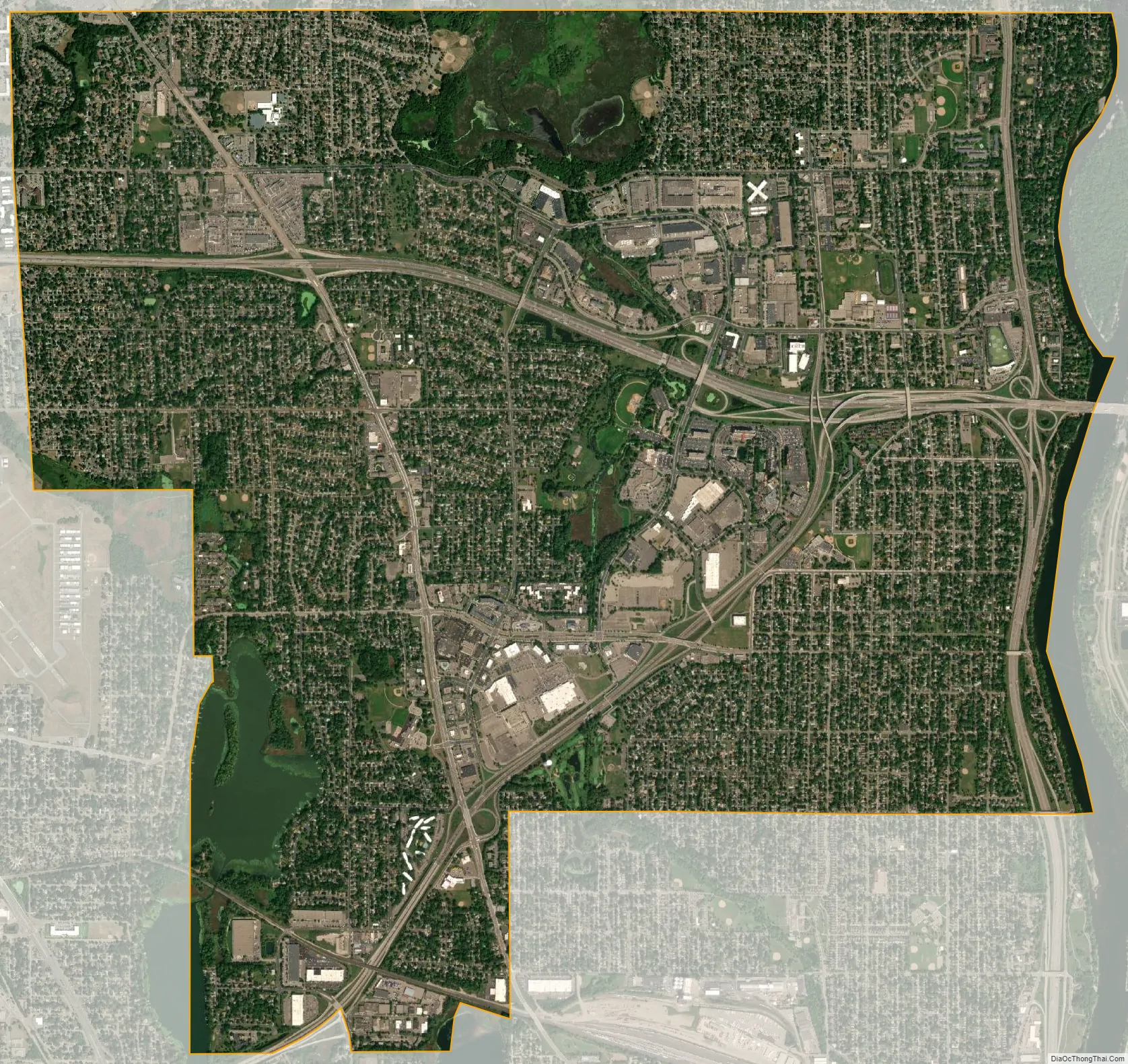
Brooklyn Center city Satellite Map
Geography
According to the United States Census Bureau, the city has an area of 8.34 square miles (21.60 km), of which 7.96 square miles (20.62 km) is land and 0.38 square miles (0.98 km) is water. All of Brooklyn Center is in the Upper Mississippi Watershed Basin. The Mississippi River is the eastern boundary of the city and is part of the Mississippi National River and Recreation Area of Minnesota. The North Mississippi Regional Park, at 5700 Lyndale Avenue North, is managed by Three Rivers Park District Board, on which Brooklyn Center is represented in District 3.
Southwestern Brooklyn Center includes Upper Twin Lake (117 acres) and connects to a chain of lakes that discharge into Shingle Creek, which discharges into the Mississippi River. Shingle Creek also runs through Palmer Lake. The city is a member of Shingle Creek and West Mississippi Watershed Management Commission, which manages the lakes, streams, and wetlands in this area. Palmer Lake Park is a natural environmental preserve of lake and marsh habitat on over 200 acres.
All of Brooklyn Center is in the state’s Deciduous Forest Biome. The Plant Hardiness Zone is 4B, with an average minimum extreme temperature of -25 to -20 Fahrenheit. The city has developed and maintains 26 parks and a 20-mile trail system. The majority of land use is single-family homes. The historical route, Osseo Road, was renamed Brooklyn Boulevard by both Brooklyn Center and Brooklyn Park in 1969. Interstates 94 and 694 and Minnesota State Highways 100 and 252 are four of the main routes in Brooklyn Center.
See also
Map of Minnesota State and its subdivision:- Aitkin
- Anoka
- Becker
- Beltrami
- Benton
- Big Stone
- Blue Earth
- Brown
- Carlton
- Carver
- Cass
- Chippewa
- Chisago
- Clay
- Clearwater
- Cook
- Cottonwood
- Crow Wing
- Dakota
- Dodge
- Douglas
- Faribault
- Fillmore
- Freeborn
- Goodhue
- Grant
- Hennepin
- Houston
- Hubbard
- Isanti
- Itasca
- Jackson
- Kanabec
- Kandiyohi
- Kittson
- Koochiching
- Lac qui Parle
- Lake
- Lake of the Woods
- Lake Superior
- Le Sueur
- Lincoln
- Lyon
- Mahnomen
- Marshall
- Martin
- McLeod
- Meeker
- Mille Lacs
- Morrison
- Mower
- Murray
- Nicollet
- Nobles
- Norman
- Olmsted
- Otter Tail
- Pennington
- Pine
- Pipestone
- Polk
- Pope
- Ramsey
- Red Lake
- Redwood
- Renville
- Rice
- Rock
- Roseau
- Saint Louis
- Scott
- Sherburne
- Sibley
- Stearns
- Steele
- Stevens
- Swift
- Todd
- Traverse
- Wabasha
- Wadena
- Waseca
- Washington
- Watonwan
- Wilkin
- Winona
- Wright
- Yellow Medicine
- Alabama
- Alaska
- Arizona
- Arkansas
- California
- Colorado
- Connecticut
- Delaware
- District of Columbia
- Florida
- Georgia
- Hawaii
- Idaho
- Illinois
- Indiana
- Iowa
- Kansas
- Kentucky
- Louisiana
- Maine
- Maryland
- Massachusetts
- Michigan
- Minnesota
- Mississippi
- Missouri
- Montana
- Nebraska
- Nevada
- New Hampshire
- New Jersey
- New Mexico
- New York
- North Carolina
- North Dakota
- Ohio
- Oklahoma
- Oregon
- Pennsylvania
- Rhode Island
- South Carolina
- South Dakota
- Tennessee
- Texas
- Utah
- Vermont
- Virginia
- Washington
- West Virginia
- Wisconsin
- Wyoming


