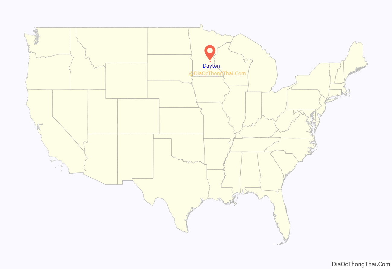
Dayton is a city in Hennepin and Wright counties in the U.S. state of Minnesota. The population was 7,262 at the 2020 census. Dayton is mainly located within Hennepin County, but a part of the city extends into Wright County as well. It is the northernmost city in Hennepin County and is a suburb of the Minneapolis–St. Paul “Twin Cities” metropolitan area.
The city of Dayton, platted in 1855, is named for city founder, Lyman Dayton. Through his energy and finances, Lyman Dayton was instrumental in bringing the railroad into Minnesota and development of the Lake Superior and Mississippi Railroad, of which he was president until 1865. The line is now part of the Burlington Northern Santa Fe Railroad.
| Name: | Dayton city |
|---|---|
| LSAD Code: | 25 |
| LSAD Description: | city (suffix) |
| State: | Minnesota |
| County: | Hennepin County, Wright County |
| Elevation: | 879 ft (268 m) |
| Land Area: | 23.42 sq mi (60.65 km²) |
| Water Area: | 1.76 sq mi (4.57 km²) |
| Population Density: | 310.09/sq mi (119.73/km²) |
| ZIP code: | 55327, 55369 |
| Area code: | 763 |
| FIPS code: | 2715022 |
| GNISfeature ID: | 0642665 |
| Website: | cityofdaytonmn.com |
Online Interactive Map
Click on ![]() to view map in "full screen" mode.
to view map in "full screen" mode.
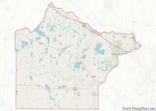
Dayton location map. Where is Dayton city?
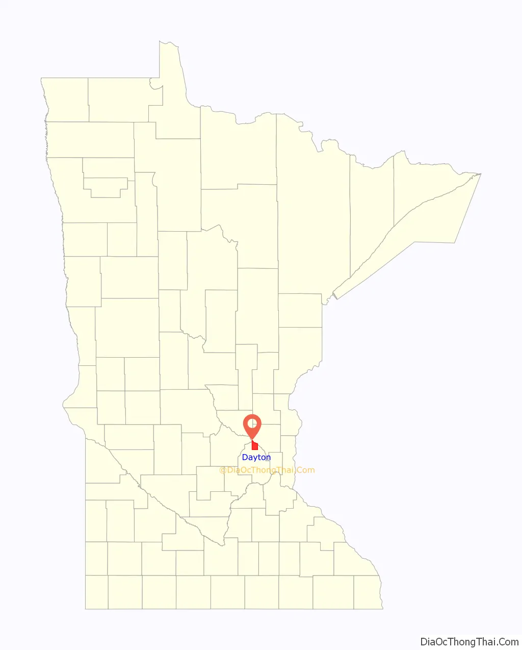
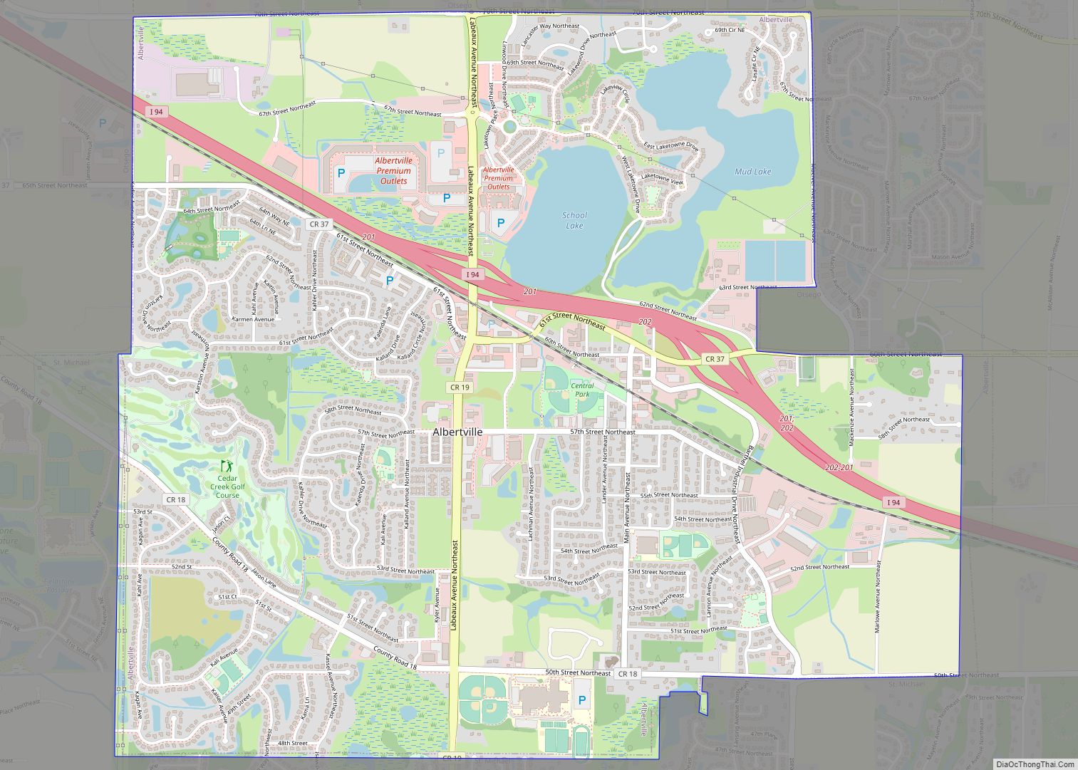
Dayton Road Map

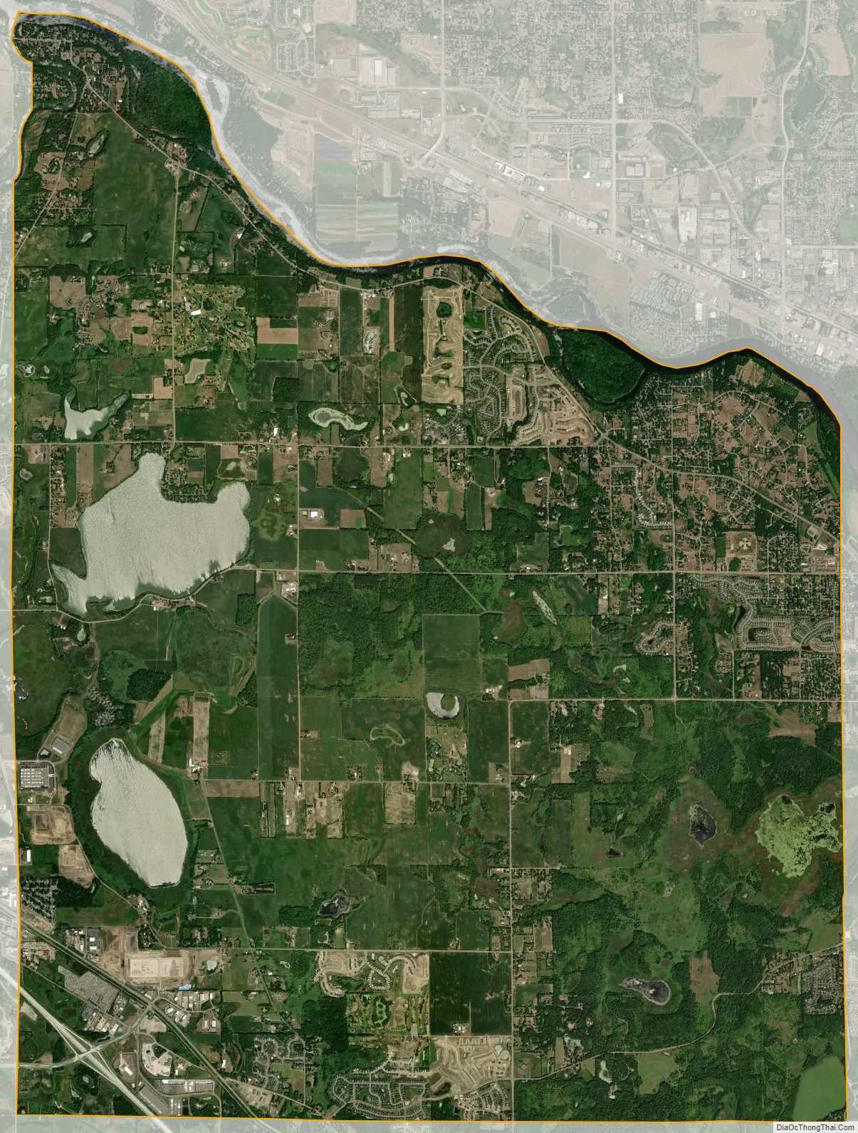
Dayton city Satellite Map
Geography
According to the United States Census Bureau, the city has a total area of 25.15 square miles (65.14 km), of which 23.25 square miles (60.22 km) is land and 1.90 square miles (4.92 km) is water. On January 15, 2003, the city’s most recent geographical expanse extended its boundaries.
Fernbrook Lane (County 121); North Diamond Lake Road (County 144); South Diamond Lake Road; and Dayton River Road (County 12) are four of the main routes in Dayton. Interstate 94 and County Road 81 pass briefly through the southwest corner of Dayton. Brockton Lane (County 13) runs north-south along Dayton’s western boundary line with adjacent city of Rogers.
The neighboring cities are Champlin, Rogers, Maple Grove, Anoka, Ramsey, Elk River, and Otsego. Corcoran is nearby, but does not border Dayton.
Dayton is located at the confluence of the Mississippi and Crow Rivers.
See also
Map of Minnesota State and its subdivision:- Aitkin
- Anoka
- Becker
- Beltrami
- Benton
- Big Stone
- Blue Earth
- Brown
- Carlton
- Carver
- Cass
- Chippewa
- Chisago
- Clay
- Clearwater
- Cook
- Cottonwood
- Crow Wing
- Dakota
- Dodge
- Douglas
- Faribault
- Fillmore
- Freeborn
- Goodhue
- Grant
- Hennepin
- Houston
- Hubbard
- Isanti
- Itasca
- Jackson
- Kanabec
- Kandiyohi
- Kittson
- Koochiching
- Lac qui Parle
- Lake
- Lake of the Woods
- Lake Superior
- Le Sueur
- Lincoln
- Lyon
- Mahnomen
- Marshall
- Martin
- McLeod
- Meeker
- Mille Lacs
- Morrison
- Mower
- Murray
- Nicollet
- Nobles
- Norman
- Olmsted
- Otter Tail
- Pennington
- Pine
- Pipestone
- Polk
- Pope
- Ramsey
- Red Lake
- Redwood
- Renville
- Rice
- Rock
- Roseau
- Saint Louis
- Scott
- Sherburne
- Sibley
- Stearns
- Steele
- Stevens
- Swift
- Todd
- Traverse
- Wabasha
- Wadena
- Waseca
- Washington
- Watonwan
- Wilkin
- Winona
- Wright
- Yellow Medicine
- Alabama
- Alaska
- Arizona
- Arkansas
- California
- Colorado
- Connecticut
- Delaware
- District of Columbia
- Florida
- Georgia
- Hawaii
- Idaho
- Illinois
- Indiana
- Iowa
- Kansas
- Kentucky
- Louisiana
- Maine
- Maryland
- Massachusetts
- Michigan
- Minnesota
- Mississippi
- Missouri
- Montana
- Nebraska
- Nevada
- New Hampshire
- New Jersey
- New Mexico
- New York
- North Carolina
- North Dakota
- Ohio
- Oklahoma
- Oregon
- Pennsylvania
- Rhode Island
- South Carolina
- South Dakota
- Tennessee
- Texas
- Utah
- Vermont
- Virginia
- Washington
- West Virginia
- Wisconsin
- Wyoming