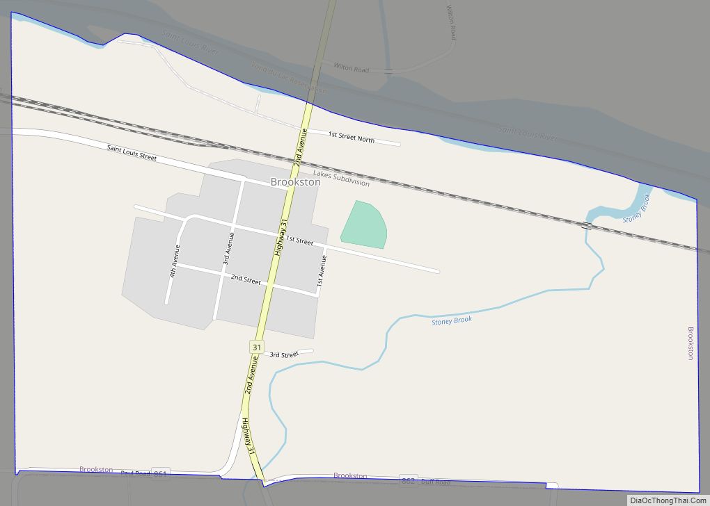
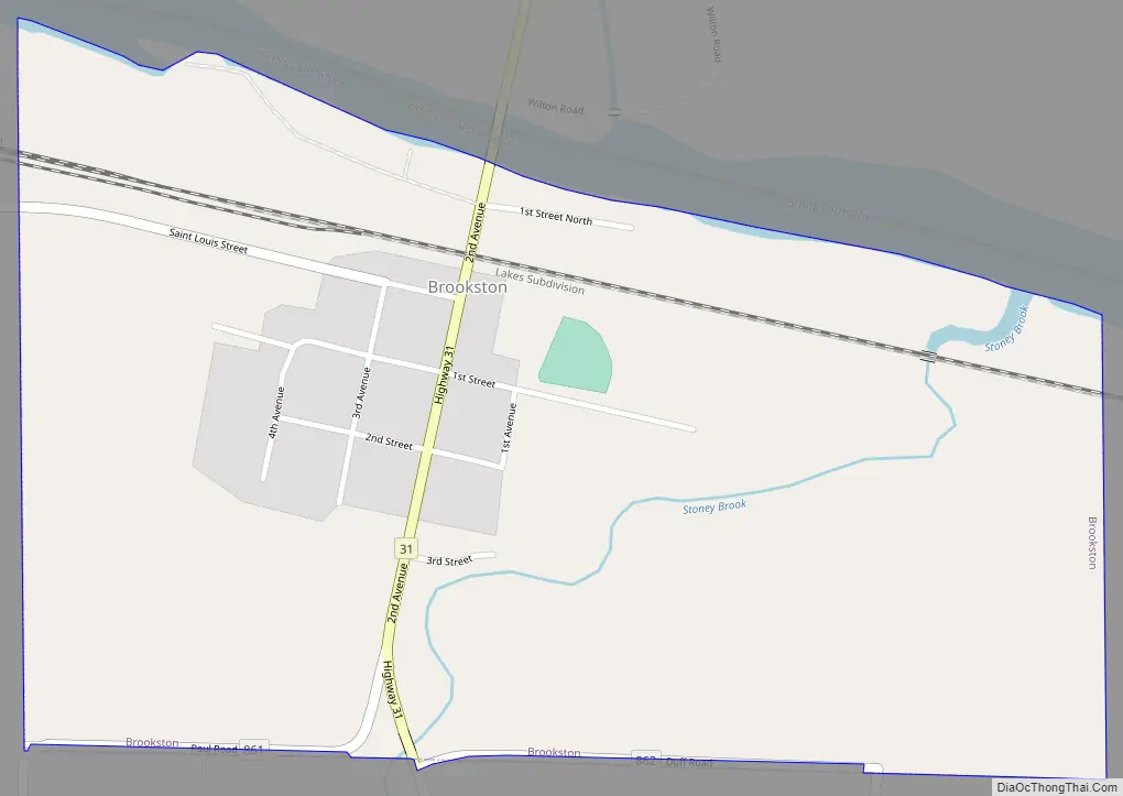
Brookston is a city in Saint Louis County, Minnesota, United States; located along the Saint Louis River, opposite the mouth of the Artichoke River. The population was 118 at the 2020 census.
Brookston is located 27 miles west of the city of Duluth and 17 miles northwest of the city of Cloquet.
U.S. Highway 2 and Saint Louis County Road 31 (CR 31) are two of the main routes in Brookston.
The city of Brookston is located within Culver Township geographically but is a separate entity. Brookston is politically independent of the township.
Brookston is located on the northern edge of the Fond du Lac Indian Reservation. It is one of three administrative centers of the reservation.
| Name: | Brookston city |
|---|---|
| LSAD Code: | 25 |
| LSAD Description: | city (suffix) |
| State: | Minnesota |
| County: | St. Louis County |
| Founded: | 1905 |
| Incorporated: | April 13, 1907 |
| Elevation: | 1,230 ft (370 m) |
| Total Area: | 0.55 sq mi (1.42 km²) |
| Land Area: | 0.55 sq mi (1.42 km²) |
| Water Area: | 0.00 sq mi (0.00 km²) |
| Total Population: | 118 |
| Population Density: | 215.72/sq mi (83.25/km²) |
| ZIP code: | 55711 |
| Area code: | 218 |
| FIPS code: | 2708056 |
| GNISfeature ID: | 0660884 |
Online Interactive Map
Click on ![]() to view map in "full screen" mode.
to view map in "full screen" mode.
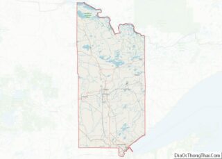
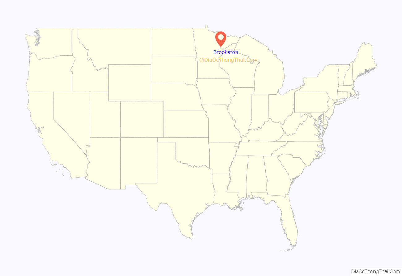
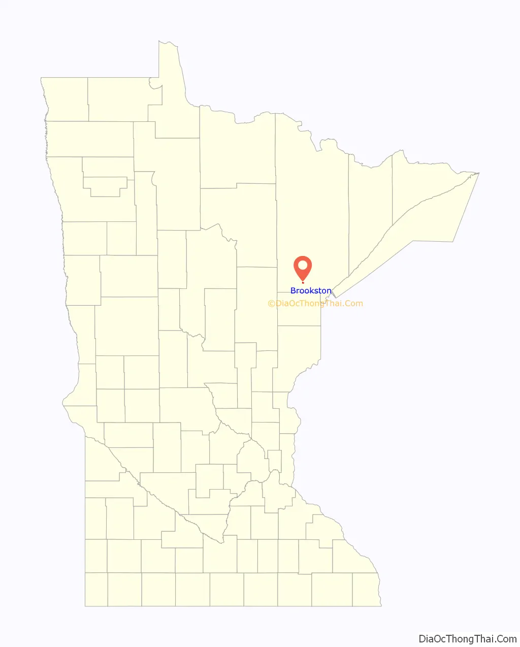
Brookston location map. Where is Brookston city?
History
Brookston is a city in sections 27 and 34 of Culver Township; it was platted about 1905 and incorporated as a village on April 13, 1907; the post office began in 1899. The city was destroyed by a forest fire in 1918 and rebuilt. It was formerly known as Stoney Brook Junction, the Duluth, Missabe and Iron Range Railroad station located in section 28.
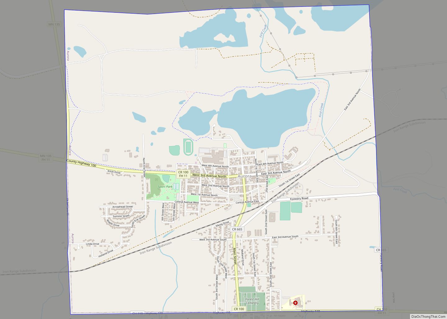
Brookston Road Map
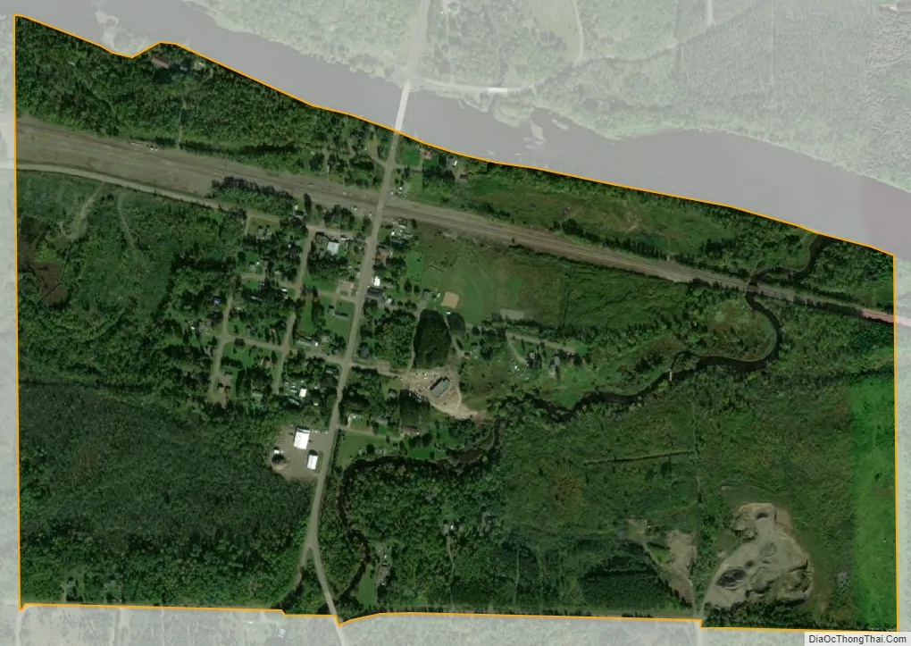
Brookston city Satellite Map
Geography
According to the United States Census Bureau, the city has a total area of 0.55 square miles (1.42 km), all land.
See also
Map of Minnesota State and its subdivision:- Aitkin
- Anoka
- Becker
- Beltrami
- Benton
- Big Stone
- Blue Earth
- Brown
- Carlton
- Carver
- Cass
- Chippewa
- Chisago
- Clay
- Clearwater
- Cook
- Cottonwood
- Crow Wing
- Dakota
- Dodge
- Douglas
- Faribault
- Fillmore
- Freeborn
- Goodhue
- Grant
- Hennepin
- Houston
- Hubbard
- Isanti
- Itasca
- Jackson
- Kanabec
- Kandiyohi
- Kittson
- Koochiching
- Lac qui Parle
- Lake
- Lake of the Woods
- Lake Superior
- Le Sueur
- Lincoln
- Lyon
- Mahnomen
- Marshall
- Martin
- McLeod
- Meeker
- Mille Lacs
- Morrison
- Mower
- Murray
- Nicollet
- Nobles
- Norman
- Olmsted
- Otter Tail
- Pennington
- Pine
- Pipestone
- Polk
- Pope
- Ramsey
- Red Lake
- Redwood
- Renville
- Rice
- Rock
- Roseau
- Saint Louis
- Scott
- Sherburne
- Sibley
- Stearns
- Steele
- Stevens
- Swift
- Todd
- Traverse
- Wabasha
- Wadena
- Waseca
- Washington
- Watonwan
- Wilkin
- Winona
- Wright
- Yellow Medicine
- Alabama
- Alaska
- Arizona
- Arkansas
- California
- Colorado
- Connecticut
- Delaware
- District of Columbia
- Florida
- Georgia
- Hawaii
- Idaho
- Illinois
- Indiana
- Iowa
- Kansas
- Kentucky
- Louisiana
- Maine
- Maryland
- Massachusetts
- Michigan
- Minnesota
- Mississippi
- Missouri
- Montana
- Nebraska
- Nevada
- New Hampshire
- New Jersey
- New Mexico
- New York
- North Carolina
- North Dakota
- Ohio
- Oklahoma
- Oregon
- Pennsylvania
- Rhode Island
- South Carolina
- South Dakota
- Tennessee
- Texas
- Utah
- Vermont
- Virginia
- Washington
- West Virginia
- Wisconsin
- Wyoming