Ely (/ˈiːli/ EE-lee) is a city in Saint Louis County, Minnesota, United States. The population was 3,268 at the 2020 census.
Located on the Vermilion iron range, Ely once had several iron ore mines. It is an entry point for campers and canoers into the Boundary Waters Canoe Area Wilderness and Canada’s Quetico Provincial Park wilderness area. The International Wolf Center and the North American Bear Center are nearby.
Ely’s main street has nature outfitters, outdoor clothing stores, and restaurants. State Highway 1 (MN 1), State Highway 169 (MN 169) and County Road 21 (Central Avenue) are Ely’s main routes. The city is 16 mi (26 km) south of the Canada–United States border and is within the Superior National Forest.
| Name: | Ely city |
|---|---|
| LSAD Code: | 25 |
| LSAD Description: | city (suffix) |
| State: | Minnesota |
| County: | St. Louis County |
| Elevation: | 1,434 ft (437 m) |
| Total Area: | 2.93 sq mi (7.59 km²) |
| Land Area: | 2.92 sq mi (7.57 km²) |
| Water Area: | 0.01 sq mi (0.02 km²) |
| Total Population: | 3,268 |
| Population Density: | 1,117.65/sq mi (431.51/km²) |
| ZIP code: | 55731 |
| Area code: | 218 |
| FIPS code: | 2719142 |
| GNISfeature ID: | 0661205 |
| Website: | www.ely.mn.us |
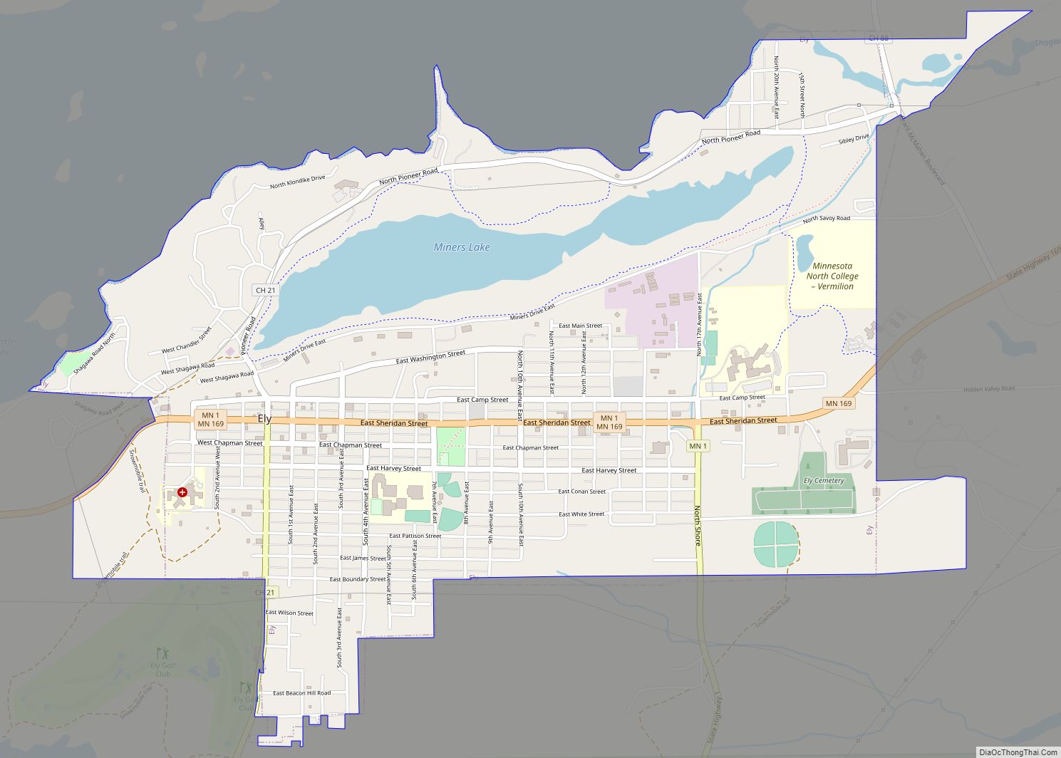
Online Interactive Map
Click on ![]() to view map in "full screen" mode.
to view map in "full screen" mode.
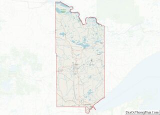
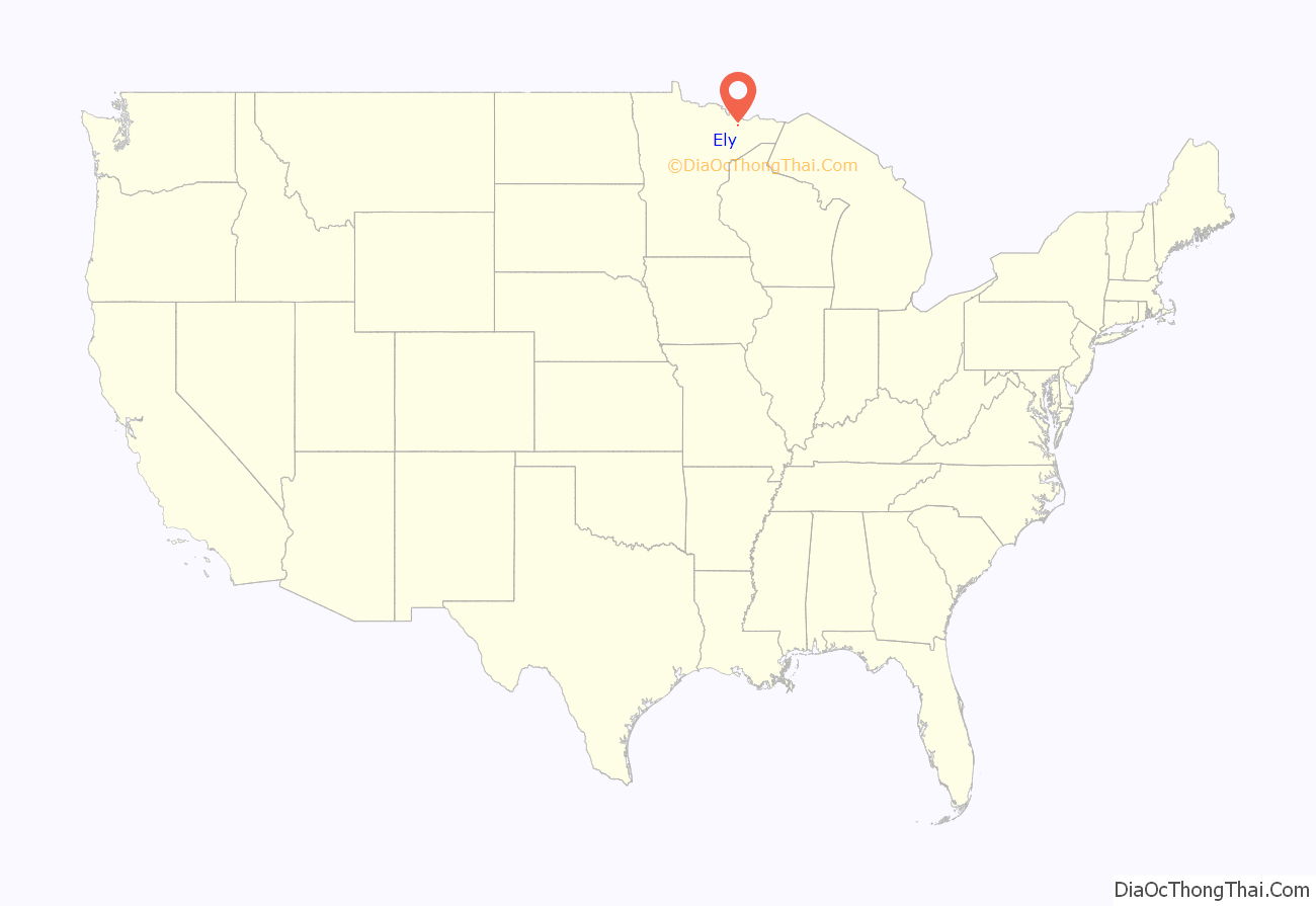
Ely location map. Where is Ely city?

History
The first Europeans to explore the area were fur traders who made their way into the wilderness in search of furs. But it was the Lake Vermillion gold rush that brought the first large numbers of pioneers to the area in 1865. Although hardly any gold was ever found, it was discovered that the area did contain large deposits of iron ore. Thousands of new immigrants were arriving in America at that time, and many of them came to the area later known as the Minnesota Iron Range, looking for work.
When the Duluth, Missabe and Iron Range Railway laid tracks extending the rails from Tower to Ely in 1888, Ely began mining operations with the opening of the Chandler Mine. Ore was shipped by rail to docks on Lake Superior in Two Harbors and Duluth. From there it was shipped by lake freighter for processing in Ashtabula and other points in Ohio.
That year the miners incorporated the town of Florence, population 177, near the east side of Shagawa Lake on a site now known as Spaulding. Florence was named after the daughter of the Chandler mine’s Captain Jack Pengilly (also the town’s first mayor). After ore was discovered farther west, the town relocated, changing its name as well. Since it was discovered that the name “Florence” was already used by another village in Minnesota, “Ely” was chosen in honor of mining executive Samuel B. Ely, a big promoter of Vermilion Range ore who lived in Michigan. (He is not known to have visited his namesake town.) In 2020, The Ely Echo wrote:
The original town site consisted of 40 acres. A man named McCormick opened the first grocery store in a small log building. A. J. Fenske built the first frame building in the fall of 1887; he also opened a hardware and furniture store. The Pioneer Hotel was also built that year at the corner of Sheridan Street and Fourth Avenue. The first school opened in 1889 in a small frame building on Second Avenue; its enrollment was 112 during the first season.
According to a history written in 1910, “The first religious service was conducted by Father Buh, who came from Tower for that purpose, and the Catholic congregation erected the first church. The first Protestant minister was Rev. Mr. Freeman, who arrived in time to hold an Easter service in 1889, and located here permanently, organizing the Presbyterian church. There are now six churches, representing as many different faiths.
Soon other mines opened in Ely: The Pioneer Mine (1889), the Zenith (1892), the Savoy (1899), and the Sibley (1899). The Pioneer was by far the most productive, producing 41 million tons or 40% of the Vermilion Range’s entire output. Eventually 11 mines opened near Ely. In 1967 the Pioneer mine closed. It is on the National Register of Historic Places and its offices house the Ely Arts & Heritage Center.
Originally the mining was an open-pit operation, but when the abundant ore was mined out, deep shafts were made to start mining underground. With the need for wooden support beams to keep the tunnels from collapsing and for lumber to meet the needs of the ever-expanding growth in the area, the logging and milling industries grew. Logging continues in the region, though on a limited scale and only for paper pulp—the major operations virtually disappeared by 1920 when the area’s tree reserves were depleted.
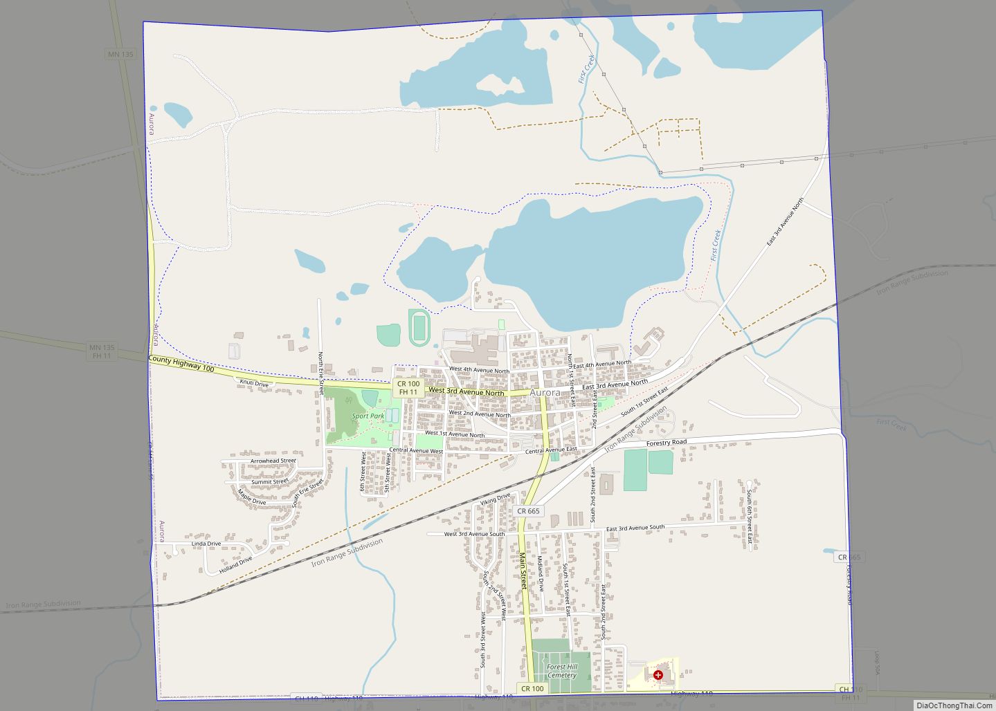
Ely Road Map

Ely city Satellite Map

Geography
According to the United States Census Bureau, the city has an area of 2.74 square miles (7.10 km); 2.73 square miles (7.07 km) is land and 0.01 square miles (0.03 km) is water.
Ely is 100 miles (160 km) north of Duluth, 117 miles southeast of International Falls, and 244 miles (393 km) north of Minneapolis–Saint Paul.
Environment
Since the 1960s, as Iron Range mines began closing, leaving only a few in operation, Ely, like many northern Minnesota communities, faced economic decline. Duluth, on the shores of Lake Superior, has built a tourist trade that has helped to sustain its economy. Ely, seen as the gateway to the Boundary Waters Canoe Area Wilderness, has also developed a lively tourist trade, but due to environmental concerns the area has recently seen controversy about a proposal to build a mining operation for copper just outside the BWCAW. The company involved, Twin Metals Minnesota, is operated by a Chilean company, Antofagasta PLC. It says it plans “to build modern mines that must go through a rigorous regulatory process before they can move forward”, but environmentalists are concerned that runoff from the mining operation could damage the BWCA wilderness area. The copper deposits beneath the forests and lakes of northeastern Minnesota are encased in sulfide ore and when that is exposed it produces sulfuric acid, which has resulted in severe water pollution in copper mines in several western U.S. areas.
In October 2021, the Biden administration filed an application for a “mineral withdrawal” that will put a hold on the development of the mine proposal while the environmental impacts are studied. The Obama administration had launched a similar study, but 24 weeks into the 28-week study the newly elected Trump administration ended it, allowing the plans for the mining operation to continue. The completed study could lead to a 20-year ban on mining upstream from the BWCAW. The Trump mineral leases were judged illegal, and in January 2022 the Biden administration canceled two Twin Metals mineral leases. The Timberjay called the Biden administration’s decision a “potentially fatal blow to [a] proposed copper-nickel mine.”
Climate
On the Köppen climate classification, Ely falls in the warm summer humid continental climate zone (Dfb). Summertime is warm (sometimes hot) and wintertime is cold (sometimes severely) and drawn out, sometimes beginning in October and lasting well into April.
On February 13, 2021, Ely set a new daily state record low with an actual air temperature of -50F.
See also
Map of Minnesota State and its subdivision:- Aitkin
- Anoka
- Becker
- Beltrami
- Benton
- Big Stone
- Blue Earth
- Brown
- Carlton
- Carver
- Cass
- Chippewa
- Chisago
- Clay
- Clearwater
- Cook
- Cottonwood
- Crow Wing
- Dakota
- Dodge
- Douglas
- Faribault
- Fillmore
- Freeborn
- Goodhue
- Grant
- Hennepin
- Houston
- Hubbard
- Isanti
- Itasca
- Jackson
- Kanabec
- Kandiyohi
- Kittson
- Koochiching
- Lac qui Parle
- Lake
- Lake of the Woods
- Lake Superior
- Le Sueur
- Lincoln
- Lyon
- Mahnomen
- Marshall
- Martin
- McLeod
- Meeker
- Mille Lacs
- Morrison
- Mower
- Murray
- Nicollet
- Nobles
- Norman
- Olmsted
- Otter Tail
- Pennington
- Pine
- Pipestone
- Polk
- Pope
- Ramsey
- Red Lake
- Redwood
- Renville
- Rice
- Rock
- Roseau
- Saint Louis
- Scott
- Sherburne
- Sibley
- Stearns
- Steele
- Stevens
- Swift
- Todd
- Traverse
- Wabasha
- Wadena
- Waseca
- Washington
- Watonwan
- Wilkin
- Winona
- Wright
- Yellow Medicine
- Alabama
- Alaska
- Arizona
- Arkansas
- California
- Colorado
- Connecticut
- Delaware
- District of Columbia
- Florida
- Georgia
- Hawaii
- Idaho
- Illinois
- Indiana
- Iowa
- Kansas
- Kentucky
- Louisiana
- Maine
- Maryland
- Massachusetts
- Michigan
- Minnesota
- Mississippi
- Missouri
- Montana
- Nebraska
- Nevada
- New Hampshire
- New Jersey
- New Mexico
- New York
- North Carolina
- North Dakota
- Ohio
- Oklahoma
- Oregon
- Pennsylvania
- Rhode Island
- South Carolina
- South Dakota
- Tennessee
- Texas
- Utah
- Vermont
- Virginia
- Washington
- West Virginia
- Wisconsin
- Wyoming