Deephaven is a small city in Hennepin County, Minnesota, United States. The community is located on Lake Minnetonka. The community’s center is the historic Cottagewood General Store, which has been serving the Lake Minnetonka area since 1895. It is located 14 miles (23 km) west-southwest of downtown Minneapolis. The population was 3,642 as of the 2010 Census, down from 3,853 as of the 2000 census.
| Name: | Deephaven city |
|---|---|
| LSAD Code: | 25 |
| LSAD Description: | city (suffix) |
| State: | Minnesota |
| County: | Hennepin County |
| Incorporated: | 1900 |
| Elevation: | 955 ft (291 m) |
| Total Area: | 3.90 sq mi (10.11 km²) |
| Land Area: | 2.33 sq mi (6.02 km²) |
| Water Area: | 1.58 sq mi (4.09 km²) |
| Total Population: | 3,899 |
| Population Density: | 1,676.99/sq mi (647.45/km²) |
| Area code: | 952 |
| FIPS code: | 2715148 |
| GNISfeature ID: | 0642705 |
| Website: | www.cityofdeephaven.org |
Online Interactive Map
Click on ![]() to view map in "full screen" mode.
to view map in "full screen" mode.
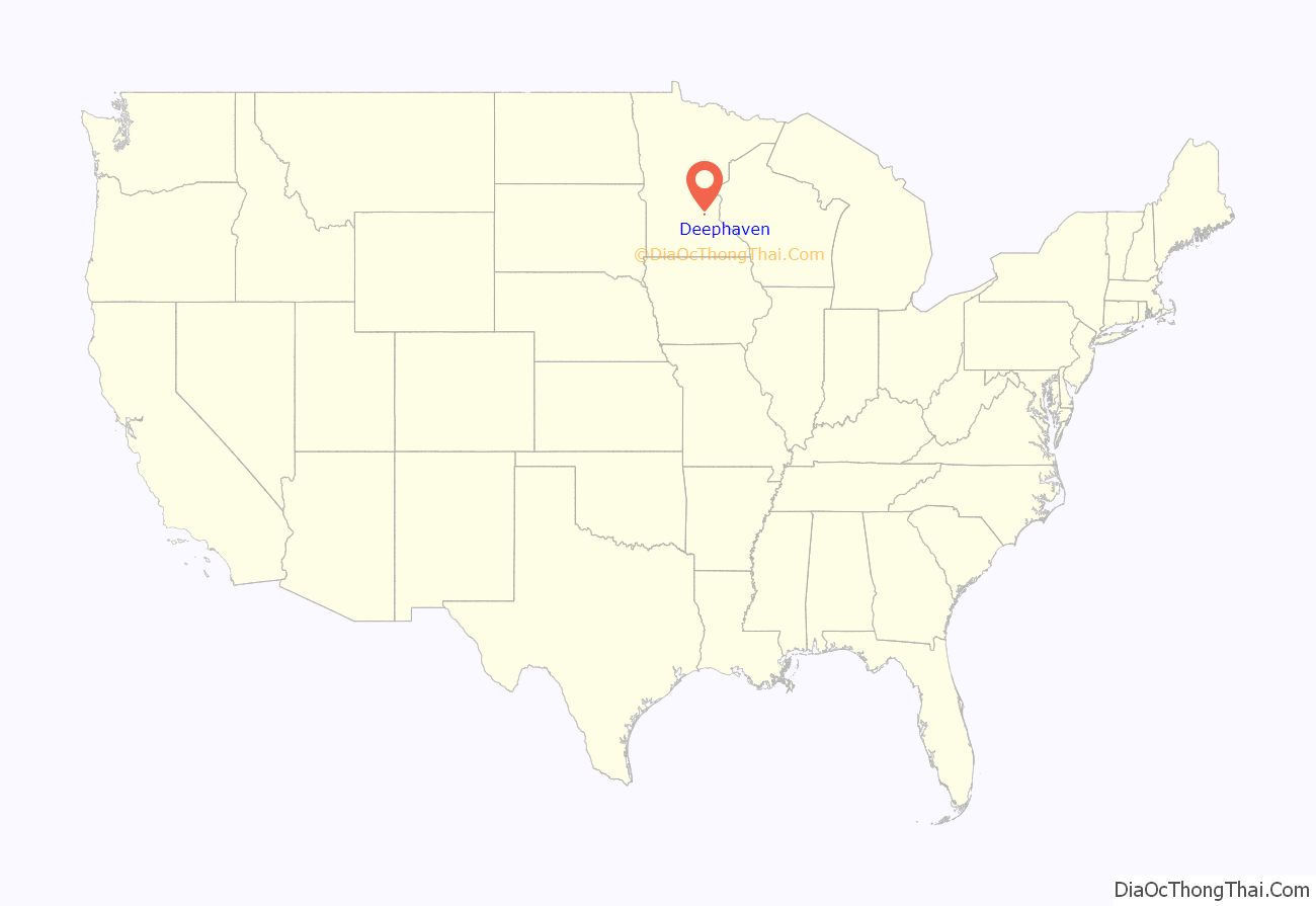
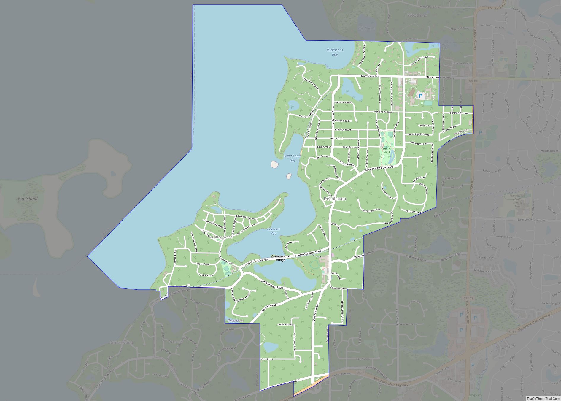
Deephaven location map. Where is Deephaven city?
History
Deephaven was settled in 1876 by Saint Louis attorney Charles Gibson. Gibson built a summer house in an area known as “Northome” and began promoting the area as a vacation destination for Southerners. In 1879 he advocated for the construction of the 150-room Hotel Saint Louis, the area’s first grand hotel. The community was connected to the Minneapolis and Saint Louis Railway to serve both the hotel and local cottagers.
The Minnetonka Yacht Club was founded in Deephaven in 1882 and incorporated in 1889. One of the club’s co-founders, Hazen Burton, built a home named “Chimo” in Deephaven in 1890. A train depot was built near the property so that the Burtons could commute to their department store in Minneapolis. The name “Deephaven” can be traced back to the name of this depot.
In 1893 Burton commissioned local boat builder Arthur Dyer to develop a new kind of sailboat called a racing scow. When the Onawa debuted in 1893, it was disqualified for winning nearly every regatta it entered. The rules were eventually modified, however, and racing scows became popular within the sailing community worldwide. The Onawa is currently displayed at the Excelsior-Lake Minnetonka Historical Society Museum in nearby Excelsior.
Lake Minnetonka fell out of favor as a vacation destination in the 1890s. The Hotel Saint Louis suffered financially and was eventually demolished in 1907. In its place, Walter Donald Douglas of the Quaker Oats fortune and his wife Mahala built a twenty-seven room estate named “Walden.” Walter Douglas perished in the Titanic disaster in 1912, however, Mahala and her French maid Berthe Leroy were survivors. Mahala returned to Deephaven as a widow and lived there until her death in 1945.
Deephaven’s historic Cottagewood General Store, opened in 1895 by Ralph M. Chapman, served as a grocer to tourists along the shores of Lake Minnetonka. The store is one of Deephaven’s most notable attractions today.
Deephaven Road Map
Deephaven city Satellite Map
Geography
According to the United States Census Bureau, the city has a total area of 2.43 square miles (6.29 km), of which 2.37 square miles (6.14 km) is land and 0.06 square miles (0.16 km) is water. Minnetonka Boulevard serves as a main route.
See also
Map of Minnesota State and its subdivision:- Aitkin
- Anoka
- Becker
- Beltrami
- Benton
- Big Stone
- Blue Earth
- Brown
- Carlton
- Carver
- Cass
- Chippewa
- Chisago
- Clay
- Clearwater
- Cook
- Cottonwood
- Crow Wing
- Dakota
- Dodge
- Douglas
- Faribault
- Fillmore
- Freeborn
- Goodhue
- Grant
- Hennepin
- Houston
- Hubbard
- Isanti
- Itasca
- Jackson
- Kanabec
- Kandiyohi
- Kittson
- Koochiching
- Lac qui Parle
- Lake
- Lake of the Woods
- Lake Superior
- Le Sueur
- Lincoln
- Lyon
- Mahnomen
- Marshall
- Martin
- McLeod
- Meeker
- Mille Lacs
- Morrison
- Mower
- Murray
- Nicollet
- Nobles
- Norman
- Olmsted
- Otter Tail
- Pennington
- Pine
- Pipestone
- Polk
- Pope
- Ramsey
- Red Lake
- Redwood
- Renville
- Rice
- Rock
- Roseau
- Saint Louis
- Scott
- Sherburne
- Sibley
- Stearns
- Steele
- Stevens
- Swift
- Todd
- Traverse
- Wabasha
- Wadena
- Waseca
- Washington
- Watonwan
- Wilkin
- Winona
- Wright
- Yellow Medicine
- Alabama
- Alaska
- Arizona
- Arkansas
- California
- Colorado
- Connecticut
- Delaware
- District of Columbia
- Florida
- Georgia
- Hawaii
- Idaho
- Illinois
- Indiana
- Iowa
- Kansas
- Kentucky
- Louisiana
- Maine
- Maryland
- Massachusetts
- Michigan
- Minnesota
- Mississippi
- Missouri
- Montana
- Nebraska
- Nevada
- New Hampshire
- New Jersey
- New Mexico
- New York
- North Carolina
- North Dakota
- Ohio
- Oklahoma
- Oregon
- Pennsylvania
- Rhode Island
- South Carolina
- South Dakota
- Tennessee
- Texas
- Utah
- Vermont
- Virginia
- Washington
- West Virginia
- Wisconsin
- Wyoming
