Finland is an unincorporated community and census-designated place (CDP) in Crystal Bay and Beaver Bay townships, Lake County, Minnesota, United States. As of the 2020 census, its population was 195.
| Name: | Finland CDP |
|---|---|
| LSAD Code: | 57 |
| LSAD Description: | CDP (suffix) |
| State: | Minnesota |
| County: | Lake County |
| Elevation: | 1,329 ft (405 m) |
| Total Area: | 6.74 sq mi (17.46 km²) |
| Land Area: | 6.72 sq mi (17.40 km²) |
| Water Area: | 0.02 sq mi (0.06 km²) |
| Total Population: | 215 |
| Population Density: | 32.00/sq mi (12.36/km²) |
| ZIP code: | 55603 |
| Area code: | 218 |
| FIPS code: | 2721104 |
| GNISfeature ID: | 656231 |
Online Interactive Map
Click on ![]() to view map in "full screen" mode.
to view map in "full screen" mode.
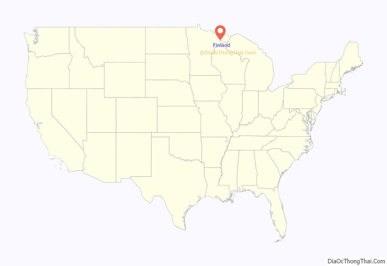
Finland location map. Where is Finland CDP?
History
A post office called Finland has been in operation since 1915, and a cooperative general store was established in 1913, which is Minnesota’s longest continuously operated store. The name of the town comes from the fact that a large portion of the early settlers were Finns.
The visitor center is the former home of forest ranger and longtime Finland resident O. M. Eckbeck, who built it in 1927.
The Lutheran church was struck by lightning on July 6, 2013, burning down as a result.
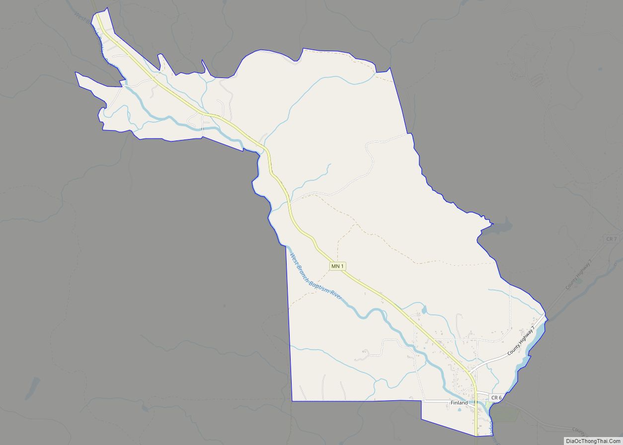
Finland Road Map
Finland city Satellite Map
Geography
The community of Finland is located 6 miles (10 km) inland from Lake Superior’s North Shore and 39 miles (63 km) northeast of the city of Two Harbors. State Highway 1, County Road 6, and County Road 7 are three of the main routes in the community. State Highway 1 continues northwest from Finland 56 miles (90 km) to Ely.
According to the United States Census Bureau, the Finland CDP has a total area of 5.4 square miles (13.9 km), of which 0.02 square miles (0.06 km), or 0.41%, are water. The Baptism River flows through the community. George H. Crosby Manitou State Park is located 7 miles (11 km) northeast of Finland.
The community is located within the Finland State Forest in Lake County.
See also
Map of Minnesota State and its subdivision:- Aitkin
- Anoka
- Becker
- Beltrami
- Benton
- Big Stone
- Blue Earth
- Brown
- Carlton
- Carver
- Cass
- Chippewa
- Chisago
- Clay
- Clearwater
- Cook
- Cottonwood
- Crow Wing
- Dakota
- Dodge
- Douglas
- Faribault
- Fillmore
- Freeborn
- Goodhue
- Grant
- Hennepin
- Houston
- Hubbard
- Isanti
- Itasca
- Jackson
- Kanabec
- Kandiyohi
- Kittson
- Koochiching
- Lac qui Parle
- Lake
- Lake of the Woods
- Lake Superior
- Le Sueur
- Lincoln
- Lyon
- Mahnomen
- Marshall
- Martin
- McLeod
- Meeker
- Mille Lacs
- Morrison
- Mower
- Murray
- Nicollet
- Nobles
- Norman
- Olmsted
- Otter Tail
- Pennington
- Pine
- Pipestone
- Polk
- Pope
- Ramsey
- Red Lake
- Redwood
- Renville
- Rice
- Rock
- Roseau
- Saint Louis
- Scott
- Sherburne
- Sibley
- Stearns
- Steele
- Stevens
- Swift
- Todd
- Traverse
- Wabasha
- Wadena
- Waseca
- Washington
- Watonwan
- Wilkin
- Winona
- Wright
- Yellow Medicine
- Alabama
- Alaska
- Arizona
- Arkansas
- California
- Colorado
- Connecticut
- Delaware
- District of Columbia
- Florida
- Georgia
- Hawaii
- Idaho
- Illinois
- Indiana
- Iowa
- Kansas
- Kentucky
- Louisiana
- Maine
- Maryland
- Massachusetts
- Michigan
- Minnesota
- Mississippi
- Missouri
- Montana
- Nebraska
- Nevada
- New Hampshire
- New Jersey
- New Mexico
- New York
- North Carolina
- North Dakota
- Ohio
- Oklahoma
- Oregon
- Pennsylvania
- Rhode Island
- South Carolina
- South Dakota
- Tennessee
- Texas
- Utah
- Vermont
- Virginia
- Washington
- West Virginia
- Wisconsin
- Wyoming
