Golden Valley is a western and first-ring suburb of Minneapolis in Hennepin County, Minnesota, United States. The population was 22,552 at the 2020 census. The city is mostly residential and is bordered by U.S. Highway 12 (Interstate 394). Over 15% of the city is parks or nature reserves. The Floyd B. Olson Memorial Highway also runs through the heart of the city providing a direct route to the Minneapolis industrial district.
Golden Valley is the main corporate headquarters of General Mills, a major flour milling and food products company originally located in Minneapolis. It is also the site of the U.S. headquarters of Pentair and local NBC affiliate KARE. The city was also home to the former Minneapolis-Honeywell headquarters, which is now the Resideo Technologies corporate offices.
| Name: | Golden Valley city |
|---|---|
| LSAD Code: | 25 |
| LSAD Description: | city (suffix) |
| State: | Minnesota |
| County: | Hennepin County |
| Founded: | 1886 |
| Incorporated: | December 17, 1886 |
| Elevation: | 856 ft (261 m) |
| Land Area: | 10.20 sq mi (26.41 km²) |
| Water Area: | 0.34 sq mi (0.88 km²) |
| Population Density: | 2,211.63/sq mi (853.87/km²) |
| ZIP code: | 55416, 55422, 55426, 55427 |
| Area code: | 763 |
| FIPS code: | 2724308 |
| GNISfeature ID: | 0644201 |
| Website: | goldenvalleymn.gov |
Online Interactive Map
Click on ![]() to view map in "full screen" mode.
to view map in "full screen" mode.
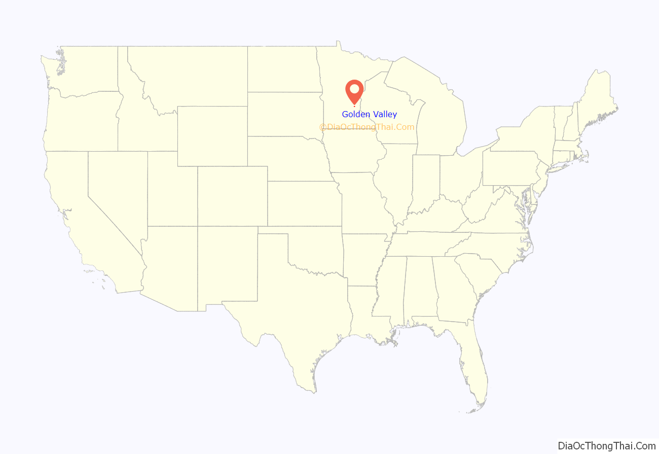
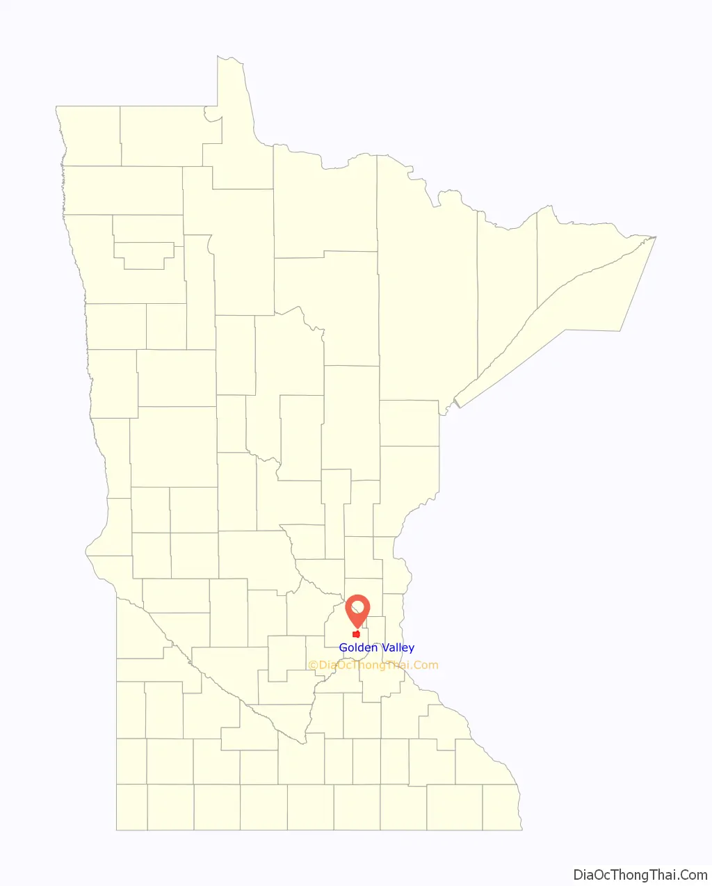
Golden Valley location map. Where is Golden Valley city?
History
Tribes of Chippewa and Sioux had encampments on nearby Medicine Lake. The first white settlers arrived in the early 1850s. Golden Valley was incorporated December 17, 1886. In the early twentieth century, it was mostly a farming community.
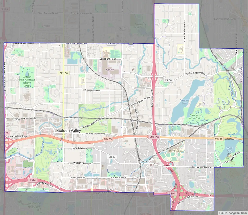
Golden Valley Road Map
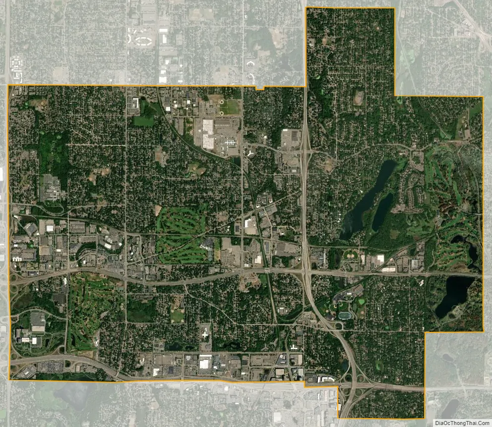
Golden Valley city Satellite Map
Geography
According to the United States Census Bureau, the city has a total area of 10.55 square miles (27.32 km), of which 10.20 square miles (26.42 km) is land and 0.35 square miles (0.91 km) is water.
The 45th parallel north runs through Golden Valley, coinciding approximately with Duluth Street.
Interstate 394, U.S. Highway 169, and Minnesota State Highways 55 and 100 are four of the main routes in the area.
See also
Map of Minnesota State and its subdivision:- Aitkin
- Anoka
- Becker
- Beltrami
- Benton
- Big Stone
- Blue Earth
- Brown
- Carlton
- Carver
- Cass
- Chippewa
- Chisago
- Clay
- Clearwater
- Cook
- Cottonwood
- Crow Wing
- Dakota
- Dodge
- Douglas
- Faribault
- Fillmore
- Freeborn
- Goodhue
- Grant
- Hennepin
- Houston
- Hubbard
- Isanti
- Itasca
- Jackson
- Kanabec
- Kandiyohi
- Kittson
- Koochiching
- Lac qui Parle
- Lake
- Lake of the Woods
- Lake Superior
- Le Sueur
- Lincoln
- Lyon
- Mahnomen
- Marshall
- Martin
- McLeod
- Meeker
- Mille Lacs
- Morrison
- Mower
- Murray
- Nicollet
- Nobles
- Norman
- Olmsted
- Otter Tail
- Pennington
- Pine
- Pipestone
- Polk
- Pope
- Ramsey
- Red Lake
- Redwood
- Renville
- Rice
- Rock
- Roseau
- Saint Louis
- Scott
- Sherburne
- Sibley
- Stearns
- Steele
- Stevens
- Swift
- Todd
- Traverse
- Wabasha
- Wadena
- Waseca
- Washington
- Watonwan
- Wilkin
- Winona
- Wright
- Yellow Medicine
- Alabama
- Alaska
- Arizona
- Arkansas
- California
- Colorado
- Connecticut
- Delaware
- District of Columbia
- Florida
- Georgia
- Hawaii
- Idaho
- Illinois
- Indiana
- Iowa
- Kansas
- Kentucky
- Louisiana
- Maine
- Maryland
- Massachusetts
- Michigan
- Minnesota
- Mississippi
- Missouri
- Montana
- Nebraska
- Nevada
- New Hampshire
- New Jersey
- New Mexico
- New York
- North Carolina
- North Dakota
- Ohio
- Oklahoma
- Oregon
- Pennsylvania
- Rhode Island
- South Carolina
- South Dakota
- Tennessee
- Texas
- Utah
- Vermont
- Virginia
- Washington
- West Virginia
- Wisconsin
- Wyoming


