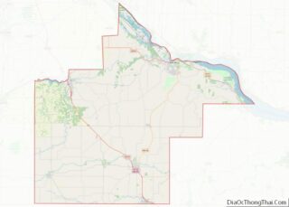
Goodhue is a city in Goodhue County, Minnesota, United States. The population was 1,176 at the 2010 census.
| Name: | Goodhue city |
|---|---|
| LSAD Code: | 25 |
| LSAD Description: | city (suffix) |
| State: | Minnesota |
| County: | Goodhue County |
| Elevation: | 1,122 ft (342 m) |
| Total Area: | 1.10 sq mi (2.85 km²) |
| Land Area: | 1.10 sq mi (2.85 km²) |
| Water Area: | 0.00 sq mi (0.00 km²) |
| Total Population: | 1,250 |
| Population Density: | 1,136.36/sq mi (438.85/km²) |
| ZIP code: | 55027 |
| Area code: | 651 |
| FIPS code: | 2724398 |
| GNISfeature ID: | 0644219 |
| Website: | http://www.cityofgoodhue.com |
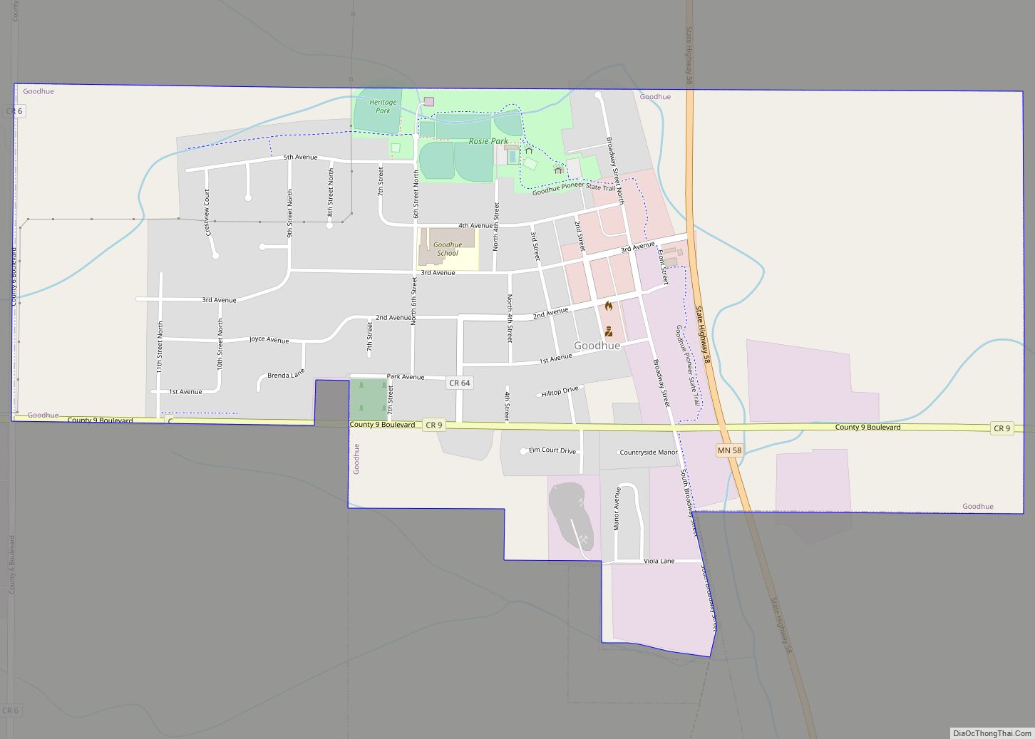
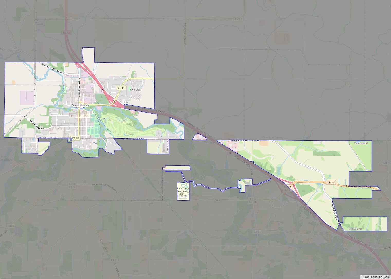
Online Interactive Map
Click on ![]() to view map in "full screen" mode.
to view map in "full screen" mode.
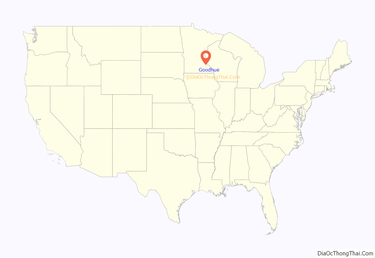
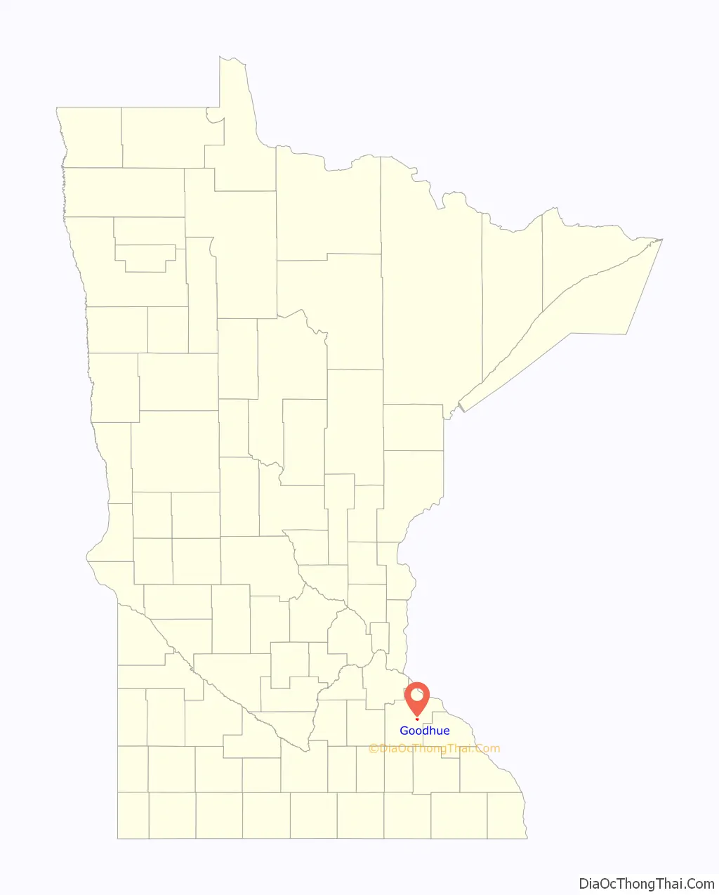
Goodhue location map. Where is Goodhue city?
History
Goodhue was incorporated in 1889.
Goodhue formerly had a rail line running through the eastern edge of the incorporated area, roughly parallel to and west of State Highway 58.
The Goodhue Area Historical Society was responsible for the construction of a museum in the community, which was named in honor of James M. Goodhue, a newspaperman who was the first editor of the St. Paul Pioneer Press.
Since the mid-1990s, Goodhue, like many Midwestern municipalities with medium to large elevator operations, has seen its housing base and population grow.
The first significant growth in 20 years began with construction of several homes in an annexed area north of Third Avenue and west of Sixth Street known as “East side”.
The Goodhue Wildcats won Class A State Championships in football in both 2003 and 2007. Also Goodhue Girls Basketball won Class A State Championship in 2016 and 2017.
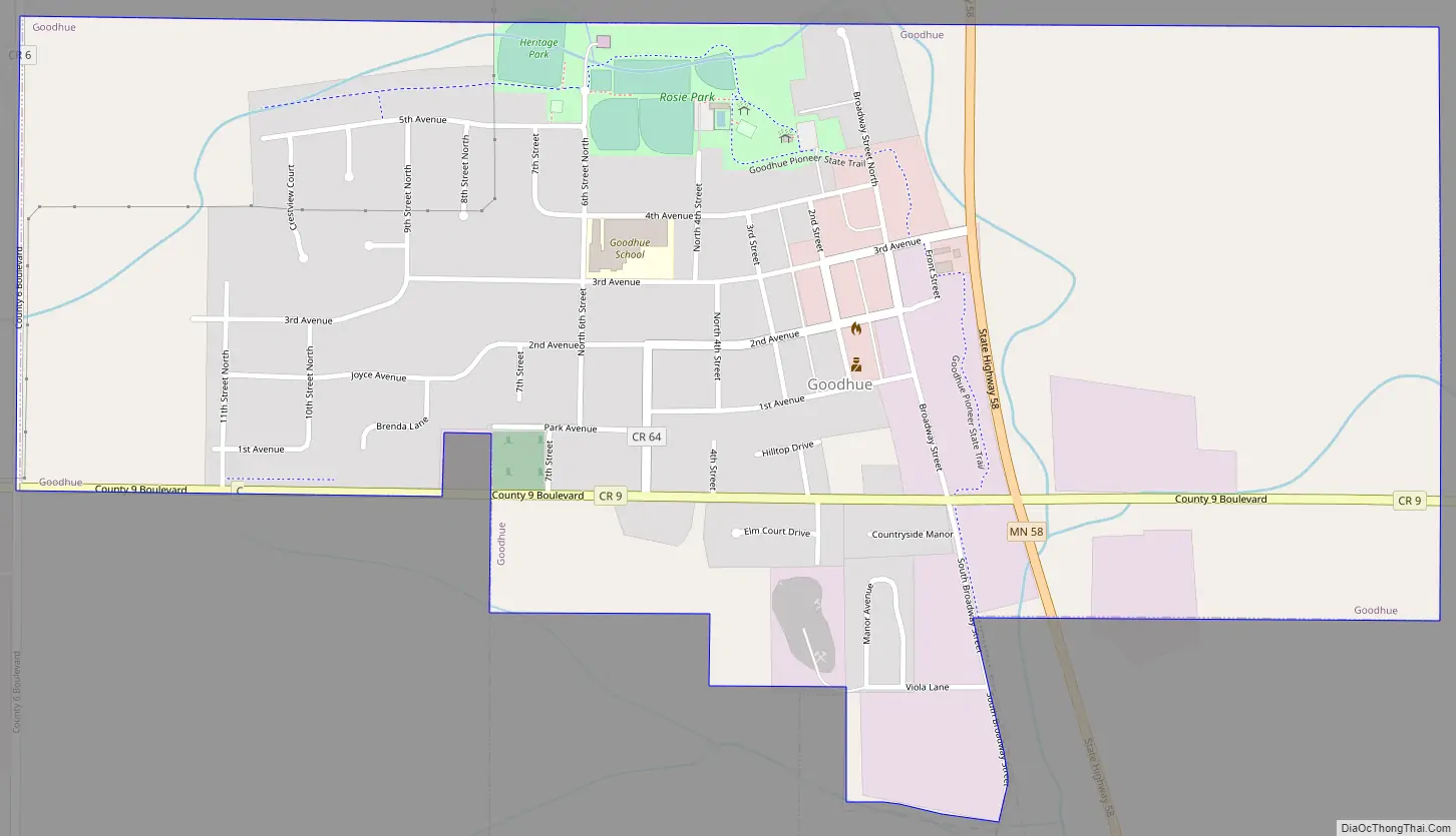
Goodhue Road Map
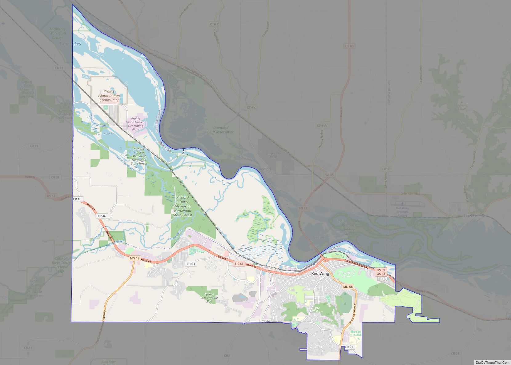
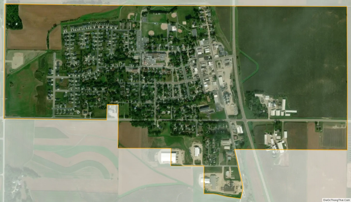
Goodhue city Satellite Map
Geography
According to the United States Census Bureau, the city has a total area of 0.94 square miles (2.43 km), all land.
Minnesota State Highway 58 and County Highway 9 are two of the main routes in the community.
The Goodhue K-12 High School is located on 510 3rd Ave. Goodhue, MN 55027
See also
Map of Minnesota State and its subdivision:- Aitkin
- Anoka
- Becker
- Beltrami
- Benton
- Big Stone
- Blue Earth
- Brown
- Carlton
- Carver
- Cass
- Chippewa
- Chisago
- Clay
- Clearwater
- Cook
- Cottonwood
- Crow Wing
- Dakota
- Dodge
- Douglas
- Faribault
- Fillmore
- Freeborn
- Goodhue
- Grant
- Hennepin
- Houston
- Hubbard
- Isanti
- Itasca
- Jackson
- Kanabec
- Kandiyohi
- Kittson
- Koochiching
- Lac qui Parle
- Lake
- Lake of the Woods
- Lake Superior
- Le Sueur
- Lincoln
- Lyon
- Mahnomen
- Marshall
- Martin
- McLeod
- Meeker
- Mille Lacs
- Morrison
- Mower
- Murray
- Nicollet
- Nobles
- Norman
- Olmsted
- Otter Tail
- Pennington
- Pine
- Pipestone
- Polk
- Pope
- Ramsey
- Red Lake
- Redwood
- Renville
- Rice
- Rock
- Roseau
- Saint Louis
- Scott
- Sherburne
- Sibley
- Stearns
- Steele
- Stevens
- Swift
- Todd
- Traverse
- Wabasha
- Wadena
- Waseca
- Washington
- Watonwan
- Wilkin
- Winona
- Wright
- Yellow Medicine
- Alabama
- Alaska
- Arizona
- Arkansas
- California
- Colorado
- Connecticut
- Delaware
- District of Columbia
- Florida
- Georgia
- Hawaii
- Idaho
- Illinois
- Indiana
- Iowa
- Kansas
- Kentucky
- Louisiana
- Maine
- Maryland
- Massachusetts
- Michigan
- Minnesota
- Mississippi
- Missouri
- Montana
- Nebraska
- Nevada
- New Hampshire
- New Jersey
- New Mexico
- New York
- North Carolina
- North Dakota
- Ohio
- Oklahoma
- Oregon
- Pennsylvania
- Rhode Island
- South Carolina
- South Dakota
- Tennessee
- Texas
- Utah
- Vermont
- Virginia
- Washington
- West Virginia
- Wisconsin
- Wyoming