Green Isle is a city in Sibley County, Minnesota, United States. The population was 522 at the 2020 census.
| Name: | Green Isle city |
|---|---|
| LSAD Code: | 25 |
| LSAD Description: | city (suffix) |
| State: | Minnesota |
| County: | Sibley County |
| Elevation: | 1,004 ft (306 m) |
| Total Area: | 1.02 sq mi (2.65 km²) |
| Land Area: | 1.01 sq mi (2.63 km²) |
| Water Area: | 0.01 sq mi (0.02 km²) |
| Total Population: | 522 |
| Population Density: | 582.27/sq mi (224.77/km²) |
| ZIP code: | 55338 |
| Area code: | 507 |
| FIPS code: | 2725658 |
| GNISfeature ID: | 0644409 |
| Website: | www.cityofgreenislemn.org |
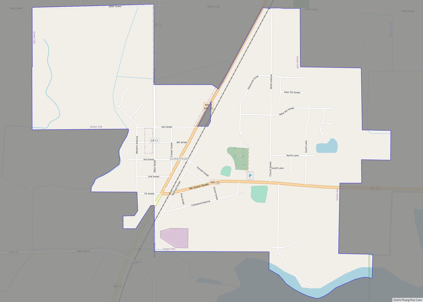
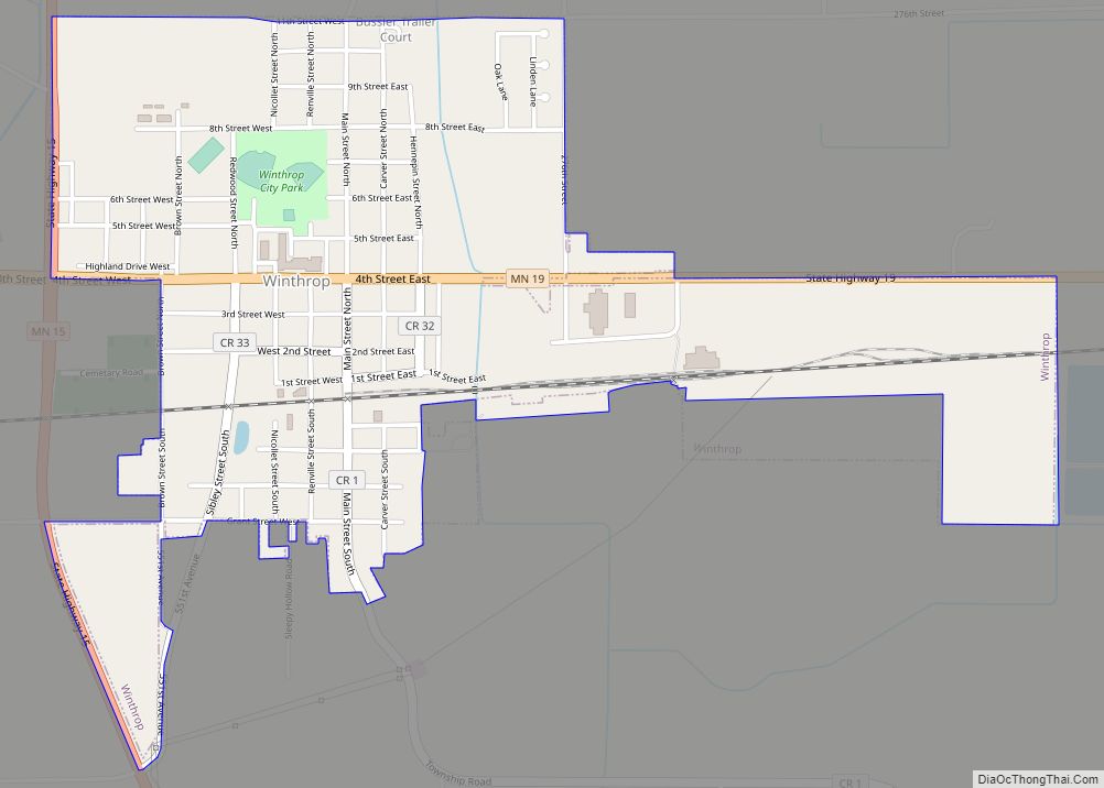
Online Interactive Map
Click on ![]() to view map in "full screen" mode.
to view map in "full screen" mode.
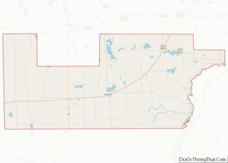
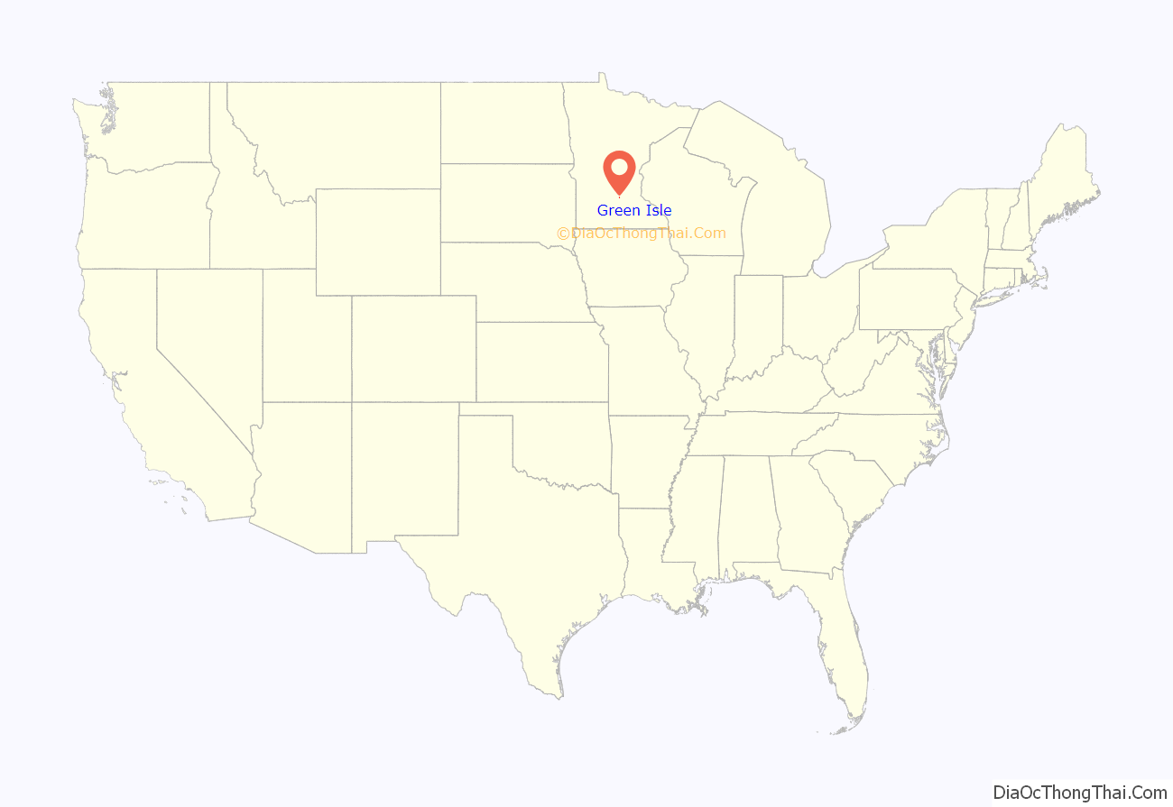
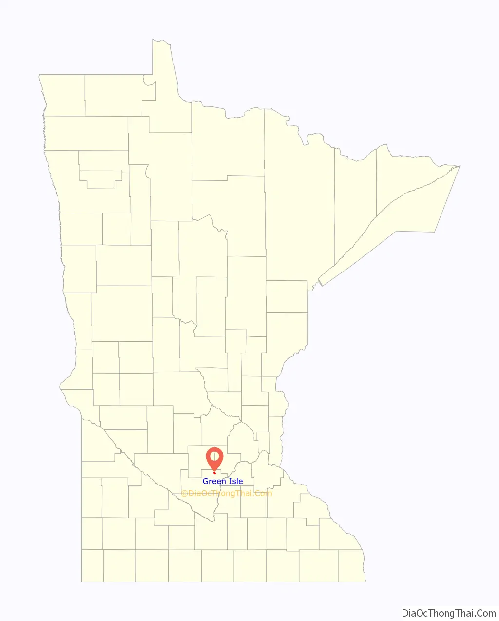
Green Isle location map. Where is Green Isle city?
History
The Minneapolis and St. Louis Railway (M&StL) originally built the railroad tracks between Norwood and Morton circa 1880. Green Isle was platted in 1881, incorporating these northeast/southwest-oriented tracks. The town was named after the preexisting township, a name allusive of Ireland, the Emerald Isle, as many of its earliest settlers were from Ireland.
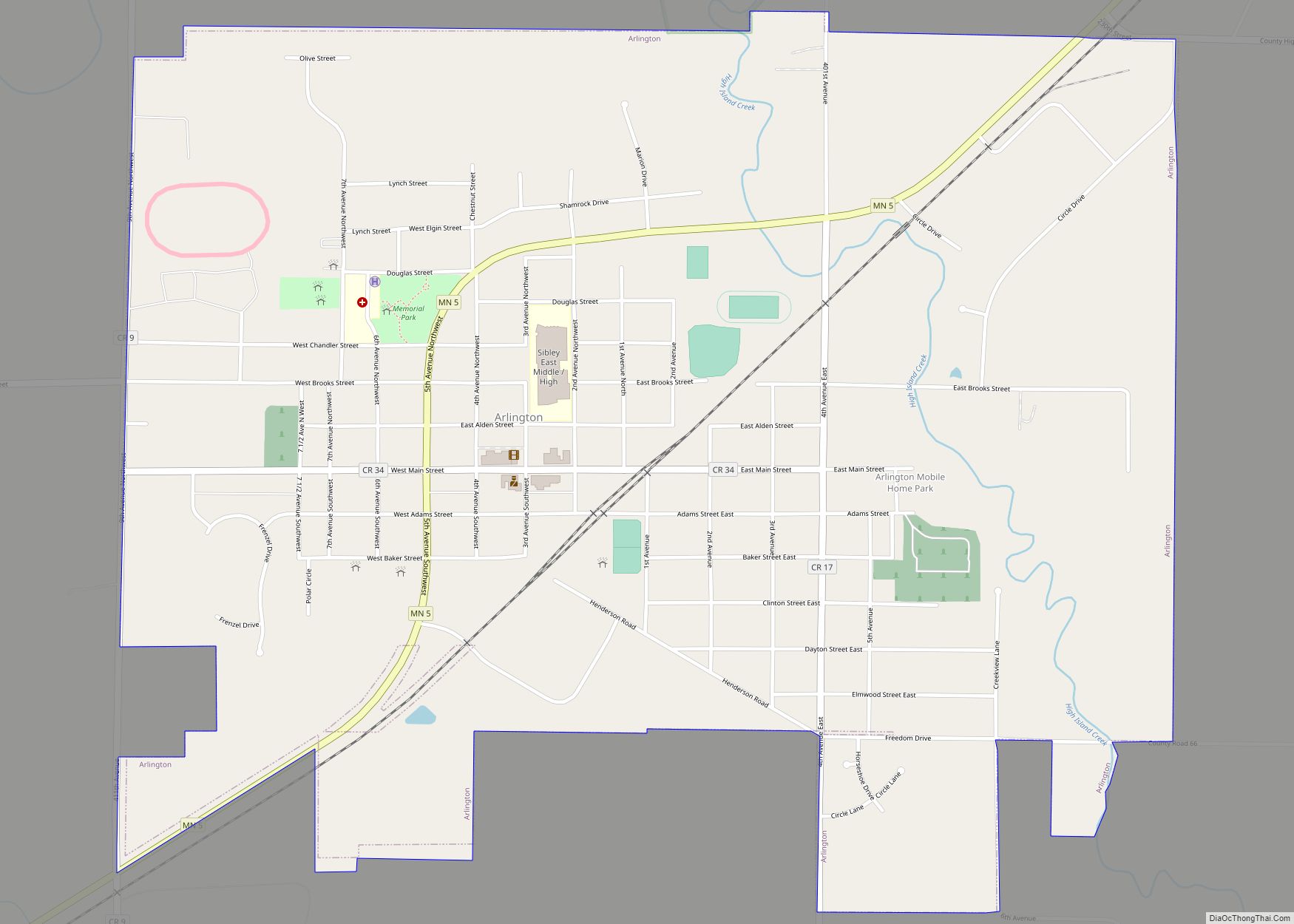
Green Isle Road Map
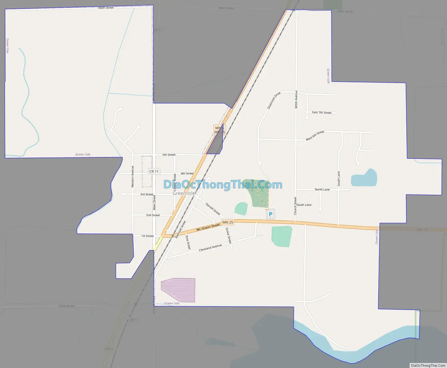
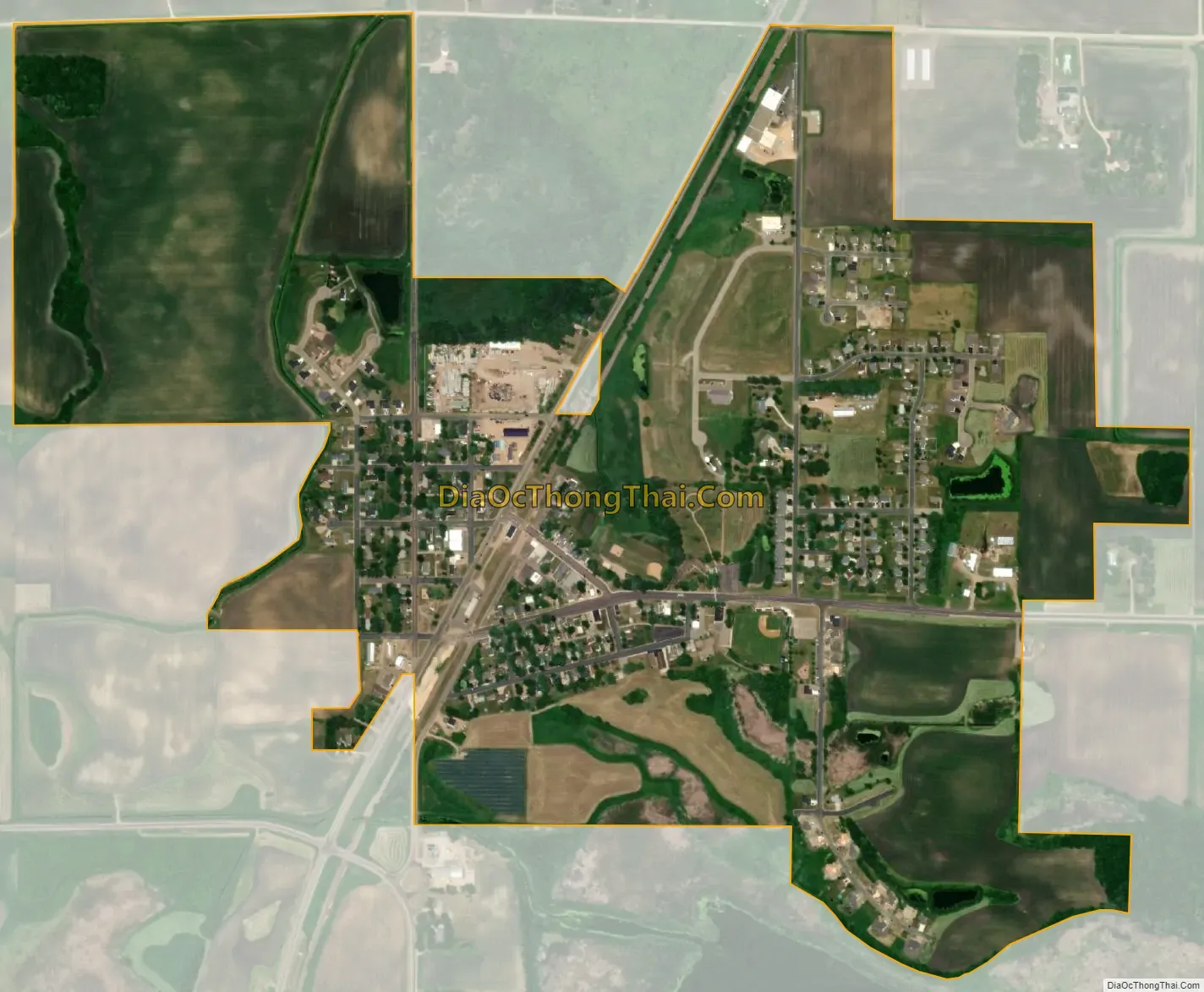
Green Isle city Satellite Map
Geography
According to the United States Census Bureau, the city has an area of 0.98 square miles (2.54 km), all land. Minnesota State Highways 5 and 25 are two of the main routes in the community.
See also
Map of Minnesota State and its subdivision:- Aitkin
- Anoka
- Becker
- Beltrami
- Benton
- Big Stone
- Blue Earth
- Brown
- Carlton
- Carver
- Cass
- Chippewa
- Chisago
- Clay
- Clearwater
- Cook
- Cottonwood
- Crow Wing
- Dakota
- Dodge
- Douglas
- Faribault
- Fillmore
- Freeborn
- Goodhue
- Grant
- Hennepin
- Houston
- Hubbard
- Isanti
- Itasca
- Jackson
- Kanabec
- Kandiyohi
- Kittson
- Koochiching
- Lac qui Parle
- Lake
- Lake of the Woods
- Lake Superior
- Le Sueur
- Lincoln
- Lyon
- Mahnomen
- Marshall
- Martin
- McLeod
- Meeker
- Mille Lacs
- Morrison
- Mower
- Murray
- Nicollet
- Nobles
- Norman
- Olmsted
- Otter Tail
- Pennington
- Pine
- Pipestone
- Polk
- Pope
- Ramsey
- Red Lake
- Redwood
- Renville
- Rice
- Rock
- Roseau
- Saint Louis
- Scott
- Sherburne
- Sibley
- Stearns
- Steele
- Stevens
- Swift
- Todd
- Traverse
- Wabasha
- Wadena
- Waseca
- Washington
- Watonwan
- Wilkin
- Winona
- Wright
- Yellow Medicine
- Alabama
- Alaska
- Arizona
- Arkansas
- California
- Colorado
- Connecticut
- Delaware
- District of Columbia
- Florida
- Georgia
- Hawaii
- Idaho
- Illinois
- Indiana
- Iowa
- Kansas
- Kentucky
- Louisiana
- Maine
- Maryland
- Massachusetts
- Michigan
- Minnesota
- Mississippi
- Missouri
- Montana
- Nebraska
- Nevada
- New Hampshire
- New Jersey
- New Mexico
- New York
- North Carolina
- North Dakota
- Ohio
- Oklahoma
- Oregon
- Pennsylvania
- Rhode Island
- South Carolina
- South Dakota
- Tennessee
- Texas
- Utah
- Vermont
- Virginia
- Washington
- West Virginia
- Wisconsin
- Wyoming