Henderson is a city in Sibley County, Minnesota, United States. The population in was 886 at the 2010 census.
| Name: | Henderson city |
|---|---|
| LSAD Code: | 25 |
| LSAD Description: | city (suffix) |
| State: | Minnesota |
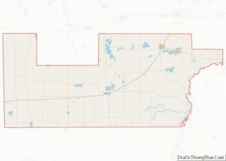
| County: | Sibley County |
| Elevation: | 420 ft (69 m) |
| Total Area: | 1.10 sq mi (2.86 km²) |
| Land Area: | 1.07 sq mi (2.78 km²) |
| Water Area: | 0.03 sq mi (0.08 km²) |
| Total Population: | 960 |
| Population Density: | 893.85/sq mi (345.01/km²) |
| ZIP code: | 56044 |
| Area code: | 507 |
| FIPS code: | 2728394 |
| GNISfeature ID: | 0644862 |
| Website: | www.henderson-mn.com |
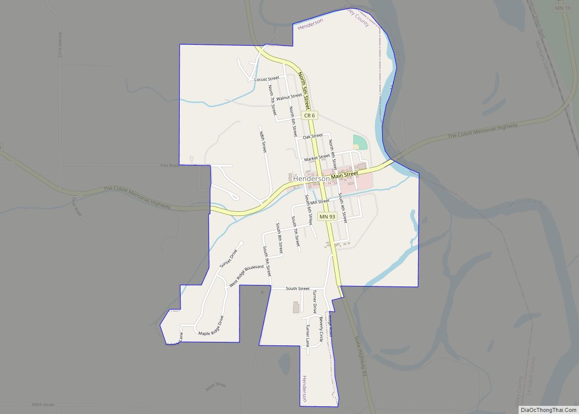
Online Interactive Map
Click on ![]() to view map in "full screen" mode.
to view map in "full screen" mode.
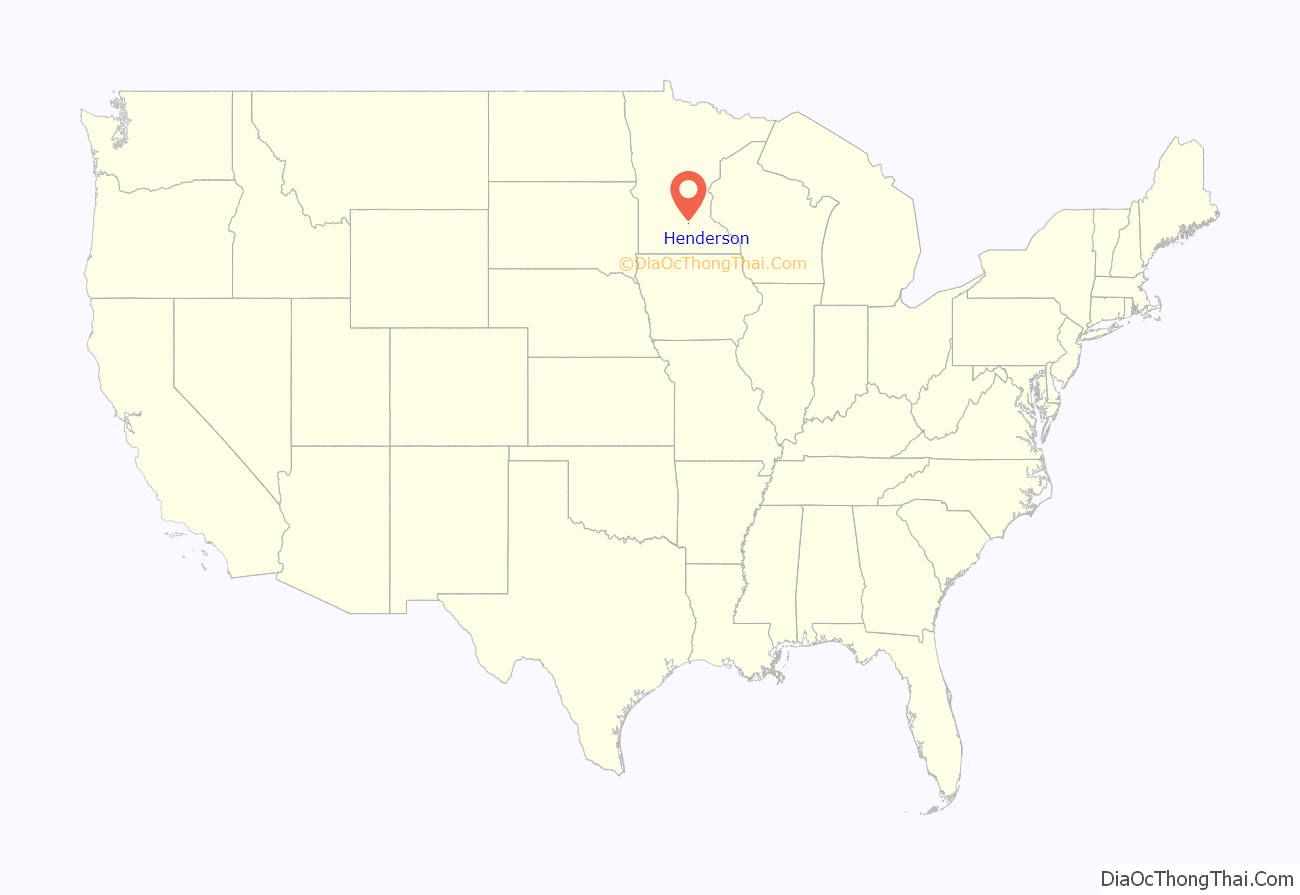
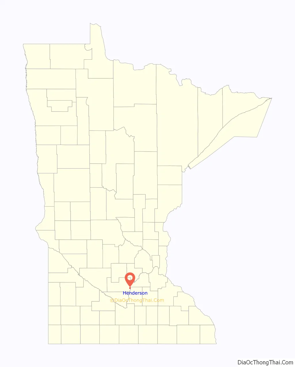
Henderson location map. Where is Henderson city?
History
Henderson was founded in August 1852 by Joseph R. Brown, and was named for his mother’s maiden name.
By 1855, Henderson had become a fast-growing city. It harbored more than 60 buildings, including a hotel, a warehouse, a steam sawmill, as well as Brown’s house, which functioned as a boarding house, a store and the Brown family residence.
In the following years, Henderson quickly became a major distribution center for the inland settlements surrounding the Minnesota River Valley. It was the trailhead of the Henderson-Pembina road.
By the mid-1860s, Henderson had two major brickyards, The Mattei and Schwartz Brickyards, which both contributed heavily to the early 1900s brick-style buildings still found in Henderson.
The seat for Sibley County was originally established in Henderson, and an imposing courthouse was erected, being put into service in 1879. But pressure from residents of Gaylord, from as far back as 1887, to gain the county seat precipitated a 1915 countywide vote that resulted in Gaylord gaining the seat; this caused around 200 residents to leave Henderson, a major decline in the city’s population. During the 50 years after that population loss, Henderson’s economy increasingly centered on agriculture. Its success in transitioning to agriculture brought rise to the present Sauerkraut Days celebration. The former courthouse, now the Henderson Community Building, houses Henderson City offices.
Henderson Road Map
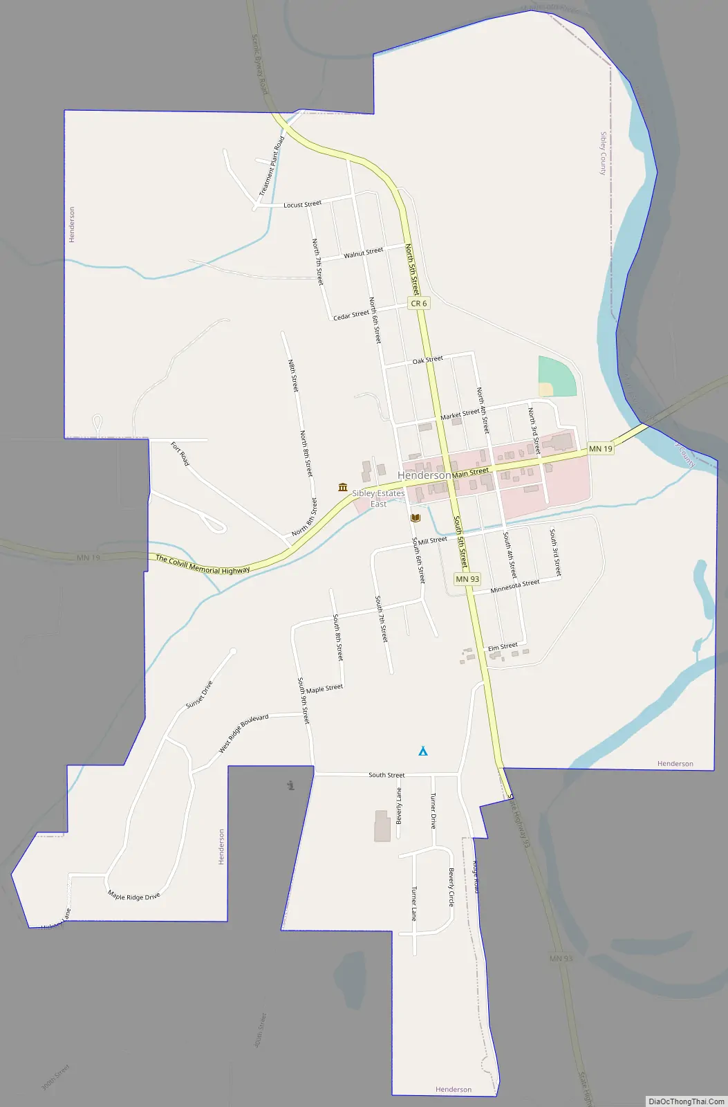
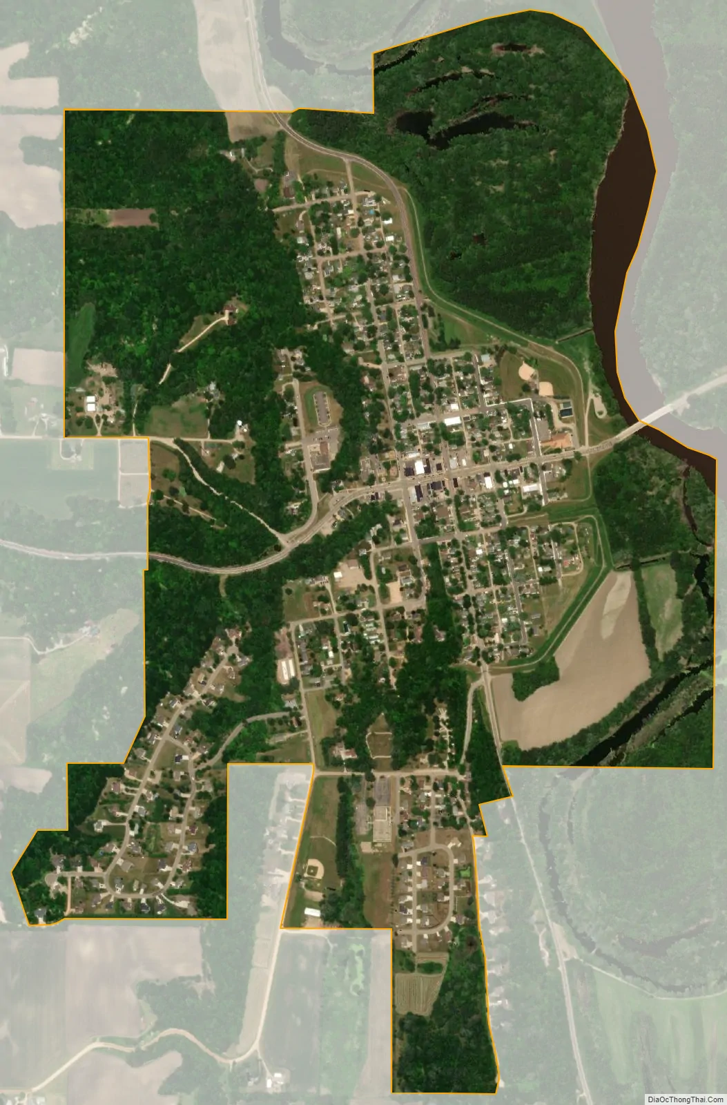
Henderson city Satellite Map
Geography
According to the United States Census Bureau, the city has an area of 1.09 square miles (2.82 km); 1.06 square miles (2.75 km) is land and 0.03 square miles (0.08 km) is water.
Minnesota State Highways 19 and 93 are two of the main routes in the community. U.S. Highway 169 passes nearby.
See also
Map of Minnesota State and its subdivision:- Aitkin
- Anoka
- Becker
- Beltrami
- Benton
- Big Stone
- Blue Earth
- Brown
- Carlton
- Carver
- Cass
- Chippewa
- Chisago
- Clay
- Clearwater
- Cook
- Cottonwood
- Crow Wing
- Dakota
- Dodge
- Douglas
- Faribault
- Fillmore
- Freeborn
- Goodhue
- Grant
- Hennepin
- Houston
- Hubbard
- Isanti
- Itasca
- Jackson
- Kanabec
- Kandiyohi
- Kittson
- Koochiching
- Lac qui Parle
- Lake
- Lake of the Woods
- Lake Superior
- Le Sueur
- Lincoln
- Lyon
- Mahnomen
- Marshall
- Martin
- McLeod
- Meeker
- Mille Lacs
- Morrison
- Mower
- Murray
- Nicollet
- Nobles
- Norman
- Olmsted
- Otter Tail
- Pennington
- Pine
- Pipestone
- Polk
- Pope
- Ramsey
- Red Lake
- Redwood
- Renville
- Rice
- Rock
- Roseau
- Saint Louis
- Scott
- Sherburne
- Sibley
- Stearns
- Steele
- Stevens
- Swift
- Todd
- Traverse
- Wabasha
- Wadena
- Waseca
- Washington
- Watonwan
- Wilkin
- Winona
- Wright
- Yellow Medicine
- Alabama
- Alaska
- Arizona
- Arkansas
- California
- Colorado
- Connecticut
- Delaware
- District of Columbia
- Florida
- Georgia
- Hawaii
- Idaho
- Illinois
- Indiana
- Iowa
- Kansas
- Kentucky
- Louisiana
- Maine
- Maryland
- Massachusetts
- Michigan
- Minnesota
- Mississippi
- Missouri
- Montana
- Nebraska
- Nevada
- New Hampshire
- New Jersey
- New Mexico
- New York
- North Carolina
- North Dakota
- Ohio
- Oklahoma
- Oregon
- Pennsylvania
- Rhode Island
- South Carolina
- South Dakota
- Tennessee
- Texas
- Utah
- Vermont
- Virginia
- Washington
- West Virginia
- Wisconsin
- Wyoming