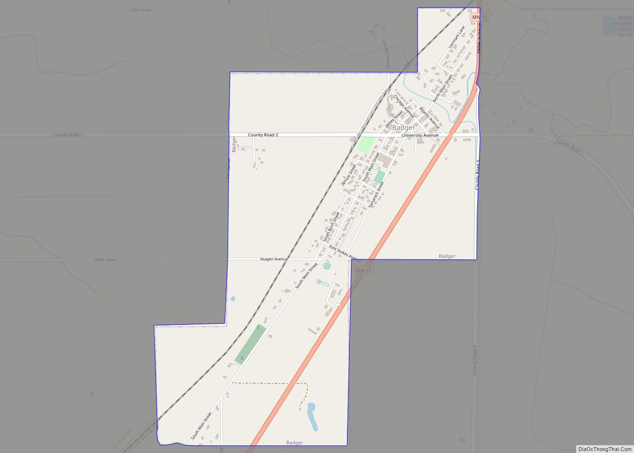
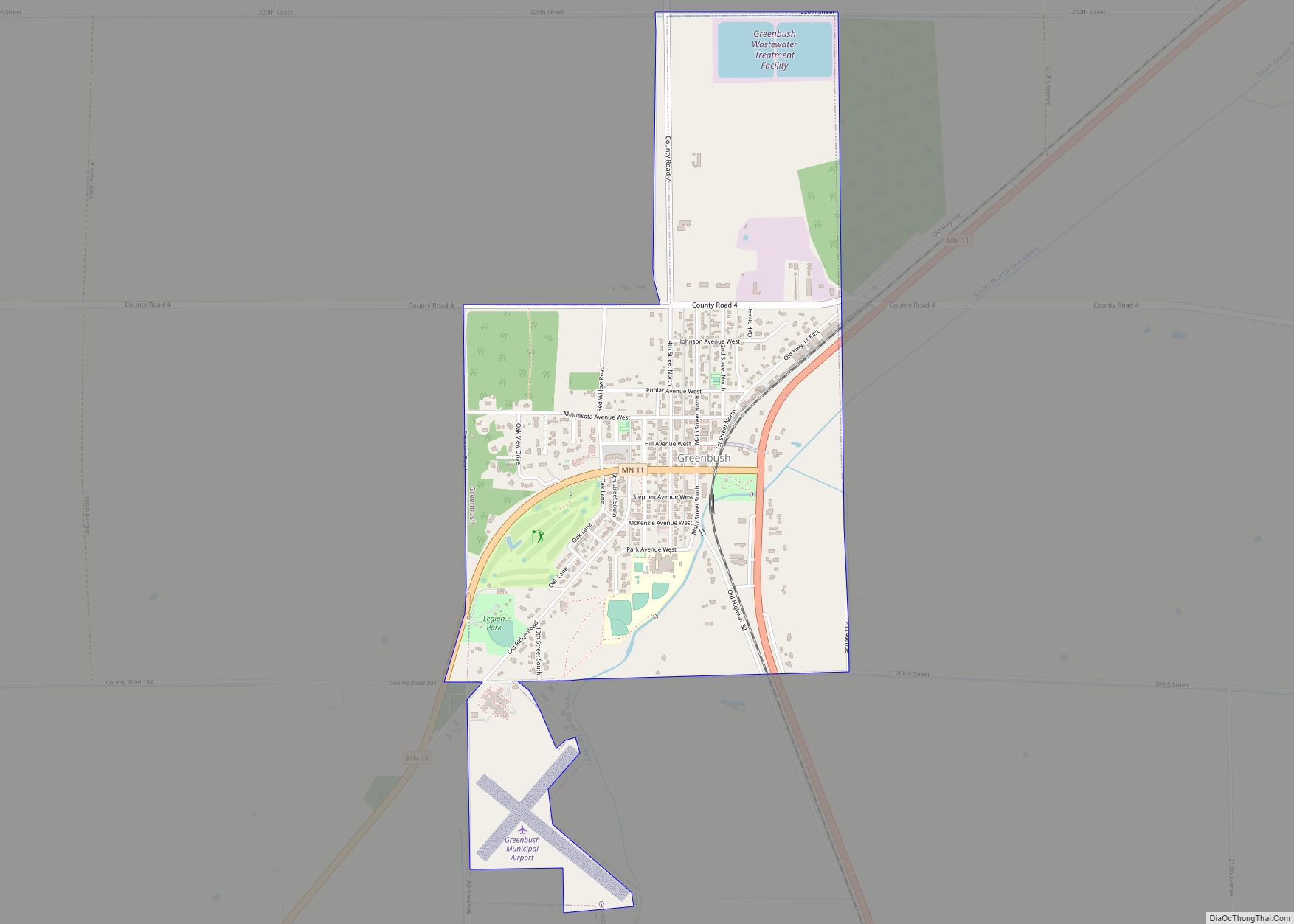
Greenbush is a city in Roseau County, Minnesota, United States. The population was 719 at the 2010 census.
Minnesota State Highways 11 and 32 are two of the main arterial routes in the community.
| Name: | Greenbush city |
|---|---|
| LSAD Code: | 25 |
| LSAD Description: | city (suffix) |
| State: | Minnesota |
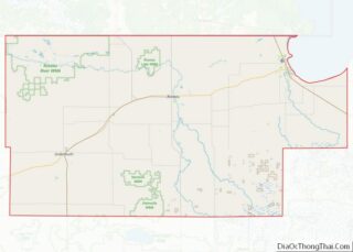
| County: | Roseau County |
| Elevation: | 1,076 ft (328 m) |
| Total Area: | 1.54 sq mi (3.98 km²) |
| Land Area: | 1.54 sq mi (3.98 km²) |
| Water Area: | 0.00 sq mi (0.00 km²) |
| Total Population: | 682 |
| Population Density: | 444.01/sq mi (171.49/km²) |
| ZIP code: | 56726 |
| Area code: | 218 |
| FIPS code: | 2725604 |
| GNISfeature ID: | 0644432 |
| Website: | greenbushmn.govoffice2.com |
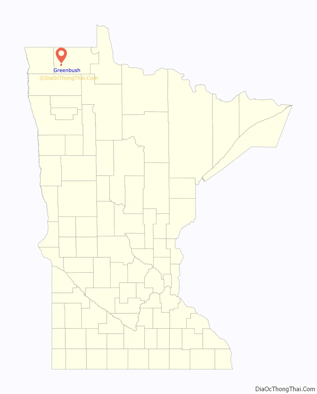
Online Interactive Map
Click on ![]() to view map in "full screen" mode.
to view map in "full screen" mode.
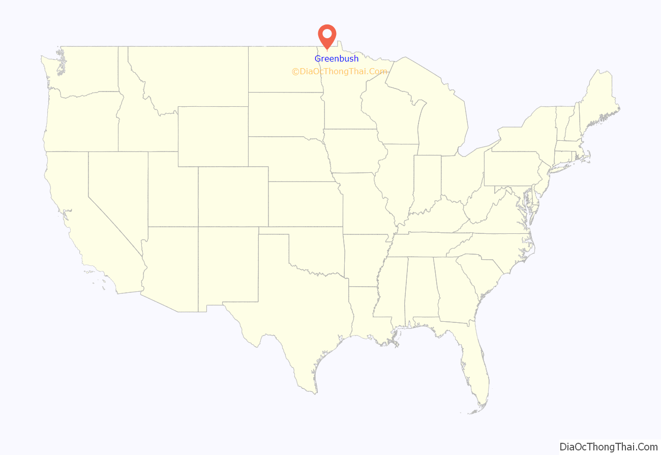
Greenbush location map. Where is Greenbush city?
History
The word Greenbush comes from “Sha Ach Wah,” which means spruce tree or green bush in Ojibwe. Scandinavian, Polish and Bohemian settlers arrived in the area in 1880s, with the largest influx immigrating in the early 1890s. The Homestead Act gave 160 acres (0.65 km) free to settlers if they set up living quarters and developed a few acres into the fields.
The original setting of the city was on a ridge of what was formerly known to be the shores of ancient Lake Agassiz. This village is now referred to as “Old Greenbush,” and is marked by Hvidso cemetery (also known as Pioneer Haven) along Highway 11. In 1904, the Great Northern railroad came to the area. It expanded north from Thief River Falls to the location of present day Greenbush, where it stopped construction. Greenbush merchants moved their businesses, buildings and all, to the new town known as “West Greenbush”, a feat which they accomplished by rolling the buildings along logs, with horses tied up to posts and walking beside them. Businesses remained open during the moving days.
A few years later, the rail line to Warroad was completed and ran directly through the old town site.
Greenbush officially became a registered city in 1905, with a population of approximately 450 people. Volunteers travelled to Crookston on foot to deliver the official documents, a journey of about 85 miles (137 km) one way.
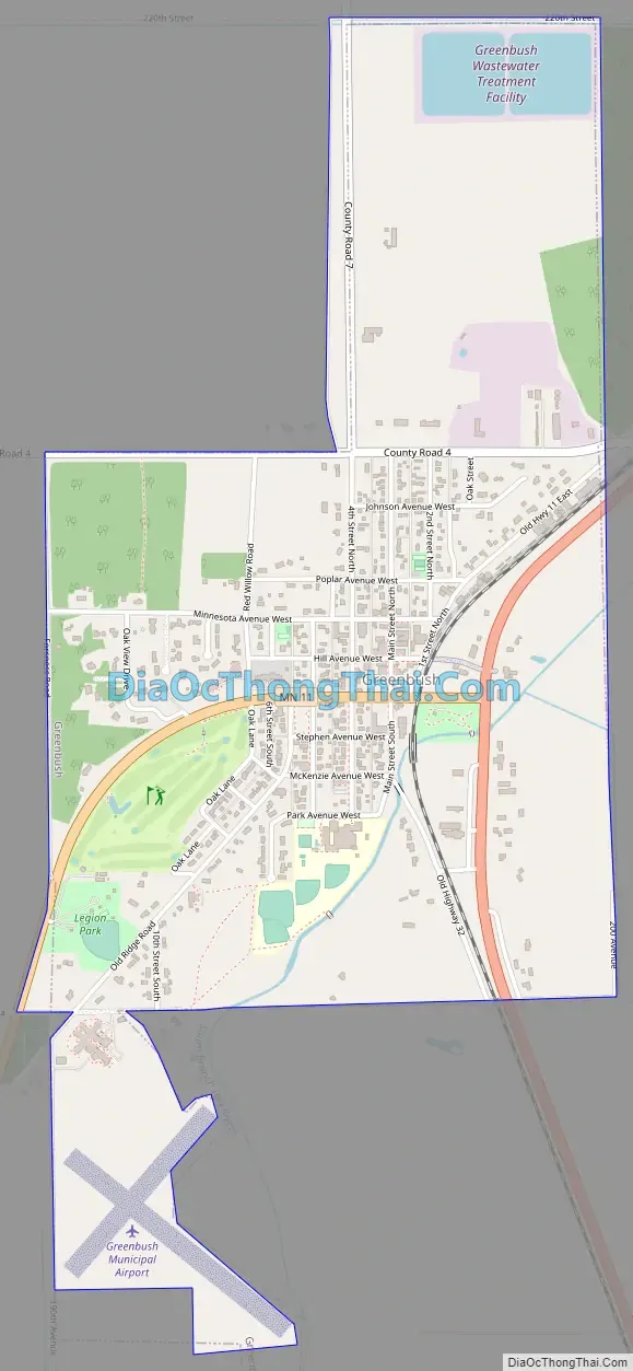
Greenbush Road Map
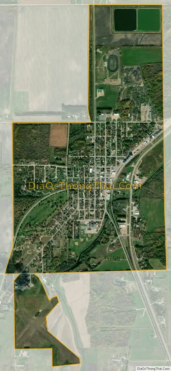
Greenbush city Satellite Map
Geography
According to the United States Census Bureau, the city has a total area of 1.51 square miles (3.91 km), all land.
See also
Map of Minnesota State and its subdivision:- Aitkin
- Anoka
- Becker
- Beltrami
- Benton
- Big Stone
- Blue Earth
- Brown
- Carlton
- Carver
- Cass
- Chippewa
- Chisago
- Clay
- Clearwater
- Cook
- Cottonwood
- Crow Wing
- Dakota
- Dodge
- Douglas
- Faribault
- Fillmore
- Freeborn
- Goodhue
- Grant
- Hennepin
- Houston
- Hubbard
- Isanti
- Itasca
- Jackson
- Kanabec
- Kandiyohi
- Kittson
- Koochiching
- Lac qui Parle
- Lake
- Lake of the Woods
- Lake Superior
- Le Sueur
- Lincoln
- Lyon
- Mahnomen
- Marshall
- Martin
- McLeod
- Meeker
- Mille Lacs
- Morrison
- Mower
- Murray
- Nicollet
- Nobles
- Norman
- Olmsted
- Otter Tail
- Pennington
- Pine
- Pipestone
- Polk
- Pope
- Ramsey
- Red Lake
- Redwood
- Renville
- Rice
- Rock
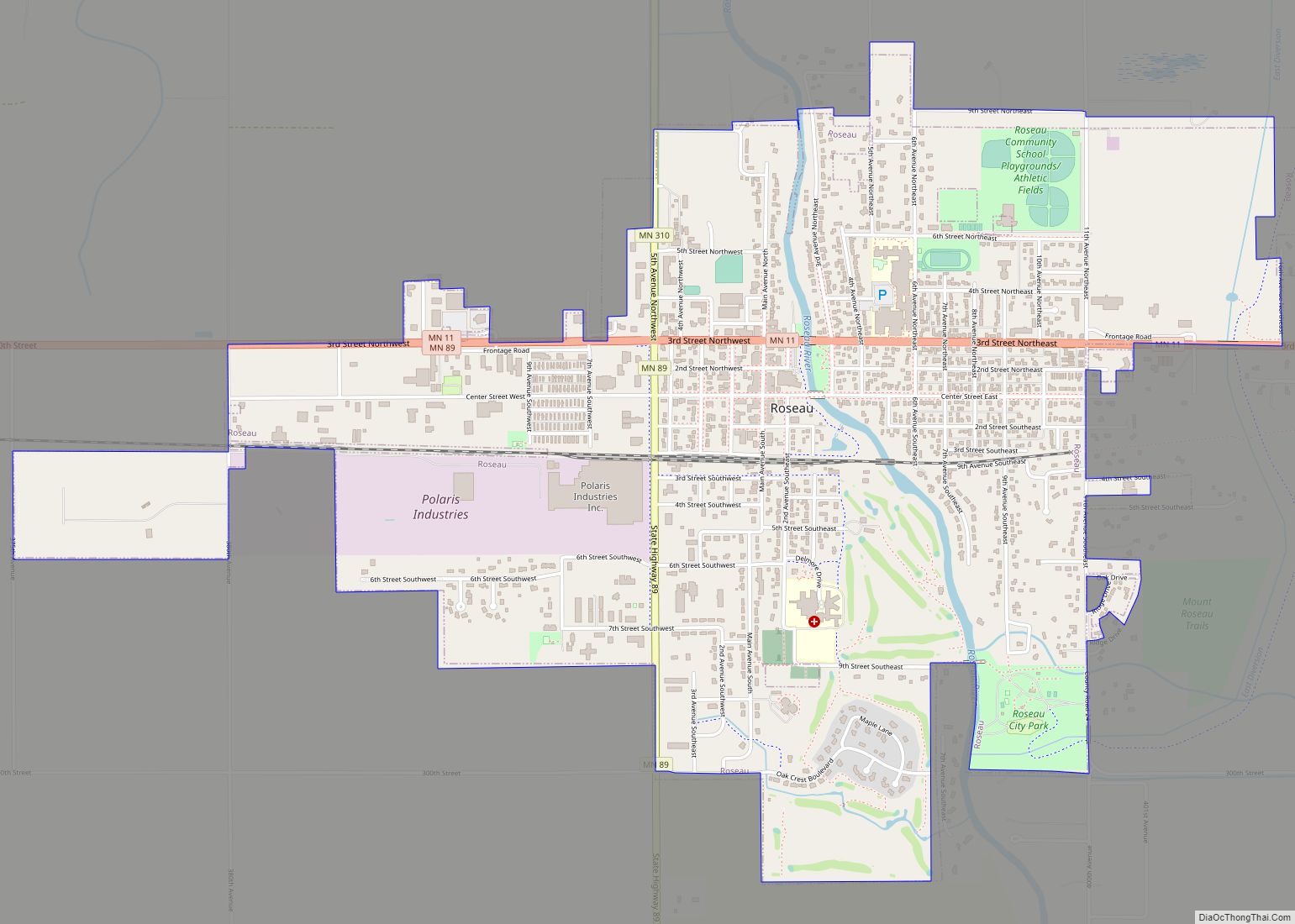
- Roseau
- Saint Louis
- Scott
- Sherburne
- Sibley
- Stearns
- Steele
- Stevens
- Swift
- Todd
- Traverse
- Wabasha
- Wadena
- Waseca
- Washington
- Watonwan
- Wilkin
- Winona
- Wright
- Yellow Medicine
- Alabama
- Alaska
- Arizona
- Arkansas
- California
- Colorado
- Connecticut
- Delaware
- District of Columbia
- Florida
- Georgia
- Hawaii
- Idaho
- Illinois
- Indiana
- Iowa
- Kansas
- Kentucky
- Louisiana
- Maine
- Maryland
- Massachusetts
- Michigan
- Minnesota
- Mississippi
- Missouri
- Montana
- Nebraska
- Nevada
- New Hampshire
- New Jersey
- New Mexico
- New York
- North Carolina
- North Dakota
- Ohio
- Oklahoma
- Oregon
- Pennsylvania
- Rhode Island
- South Carolina
- South Dakota
- Tennessee
- Texas
- Utah
- Vermont
- Virginia
- Washington
- West Virginia
- Wisconsin
- Wyoming