Lake Park is a city in Becker County, Minnesota, United States. The population was 728 at the 2020 census.
| Name: | Lake Park city |
|---|---|
| LSAD Code: | 25 |
| LSAD Description: | city (suffix) |
| State: | Minnesota |
| County: | Becker County |
| Elevation: | 1,345 ft (410 m) |
| Total Area: | 0.96 sq mi (2.49 km²) |
| Land Area: | 0.96 sq mi (2.49 km²) |
| Water Area: | 0.00 sq mi (0.00 km²) |
| Total Population: | 728 |
| Population Density: | 757.54/sq mi (292.50/km²) |
| ZIP code: | 56554 |
| Area code: | 218 |
| FIPS code: | 2734784 |
| GNISfeature ID: | 0646380 |
| Website: | lakeparkmn.com |
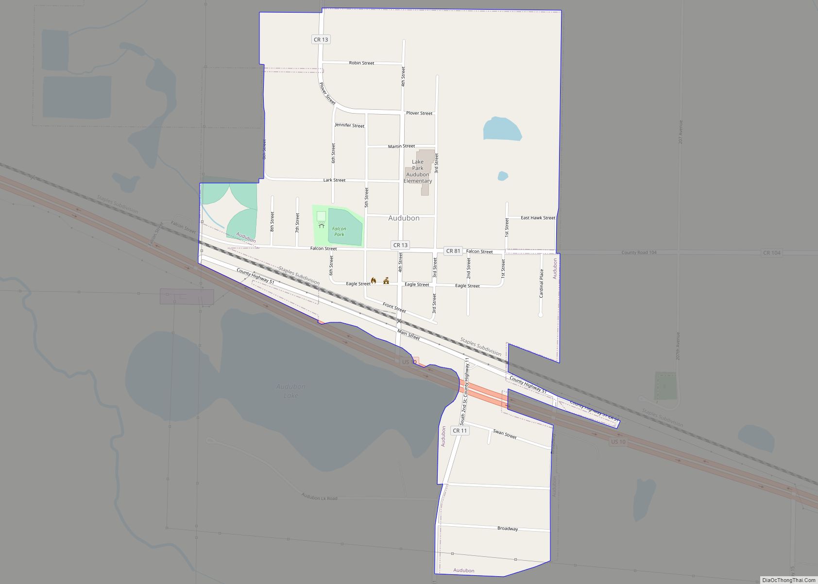
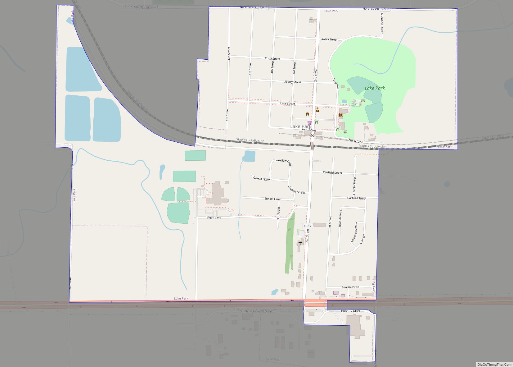
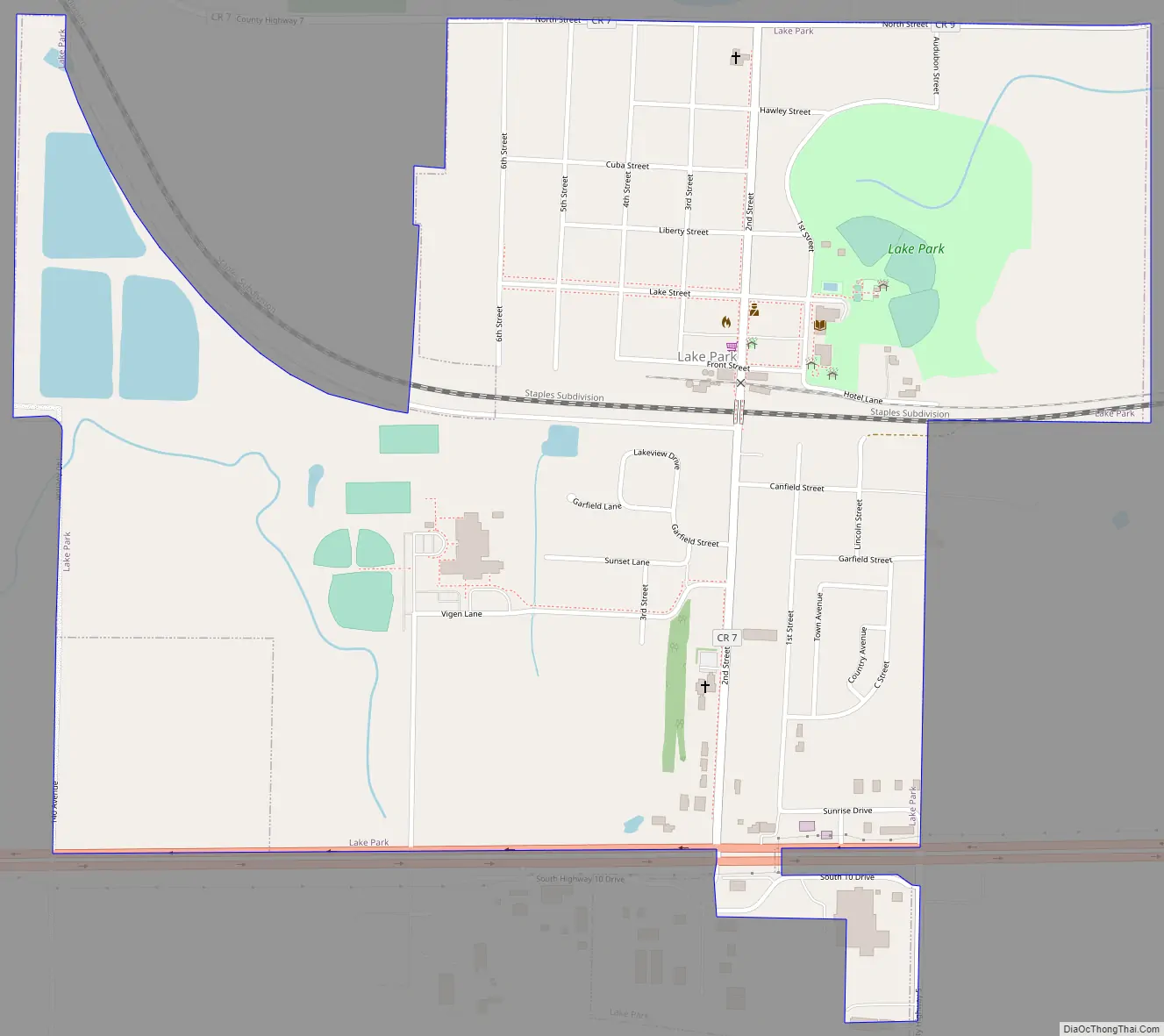
Online Interactive Map
Click on ![]() to view map in "full screen" mode.
to view map in "full screen" mode.
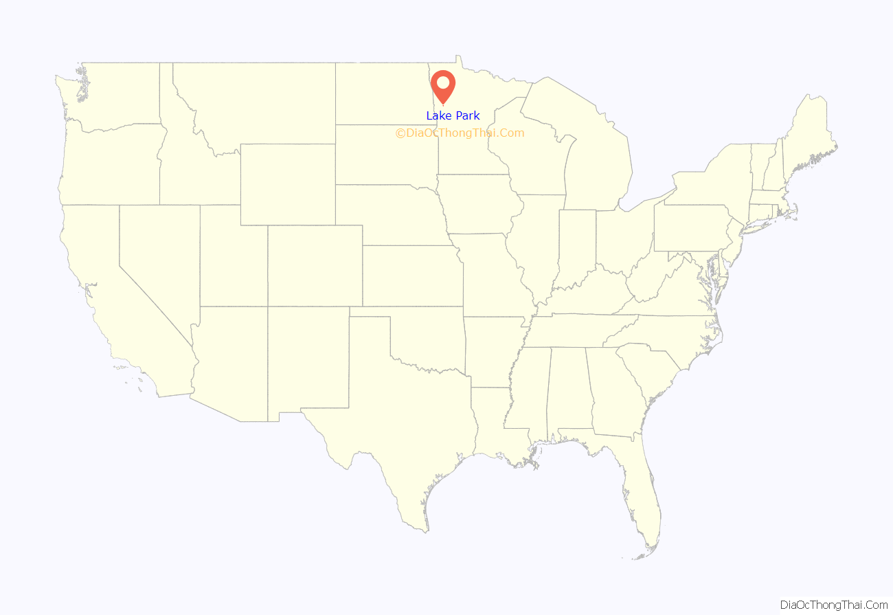
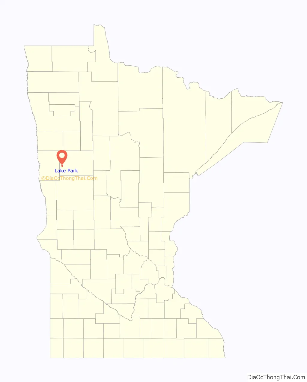
Lake Park location map. Where is Lake Park city?
History
The area upon where Lake Park was founded, started to be settled in 1841 by fur traders while a Dakota encampment still existed on Lake Flora on which part of the City Park is now located.
The area was originally founded as Liberty Township. In 1871, the Liberty Township Board changed the name to Lake Park Township; for which the name “Lake Park” comes from a Dakota phrase of “Where the Prairies meet the Waters” as the site became a railway stop for the Great Northern Railway by the town founder, James Canfield.
The city was officially incorporated separate from the township on the along the border of Lake Park and Cuba Townships. It was thenceforth known officially as the Village of Lake Park until the 1970s, when Lake Park was converted by the State of Minnesota into a City of the Fourth Class (Population under 5,000), for which it remains today. For many decades, up until the mid-1980s it was also known as the “Lefse Capital of the World” for its lefse factories and their high production, but they came to an end due to a national recession and the loss of regular rail freight service stops in the city. Today, the city is small rebounding family community with an excellent school, new small businesses, and expansion for additional housing.
Lake Park Road Map
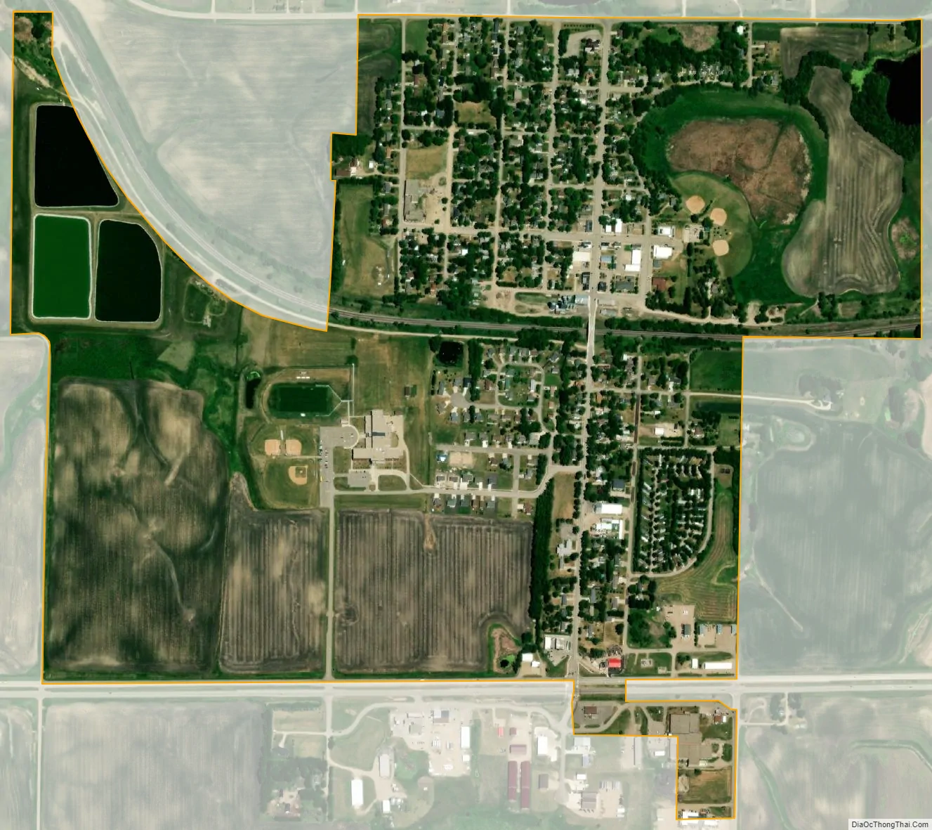
Lake Park city Satellite Map
Geography
According to the United States Census Bureau, the city has a total area of 0.97 square miles (2.51 km), all land.
Lake Park is located on U.S. Route 10, five miles east of the county line and is southwest of Labelle Lake. The only school in Lake Park is the Lake Park/Audubon high school.
See also
Map of Minnesota State and its subdivision:- Aitkin
- Anoka
- Becker
- Beltrami
- Benton
- Big Stone
- Blue Earth
- Brown
- Carlton
- Carver
- Cass
- Chippewa
- Chisago
- Clay
- Clearwater
- Cook
- Cottonwood
- Crow Wing
- Dakota
- Dodge
- Douglas
- Faribault
- Fillmore
- Freeborn
- Goodhue
- Grant
- Hennepin
- Houston
- Hubbard
- Isanti
- Itasca
- Jackson
- Kanabec
- Kandiyohi
- Kittson
- Koochiching
- Lac qui Parle
- Lake
- Lake of the Woods
- Lake Superior
- Le Sueur
- Lincoln
- Lyon
- Mahnomen
- Marshall
- Martin
- McLeod
- Meeker
- Mille Lacs
- Morrison
- Mower
- Murray
- Nicollet
- Nobles
- Norman
- Olmsted
- Otter Tail
- Pennington
- Pine
- Pipestone
- Polk
- Pope
- Ramsey
- Red Lake
- Redwood
- Renville
- Rice
- Rock
- Roseau
- Saint Louis
- Scott
- Sherburne
- Sibley
- Stearns
- Steele
- Stevens
- Swift
- Todd
- Traverse
- Wabasha
- Wadena
- Waseca
- Washington
- Watonwan
- Wilkin
- Winona
- Wright
- Yellow Medicine
- Alabama
- Alaska
- Arizona
- Arkansas
- California
- Colorado
- Connecticut
- Delaware
- District of Columbia
- Florida
- Georgia
- Hawaii
- Idaho
- Illinois
- Indiana
- Iowa
- Kansas
- Kentucky
- Louisiana
- Maine
- Maryland
- Massachusetts
- Michigan
- Minnesota
- Mississippi
- Missouri
- Montana
- Nebraska
- Nevada
- New Hampshire
- New Jersey
- New Mexico
- New York
- North Carolina
- North Dakota
- Ohio
- Oklahoma
- Oregon
- Pennsylvania
- Rhode Island
- South Carolina
- South Dakota
- Tennessee
- Texas
- Utah
- Vermont
- Virginia
- Washington
- West Virginia
- Wisconsin
- Wyoming