Nerstrand (/ˈnɪərstʃrænd/ NEER-schrand) is a city in Rice County, Minnesota, United States. The population was 294 at the 2018 census.
Minnesota State Highway 246 serves as a main route in the community. Minnesota State Highways 56 and 60 are nearby.
| Name: | Nerstrand city |
|---|---|
| LSAD Code: | 25 |
| LSAD Description: | city (suffix) |
| State: | Minnesota |
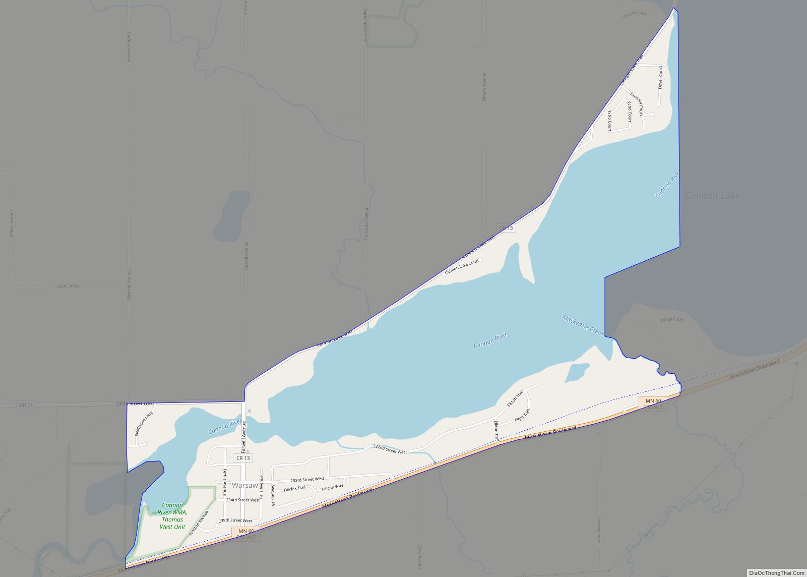
| County: | Rice County |
| Elevation: | 1,191 ft (363 m) |
| Total Area: | 1.42 sq mi (3.67 km²) |
| Land Area: | 1.42 sq mi (3.67 km²) |
| Water Area: | 0.00 sq mi (0.00 km²) |
| Total Population: | 273 |
| Population Density: | 192.93/sq mi (74.47/km²) |
| ZIP code: | 55053 |
| Area code: | 507 |
| FIPS code: | 2745196 |
| GNISfeature ID: | 0648482 |
Online Interactive Map
Click on ![]() to view map in "full screen" mode.
to view map in "full screen" mode.
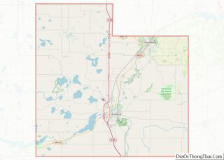
Nerstrand location map. Where is Nerstrand city?


History
In 1856, Norwegian immigrant Osmund Osmundson moved to Wheeling Township in Rice County. He homesteaded the present site of Nerstrand, building a house and farm, and began to envision a town on the site. In 1877 he built a store on what became the right-of-way for railroad tracks on what is now Main Street. In 1885 the Minnesota and North Western Railroad (later the Chicago Great Western Railway) was constructed, extending from Lyle, Minnesota to St. Paul, and Osmundson platted the town on the line, naming it after his hometown of Nedstrand in Tysvær, Norway.
The town was the center of a significant Norwegian immigrant community, which included people in the surrounding township and county. Some, like Osmundson and Tosten Bonde (who lived just outside the city limits), became state legislators. Thorstein Veblen, who grew up just outside the town, became a noted sociologist and economist.
The town incorporated in 1897 and its first city hall was built that year. It proved too small within a few years, and a new city hall was built in 1907. Nerstrand City Hall was placed on the National Register of Historic Places on April 6, 1982, alongside the Osmund Osmundson House and the Bonde Farmhouse. The Thorstein Veblen Farmstead became a National Historic Landmark. The railroad tracks have been removed.
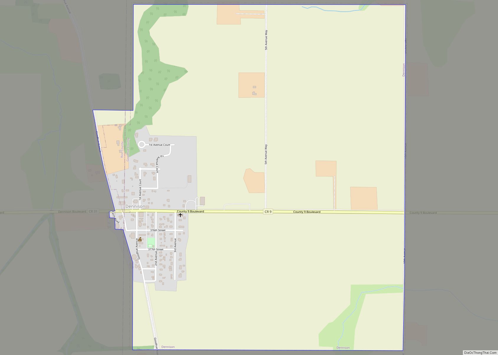
Nerstrand Road Map

Nerstrand city Satellite Map

Geography
According to the United States Census Bureau, the city has a total area of 1.417 square miles (3.67 km), all land.
The town was notorious for the nearby Nerstrand Hill, bane of the locomotive engineer, with the steepest grade on the line from St. Paul to Manly Junction, Iowa.
See also
Map of Minnesota State and its subdivision:- Aitkin
- Anoka
- Becker
- Beltrami
- Benton
- Big Stone
- Blue Earth
- Brown
- Carlton
- Carver
- Cass
- Chippewa
- Chisago
- Clay
- Clearwater
- Cook
- Cottonwood
- Crow Wing
- Dakota
- Dodge
- Douglas
- Faribault
- Fillmore
- Freeborn
- Goodhue
- Grant
- Hennepin
- Houston
- Hubbard
- Isanti
- Itasca
- Jackson
- Kanabec
- Kandiyohi
- Kittson
- Koochiching
- Lac qui Parle
- Lake
- Lake of the Woods
- Lake Superior
- Le Sueur
- Lincoln
- Lyon
- Mahnomen
- Marshall
- Martin
- McLeod
- Meeker
- Mille Lacs
- Morrison
- Mower
- Murray
- Nicollet
- Nobles
- Norman
- Olmsted
- Otter Tail
- Pennington
- Pine
- Pipestone
- Polk
- Pope
- Ramsey
- Red Lake
- Redwood
- Renville
- Rice
- Rock
- Roseau
- Saint Louis
- Scott
- Sherburne
- Sibley
- Stearns
- Steele
- Stevens
- Swift
- Todd
- Traverse
- Wabasha
- Wadena
- Waseca
- Washington
- Watonwan
- Wilkin
- Winona
- Wright
- Yellow Medicine
- Alabama
- Alaska
- Arizona
- Arkansas
- California
- Colorado
- Connecticut
- Delaware
- District of Columbia
- Florida
- Georgia
- Hawaii
- Idaho
- Illinois
- Indiana
- Iowa
- Kansas
- Kentucky
- Louisiana
- Maine
- Maryland
- Massachusetts
- Michigan
- Minnesota
- Mississippi
- Missouri
- Montana
- Nebraska
- Nevada
- New Hampshire
- New Jersey
- New Mexico
- New York
- North Carolina
- North Dakota
- Ohio
- Oklahoma
- Oregon
- Pennsylvania
- Rhode Island
- South Carolina
- South Dakota
- Tennessee
- Texas
- Utah
- Vermont
- Virginia
- Washington
- West Virginia
- Wisconsin
- Wyoming