Roosevelt is a city in Lake of the Woods and Roseau counties in the State of Minnesota. The population was 151 at the time of the 2010 census.
| Name: | Roosevelt city |
|---|---|
| LSAD Code: | 25 |
| LSAD Description: | city (suffix) |
| State: | Minnesota |
| County: | Lake of the Woods County, Roseau County |
| Elevation: | 1,161 ft (354 m) |
| Total Area: | 1.03 sq mi (2.66 km²) |
| Land Area: | 1.03 sq mi (2.66 km²) |
| Water Area: | 0.00 sq mi (0.00 km²) |
| Total Population: | 153 |
| Population Density: | 148.98/sq mi (57.53/km²) |
| ZIP code: | 56673, 56682 |
| Area code: | 218 |
| FIPS code: | 2755438 |
| GNISfeature ID: | 0650236 |
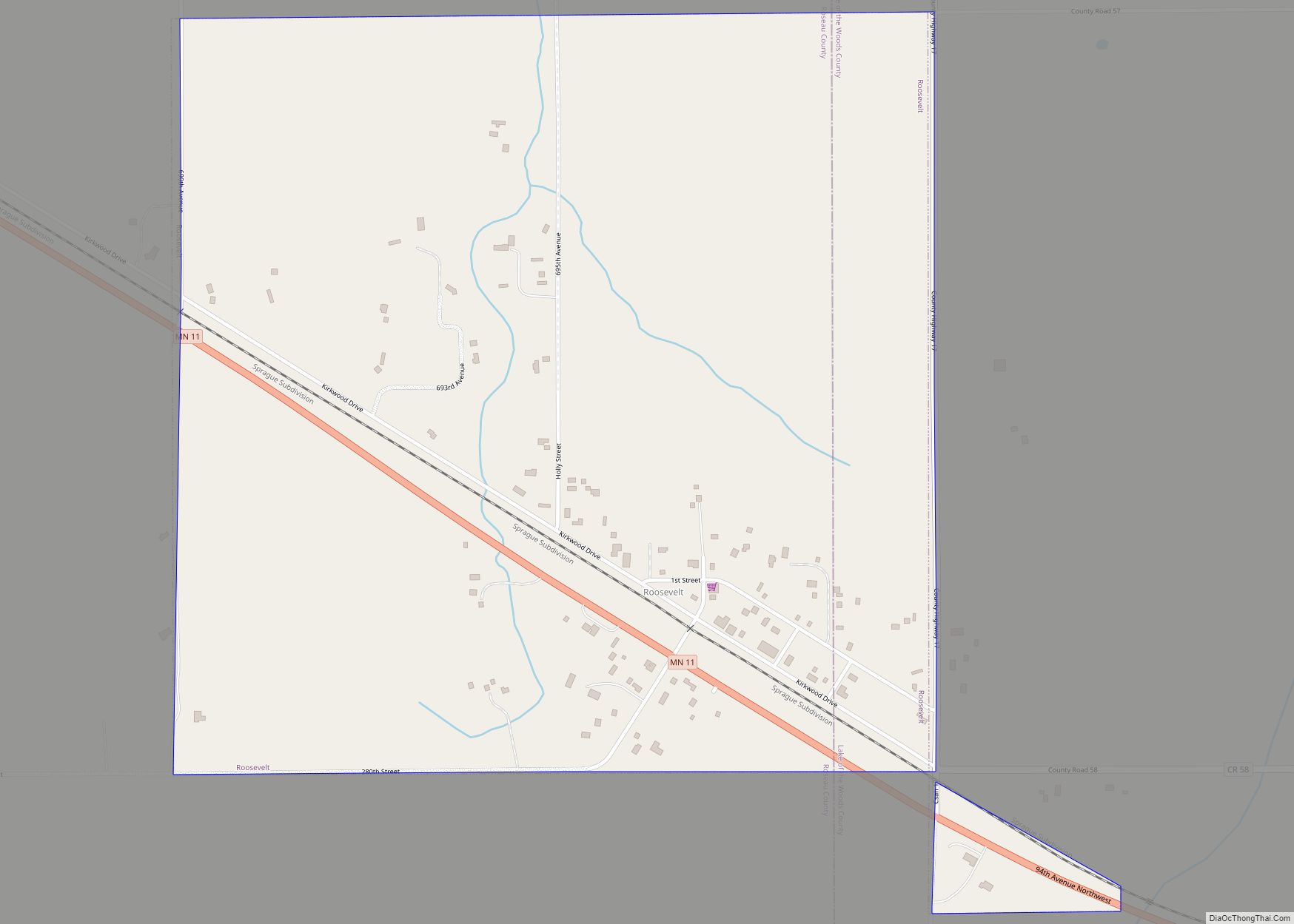
Online Interactive Map
Click on ![]() to view map in "full screen" mode.
to view map in "full screen" mode.
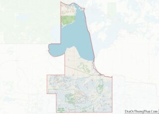
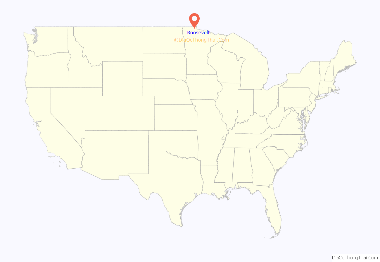
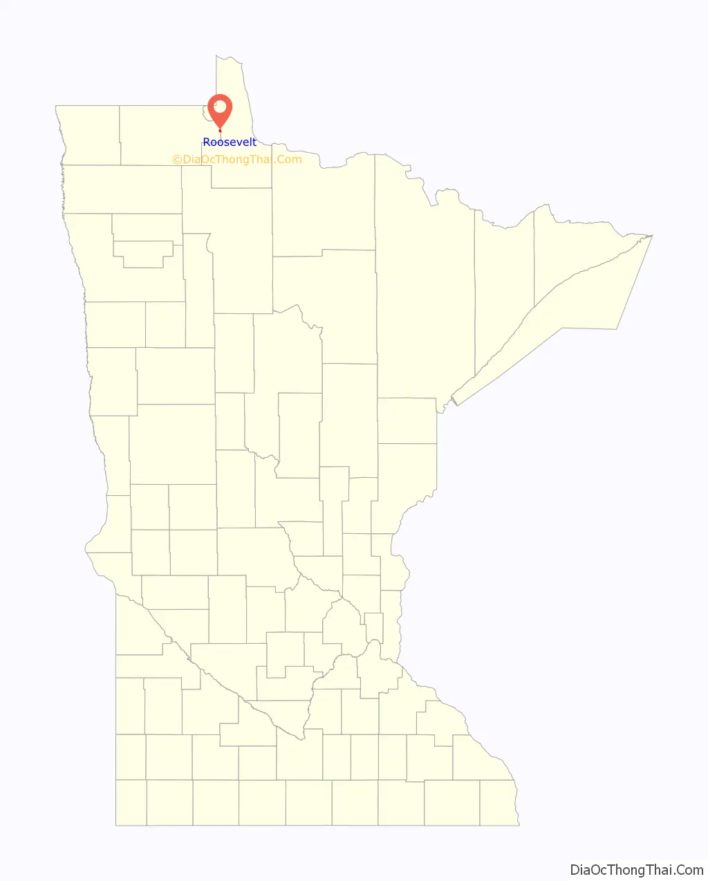
Roosevelt location map. Where is Roosevelt city?
History
A post office called Roosevelt has been in operation since 1901. Roosevelt also features a full service grocery store called Knutson Grocery that has been in operation for over 100 years. The city was named for Theodore Roosevelt the 26th president of the United States.
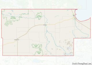
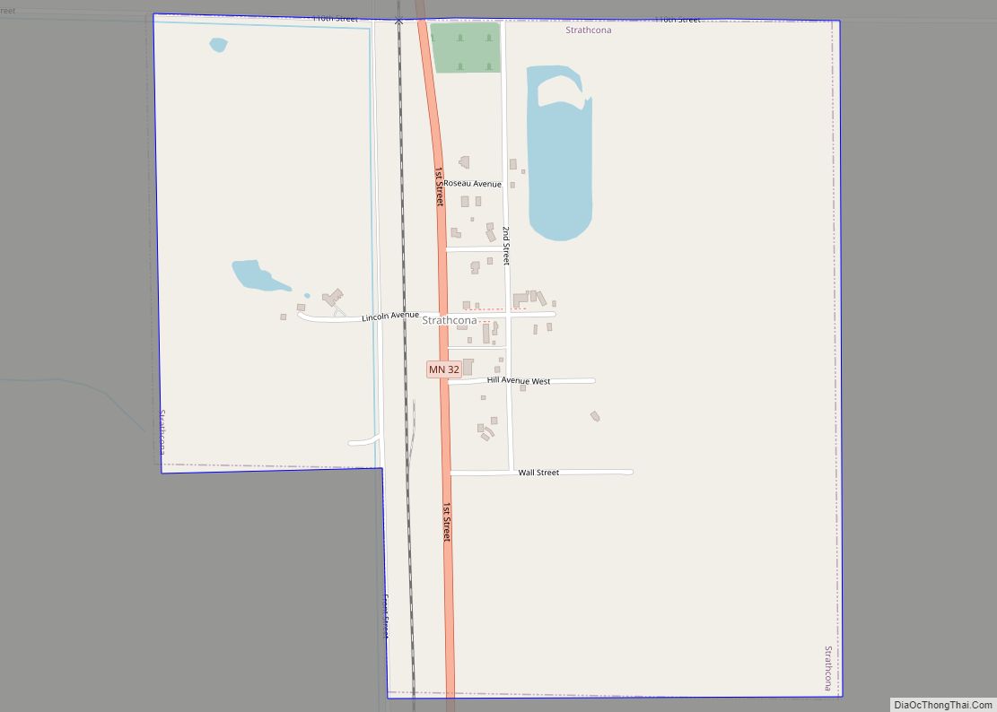
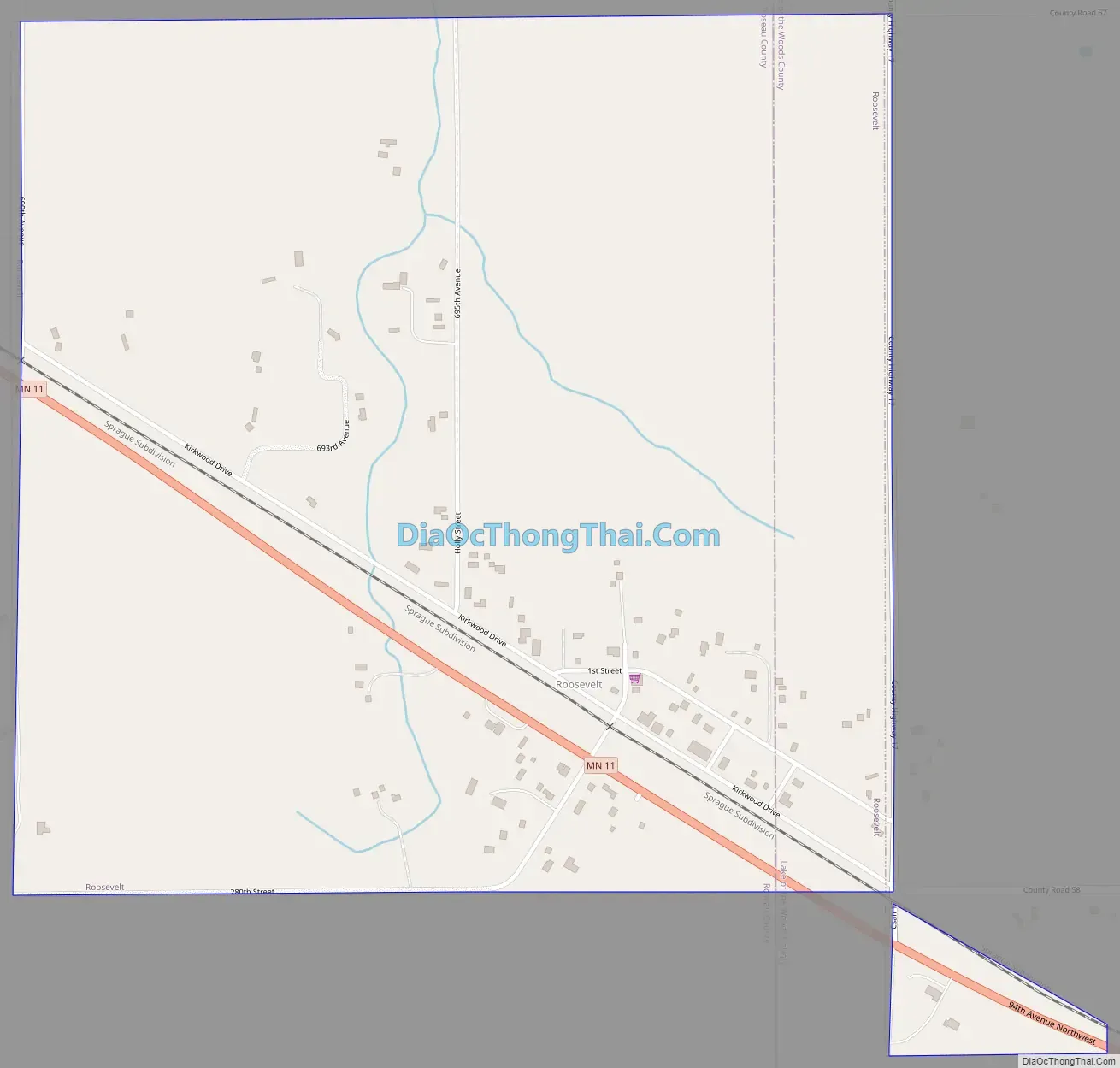
Roosevelt Road Map
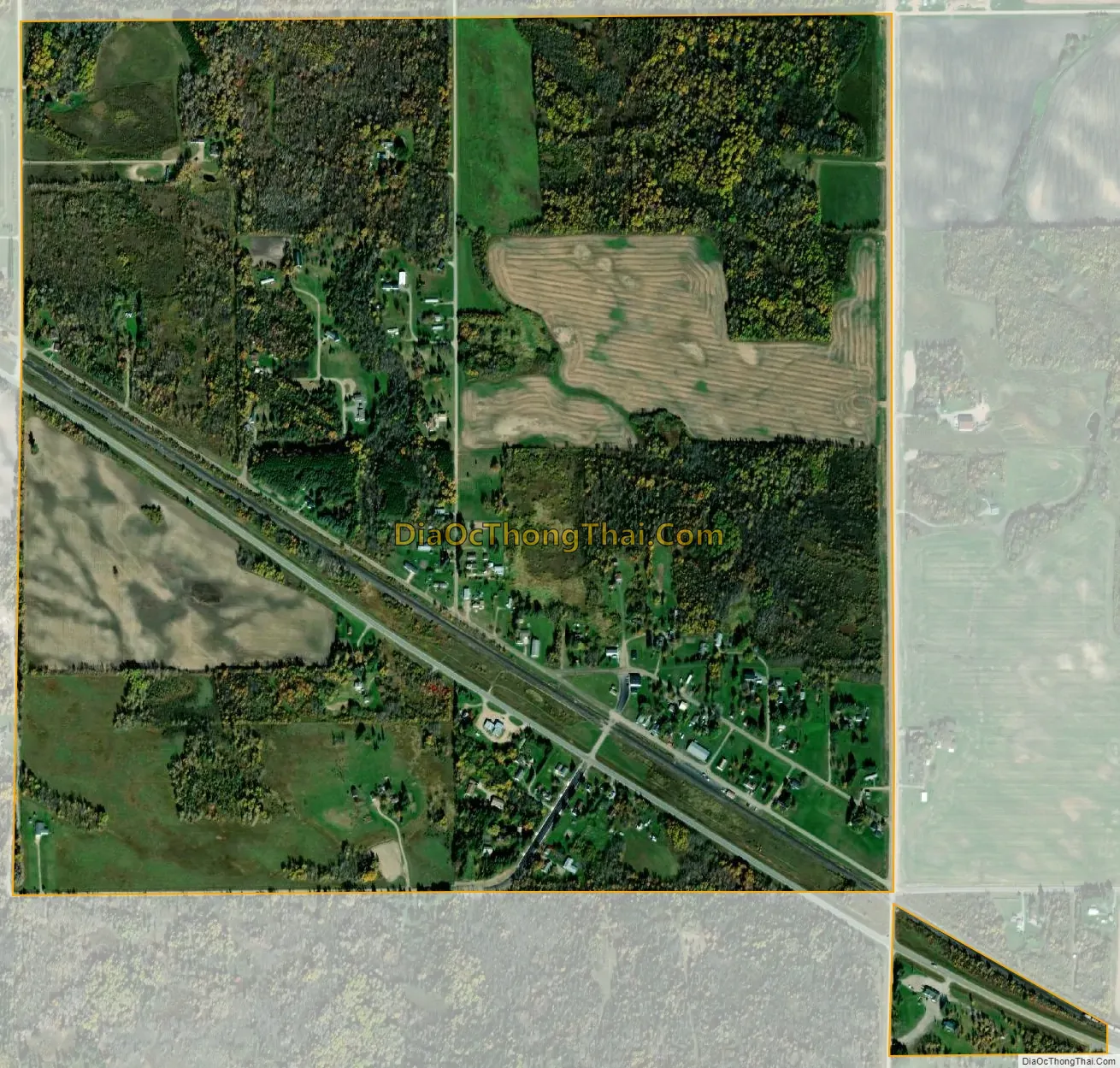
Roosevelt city Satellite Map
Geography
According to the United States Census Bureau, the city has a total area of 1.04 square miles (2.69 km), all land. Most of the city lies in Roseau County, with only a tiny percentage in Lake of the Woods County.
Roosevelt is located along Minnesota State Highway 11.
See also
Map of Minnesota State and its subdivision:- Aitkin
- Anoka
- Becker
- Beltrami
- Benton
- Big Stone
- Blue Earth
- Brown
- Carlton
- Carver
- Cass
- Chippewa
- Chisago
- Clay
- Clearwater
- Cook
- Cottonwood
- Crow Wing
- Dakota
- Dodge
- Douglas
- Faribault
- Fillmore
- Freeborn
- Goodhue
- Grant
- Hennepin
- Houston
- Hubbard
- Isanti
- Itasca
- Jackson
- Kanabec
- Kandiyohi
- Kittson
- Koochiching
- Lac qui Parle
- Lake
- Lake of the Woods
- Lake Superior
- Le Sueur
- Lincoln
- Lyon
- Mahnomen
- Marshall
- Martin
- McLeod
- Meeker
- Mille Lacs
- Morrison
- Mower
- Murray
- Nicollet
- Nobles
- Norman
- Olmsted
- Otter Tail
- Pennington
- Pine
- Pipestone
- Polk
- Pope
- Ramsey
- Red Lake
- Redwood
- Renville
- Rice
- Rock
- Roseau
- Saint Louis
- Scott
- Sherburne
- Sibley
- Stearns
- Steele
- Stevens
- Swift
- Todd
- Traverse
- Wabasha
- Wadena
- Waseca
- Washington
- Watonwan
- Wilkin
- Winona
- Wright
- Yellow Medicine
- Alabama
- Alaska
- Arizona
- Arkansas
- California
- Colorado
- Connecticut
- Delaware
- District of Columbia
- Florida
- Georgia
- Hawaii
- Idaho
- Illinois
- Indiana
- Iowa
- Kansas
- Kentucky
- Louisiana
- Maine
- Maryland
- Massachusetts
- Michigan
- Minnesota
- Mississippi
- Missouri
- Montana
- Nebraska
- Nevada
- New Hampshire
- New Jersey
- New Mexico
- New York
- North Carolina
- North Dakota
- Ohio
- Oklahoma
- Oregon
- Pennsylvania
- Rhode Island
- South Carolina
- South Dakota
- Tennessee
- Texas
- Utah
- Vermont
- Virginia
- Washington
- West Virginia
- Wisconsin
- Wyoming