Shorewood is a city nestled in the woods along on the shores of Lake Minnetonka in Hennepin County, Minnesota, United States. The population was 7,307 at the 2010 census. The city was incorporated in 1956. Its area was originally part of the former Excelsior Township.
State Highway 7 serves as a main route.
| Name: | Shorewood city |
|---|---|
| LSAD Code: | 25 |
| LSAD Description: | city (suffix) |
| State: | Minnesota |
| County: | Hennepin County |
| Total Area: | 8.15 sq mi (21.12 km²) |
| Land Area: | 5.31 sq mi (13.75 km²) |
| Water Area: | 2.84 sq mi (7.37 km²) |
| Total Population: | 7,783 |
| Population Density: | 1,465.73/sq mi (565.91/km²) |
| FIPS code: | 2760016 |
| Website: | www.ci.shorewood.mn.us |
Online Interactive Map
Click on ![]() to view map in "full screen" mode.
to view map in "full screen" mode.
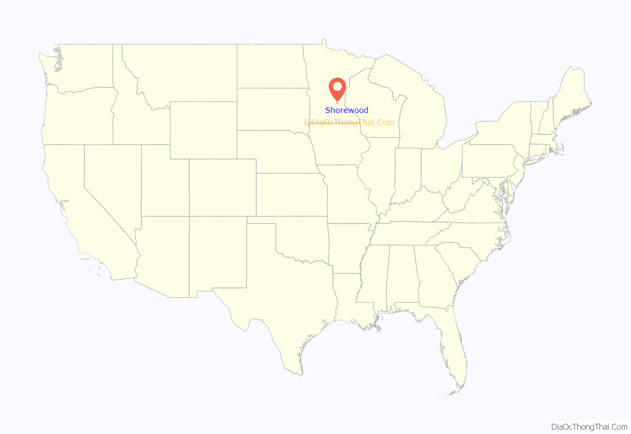
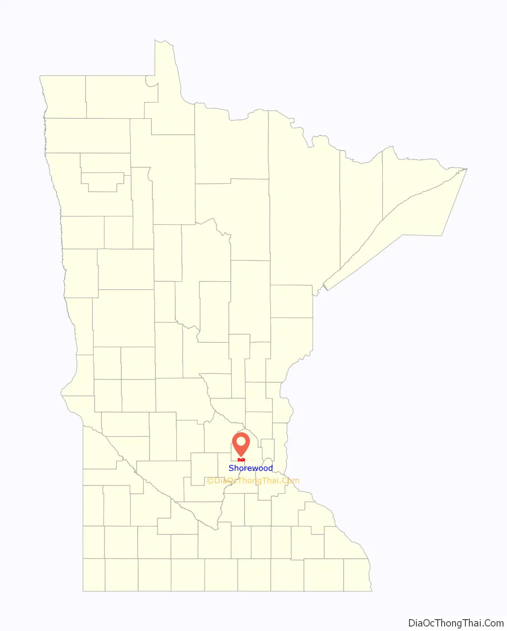
Shorewood location map. Where is Shorewood city?
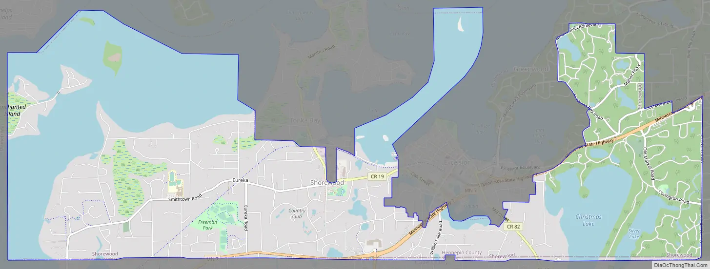
Shorewood Road Map
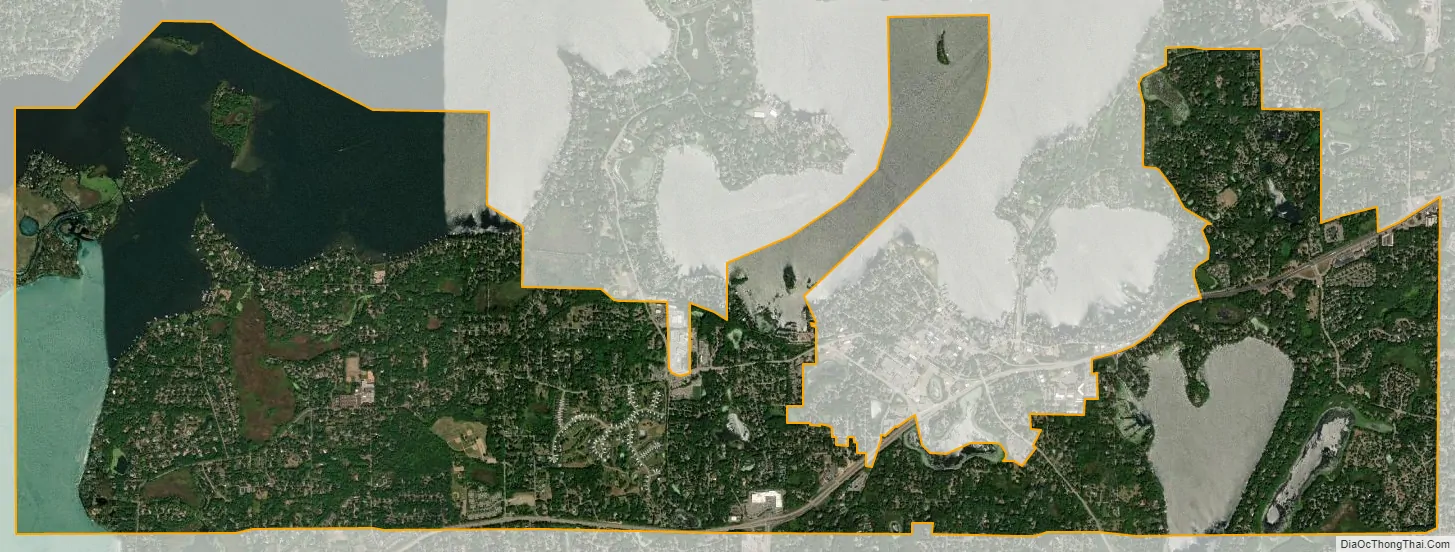
Shorewood city Satellite Map
Geography
According to the United States Census Bureau, the city has a total area of 13.33 square miles (34.52 km), of which 5.34 square miles (13.83 km) is land and 7.99 square miles (20.69 km) is water. It includes the Lake Minnetonka islands of Spray, Shady, and part of Enchanted. These islands are more accessible from the nearby city of Mound that provides them with postal services, fire protection, and schools.
See also
Map of Minnesota State and its subdivision:- Aitkin
- Anoka
- Becker
- Beltrami
- Benton
- Big Stone
- Blue Earth
- Brown
- Carlton
- Carver
- Cass
- Chippewa
- Chisago
- Clay
- Clearwater
- Cook
- Cottonwood
- Crow Wing
- Dakota
- Dodge
- Douglas
- Faribault
- Fillmore
- Freeborn
- Goodhue
- Grant
- Hennepin
- Houston
- Hubbard
- Isanti
- Itasca
- Jackson
- Kanabec
- Kandiyohi
- Kittson
- Koochiching
- Lac qui Parle
- Lake
- Lake of the Woods
- Lake Superior
- Le Sueur
- Lincoln
- Lyon
- Mahnomen
- Marshall
- Martin
- McLeod
- Meeker
- Mille Lacs
- Morrison
- Mower
- Murray
- Nicollet
- Nobles
- Norman
- Olmsted
- Otter Tail
- Pennington
- Pine
- Pipestone
- Polk
- Pope
- Ramsey
- Red Lake
- Redwood
- Renville
- Rice
- Rock
- Roseau
- Saint Louis
- Scott
- Sherburne
- Sibley
- Stearns
- Steele
- Stevens
- Swift
- Todd
- Traverse
- Wabasha
- Wadena
- Waseca
- Washington
- Watonwan
- Wilkin
- Winona
- Wright
- Yellow Medicine
- Alabama
- Alaska
- Arizona
- Arkansas
- California
- Colorado
- Connecticut
- Delaware
- District of Columbia
- Florida
- Georgia
- Hawaii
- Idaho
- Illinois
- Indiana
- Iowa
- Kansas
- Kentucky
- Louisiana
- Maine
- Maryland
- Massachusetts
- Michigan
- Minnesota
- Mississippi
- Missouri
- Montana
- Nebraska
- Nevada
- New Hampshire
- New Jersey
- New Mexico
- New York
- North Carolina
- North Dakota
- Ohio
- Oklahoma
- Oregon
- Pennsylvania
- Rhode Island
- South Carolina
- South Dakota
- Tennessee
- Texas
- Utah
- Vermont
- Virginia
- Washington
- West Virginia
- Wisconsin
- Wyoming


