Tonka Bay is a city in Hennepin County, Minnesota, United States. It is located on Lake Minnetonka between the upper and lower lakes. It gained some popularity in the 1880s and 1890s as a summer lake resort. The population of Tonka Bay was 1,475 at the 2010 census.
| Name: | Tonka Bay city |
|---|---|
| LSAD Code: | 25 |
| LSAD Description: | city (suffix) |
| State: | Minnesota |
| County: | Hennepin County |
| Incorporated: | 1901 |
| Total Area: | 2.11 sq mi (5.47 km²) |
| Land Area: | 0.94 sq mi (2.43 km²) |
| Water Area: | 1.17 sq mi (3.03 km²) |
| Total Population: | 1,442 |
| Population Density: | 1,535.68/sq mi (593.05/km²) |
| FIPS code: | 2765164 |
| Website: | www.cityoftonkabay.net |
Online Interactive Map
Click on ![]() to view map in "full screen" mode.
to view map in "full screen" mode.
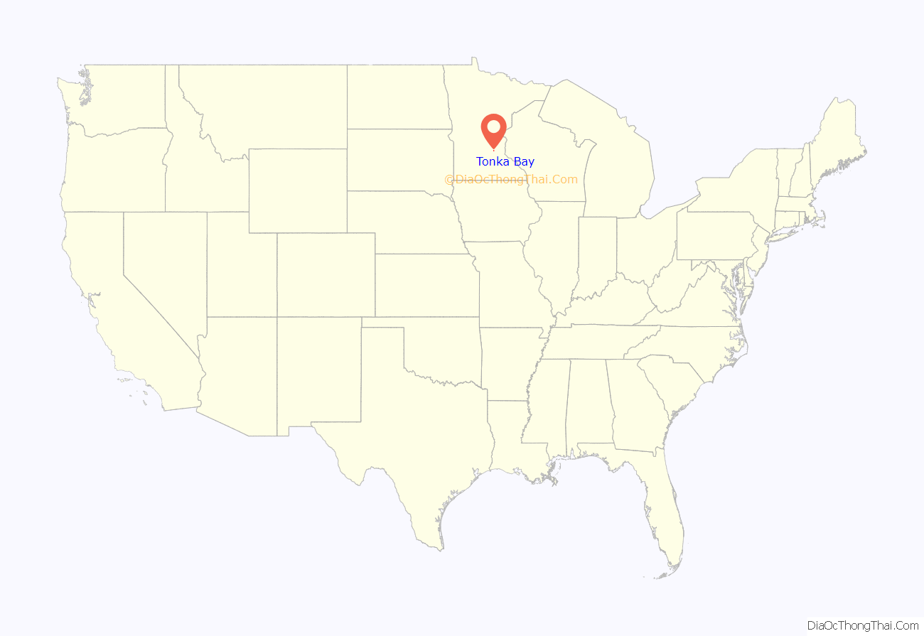
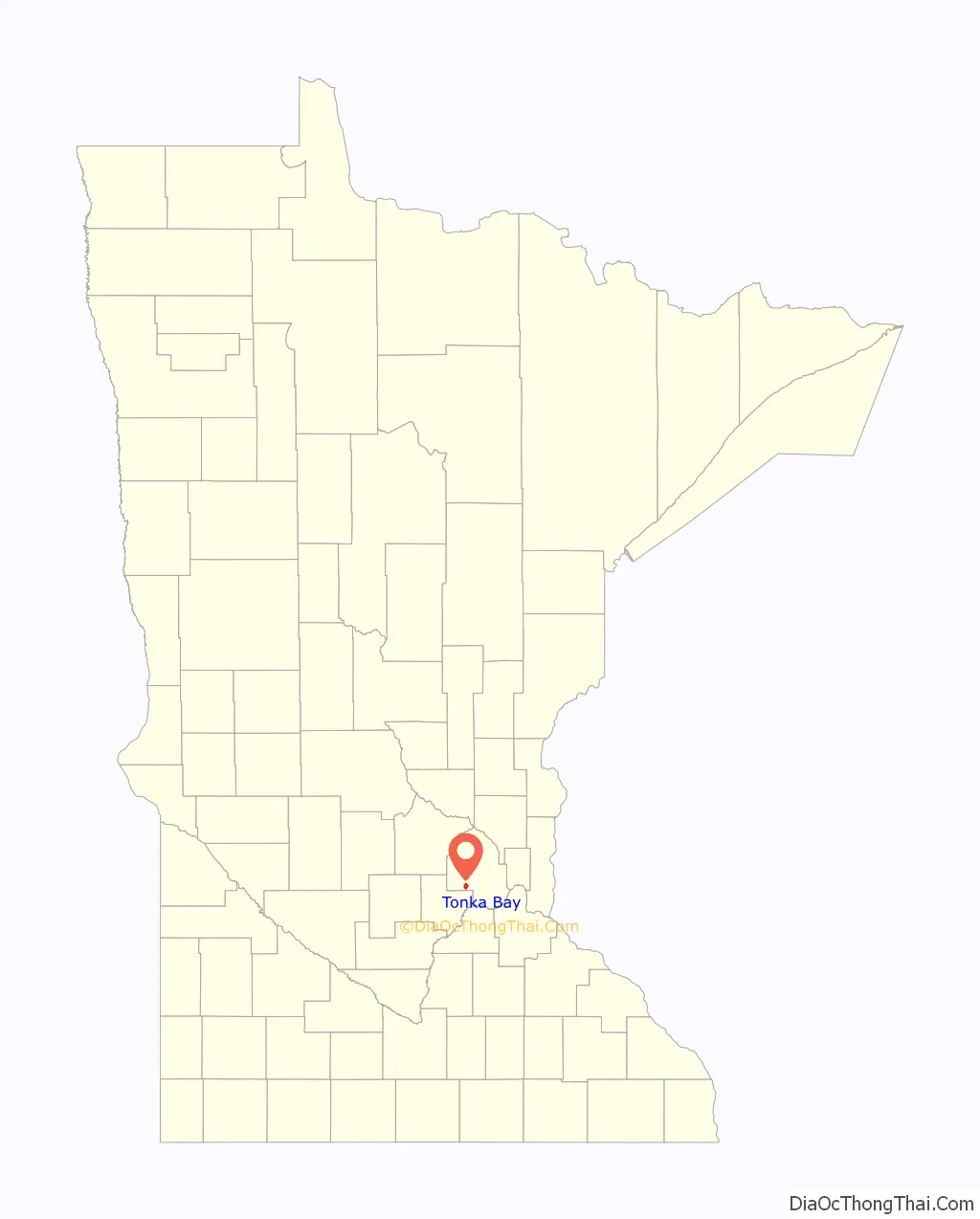
Tonka Bay location map. Where is Tonka Bay city?
History
Circa 10,000 B.C. – Tonka Bay forms during the recession of the last glaciation – the Wisconsin. Upper and Lower Lake Minnetonka and the peninsula and bays that now make up Tonka Bay forms as the ice sheet retreats.
1852 – Signing of Treaty of Traverse des Sioux that opens up the Lake Minnetonka area to white settlement.
1852 –Territorial Governor Alexander Ramsey explores Lake Minnetonka and officially names it “Minne” (Sioux for water) and “Tonka” (Sioux for big or strong).
1853 – Reverend Stephen Hull comes to the area. He creates the first narrows, “Hull’s Narrows,” located nearby present-day County Road 19 north of West Point Road. The Narrows allows boats to pass between Upper and Lower Lake Minnetonka.
1864 – Horticulturist Peter Gideon claimed 160 acres (0.65 km) in what would become Tonka Bay. Here he propagated the “Wealthy” apple, which can survive the harsh Minnesota winters, named for his wife Wealthy Hull.
1879 – The Lake Park Hotel is built as part of the Chautauqua movement.
1887 – Old Orchard House is built by John Finley Wilcox. He plants hundreds of acres of orchards that once stood alongside County Road 19.
1890 – Fred B. Snyder buys the 28-acre Clay Cliffe Estate for $56.
1901 – Tonka Bay incorporates in response to the need to provide services for its increasingly stable population. Wilcox becomes Tonka Bay’s first mayor.
1904 –Tonka Bay elementary school is built.
1908 – The Twin City Rapid Transit Company purchases the Lake Park Hotel and changes its name to the Tonka Bay Hotel. It closes in 1911.
1911 – The first bridge over the narrows is built in Tonka Bay.
1913 –Tonka Bay Marine is founded by the Westman Family.
1953 –Tonka Bay’s elementary school becomes Tonka Bay Village Hall.
1955 – Minnetonka Plaza constructed.
Late 1980s to mid 1990s– New developments are built on the grounds of great estates of the past, such as the Clay Cliffe Estate, Arbor Shores, and the W.O. Winston Estate, now known as the subdivision of Gideon’s Point.
2002 – Police/Fire Campus constructed.
2003 to 2004 – Plaza renamed Tonka Village Shopping Center, Liquor Store sold to County for demolition to make way for County Road 19 reconstruction.
2011 – 12 boat slips were added to the City Marina.
2016 – City Monument installed at southern town border.
2017 – City Monument at northern town border.
Formerly part of Excelsior Township, Tonka Bay was incorporated as an independent village in 1901.
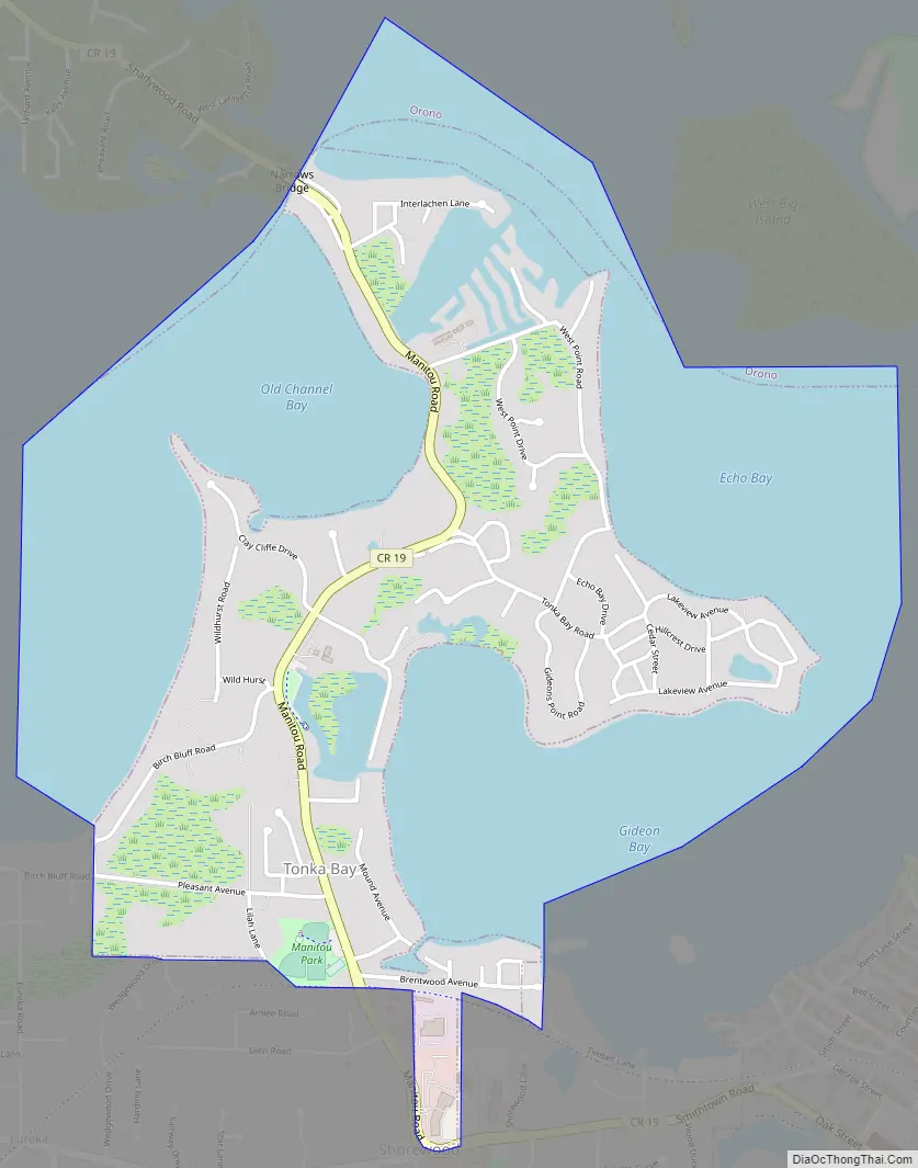
Tonka Bay Road Map
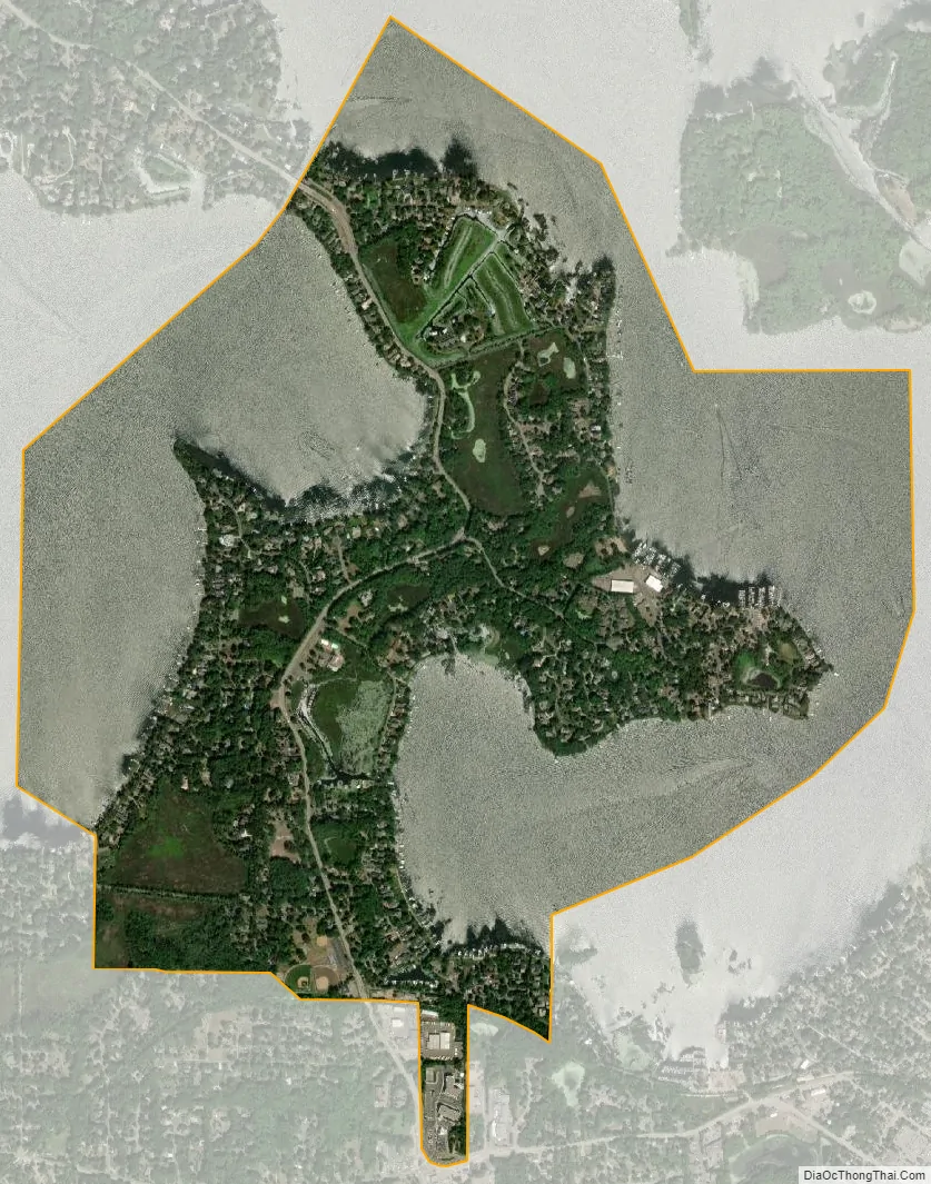
Tonka Bay city Satellite Map
Geography
According to the United States Census Bureau, the city has a total area of 0.99 square miles (2.56 km), of which 0.93 square miles (2.41 km) is land and 0.06 square miles (0.16 km) is water. Manitou Road serves as a main route.
See also
Map of Minnesota State and its subdivision:- Aitkin
- Anoka
- Becker
- Beltrami
- Benton
- Big Stone
- Blue Earth
- Brown
- Carlton
- Carver
- Cass
- Chippewa
- Chisago
- Clay
- Clearwater
- Cook
- Cottonwood
- Crow Wing
- Dakota
- Dodge
- Douglas
- Faribault
- Fillmore
- Freeborn
- Goodhue
- Grant
- Hennepin
- Houston
- Hubbard
- Isanti
- Itasca
- Jackson
- Kanabec
- Kandiyohi
- Kittson
- Koochiching
- Lac qui Parle
- Lake
- Lake of the Woods
- Lake Superior
- Le Sueur
- Lincoln
- Lyon
- Mahnomen
- Marshall
- Martin
- McLeod
- Meeker
- Mille Lacs
- Morrison
- Mower
- Murray
- Nicollet
- Nobles
- Norman
- Olmsted
- Otter Tail
- Pennington
- Pine
- Pipestone
- Polk
- Pope
- Ramsey
- Red Lake
- Redwood
- Renville
- Rice
- Rock
- Roseau
- Saint Louis
- Scott
- Sherburne
- Sibley
- Stearns
- Steele
- Stevens
- Swift
- Todd
- Traverse
- Wabasha
- Wadena
- Waseca
- Washington
- Watonwan
- Wilkin
- Winona
- Wright
- Yellow Medicine
- Alabama
- Alaska
- Arizona
- Arkansas
- California
- Colorado
- Connecticut
- Delaware
- District of Columbia
- Florida
- Georgia
- Hawaii
- Idaho
- Illinois
- Indiana
- Iowa
- Kansas
- Kentucky
- Louisiana
- Maine
- Maryland
- Massachusetts
- Michigan
- Minnesota
- Mississippi
- Missouri
- Montana
- Nebraska
- Nevada
- New Hampshire
- New Jersey
- New Mexico
- New York
- North Carolina
- North Dakota
- Ohio
- Oklahoma
- Oregon
- Pennsylvania
- Rhode Island
- South Carolina
- South Dakota
- Tennessee
- Texas
- Utah
- Vermont
- Virginia
- Washington
- West Virginia
- Wisconsin
- Wyoming


