Irvington, sometimes known as Irvington-on-Hudson, is a suburban village in the town of Greenburgh in Westchester County, New York, United States. It is located on the eastern bank of the Hudson River, 20 miles (32 km) north of midtown Manhattan in New York City, and is served by a station stop on the Metro-North Hudson Line. To the north of Irvington is the village of Tarrytown, to the south the village of Dobbs Ferry, and to the east unincorporated parts of Greenburgh, including East Irvington. Irvington includes within its boundaries the community of Ardsley-on-Hudson, which has its own ZIP code and Metro-North station, but which should not be confused with the nearby village of Ardsley.
The population of Irvington at the 2020 census was 6,652. Because many of Irvington’s residents – especially those in the upper income brackets – live in Irvington and work in New York City, the village has a reputation as a “commuter town” or a “bedroom community”.
The village’s half-mile-long (0.8 kilometers) Main Street area has been designated as a historic district by New York State and on January 15, 2014, was added to the National Register of Historic Places. In 2010, Westchester Magazine ranked Irvington as the “Best Place to Live in Westchester”.
| Name: | Irvington village |
|---|---|
| LSAD Code: | 47 |
| LSAD Description: | village (suffix) |
| State: | New York |
| County: | Westchester County |
| Elevation: | 125 ft (38 m) |
| Total Area: | 4.08 sq mi (10.57 km²) |
| Land Area: | 2.79 sq mi (7.23 km²) |
| Water Area: | 1.29 sq mi (3.34 km²) |
| Total Population: | 6,652 |
| Population Density: | 2,384.23/sq mi (920.66/km²) |
| ZIP code: | 10533 10503 (Ardsley-on-Hudson) |
| Area code: | 914 |
| FIPS code: | 3637803 |
| GNISfeature ID: | 0953803 |
| Website: | www.irvingtonny.gov |
Online Interactive Map
Click on ![]() to view map in "full screen" mode.
to view map in "full screen" mode.
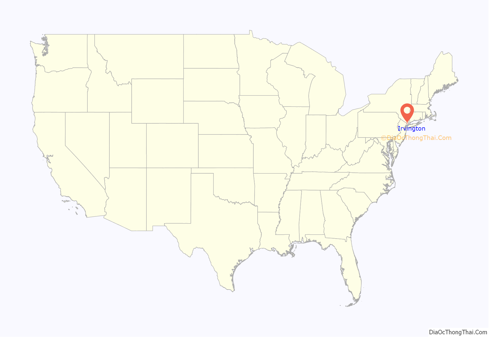
Irvington location map. Where is Irvington village?
History
Before the area where Irvington is now located was settled by Europeans, it was inhabited by the Wickquasgeck, a band of the Wappingers, related to the Lenape (Delaware) tribes which dominated lower New York state and New Jersey. The Wickquasgeck still lived in the area as late as 1775.
After the Dutch came to the area in the 1600s, the land was part of the Bisightick tract of the Adrian Van der Donck grant. Early settlers in the Irvington area were Stephen Ecker, Jan Harmes, Captain John Buckhout, and Barent Dutcher. The Van der Donck grant was purchased by Frederick Philipse in 1682, after the British had taken over the area in 1664. At first it was settled by tenant farmers, but by the 1700s, most of the settlers were artisans. The King’s Highway – later the Albany Post Road, and now Broadway – which connected New York City with Albany, was built through the settlement by the 1720s, which created a need for inns and taverns to supplement Odell’s Tavern, which was built in 1690.
In 1785, the state of New York confiscated the Phillipse’s land from his grandson, Frederick Philipse III, after he sided with the British in the American Revolution, and sold it to local patriot farmers who had been tenants of the Phillipse family. This is presumably how part of it came to be the farm of William Dutcher. Dutcher sold half of his farm to Justus Dearman in 1817, who then sold it to Gustavo F. Sacchi in 1848 for $26,000. Sacchi sold the parcel to John Jay – the grandson of the American Founding Father by the same name – that same year, and Jay laid it out as a village which he called “Dearman”, after Justus Dearman, and sold lots at auction in New York City starting on April 25, 1850.
The organization of the streets into a right-angled grid pattern was criticized by Andrew Jackson Downing, who was at the time the foremost expert on landscape design. Downing condemned the use of the street grid outside of cities and saw the hilly and heavily wooded site of Dearman as particularly suited to his own theories, which called for curvilinear roads and irregular lots which followed the contours of the land. With the frequent steamboat, stagecoach, and train transportation available, he felt that Dearman could have been an ideal suburb, instead of “mere rows of houses upon streets crossing each other at right angles and bordered with shade trees”.
The side streets off the village’s Main Street – or “Main Avenue”, as an 1868 map has it – were originally designated “A”, “B”, “C”, and so forth, but are today named after many of the area’s early settlers, such as Barent and William Dutcher, Captain John Buckhout (who lived to 103) and Wolfert Ecker (or “Acker”).
American Revolution
Wolfert Ecker’s house, then owned by Jacob van Tassel, was burned by the British in the Revolutionary War because it had become a notorious hang-out for American patriots. Washington Irving later wrote about it under the name of “Wolfert’s Roost” (“roost” meaning “rest”), and purchased and re-modeled another house on the land to become “Sunnyside”. Another early settler was Capt. Jan Harnse, and the Harnse-Conklin-Odell Tavern on Broadway was built in 1693 and became an inn in 1743. (See below) It was at Odell’s Tavern that the Committee of Safety, the executive committee of the legislature of the new State of New York, officially received the news that George Washington had lost the Battle of Long Island, and, later, British troops camped nearby, putting Jonathan Odell into custody in the Old Dutch Church in Sleepy Hollow. No major battles of the Revolutionary War were fought in the area, only minor skirmishes between residents and soldiers.
With the capture of New York City by the British, Irvington and the rest of southern Westchester County became the “Neutral ground”, an unofficial 30-mile (48 km) wide zone separating British-occupied territory from that held by the Americans, and the people of the area who remained – many of the Patriot population had fled – traded with both sides to great profit. However, there was also a great deal of pillaging and plundering, even of Tory households, both by the regular British army and loyalist militias and irregulars, all in the name of hunting down rebels. By the time the war was over, the countryside had been ravaged:
Eventually, the area recovered and continued to develop. The Hudson River Railroad reached the settlement on September 29, 1849; the first passengers on a regularly scheduled run through the village paid fifty cents to travel from Peekskill to Chambers Street in Manhattan on September 29, 1849. By 1853, a ferry ran across the Hudson from Dearman to Piermont on the west bank, the village had a population of around 600, a hotel, six stores, a lumber yard and around 50 houses, and the hamlet of “Abbotsford” – which would later become Ardsley-on-Hudson – was forming along Clinton Avenue.
A change of name
In 1854, Dearman and Abbotsford combined, and by popular vote adopted the name “Irvington”, to honor the American author Washington Irving, who was still alive at that time and living in nearby “Sunnyside” – which is today preserved as a museum. Influential residents of the village prevailed upon the Hudson River Railroad, which had reached the village by 1849, to change the name of the train station to “Irvington”, and also convinced the Postmaster to change the name of the local post office as well. It was thus under the name of “Irvington” that the village incorporated on April 16, 1872.
By the census of 1860, the population of the village was 599. A few years later, in 1863, Irvington was touched by the New York Draft Riots. Fearing that the violence in the city, which had to be put down by Federal troops, would spread to Westchester, special police were brought in and quartered in a schoolhouse on Sunnyside Lane. They were commanded by James Hamilton – the third son of Alexander Hamilton – whose estate, Nevis, was on South Broadway. The presence of this special force deterred any violence a group of draft protestors which passed through Greenburgh on their way to Tarrytown may have intended. This was the only instance in which Civil War-related activity directly affected Irvington.
With convenient rail transportation now available, the village’s cool summer breezes off the Hudson and the rural riparian setting began to attract wealthy residents of New York City – businessmen, politicians and professionals – to the area to buy up farms and build large summer residences on their new estates, setting a pattern which would hold until the early 20th century. Still, the village continued to expand, with various commercial enterprises opening along the waterfront. Pateman & Lockwood, a lumber, coal and building supply company, opened in the village in 1853, and Lord & Burnham, which built boilers and greenhouses, in 1856. Both expanded to newly created land across the railroad tracks, in 1889 and 1912 respectively, and the Cypress Lumber Company opened on a nearby site in 1909. Notwithstanding this commercial activity, for many years, through the 19th and early 20th centuries, Irvington was a relatively small community surrounded by numerous large estates and mansions where millionaires, aristocrats and captains of industry lived – the population was reported as 2,299 in 1890 and 2,013 in 1898.
After World War I, some of the bigger estates in the area were broken up into smaller lots, and were developed into communities inside the village, such as Jaffray Park, Matthiessen Park and Spiro Park. Many of the estates and mansions are now gone, but a small number still exist. After World War II, cooperative apartment complexes were built in the village, but despite these changes, Irvington still has many large houses, and is still an overwhelmingly well-heeled community.
Recent events
In June 2016, Irvington Fire Chief Christopher D. DePaoli was one of 23 recipients of the Carnegie Hero Fund Commission medal for heroism. In April 2015, DePaoli stepped in when he saw a woman being attacked by a man with a knife at the Irvington Metro-North Station. DePaoli was able get between the man and the woman, the man’s girlfriend, who was on the ground being stabbed, and distract him with a baseball bat until the police arrived. The man was arrested and the woman survived the attack.
Since 2014, Irvington has held a “Celebrate Irvington” festival on the village’s Main Street in the early summer.
Irvington’s first murder since 1974 took place on April 25, 2018, when a recently-hired dishwasher stabbed Bonifacio Rodriguez, a prep cook, in the kitchen of the River City Grille at 6 South Broadway. The accused woman, New York City resident Rosa Ramirez, told police when she was arrested shortly after the incident. that she had suffered a “psychotic break”. Ramirez pleaded guilty to second-degree murder, a Class A felony, on February 21, 2020, in return for an expected sentence of 17 years to life, which was made official in September 2020.
In May 2020, a lawsuit was filed against an 18 year old Irvington High School senior, Ellis Pinsky, who was accused with co-conspirators from the US and Europe of swindling digital currency investor Michael Terpin – the founder and chief executive officer of Transform Group – of $23.8 million in 2018, when the accused was 15 years old, through the use of data stolen from smartphones by “SIM swaps”. The complaint alleges that Pinsky had a personal worth of $70 million as of December 2017. The lawsuit was filed in federal court in White Plains, New York and asked for triple damages. An investigation by the New York Post revealed that Pinsky lived a lavish lifestyle, driving an Audi R8, maintaining an account with a private air service, purchasing prime tickets to New York Rangers hockey games, and wearing expensive clothing. Pinsky had previously been recognized by the College Board as being an “AP Scholar”.
Irvington Road Map
Irvington city Satellite Map
Geography
The village has a total area of 4.0 square miles (10 km), of which 2.8 square miles (7.3 km) or about 1,850 acres (750 ha) is land and 1.2 square miles (3.1 km), or 30.94%, is water.
The village’s main thoroughfare is Broadway (Route 9) originally an Indian footpath which gradually became a horse track and then a dirt road. It came to be called the “King’s Highway” around the time that it reached Albany. Later, it was called the “Queen’s Highway”, after Queen Anne, the “Highland Turnpike” after 1800 – a name still preserved in the nearby town of Ossining – the “Albany Post Road” and, after 1850, “Broadway”. The stretch that runs through Irvington was completed by 1723. During his tenure as Postmaster General, Benjamin Franklin had 3-foot-high (0.91 m) sandstone milestone markers placed along the Broadway, inscribed with the distance from New York City. Milestone #27 is still in place in Irvington, near the driveway to 30 South Broadway.
Broadway runs north-south parallel to the river, and connects Irvington to Dobbs Ferry in the south and Tarrytown in the north. All of the village’s major streets, including Main Street, extend east and west from Broadway, and are designated as such. Broadway is designated “North Broadway” above Main Street, and “South Broadway” below it. Main Street begins at the Metro-North train station, just off the Hudson River, and travels uphill to Broadway. Side streets off of Main, which were originally designated A Street, B Street, C Street, etc. when the village grid was laid out, now have names, most of which come from local history: Astor, Buckhout, Cottenet, Dutcher, Ecker, Ferris and Grinnell.
The southbound Saw Mill River Parkway can be reached via Harriman Road/Cyrus Field Road, past the village reservoir, or East Sunnyside Lane/Mountain Road through East Irvington. The northbound Saw Mill and the New York State Thruway are accessible via Ardsley, and the Mario Cuomo Bridge is nearby in Tarrytown.
Commuter train service to New York City is available at the Irvington and Ardsley-on-Hudson train stations, served by the Metro-North Railroad of the MTA. Bus service is provided on Broadway by the Westchester County Beeline Bus System via route #1T (The Bronx-Yonkers-Tarrytown) and #1W (The Bronx-Yonkers-White Plains).
As with all river communities in Westchester, Irvington is traversed by a stretch of the old Croton Aqueduct, about 3 miles (4.8 km) long, which is now part of the Old Croton Trailway State Park. The Aqueduct is a National Historic Landmark.
See also
Map of New York State and its subdivision:- Albany
- Allegany
- Bronx
- Broome
- Cattaraugus
- Cayuga
- Chautauqua
- Chemung
- Chenango
- Clinton
- Columbia
- Cortland
- Delaware
- Dutchess
- Erie
- Essex
- Franklin
- Fulton
- Genesee
- Greene
- Hamilton
- Herkimer
- Jefferson
- Kings
- Lake Ontario
- Lewis
- Livingston
- Madison
- Monroe
- Montgomery
- Nassau
- New York
- Niagara
- Oneida
- Onondaga
- Ontario
- Orange
- Orleans
- Oswego
- Otsego
- Putnam
- Queens
- Rensselaer
- Richmond
- Rockland
- Saint Lawrence
- Saratoga
- Schenectady
- Schoharie
- Schuyler
- Seneca
- Steuben
- Suffolk
- Sullivan
- Tioga
- Tompkins
- Ulster
- Warren
- Washington
- Wayne
- Westchester
- Wyoming
- Yates
- Alabama
- Alaska
- Arizona
- Arkansas
- California
- Colorado
- Connecticut
- Delaware
- District of Columbia
- Florida
- Georgia
- Hawaii
- Idaho
- Illinois
- Indiana
- Iowa
- Kansas
- Kentucky
- Louisiana
- Maine
- Maryland
- Massachusetts
- Michigan
- Minnesota
- Mississippi
- Missouri
- Montana
- Nebraska
- Nevada
- New Hampshire
- New Jersey
- New Mexico
- New York
- North Carolina
- North Dakota
- Ohio
- Oklahoma
- Oregon
- Pennsylvania
- Rhode Island
- South Carolina
- South Dakota
- Tennessee
- Texas
- Utah
- Vermont
- Virginia
- Washington
- West Virginia
- Wisconsin
- Wyoming
