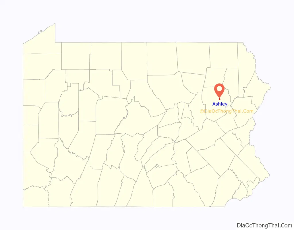
Ashley is a borough in Luzerne County, Pennsylvania, one mile (2 km) from Wilkes Barre. The population was 2,588 at the 2020 census.
| Name: | Ashley borough |
|---|---|
| LSAD Code: | 21 |
| LSAD Description: | borough (suffix) |
| State: | Pennsylvania |
| County: | Luzerne County |
| Elevation: | 627 ft (191 m) |
| Total Area: | 0.93 sq mi (2.42 km²) |
| Land Area: | 0.93 sq mi (2.42 km²) |
| Water Area: | 0.00 sq mi (0.00 km²) |
| Total Population: | 2,596 |
| Population Density: | 2,782.42/sq mi (1,073.86/km²) |
| Area code: | 570 |
| FIPS code: | 4203272 |
| Website: | www.ashleypa.net |
Online Interactive Map
Click on ![]() to view map in "full screen" mode.
to view map in "full screen" mode.
Ashley location map. Where is Ashley borough?
History
Ashley was first settled in 1830. Forty years later, in 1870, it was incorporated as a borough. It was a productive coal mining town well into the twentieth century, reaching its peak population of 7,039 in 1930. The Huber Breaker, built in 1939 to process coal from several local collieries, ceased operating in 1976, and was demolished in 2014.
Ashley Road Map
Ashley city Satellite Map
Geography
Ashley is located at 41°12′51″N 75°53′58″W / 41.21417°N 75.89944°W / 41.21417; -75.89944 (41.214182, -75.899387). According to the U.S. Census Bureau, the borough has a total area of 0.9 square miles (2.3 km), all land. Most of the homes and businesses are located in the northern and western sections of Ashley. Hanover Township encircles the borough. Ashley is served by the Hanover Area School District.
Transportation
Interstate 81 and Pennsylvania Route 309 pass through the eastern and southern portions of the town. NEPTA bus route 13 serves Ashley.
See also
Map of Pennsylvania State and its subdivision:- Adams
- Allegheny
- Armstrong
- Beaver
- Bedford
- Berks
- Blair
- Bradford
- Bucks
- Butler
- Cambria
- Cameron
- Carbon
- Centre
- Chester
- Clarion
- Clearfield
- Clinton
- Columbia
- Crawford
- Cumberland
- Dauphin
- Delaware
- Elk
- Erie
- Fayette
- Forest
- Franklin
- Fulton
- Greene
- Huntingdon
- Indiana
- Jefferson
- Juniata
- Lackawanna
- Lancaster
- Lawrence
- Lebanon
- Lehigh
- Luzerne
- Lycoming
- Mc Kean
- Mercer
- Mifflin
- Monroe
- Montgomery
- Montour
- Northampton
- Northumberland
- Perry
- Philadelphia
- Pike
- Potter
- Schuylkill
- Snyder
- Somerset
- Sullivan
- Susquehanna
- Tioga
- Union
- Venango
- Warren
- Washington
- Wayne
- Westmoreland
- Wyoming
- York
- Alabama
- Alaska
- Arizona
- Arkansas
- California
- Colorado
- Connecticut
- Delaware
- District of Columbia
- Florida
- Georgia
- Hawaii
- Idaho
- Illinois
- Indiana
- Iowa
- Kansas
- Kentucky
- Louisiana
- Maine
- Maryland
- Massachusetts
- Michigan
- Minnesota
- Mississippi
- Missouri
- Montana
- Nebraska
- Nevada
- New Hampshire
- New Jersey
- New Mexico
- New York
- North Carolina
- North Dakota
- Ohio
- Oklahoma
- Oregon
- Pennsylvania
- Rhode Island
- South Carolina
- South Dakota
- Tennessee
- Texas
- Utah
- Vermont
- Virginia
- Washington
- West Virginia
- Wisconsin
- Wyoming

