Belle Vernon is a borough in Fayette County, Pennsylvania, United States. It is situated along the Monongahela River, abutting two other counties, Westmoreland to the north and Washington across the river. As of the 2020 census, Belle Vernon had a population of 1,025.
“Bellevernon”, as it was originally spelled, was laid out in 1813 by Noah Speers in northwestern Fayette County. French for “beautiful green”, this was the name chosen by both Noah Speers for his little community on the Monongahela River and later by his son Louis, who founded a town with nearly the same name just up the hill (North Belle Vernon, Pennsylvania). Directly across the river lies the borough of Speers, anchoring the far side of the landmark I-70 bridge as the east bridge abutments lie in adjacent Rostraver Township.
| Name: | Belle Vernon borough |
|---|---|
| LSAD Code: | 21 |
| LSAD Description: | borough (suffix) |
| State: | Pennsylvania |
| County: | Fayette County |
| Total Area: | 0.33 sq mi (0.85 km²) |
| Land Area: | 0.26 sq mi (0.68 km²) |
| Water Area: | 0.07 sq mi (0.18 km²) |
| Total Population: | 1,024 |
| Population Density: | 3,923.37/sq mi (1,513.80/km²) |
| Area code: | 724 |
| FIPS code: | 4205288 |
Online Interactive Map
Click on ![]() to view map in "full screen" mode.
to view map in "full screen" mode.
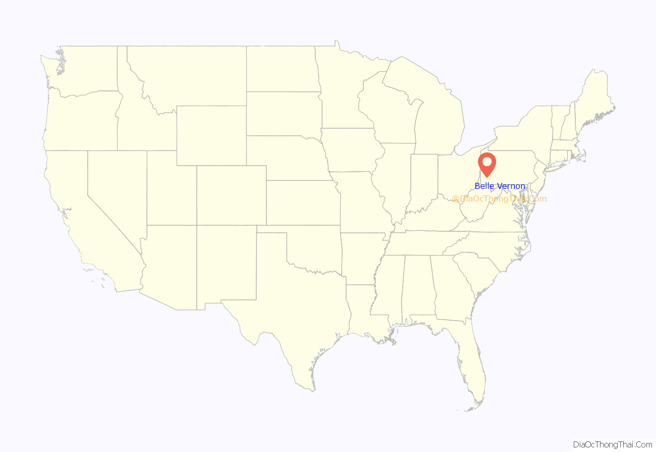
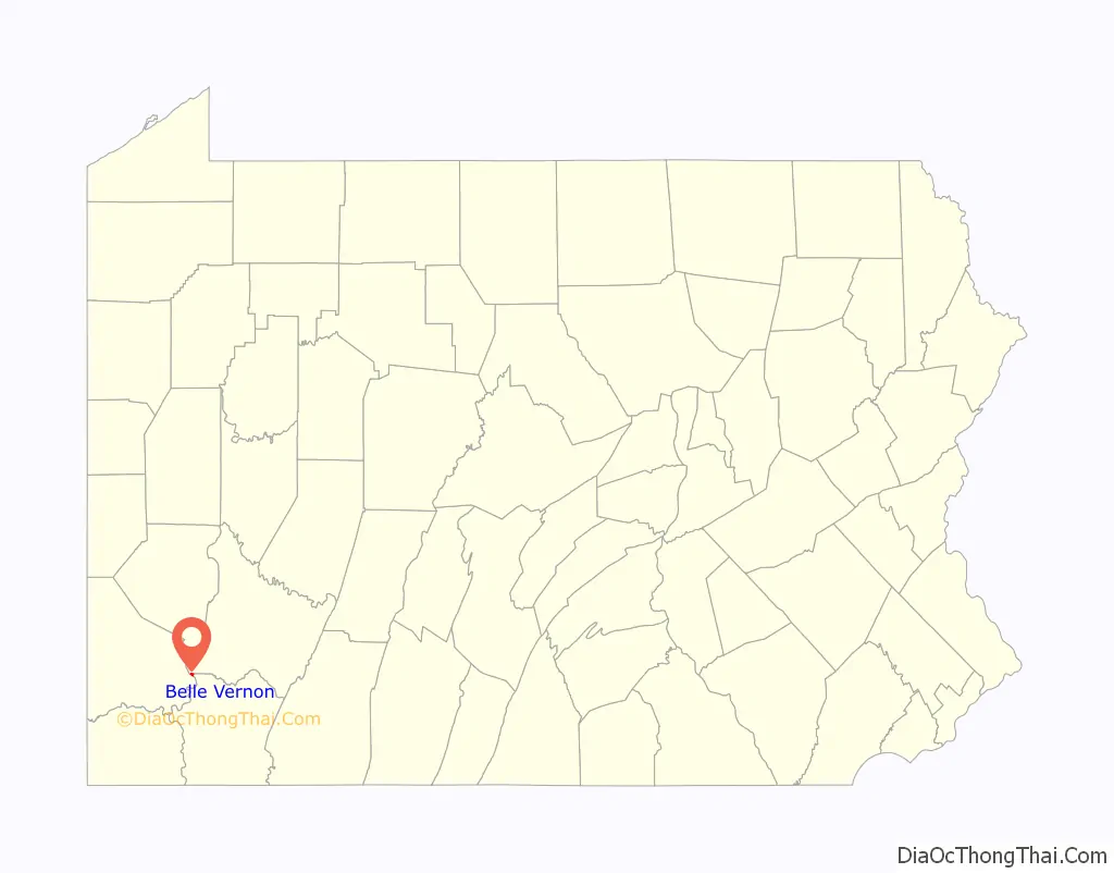
Belle Vernon location map. Where is Belle Vernon borough?
History
Noah Speers was the father of Louis M. Speers, born in a log cabin on the Speers homestead/Gibsonton farm in 1810. The younger Speers played a large role in the development of Belle Vernon. During his lifetime, the population grew to about 700, and there was a steam ferry connecting Belle Vernon with Allen Township across the river. The little hamlet boasted five dry goods stores, four groceries, two glasshouses with 87 employees, a boot and shoe, cabinet, chair, wagon, saddle/harness, blacksmith/tanning shops, and two sawmills. Louis Speers owned a sandbank outside of town which produced the best quality glass sand. He also owned a large coal works and a large boat yard with more than 50 employees. Louis resided on the northwest corner of Main and 2nd streets.
Boat hulls were built at his boatyard (owned in partnership with a man named Morgan Gaskill), located on 3rd Street in the 1830s and 1840s. Several steamboats are noted to have come from the yard, including the Minstrel, which in 1842 fell off its building docks killing one and injuring 10. The St. Anthony bound for Galena, Illinois, and the Cassandra headed to Knoxville, Tennessee, came from the Belle Vernon yard. Two boats bound for customers in Pittsburgh were the Alert and the Avalanche (1847).
In 1853, Mr. Speers built a sawmill with partner William Latta, a boat builder, below the mouth of Speers Run. It was destroyed by fire in 1877 and rebuilt by his son William F. Speers. William, who spent three months in Libby Prison during the Civil War, left the army after attaining the rank of lieutenant colonel. William went bankrupt soon after completing the new mill and sold it to the Belle Vernon Saw and Planing Company in 1880.
The small village of Speers across the river, laid out in 1860 by a kinsman, gets its name from the same family. North Belle Vernon, in Westmoreland County, was laid out in 1872 by Louis and was incorporated in 1876. Louis died two years later in 1878 and is buried at the Rehoboth Presbyterian Church Cemetery.
Samuel Dougherty, a carpenter, is claimed to have built the first dwelling in North Belle Vernon on Broad Avenue near Spring Alley. He was justice of the peace, council member, school director, and judge of election, all at the same time. The first two industries were a foundry in 1873 on Broad Avenue above Spring Alley and a flour mill on Speer Street in 1874. Most of these early buildings surrounded the intersection of Short Street and Broad Avenue. Lots were not sold until 1900 and the area beyond Arch Street then began to build up.
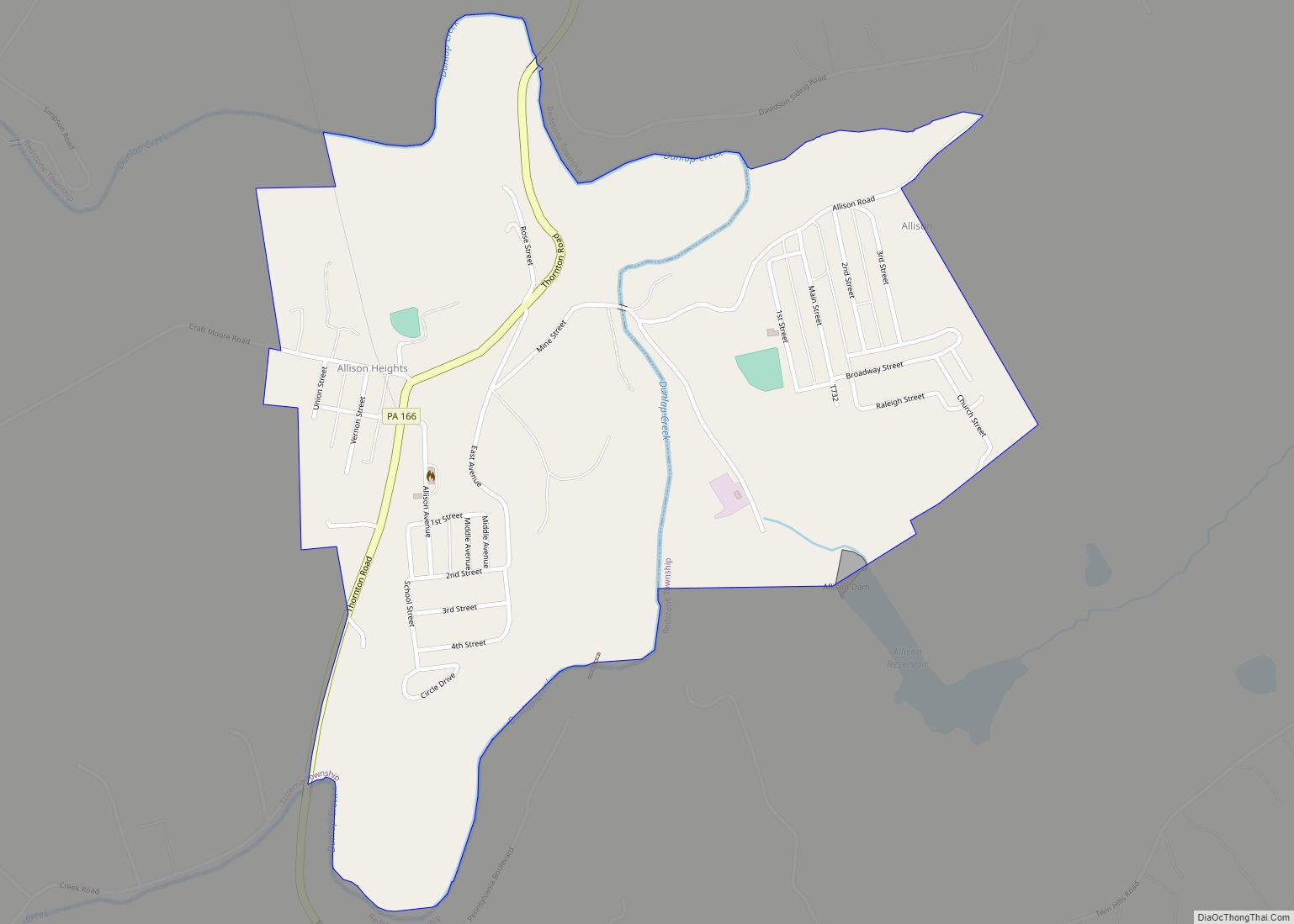
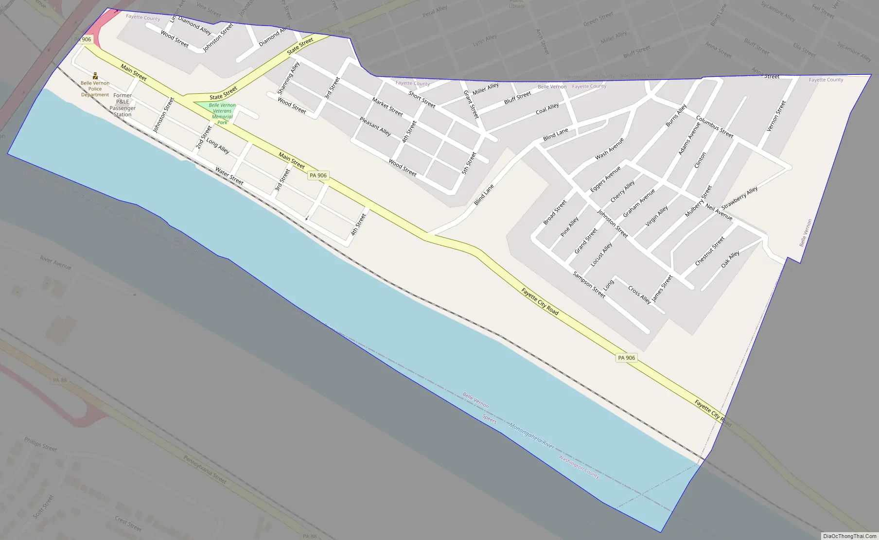
Belle Vernon Road Map
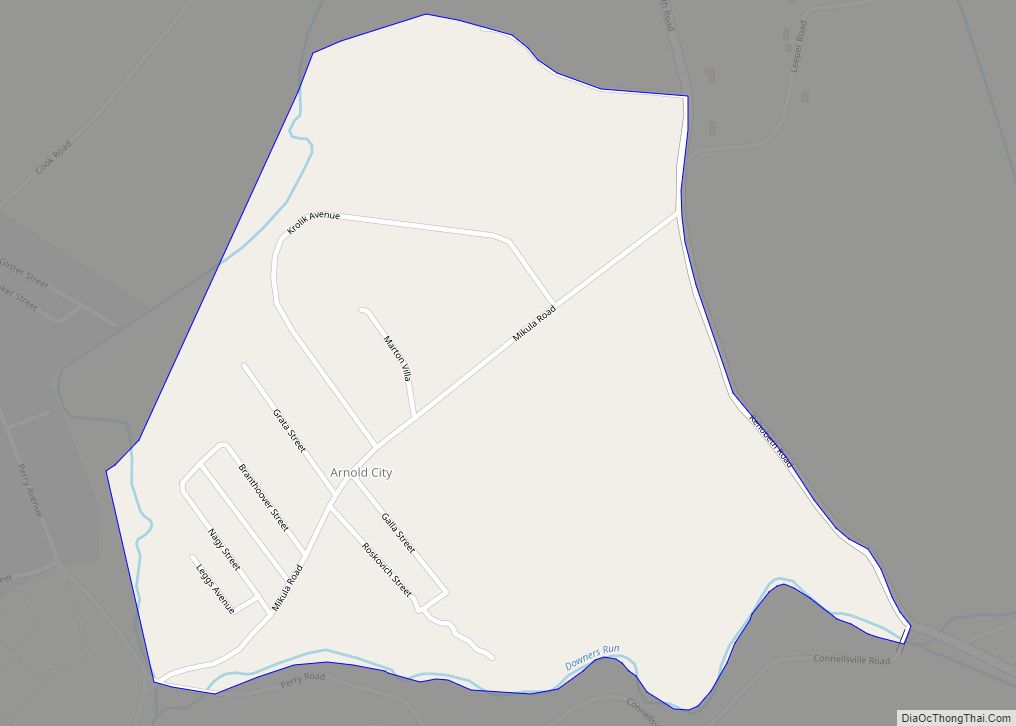
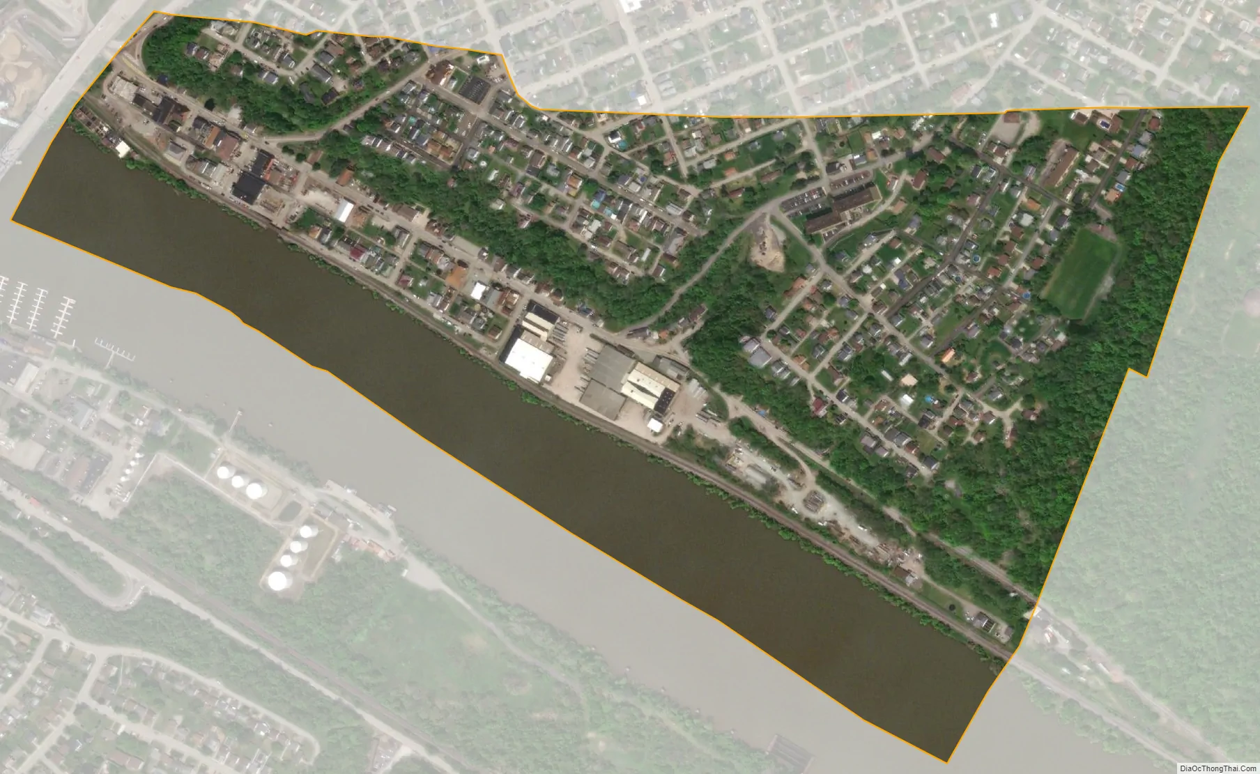
Belle Vernon city Satellite Map
Geography
Belle Vernon is located at 40°7′37″N 79°52′6″W / 40.12694°N 79.86833°W / 40.12694; -79.86833 (40.126936, -79.868285), nestled in the northwestern corner of Fayette County, with abutting borders on Washington County, to the west across the river, and Westmoreland County to the north.
According to the United States Census Bureau, the borough has a total area of 0.31 square miles (0.81 km), of which 0.25 square miles (0.65 km) is land and 0.07 square miles (0.17 km), or 20.29%, is water.
See also
Map of Pennsylvania State and its subdivision:- Adams
- Allegheny
- Armstrong
- Beaver
- Bedford
- Berks
- Blair
- Bradford
- Bucks
- Butler
- Cambria
- Cameron
- Carbon
- Centre
- Chester
- Clarion
- Clearfield
- Clinton
- Columbia
- Crawford
- Cumberland
- Dauphin
- Delaware
- Elk
- Erie
- Fayette
- Forest
- Franklin
- Fulton
- Greene
- Huntingdon
- Indiana
- Jefferson
- Juniata
- Lackawanna
- Lancaster
- Lawrence
- Lebanon
- Lehigh
- Luzerne
- Lycoming
- Mc Kean
- Mercer
- Mifflin
- Monroe
- Montgomery
- Montour
- Northampton
- Northumberland
- Perry
- Philadelphia
- Pike
- Potter
- Schuylkill
- Snyder
- Somerset
- Sullivan
- Susquehanna
- Tioga
- Union
- Venango
- Warren
- Washington
- Wayne
- Westmoreland
- Wyoming
- York
- Alabama
- Alaska
- Arizona
- Arkansas
- California
- Colorado
- Connecticut
- Delaware
- District of Columbia
- Florida
- Georgia
- Hawaii
- Idaho
- Illinois
- Indiana
- Iowa
- Kansas
- Kentucky
- Louisiana
- Maine
- Maryland
- Massachusetts
- Michigan
- Minnesota
- Mississippi
- Missouri
- Montana
- Nebraska
- Nevada
- New Hampshire
- New Jersey
- New Mexico
- New York
- North Carolina
- North Dakota
- Ohio
- Oklahoma
- Oregon
- Pennsylvania
- Rhode Island
- South Carolina
- South Dakota
- Tennessee
- Texas
- Utah
- Vermont
- Virginia
- Washington
- West Virginia
- Wisconsin
- Wyoming