Bellwood is a borough in Blair County, Pennsylvania, United States. It is part of the Altoona, PA Metropolitan Statistical Area. The population was at 1,829 as of the 2020 census.
| Name: | Bellwood borough |
|---|---|
| LSAD Code: | 21 |
| LSAD Description: | borough (suffix) |
| State: | Pennsylvania |
| County: | Blair County |
| Incorporated: | 1898 |
| Elevation: | 1,070 ft (330 m) |
| Total Area: | 0.48 sq mi (1.23 km²) |
| Land Area: | 0.48 sq mi (1.23 km²) |
| Water Area: | 0.00 sq mi (0.00 km²) |
| Total Population: | 1,827 |
| Population Density: | 3,838.24/sq mi (1,482.19/km²) |
| Area code: | 814 |
| FIPS code: | 4205384 |
| GNISfeature ID: | 1214940 |
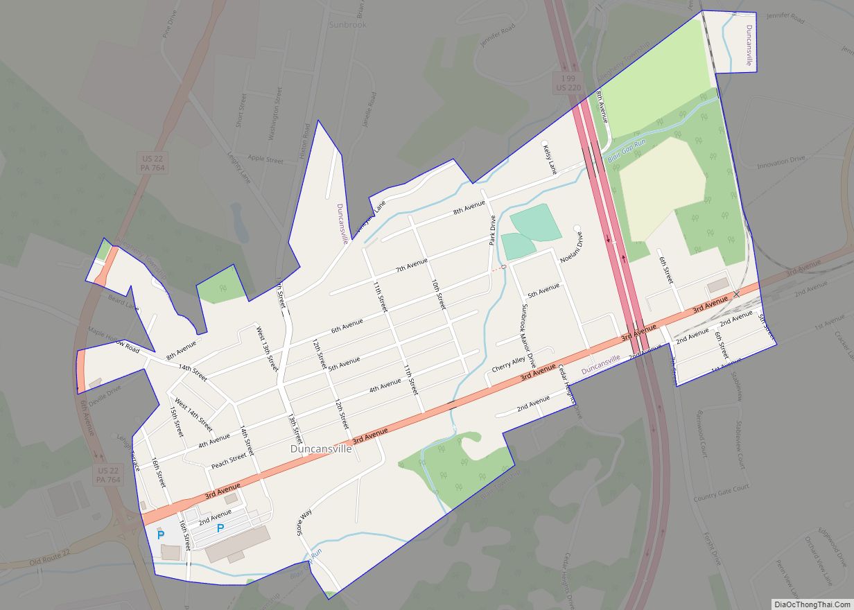
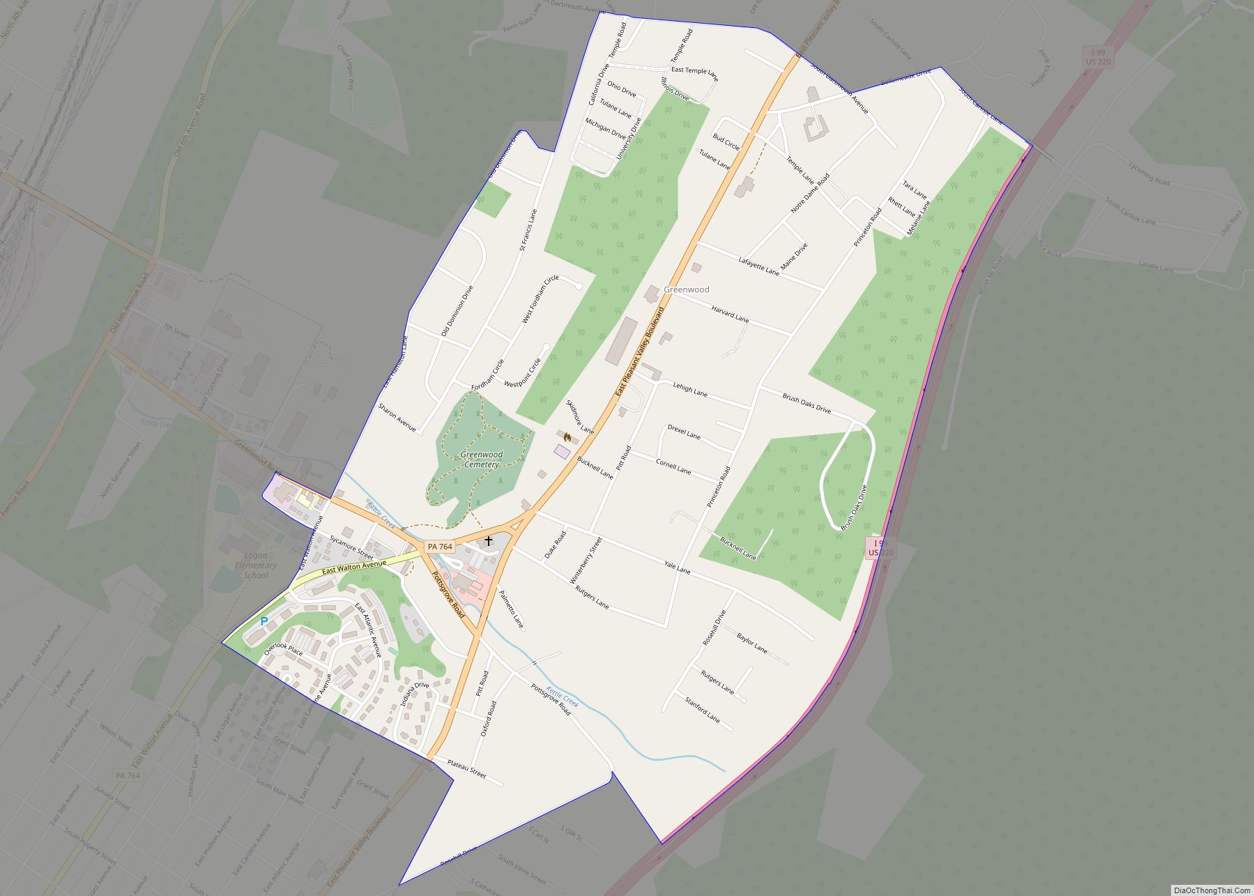
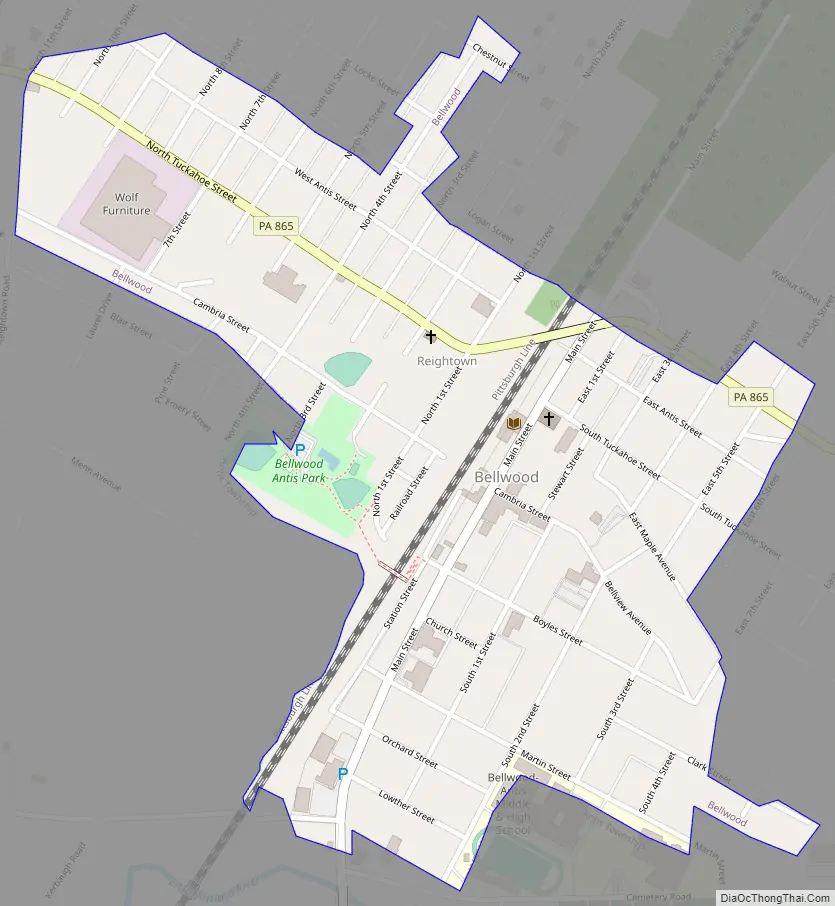
Online Interactive Map
Click on ![]() to view map in "full screen" mode.
to view map in "full screen" mode.
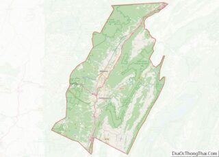
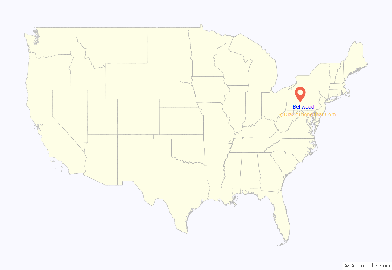
Bellwood location map. Where is Bellwood borough?
History
Bellwood’s first resident was Edward Bell who moved here with his wife, mother, and father John Bell in 1806. Edward Bell’s son, Martin Bell, founded the Sabbath Rest Foundry located in Antis Township (Pinecroft) so-called because he invented a new way to stoke the fires and leave them burn Sunday without having any person attend to them.
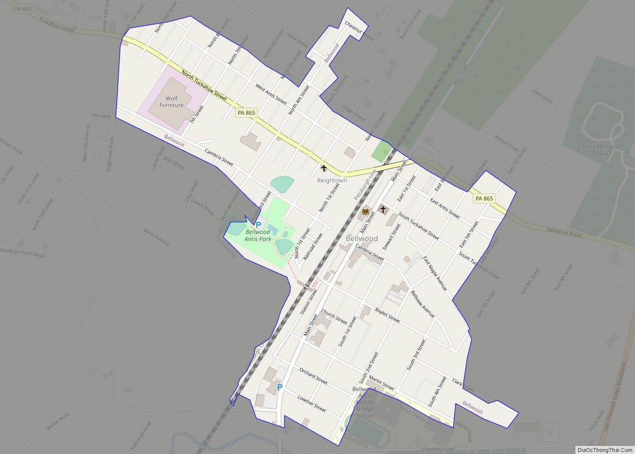
Bellwood Road Map
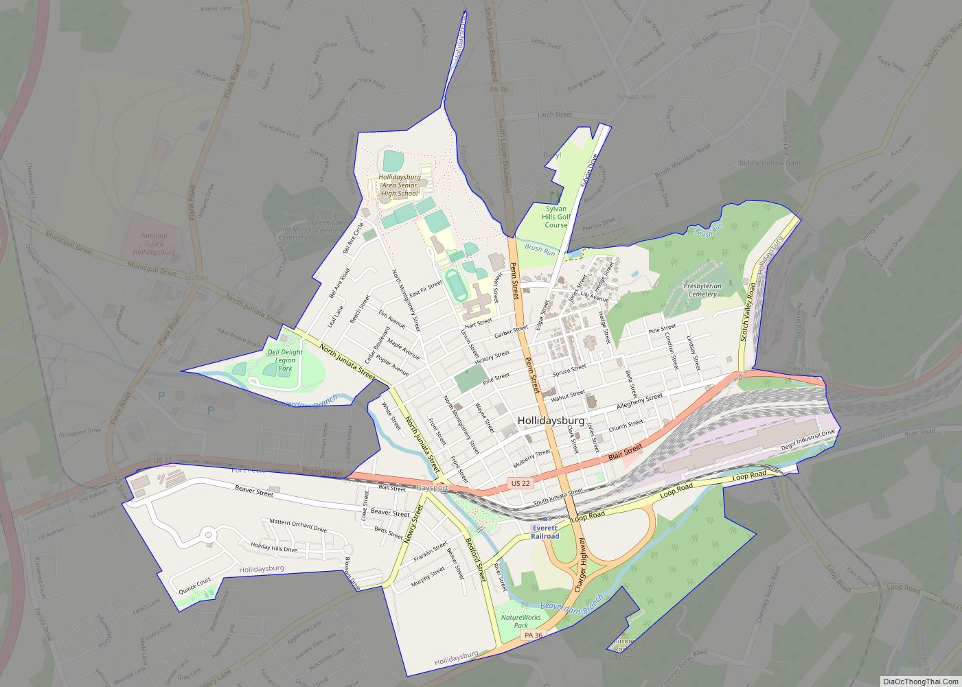
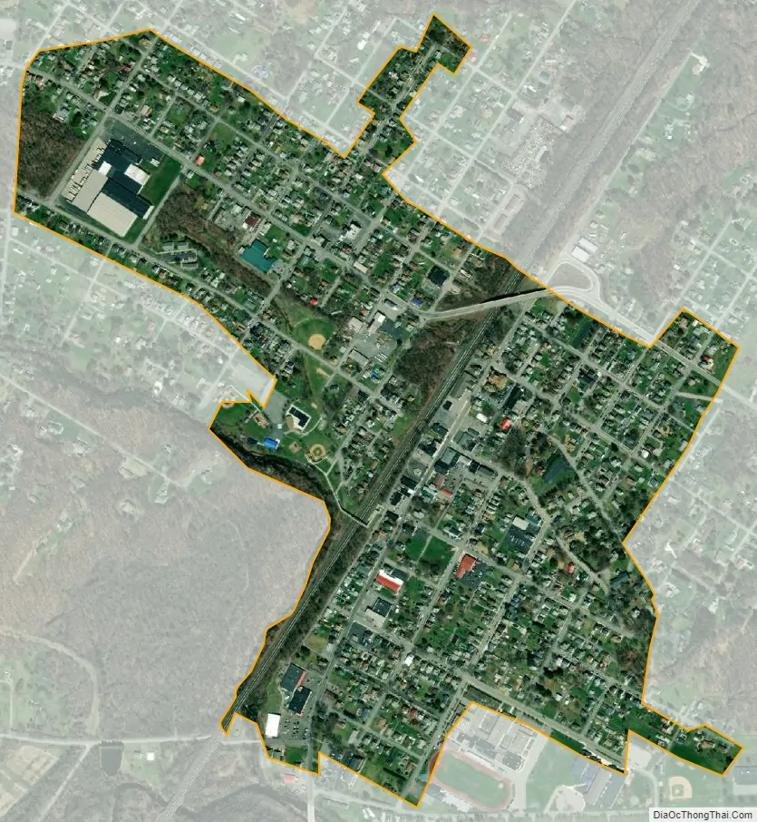
Bellwood city Satellite Map
Geography
Bellwood is located at 40°36′6″N 78°20′1″W / 40.60167°N 78.33361°W / 40.60167; -78.33361 (40.601566, -78.333616).
According to the United States Census Bureau, the borough has a total area of 0.5 square miles (1.3 km), all land. Bellwood is a rural area situated in the Tuckahoe Valley, part of the Logan Valley area. Bellwood was originally called Bell’s Mills. The Borough of Bellwood is surrounded by the Township of Antis.
See also
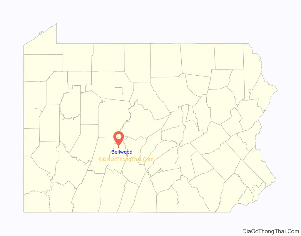
Map of Pennsylvania State and its subdivision:- Adams
- Allegheny
- Armstrong
- Beaver
- Bedford
- Berks
- Blair
- Bradford
- Bucks
- Butler
- Cambria
- Cameron
- Carbon
- Centre
- Chester
- Clarion
- Clearfield
- Clinton
- Columbia
- Crawford
- Cumberland
- Dauphin
- Delaware
- Elk
- Erie
- Fayette
- Forest
- Franklin
- Fulton
- Greene
- Huntingdon
- Indiana
- Jefferson
- Juniata
- Lackawanna
- Lancaster
- Lawrence
- Lebanon
- Lehigh
- Luzerne
- Lycoming
- Mc Kean
- Mercer
- Mifflin
- Monroe
- Montgomery
- Montour
- Northampton
- Northumberland
- Perry
- Philadelphia
- Pike
- Potter
- Schuylkill
- Snyder
- Somerset
- Sullivan
- Susquehanna
- Tioga
- Union
- Venango
- Warren
- Washington
- Wayne
- Westmoreland
- Wyoming
- York
- Alabama
- Alaska
- Arizona
- Arkansas
- California
- Colorado
- Connecticut
- Delaware
- District of Columbia
- Florida
- Georgia
- Hawaii
- Idaho
- Illinois
- Indiana
- Iowa
- Kansas
- Kentucky
- Louisiana
- Maine
- Maryland
- Massachusetts
- Michigan
- Minnesota
- Mississippi
- Missouri
- Montana
- Nebraska
- Nevada
- New Hampshire
- New Jersey
- New Mexico
- New York
- North Carolina
- North Dakota
- Ohio
- Oklahoma
- Oregon
- Pennsylvania
- Rhode Island
- South Carolina
- South Dakota
- Tennessee
- Texas
- Utah
- Vermont
- Virginia
- Washington
- West Virginia
- Wisconsin
- Wyoming