Bernville (Pennsylvania Dutch: Bannwill) is a borough in Berks County, Pennsylvania. The population was 955 at the 2010 census. Bernville is bordered by Penn Township to the north, east, and south and by Jefferson Township to the west.
| Name: | Bernville borough |
|---|---|
| LSAD Code: | 21 |
| LSAD Description: | borough (suffix) |
| State: | Pennsylvania |
| County: | Berks County |
| Elevation: | 328 ft (100 m) |
| Total Area: | 0.43 sq mi (1.12 km²) |
| Land Area: | 0.42 sq mi (1.10 km²) |
| Water Area: | 0.01 sq mi (0.02 km²) |
| Total Population: | 905 |
| Population Density: | 2,129.41/sq mi (823.00/km²) |
| ZIP code: | 19506 |
| Area code: | 610 |
| FIPS code: | 4205848 |
Online Interactive Map
Click on ![]() to view map in "full screen" mode.
to view map in "full screen" mode.
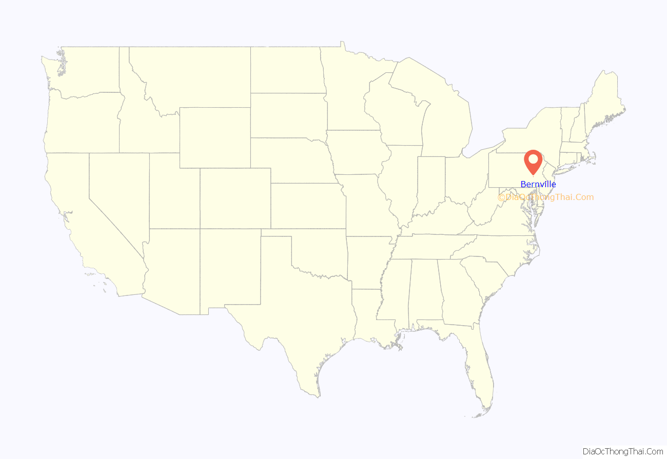
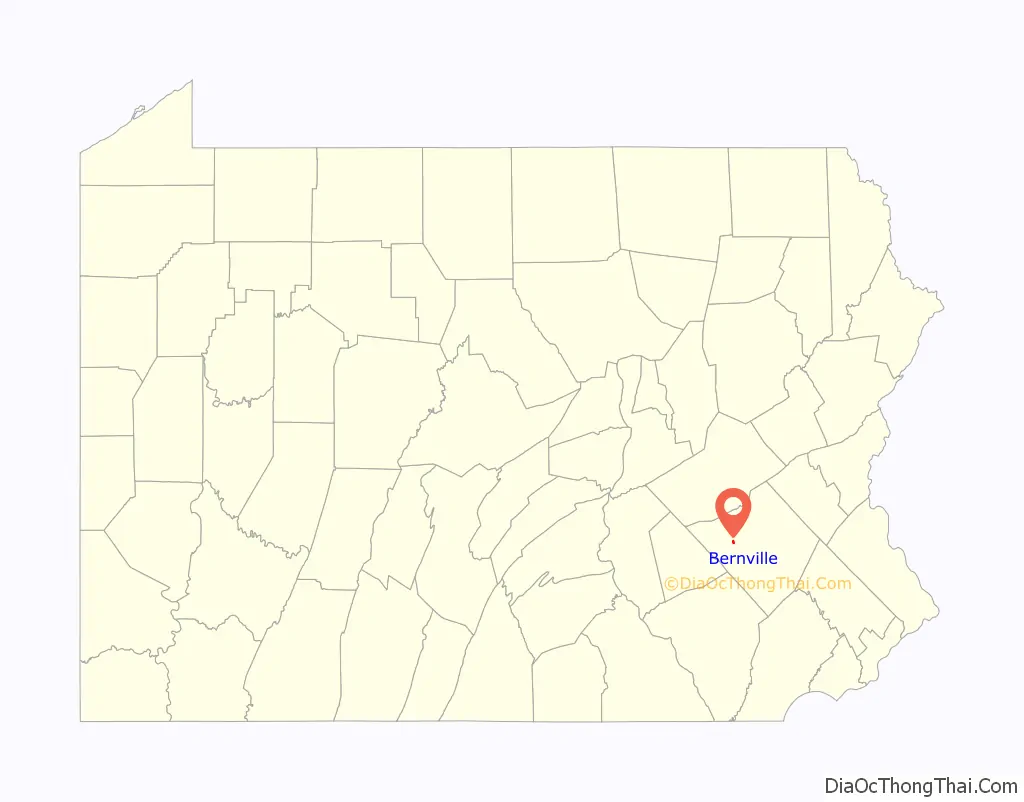
Bernville location map. Where is Bernville borough?
History
Before European settlers arrived in the Tulpehocken Creek valley, the area was inhabited by the Lenape people. In 1723, thirty-three Palatine families from Schoharie, New York, moved to the confluences of the Tulpehocken and Northkill Creeks. By 1735, a saw and grist mill was located three and a half miles up the Tulpehocken river from Bernville.
In 1737, Stephanus Umbenhauer immigrated from Bern, Switzerland, and purchased 220 acres (0.89 km) from Thomas Penn. In 1819, Stephanus’ grandson, Johann Thomas Umbenhauer, set aside 46 acres (190,000 m) to be divided into 62 lots. On 24 August 1819, Peter Bennethum bought the first six lots. In January 1820, the town was named Bernville after Stephanus’ birthplace. The first house was built by Philip Filbert in 1820. In 1828, the Union Canal was completed, connecting the Susquehanna and Schuylkill rivers. Union Canal guard lock #36 and Lock #36 with a lift of 5.0 feet (1.5 m) is located at the southwest corner of Bernville, near where Northkill Creek empties into Tulpehocken Creek. An historic marker on Route 183 states: “The canal, at this point, followed the north bank of the Tulpehocken. A dam, two locks, and a mule bridge made it possible for boats to cross Northkill Creek. Nearby were grist mills, a lime kiln, and a tannery.” Due to the proximity of the Bernville Locks and the town’s location on the canal, Bernville was a primary and prospering canal port.
In 1851, the village of Bernville, discontented with Penn Township’s road maintenance and community services, incorporated as a borough. The borough included the original 62 lots, most of which measured 60 by 260 feet (18 by 79 m). In 1884, the Union Canal closed. With no canal or railroad access, Bernville withered. In 1950, Bernville Borough annexed property from Penn Township at both ends of Main Street.
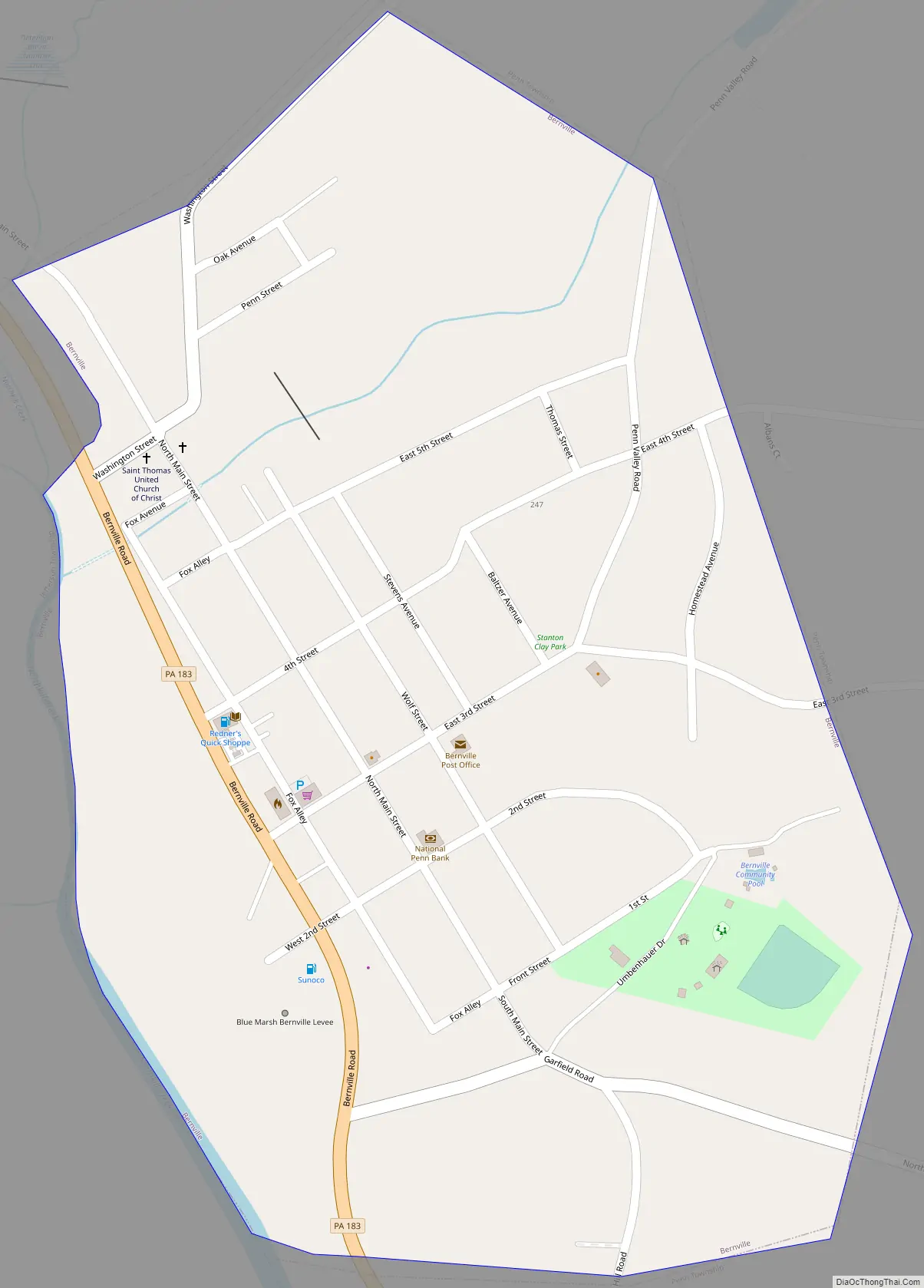
Bernville Road Map
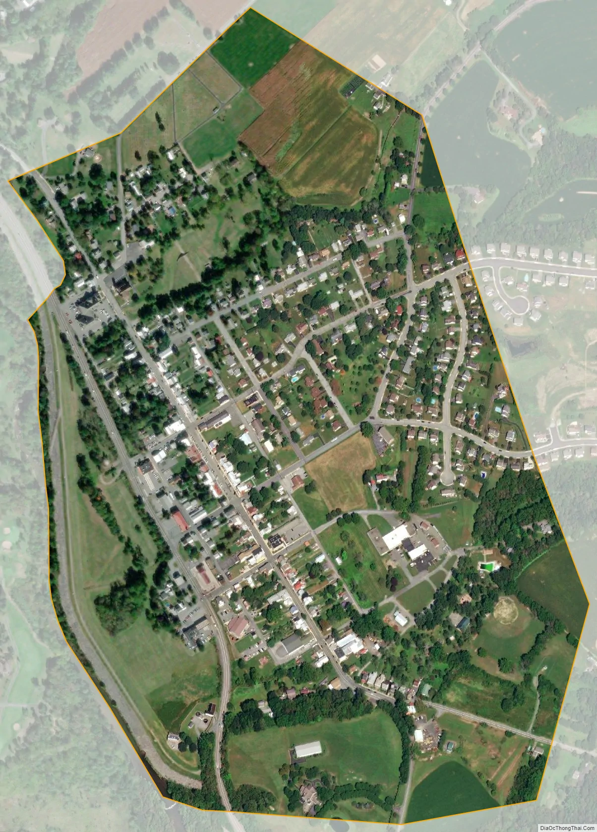
Bernville city Satellite Map
Geography
Bernville is located at 40°26′1″N 76°6′40″W / 40.43361°N 76.11111°W / 40.43361; -76.11111 (40.433742, -76.111039). According to the U.S. Census Bureau, the borough has a total area of 0.42 square miles (1.1 km), of which 0.008 square miles (0.02 km), or 1.52%, is water. The boundary with Jefferson Township is formed primarily by Northkill Creek, but diverges from the creek north of its confluence with Little Northkill Creek.
See also
Map of Pennsylvania State and its subdivision:- Adams
- Allegheny
- Armstrong
- Beaver
- Bedford
- Berks
- Blair
- Bradford
- Bucks
- Butler
- Cambria
- Cameron
- Carbon
- Centre
- Chester
- Clarion
- Clearfield
- Clinton
- Columbia
- Crawford
- Cumberland
- Dauphin
- Delaware
- Elk
- Erie
- Fayette
- Forest
- Franklin
- Fulton
- Greene
- Huntingdon
- Indiana
- Jefferson
- Juniata
- Lackawanna
- Lancaster
- Lawrence
- Lebanon
- Lehigh
- Luzerne
- Lycoming
- Mc Kean
- Mercer
- Mifflin
- Monroe
- Montgomery
- Montour
- Northampton
- Northumberland
- Perry
- Philadelphia
- Pike
- Potter
- Schuylkill
- Snyder
- Somerset
- Sullivan
- Susquehanna
- Tioga
- Union
- Venango
- Warren
- Washington
- Wayne
- Westmoreland
- Wyoming
- York
- Alabama
- Alaska
- Arizona
- Arkansas
- California
- Colorado
- Connecticut
- Delaware
- District of Columbia
- Florida
- Georgia
- Hawaii
- Idaho
- Illinois
- Indiana
- Iowa
- Kansas
- Kentucky
- Louisiana
- Maine
- Maryland
- Massachusetts
- Michigan
- Minnesota
- Mississippi
- Missouri
- Montana
- Nebraska
- Nevada
- New Hampshire
- New Jersey
- New Mexico
- New York
- North Carolina
- North Dakota
- Ohio
- Oklahoma
- Oregon
- Pennsylvania
- Rhode Island
- South Carolina
- South Dakota
- Tennessee
- Texas
- Utah
- Vermont
- Virginia
- Washington
- West Virginia
- Wisconsin
- Wyoming


