Birdsboro is a borough in Berks County, Pennsylvania, United States. It is located along the Schuylkill River 8 miles (13 km) southeast of Reading. As of the 2010 census, it had a population of 5,163. Birdsboro’s economy had historically been rooted in large foundries and machine shops, none of which remain in operation today.
| Name: | Birdsboro borough |
|---|---|
| LSAD Code: | 21 |
| LSAD Description: | borough (suffix) |
| State: | Pennsylvania |
| County: | Berks County |
| Elevation: | 207 ft (63 m) |
| Total Area: | 1.35 sq mi (3.51 km²) |
| Land Area: | 1.32 sq mi (3.43 km²) |
| Water Area: | 0.03 sq mi (0.08 km²) |
| Total Population: | 5,106 |
| Population Density: | 3,856.50/sq mi (1,488.88/km²) |
| ZIP code: | 19508 |
| Area code: | 610 |
| FIPS code: | 4206504 |
| Website: | www.birdsboropa.org |
Online Interactive Map
Click on ![]() to view map in "full screen" mode.
to view map in "full screen" mode.
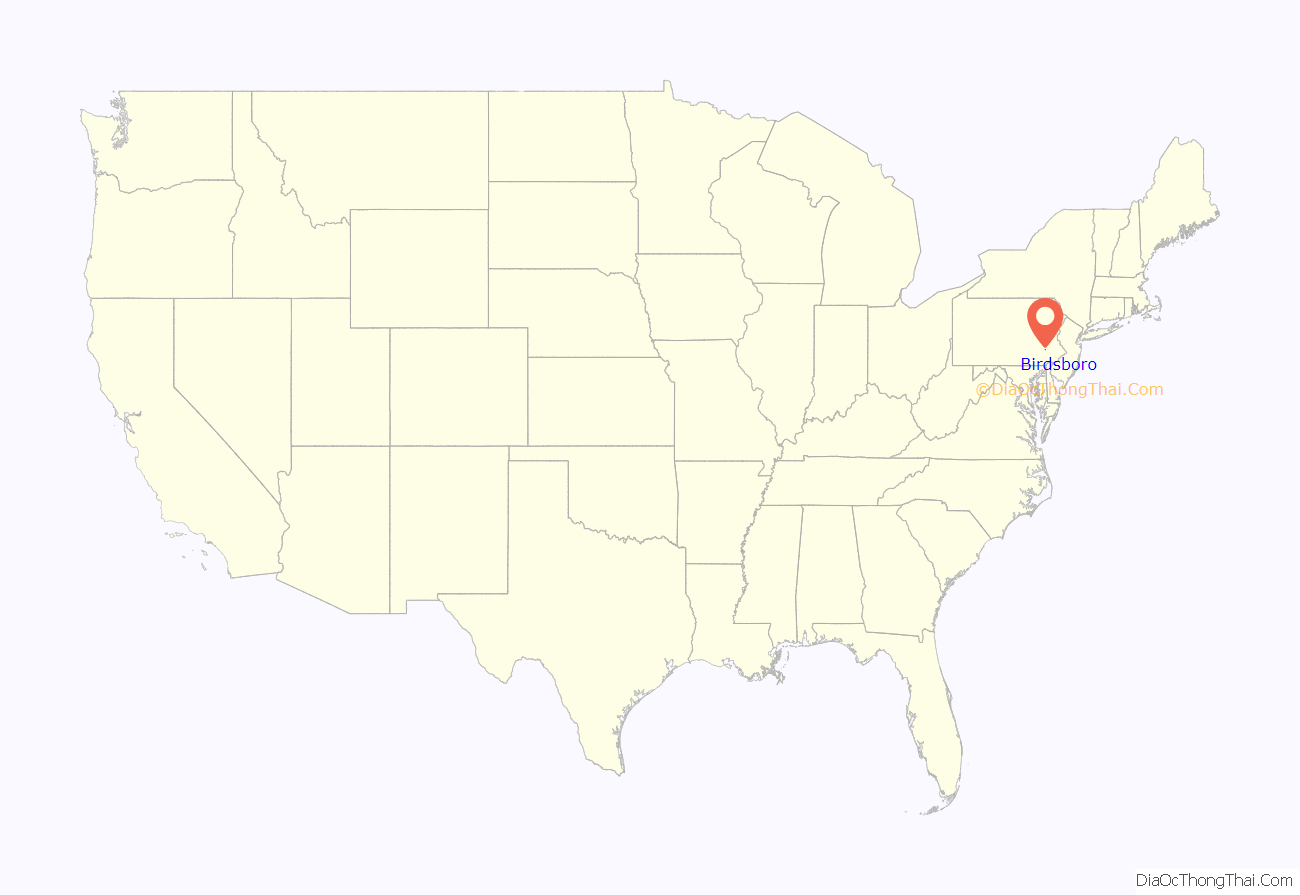
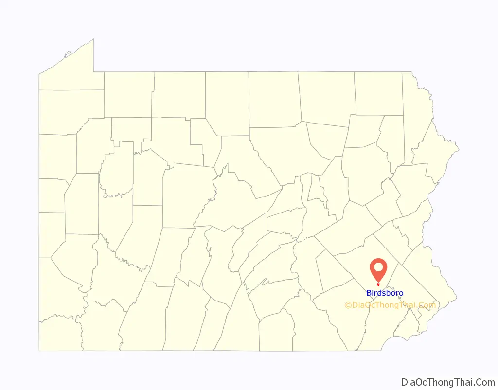
Birdsboro location map. Where is Birdsboro borough?
History
Birdsboro was named for ironmaker William Bird, who established a forge on Hay Creek about 1740. His son Marcus founded Hopewell Furnace in 1771, which was the largest domestic producer of iron by the time of the American Revolution. The Schuylkill Canal, running parallel to the river, was completed in 1827. The Philadelphia and Reading Railroad, constructed to haul anthracite coal, was completed in 1843. Edward and George Brooke, descendants of the Birds, established the Birdsboro Iron Foundry Company (1867), which became Birdsboro Steel Company (1905). The principal employer for 120 years, the steel plant closed in 1988, following a lengthy strike.
The borough was created in 1872, from sections of Union and Robeson townships. Its population increased slowly from 2,261 in 1890, to 2,264 in 1900, to 2,930 in 1910. The population was 5,064 at the 2000 census.
Armorcast Corporation built a plant in the borough in 1944, which manufactured tanks for World War II and the Korean War. The plant closed in 1988.
Suburban housing developments such as Mansion Heights, built on the hills overlooking the valley in the 1980s and 1990s, increased the borough’s population markedly. Still, the local Episcopal church closed in 2002, and the Roman Catholic parish built a new church and school outside the borough, in Douglassville, in 2005.
In 1987, torrential rains over a period of several days caused Hay Creek to flood parts of Pennsylvania Route 82, which ran through the borough at the time, and damaged the five bridges between Rock Hollow Road and Douglas Street. The bridge upstream from Douglas Street was repaired. However, after many years of discussion between local and state officials, the decision was finally made in 2004 that the remaining upstream bridges should not be rebuilt. For years, the area had been used as an informal walking trail. The former road connecting Birdsboro to Scarlet’s Mill is now used formally as a nature trail. In December 2008, the PA 82 designation was removed from this stretch of road. This area is now part of Hopewell Big Woods, which allows public access for hiking, fishing, hunting and other outdoor activities.
St. Michael’s Protestant Episcopal Church, Parish House and Rectory was listed on the National Register of Historic Places in 1982.
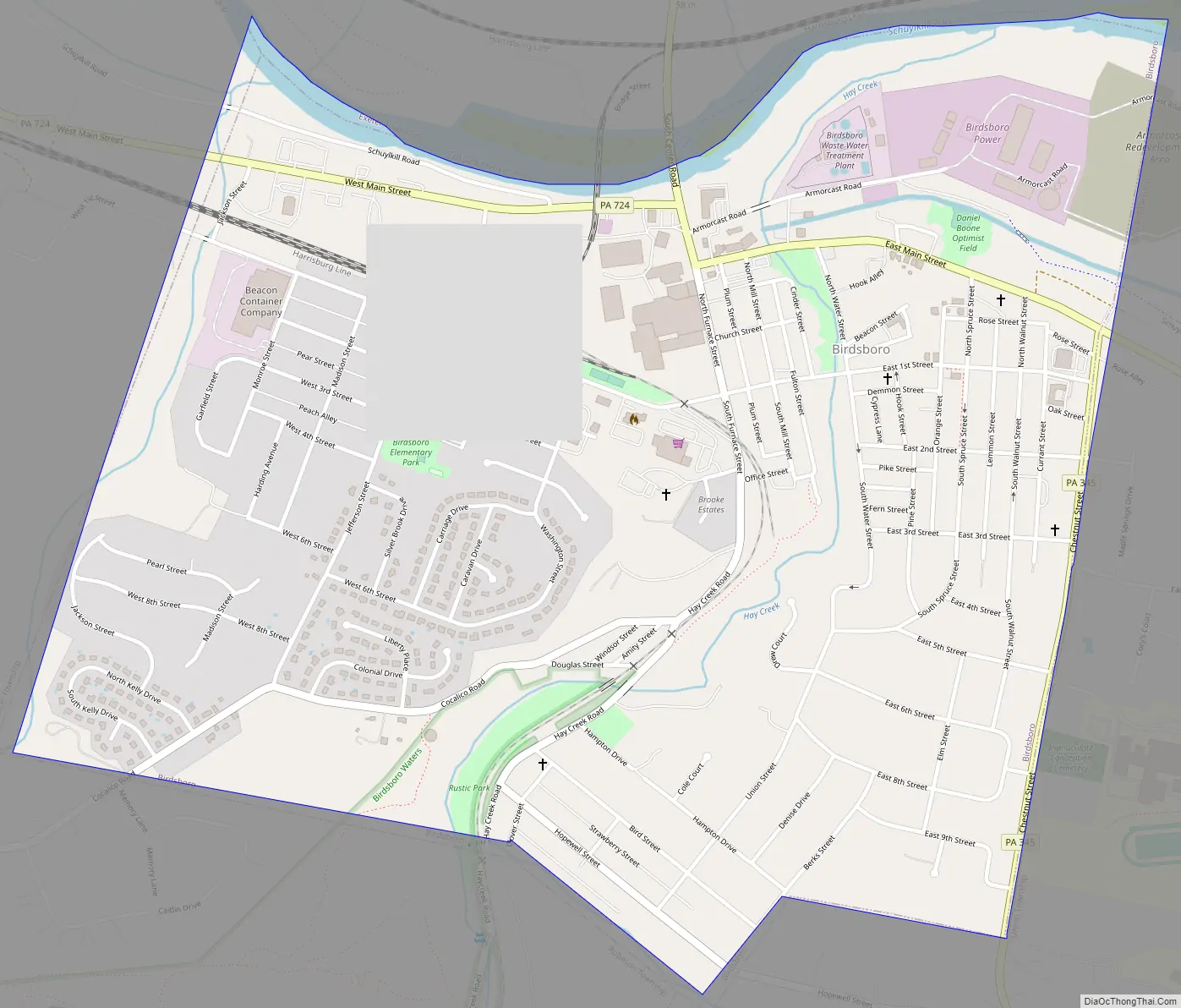
Birdsboro Road Map
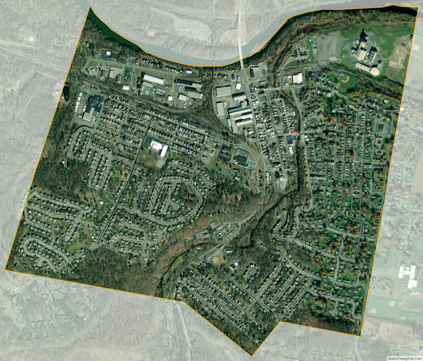
Birdsboro city Satellite Map
Geography
Birdsboro is located in southern Berks County at 40°15′47″N 75°48′28″W / 40.26306°N 75.80778°W / 40.26306; -75.80778 (40.263142, -75.807832). Its northern border is the Schuylkill River, with Exeter Township to the north. Union Township is to the east, and Robeson Township is to the south and west.
According to the U.S. Census Bureau, Birdsboro has a total area of 1.37 square miles (3.54 km), of which 1.34 square miles (3.46 km) is land and 0.03 square miles (0.08 km), or 2.27%, is water. Birdsboro is located on the northern edge of the Hopewell Big Woods, the largest area of contiguous forest in southeastern Pennsylvania.
Climate
The climate in this area is characterized by hot, humid summers and generally mild to cool winters. According to the Köppen Climate Classification system, Birdsboro has a humid subtropical climate, abbreviated “Cfa” on climate maps.
See also
Map of Pennsylvania State and its subdivision:- Adams
- Allegheny
- Armstrong
- Beaver
- Bedford
- Berks
- Blair
- Bradford
- Bucks
- Butler
- Cambria
- Cameron
- Carbon
- Centre
- Chester
- Clarion
- Clearfield
- Clinton
- Columbia
- Crawford
- Cumberland
- Dauphin
- Delaware
- Elk
- Erie
- Fayette
- Forest
- Franklin
- Fulton
- Greene
- Huntingdon
- Indiana
- Jefferson
- Juniata
- Lackawanna
- Lancaster
- Lawrence
- Lebanon
- Lehigh
- Luzerne
- Lycoming
- Mc Kean
- Mercer
- Mifflin
- Monroe
- Montgomery
- Montour
- Northampton
- Northumberland
- Perry
- Philadelphia
- Pike
- Potter
- Schuylkill
- Snyder
- Somerset
- Sullivan
- Susquehanna
- Tioga
- Union
- Venango
- Warren
- Washington
- Wayne
- Westmoreland
- Wyoming
- York
- Alabama
- Alaska
- Arizona
- Arkansas
- California
- Colorado
- Connecticut
- Delaware
- District of Columbia
- Florida
- Georgia
- Hawaii
- Idaho
- Illinois
- Indiana
- Iowa
- Kansas
- Kentucky
- Louisiana
- Maine
- Maryland
- Massachusetts
- Michigan
- Minnesota
- Mississippi
- Missouri
- Montana
- Nebraska
- Nevada
- New Hampshire
- New Jersey
- New Mexico
- New York
- North Carolina
- North Dakota
- Ohio
- Oklahoma
- Oregon
- Pennsylvania
- Rhode Island
- South Carolina
- South Dakota
- Tennessee
- Texas
- Utah
- Vermont
- Virginia
- Washington
- West Virginia
- Wisconsin
- Wyoming


