Boalsburg is an unincorporated community and census-designated place (CDP) in Harris Township, Centre County, Pennsylvania, United States. It is part of the State College, Pennsylvania Metropolitan Statistical Area. The population was 3,722 at the 2010 census. The village claims to be the birthplace of Memorial Day. However, that claim was brought into question by Bellware and Gardiner in their book, The Genesis of the Memorial Day Holiday in America, in 2014. In their book, Bellware and Gardiner point out that the Boalsburg story was first published in 1904, forty years after the fact with no indication that General Logan drew inspiration from any activities in Boalsburg and no evidence that it started the holiday.
| Name: | Boalsburg CDP |
|---|---|
| LSAD Code: | 57 |
| LSAD Description: | CDP (suffix) |
| State: | Pennsylvania |
| County: | Centre County |
| Elevation: | 1,105 ft (337 m) |
| Total Area: | 5.80 sq mi (15.03 km²) |
| Land Area: | 5.80 sq mi (15.02 km²) |
| Water Area: | 0.01 sq mi (0.01 km²) |
| Total Population: | 4,577 |
| Population Density: | 789.55/sq mi (304.82/km²) |
| ZIP code: | 16827 |
| Area code: | 814 |
| FIPS code: | 4207368 |
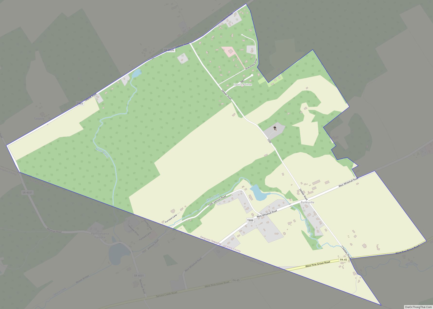
Online Interactive Map
Click on ![]() to view map in "full screen" mode.
to view map in "full screen" mode.
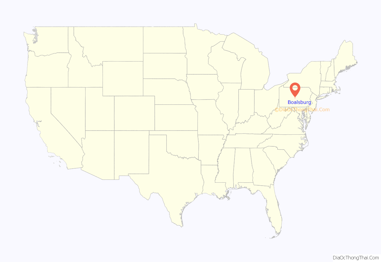
Boalsburg location map. Where is Boalsburg CDP?
History
The name “Boalsburg” comes from the Boal family who settled the region after emigrating from County Londonderry, Ireland. The fourth generation of the Boal family, Col. Theodore Davis Boal, married Mathilde de Lagarde whose mother’s sister Victoria married Diego Santiago Colón, a descendant of Christopher Columbus. Mathilde inherited a portion of her aunt Victoria’s estate in 1908 and brought the Columbus Chapel to the Boal Mansion from Spain in 1919 This inheritance included an admiral’s desk that family tradition says belonged to Columbus himself. The Columbus Chapel and Boal Mansion Museum are open to the public. Boalsburg originally was on the main road for travelers from Philadelphia to Pittsburgh, with the David Boal tavern that housed travelers still standing today. Boalsburg is home to the Pennsylvania Military Museum, as well as the headquarters of the Civil War reenacting unit, 3rd Pennsylvania Light Artillery Battery B.
The Boalsburg Historic District and Hill House were added to the National Register of Historic Places in 1977. The Boal Mansion was added the following year.
The town has a market square design known as ‘the Diamond’, a common design feature of towns in the northern province of Ulster in Ireland, the style of which was imported by emigrants from Ulster to Pennsylvania.
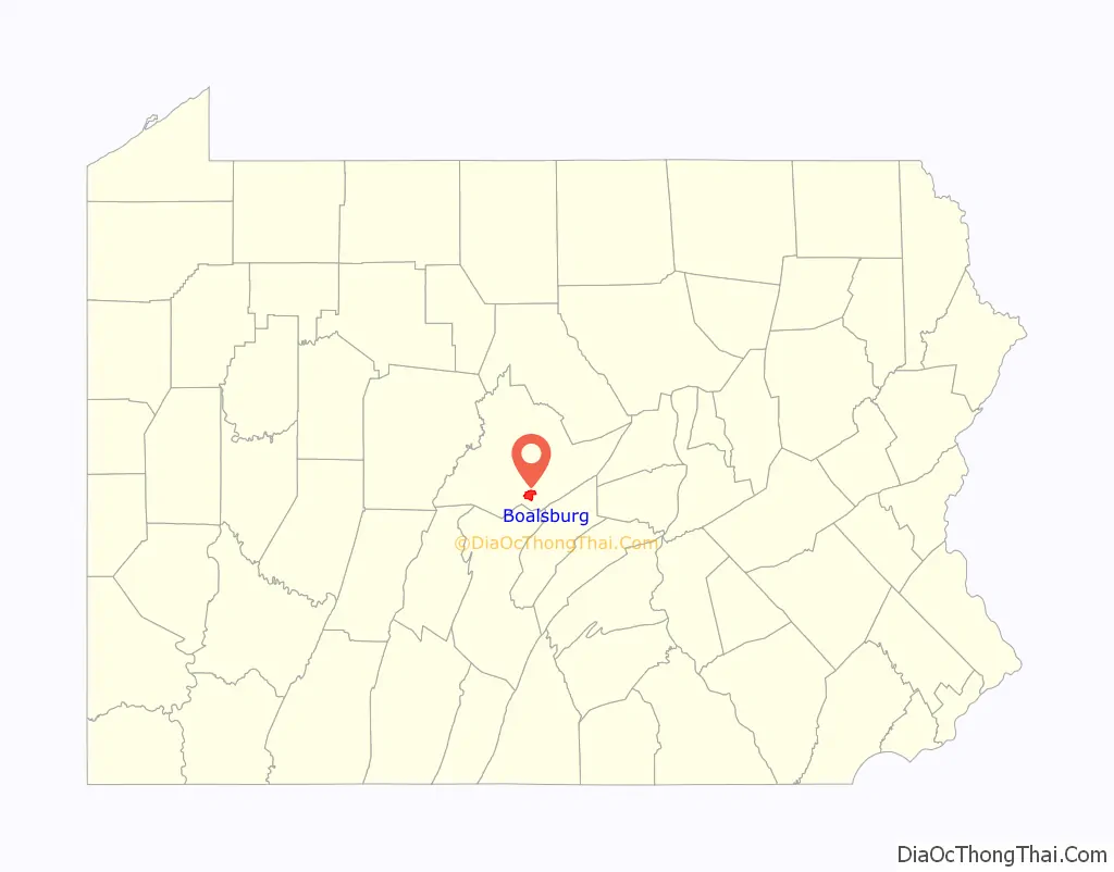
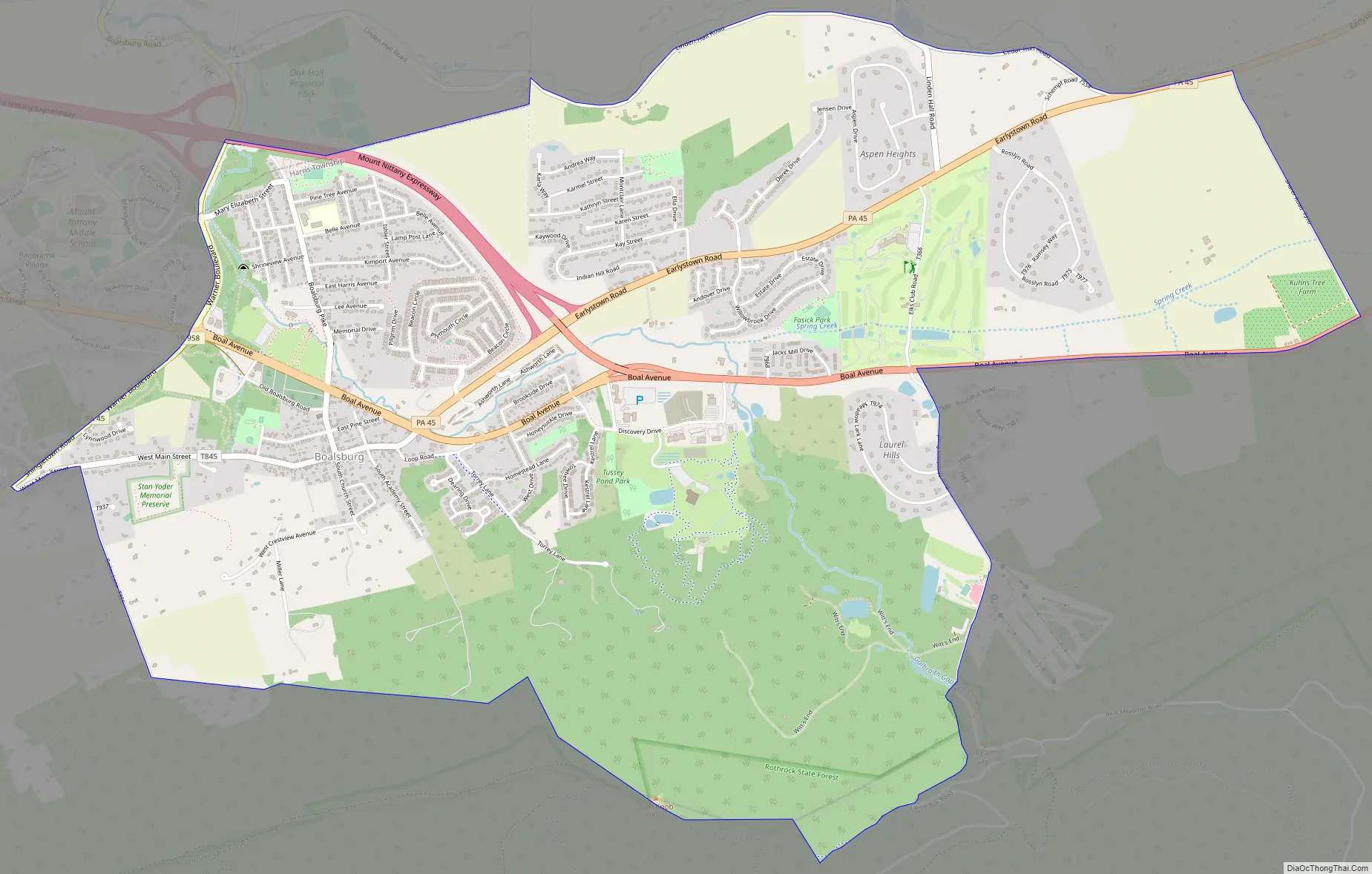
Boalsburg Road Map
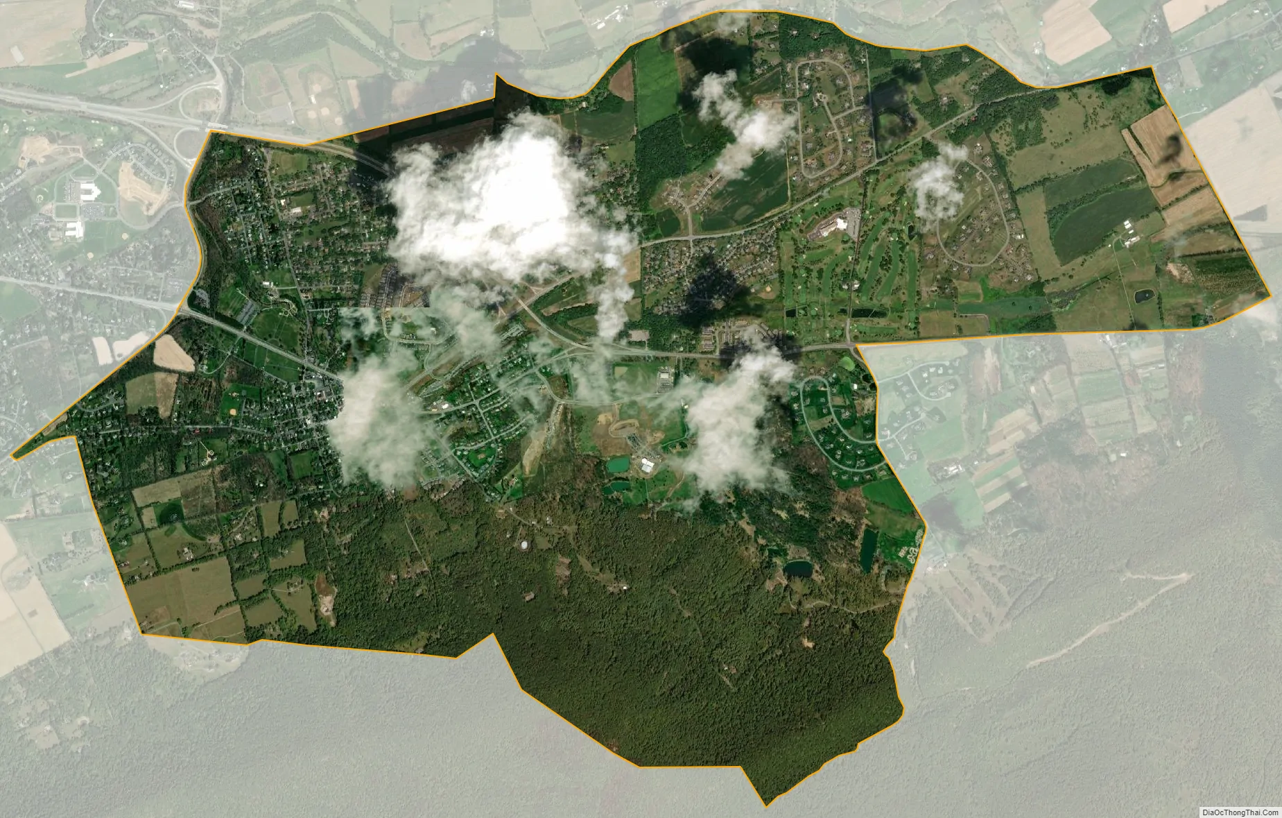
Boalsburg city Satellite Map
Geography
Boalsburg is located in southern Centre County at 40°46′58″N 77°47′13″W / 40.78278°N 77.78694°W / 40.78278; -77.78694 (40.782670, -77.786899). It occupies the central and northern sections of Harris Township and extends northwest slightly into College Township. It borders Rothrock State Forest.
According to the United States Census Bureau, the CDP has a total area of 5.8 square miles (15.0 km), all land. It is centered upon Pennsylvania Route 45 and Business U.S. Route 322. 322 begins as the Mount Nittany Expressway in the CDP and travels northwest from Boalsburg, bypassing State College to the east and north, while Business 322 begins as Boal Avenue and proceeds into the center of State College, 4 miles (6 km) northwest of Boalsburg, as Atherton Street. In the other direction US 322 leads east and then south 27 miles (43 km) to Lewistown.
Spring Creek flows northward through Boalsburg towards Bald Eagle Creek, a tributary of the West Branch Susquehanna River. The Tussey Mountain Ski Area is located on the eastern edge of Boalsburg.
See also
Map of Pennsylvania State and its subdivision:- Adams
- Allegheny
- Armstrong
- Beaver
- Bedford
- Berks
- Blair
- Bradford
- Bucks
- Butler
- Cambria
- Cameron
- Carbon
- Centre
- Chester
- Clarion
- Clearfield
- Clinton
- Columbia
- Crawford
- Cumberland
- Dauphin
- Delaware
- Elk
- Erie
- Fayette
- Forest
- Franklin
- Fulton
- Greene
- Huntingdon
- Indiana
- Jefferson
- Juniata
- Lackawanna
- Lancaster
- Lawrence
- Lebanon
- Lehigh
- Luzerne
- Lycoming
- Mc Kean
- Mercer
- Mifflin
- Monroe
- Montgomery
- Montour
- Northampton
- Northumberland
- Perry
- Philadelphia
- Pike
- Potter
- Schuylkill
- Snyder
- Somerset
- Sullivan
- Susquehanna
- Tioga
- Union
- Venango
- Warren
- Washington
- Wayne
- Westmoreland
- Wyoming
- York
- Alabama
- Alaska
- Arizona
- Arkansas
- California
- Colorado
- Connecticut
- Delaware
- District of Columbia
- Florida
- Georgia
- Hawaii
- Idaho
- Illinois
- Indiana
- Iowa
- Kansas
- Kentucky
- Louisiana
- Maine
- Maryland
- Massachusetts
- Michigan
- Minnesota
- Mississippi
- Missouri
- Montana
- Nebraska
- Nevada
- New Hampshire
- New Jersey
- New Mexico
- New York
- North Carolina
- North Dakota
- Ohio
- Oklahoma
- Oregon
- Pennsylvania
- Rhode Island
- South Carolina
- South Dakota
- Tennessee
- Texas
- Utah
- Vermont
- Virginia
- Washington
- West Virginia
- Wisconsin
- Wyoming