Bruin is a borough in Butler County, Pennsylvania, United States. The population was 524 at the 2010 census.
| Name: | Bruin borough |
|---|---|
| LSAD Code: | 21 |
| LSAD Description: | borough (suffix) |
| State: | Pennsylvania |
| County: | Butler County |
| Total Area: | 1.82 sq mi (4.73 km²) |
| Land Area: | 1.82 sq mi (4.73 km²) |
| Water Area: | 0.00 sq mi (0.00 km²) |
| Total Population: | 423 |
| Population Density: | 231.78/sq mi (89.51/km²) |
| Area code: | 724 |
| FIPS code: | 4209528 |
Online Interactive Map
Click on ![]() to view map in "full screen" mode.
to view map in "full screen" mode.
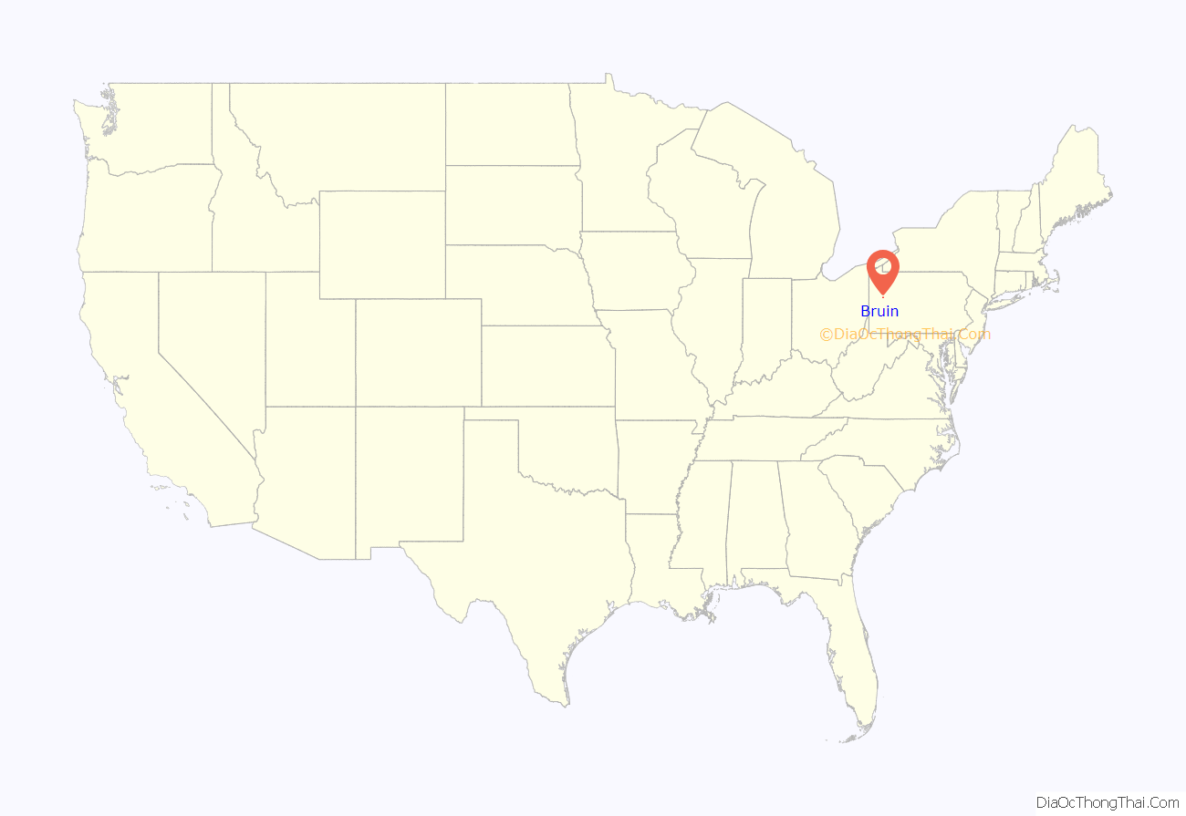
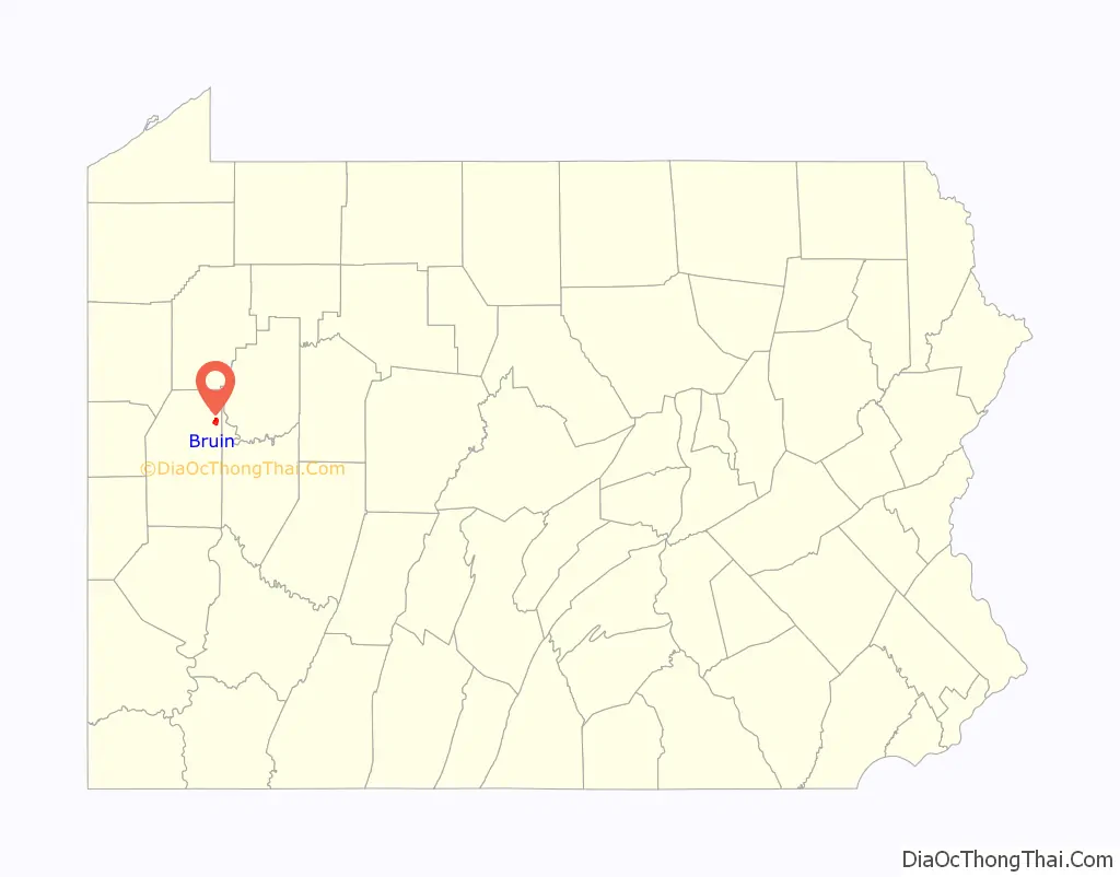
Bruin location map. Where is Bruin borough?
History
Among the early immigrants who settled in the area soon after the close of the Revolutionary War, were a number of north of Ireland families. In 1796, when the settlement of this section of Butler County began, several of these families migrated here, becoming the pioneers of the township. Among those said to have arrived in that year, embracing these north of Ireland families, were a few Germans and a number of native-born Pennsylvanians.
The land was first laid out and surveyed by John Martin in 1837 and was known as Martinsburg, then part of Parker Township. The name was later changed to Bruin. In 1841 Robert Black opened a store near Fletcher’s Mill and soon afterward Archibald Martin opened a hotel.
In 1872 came the tidal wave of oil operators, drillers, pumpers and torpedo men, the population rapidly increasing to 500 or more. The Connolly Brothers established a machine shop, and the Twohils opened another. W.J. Harshaw came after the oil discoveries and opened a general store. Woods & Markwell came in early. T.G. Campbell carried on business here for a number of years, and H.M. Caldwell and J.A. McKallip established a general store in 1877. In the fall of that year the decrease in oil production and the smallpox epidemic, which carried away five persons, almost depopulated the village and district. A small band of Indians continued to reside here for a number of years, and at intervals the fathers of the little tribe would revisit the settlements. The young Native men, many of whom were doubtless born in the area, frequently returned to hunt deer or panther. The borough was incorporated in 1901.
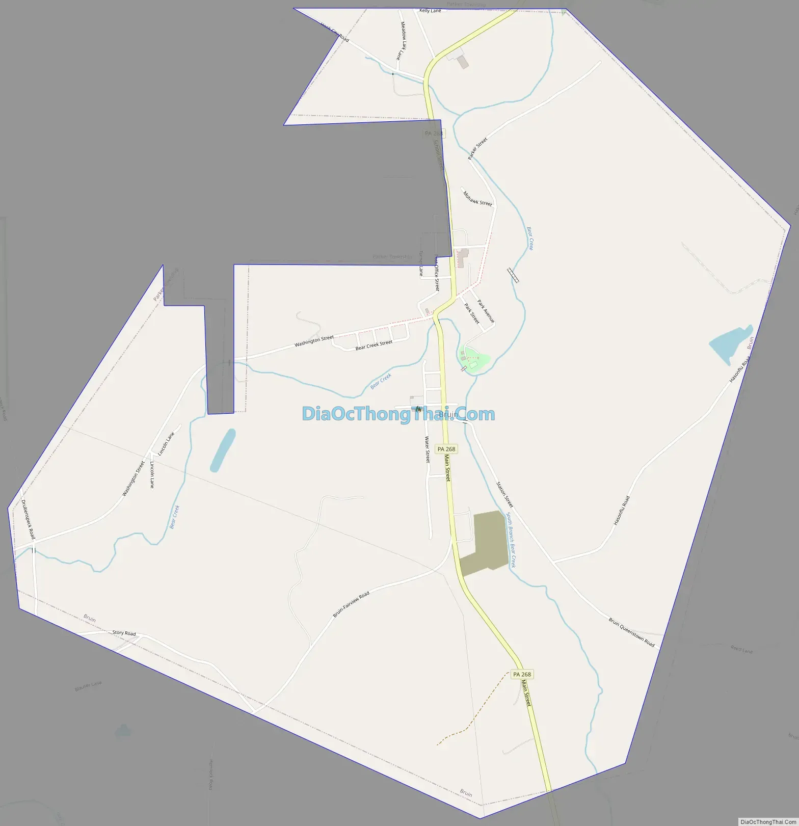
Bruin Road Map
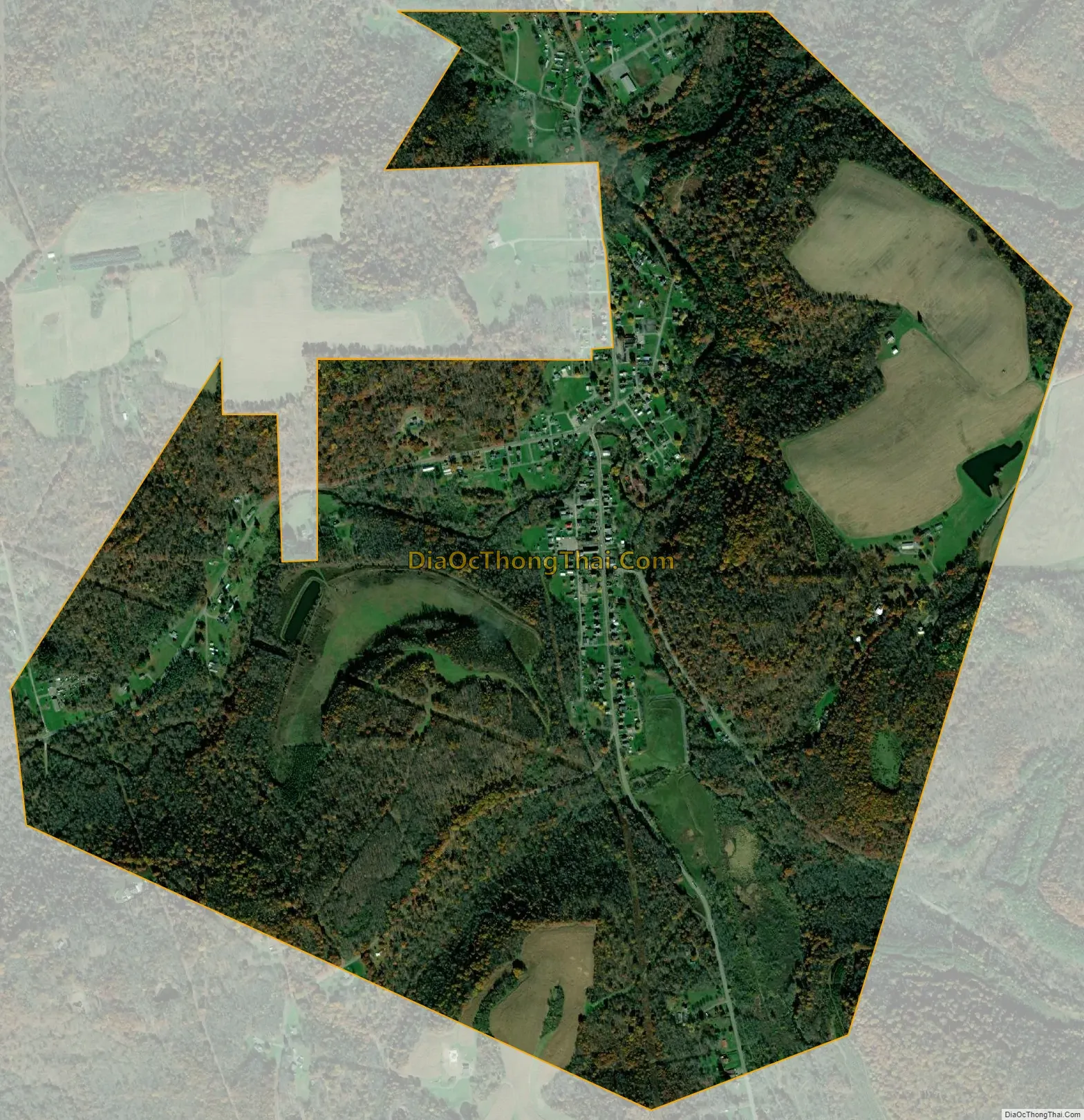
Bruin city Satellite Map
Geography
Bruin is located in northeastern Butler County in the valley of Bear Creek, a tributary of the Allegheny River. It is approximately 53 miles (85 km) north of Pittsburgh. The borough is surrounded by Parker Township but is separate from it. Pennsylvania Route 268 passes through the center of town, leading northeast 4 miles (6 km) to the city of Parker and south 3 miles (5 km) to Petrolia.
According to the United States Census Bureau, the borough of Bruin has a total area of 1.8 square miles (4.7 km), all land.
See also
Map of Pennsylvania State and its subdivision:- Adams
- Allegheny
- Armstrong
- Beaver
- Bedford
- Berks
- Blair
- Bradford
- Bucks
- Butler
- Cambria
- Cameron
- Carbon
- Centre
- Chester
- Clarion
- Clearfield
- Clinton
- Columbia
- Crawford
- Cumberland
- Dauphin
- Delaware
- Elk
- Erie
- Fayette
- Forest
- Franklin
- Fulton
- Greene
- Huntingdon
- Indiana
- Jefferson
- Juniata
- Lackawanna
- Lancaster
- Lawrence
- Lebanon
- Lehigh
- Luzerne
- Lycoming
- Mc Kean
- Mercer
- Mifflin
- Monroe
- Montgomery
- Montour
- Northampton
- Northumberland
- Perry
- Philadelphia
- Pike
- Potter
- Schuylkill
- Snyder
- Somerset
- Sullivan
- Susquehanna
- Tioga
- Union
- Venango
- Warren
- Washington
- Wayne
- Westmoreland
- Wyoming
- York
- Alabama
- Alaska
- Arizona
- Arkansas
- California
- Colorado
- Connecticut
- Delaware
- District of Columbia
- Florida
- Georgia
- Hawaii
- Idaho
- Illinois
- Indiana
- Iowa
- Kansas
- Kentucky
- Louisiana
- Maine
- Maryland
- Massachusetts
- Michigan
- Minnesota
- Mississippi
- Missouri
- Montana
- Nebraska
- Nevada
- New Hampshire
- New Jersey
- New Mexico
- New York
- North Carolina
- North Dakota
- Ohio
- Oklahoma
- Oregon
- Pennsylvania
- Rhode Island
- South Carolina
- South Dakota
- Tennessee
- Texas
- Utah
- Vermont
- Virginia
- Washington
- West Virginia
- Wisconsin
- Wyoming


