Chalfont is a borough with home rule status in Bucks County, Pennsylvania. The population was 4,009 at the 2010 census. The borough is served by SEPTA Regional Rail’s Lansdale/Doylestown Line at Chalfont station.
Chalfont is named after Chalfont St Giles in Buckinghamshire, England. Chalfont was the home of William Penn’s first wife, and William Penn is buried at Jordans Quaker Meeting House near Chalfont St Giles.
| Name: | Chalfont borough |
|---|---|
| LSAD Code: | 21 |
| LSAD Description: | borough (suffix) |
| State: | Pennsylvania |
| County: | Bucks County |
| Elevation: | 272 ft (83 m) |
| Total Area: | 1.64 sq mi (4.24 km²) |
| Land Area: | 1.62 sq mi (4.19 km²) |
| Water Area: | 0.02 sq mi (0.05 km²) |
| Total Population: | 4,253 |
| Population Density: | 2,628.55/sq mi (1,014.63/km²) |
| ZIP code: | 18914 |
| Area code: | 215, 267 and 445 |
| FIPS code: | 4212504 |
| Website: | www.chalfontborough.com |
Online Interactive Map
Click on ![]() to view map in "full screen" mode.
to view map in "full screen" mode.
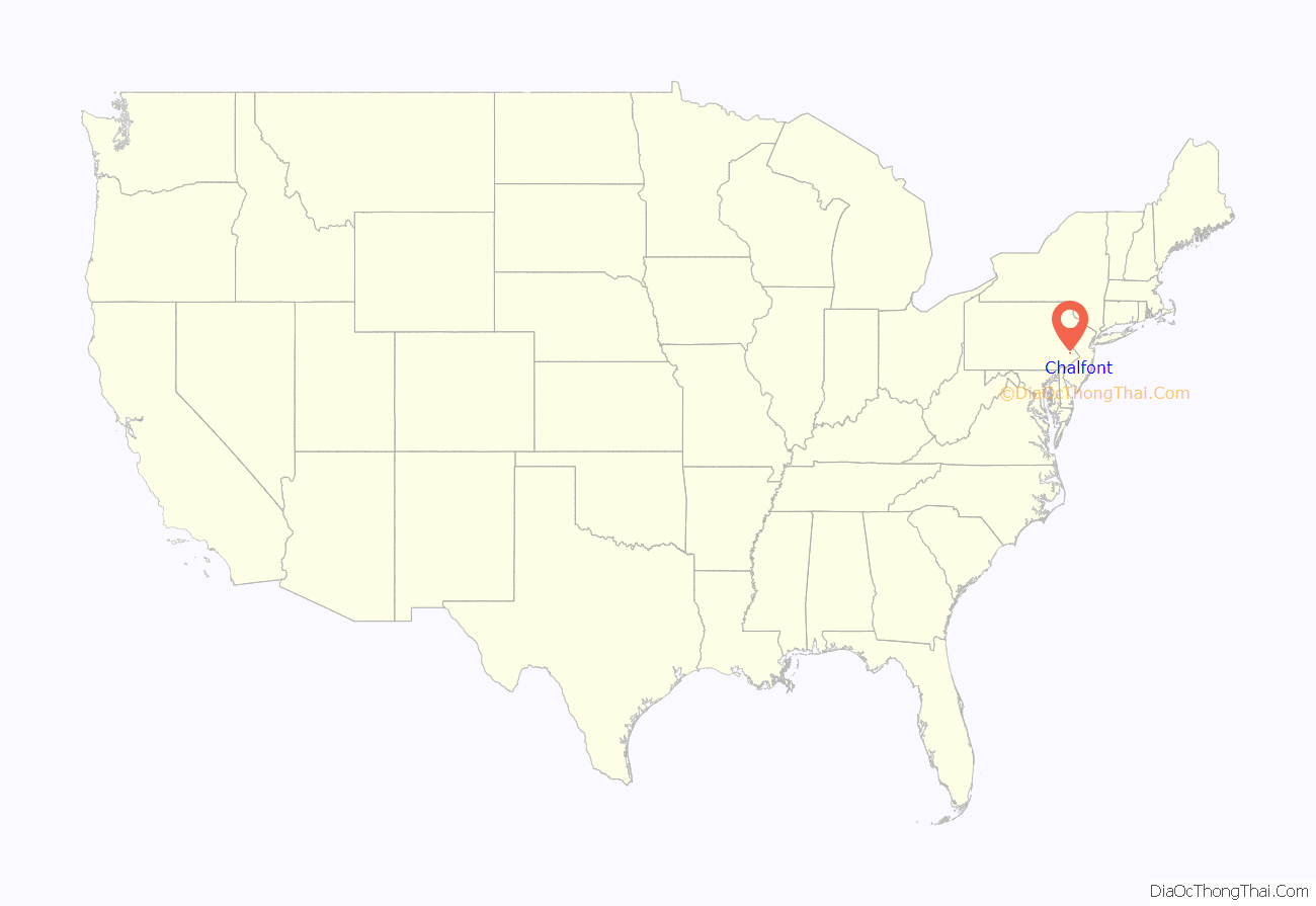
Chalfont location map. Where is Chalfont borough?
History
Originally, the Lenape Valley Native Americans dwelled in present-day Chalfont. In 1683, William Penn signed a treaty with the local chief and parceled the land to the Free Society of Traders. In 1720, Simon Butler bought over 150 acres of land, including the “Village of Chalfont.” After the construction of his home and mill, Butler bought more than 400 more acres of land. Butler was a giant historical figure who acted as a legal and economic powerhouse in the area. After his death, the land was parceled to a number of people. Between then and 1901 Chalfont held several names, including Butler’s Mill, Kungle’s Tavern, Barndtsville, and Whitehallville. For many years, the most important building in the area was the tavern and public house, which has burnt down many times and now stands as the Pop Inn. During the Victorian era, a train-station was built which helped the community grow and brought about the construction of the many Victorian houses.
In 1885, Chalfont established Forest Park. Forest park started out as a small picnic ground where music could be played. The appearance of the train station in Chalfont assured the park’s success. However, as the park grew it became a small amusement park where local people could enjoy rides, a large swimming pool built in the 1930s, music (including string bands in the 1940s) and as the hosting ground for many company picnics. The park closed its doors forever in 1968.
George Eckhart later owned the Butler’s mill which burned in 1835, he built a larger mill. Later Eckhart’s son Martin inherited the mill and his other son inherited the farm. Part of the farmland included woods of mostly oak locally known as Eckhart’s Grove which was frequently used for dance parties, family gatherings, religious camp meetings and Sunday School picnics. Later, in 1885 the mill was owned by Philip B. Grove who leased it to Valentine B. Clymer and Matthew S. Cogan when it burned again and was never rebuilt. Another gristmill was built in 1793 not far from Bulter’s mill first operated by men named Miller and Evans, later by Francis D. Hartzel, two of his sons succeeded him. After a fire in 1878, the mill was rebuilt and much of the machinery replaced. About 1761, Henry Lewis built a stone tavern operated by George Kungle during the Revolutionary period. Chalfont was known as Kungles Tavern. After Kungle, the tavern was later owned consecutively by James Morris, Lewis Morris, Abner Morris, then John Barndt from Tylersport. The village was then known as Barndtsville.
William Stevens had a store on the south bank of the West Branch Neshaminy Creek and opened a post office in 1845. Chalfont was then known as Whitehallville. In 1869, the North Pennsylvania Railroad changed the name of the station to Chalfont. Sometime before 1885, the farm inherited by Charles Eckhart was purchased by Isaac Funk. On 27 June 1885, Funk opened the Forest Park on the grounds of the Eckhart’s Grove. Guest speakers were attorneys from Doylestown J. Freeman Hendricks and John D. James. Music was provided by the Chalfont Cornet Band. On 20 June 1778, detachments of George Washington’s army passed through the West Branch Neshaminy Creek and the North Branch Neshaminy Creek as they travelled from their camp at Valley Forge to Monmouth.
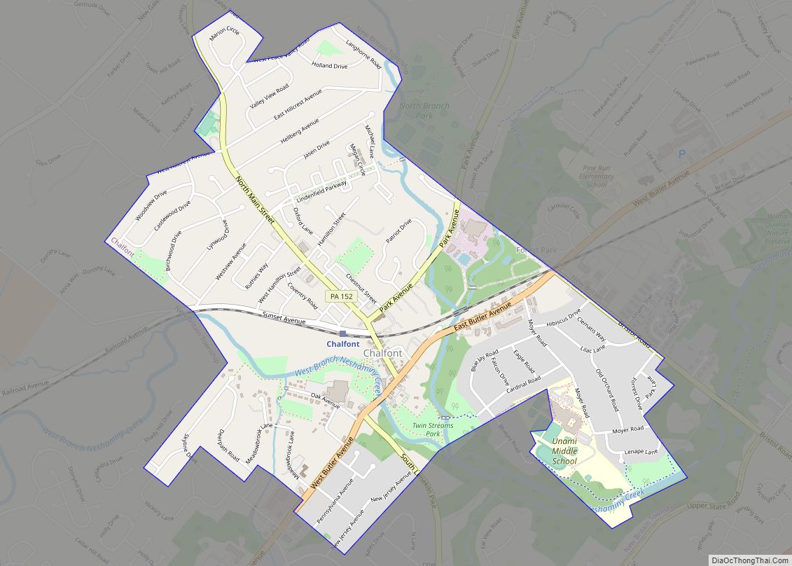
Chalfont Road Map
Chalfont city Satellite Map
Geography
Neshaminy Creek and Pine Run pass through Chalfont. According to the U.S. Census Bureau, the borough has a total area of 1.6 square miles (4.1 km), all land.
Chalfont is located within the Delaware Valley.
Climate
According to the Köppen climate classification system, Chalfont has a Hot-summer Humid continental climate (Dfa). Dfa climates are characterized by at least one month having an average mean temperature ≤ 32.0 °F (0.0 °C), at least four months with an average mean temperature ≥ 50.0 °F (10.0 °C), at least one month with an average mean temperature ≥ 71.6 °F (22.0 °C) and no significant precipitation difference between seasons. Although most summer days are slightly humid in Chalfont, episodes of heat and high humidity can occur with heat index values > 106 °F (41 °C). Since 1981, the highest air temperature was 102.7 °F (39.3 °C) on July 22, 2011, and the highest daily average mean dew point was 74.8 °F (23.8 °C) on August 3, 2016. The average wettest month is July, which corresponds with the annual peak in thunderstorm activity. Since 1981, the wettest calendar day was 6.81 inches (173 mm) on September 16, 1999. During the winter months, the average annual extreme minimum air temperature is −0.6 °F (−18.1 °C). Since 1981, the coldest air temperature was −11.9 °F (−24.4 °C) on January 22, 1984. Episodes of extreme cold and wind can occur, with wind chill values < −11 °F (−24 °C). The average annual snowfall (Nov-Apr) is between 30 and 36 inches (76 and 91 cm). Ice storms and large snowstorms depositing ≥ 12 inches (30 cm) of snow occur once every few years, particularly during nor’easters from December through February.
Ecology
According to the A. W. Kuchler U.S. potential natural vegetation types, Chalfont would have a dominant vegetation type of Appalachian Oak (104) with a dominant vegetation form of Eastern Hardwood Forest (25). The plant hardiness zone is 6b with an average annual extreme minimum air temperature of −0.6 °F (−18.1 °C). The spring bloom typically begins by April 11 and fall color usually peaks by October 30.
See also
Map of Pennsylvania State and its subdivision:- Adams
- Allegheny
- Armstrong
- Beaver
- Bedford
- Berks
- Blair
- Bradford
- Bucks
- Butler
- Cambria
- Cameron
- Carbon
- Centre
- Chester
- Clarion
- Clearfield
- Clinton
- Columbia
- Crawford
- Cumberland
- Dauphin
- Delaware
- Elk
- Erie
- Fayette
- Forest
- Franklin
- Fulton
- Greene
- Huntingdon
- Indiana
- Jefferson
- Juniata
- Lackawanna
- Lancaster
- Lawrence
- Lebanon
- Lehigh
- Luzerne
- Lycoming
- Mc Kean
- Mercer
- Mifflin
- Monroe
- Montgomery
- Montour
- Northampton
- Northumberland
- Perry
- Philadelphia
- Pike
- Potter
- Schuylkill
- Snyder
- Somerset
- Sullivan
- Susquehanna
- Tioga
- Union
- Venango
- Warren
- Washington
- Wayne
- Westmoreland
- Wyoming
- York
- Alabama
- Alaska
- Arizona
- Arkansas
- California
- Colorado
- Connecticut
- Delaware
- District of Columbia
- Florida
- Georgia
- Hawaii
- Idaho
- Illinois
- Indiana
- Iowa
- Kansas
- Kentucky
- Louisiana
- Maine
- Maryland
- Massachusetts
- Michigan
- Minnesota
- Mississippi
- Missouri
- Montana
- Nebraska
- Nevada
- New Hampshire
- New Jersey
- New Mexico
- New York
- North Carolina
- North Dakota
- Ohio
- Oklahoma
- Oregon
- Pennsylvania
- Rhode Island
- South Carolina
- South Dakota
- Tennessee
- Texas
- Utah
- Vermont
- Virginia
- Washington
- West Virginia
- Wisconsin
- Wyoming
