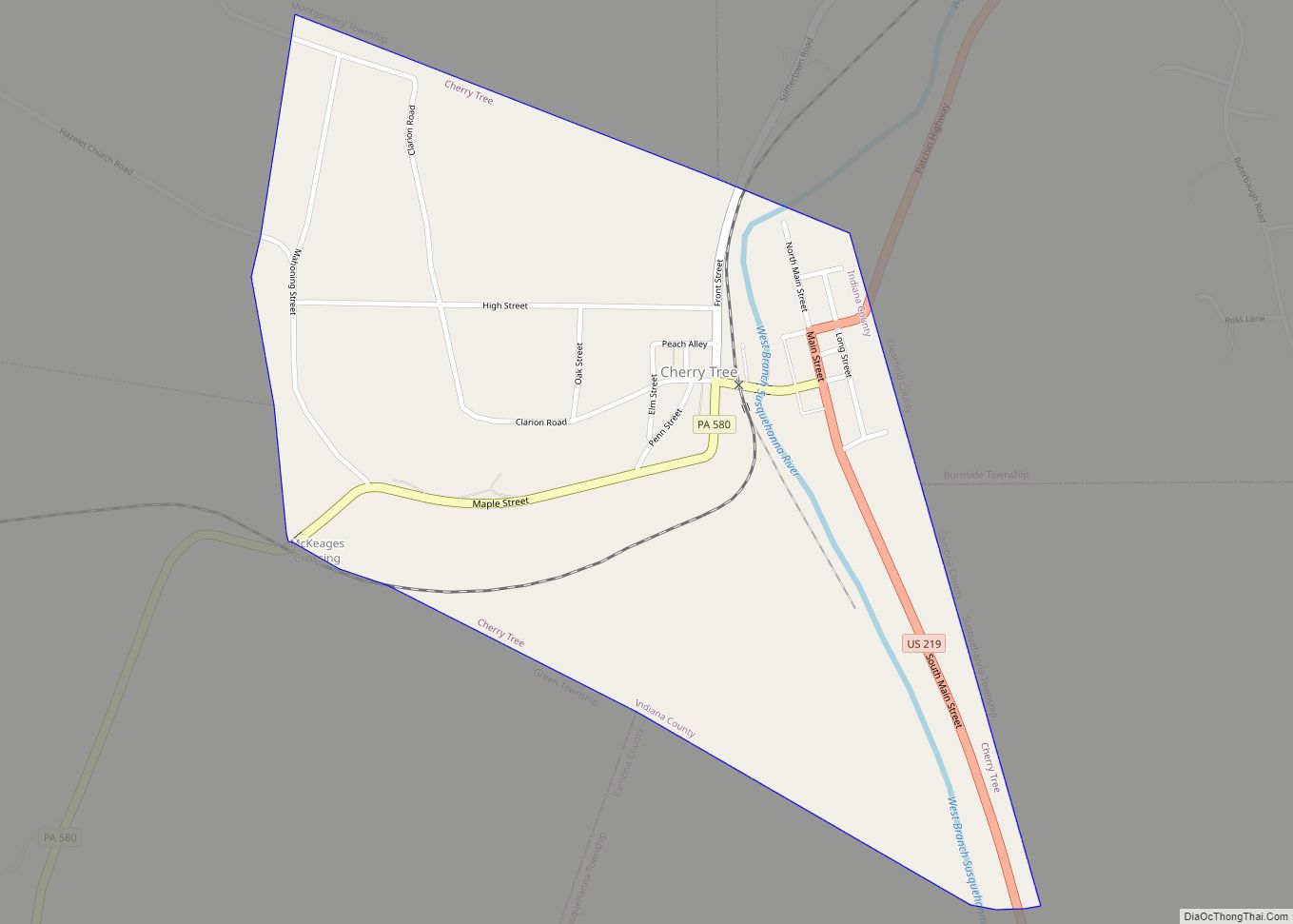
Cherry Tree is a borough in Indiana County, Pennsylvania, United States. The population was 276 at the 2020 census.
| Name: | Cherry Tree borough |
|---|---|
| LSAD Code: | 21 |
| LSAD Description: | borough (suffix) |
| State: | Pennsylvania |
| County: | Indiana County |
| Total Area: | 0.53 sq mi (1.37 km²) |
| Land Area: | 0.51 sq mi (1.33 km²) |
| Water Area: | 0.01 sq mi (0.04 km²) |
| Total Population: | 268 |
| Population Density: | 521.40/sq mi (201.45/km²) |
| FIPS code: | 4213120 |
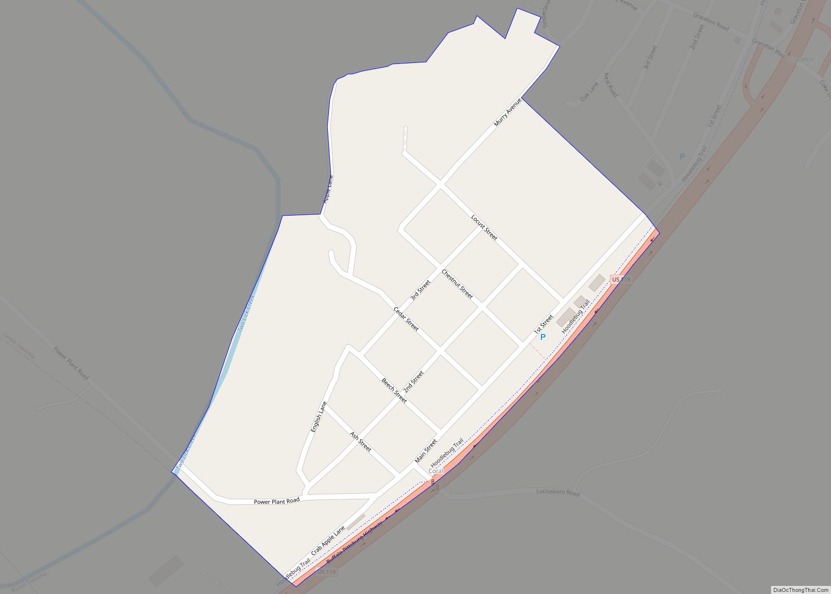
Online Interactive Map
Click on ![]() to view map in "full screen" mode.
to view map in "full screen" mode.
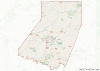
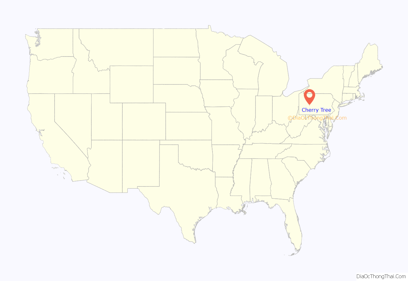
Cherry Tree location map. Where is Cherry Tree borough?
History
Cherry Tree was originally known as “Canoe Place” because its location marked the spot where the West Branch of the Susquehanna River was no longer navigable and canoes would have to portage. The latter settlement was known as “Newman’s Mills” and later “Grant Post Office”. The current name was officially adopted in 1907 but had been in use informally by local residents for many years before that time.
Cherry Tree was named for a large cherry tree that stood at the confluence of Cush Cushion Creek and the West Branch of the Susquehanna River. The tree marked the eastern boundary of the territory acquired by the Penn family from the Six Nations of the Iroquois at the Treaty of Fort Stanwix on November 5, 1768. The boundary, called the “purchase line”, extended from the cherry tree westward to the current site of Kittanning on the Allegheny River.
Cherry Tree was a center of the lumber industry in the later 19th century.
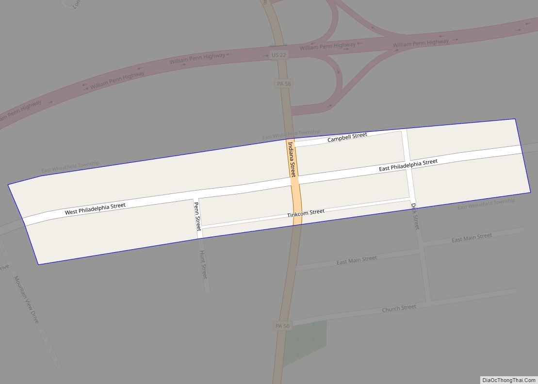
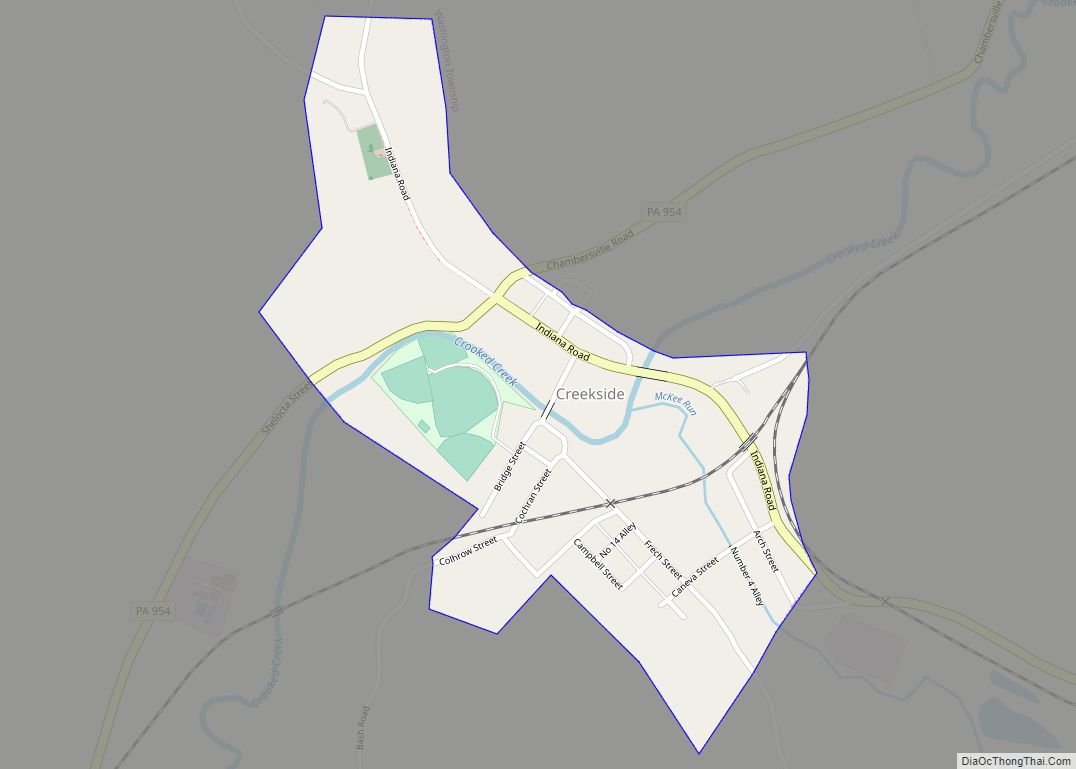
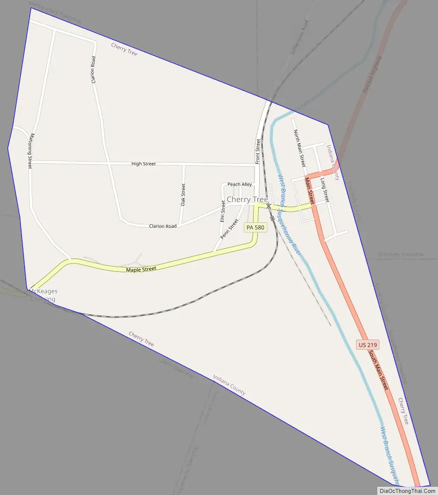
Cherry Tree Road Map
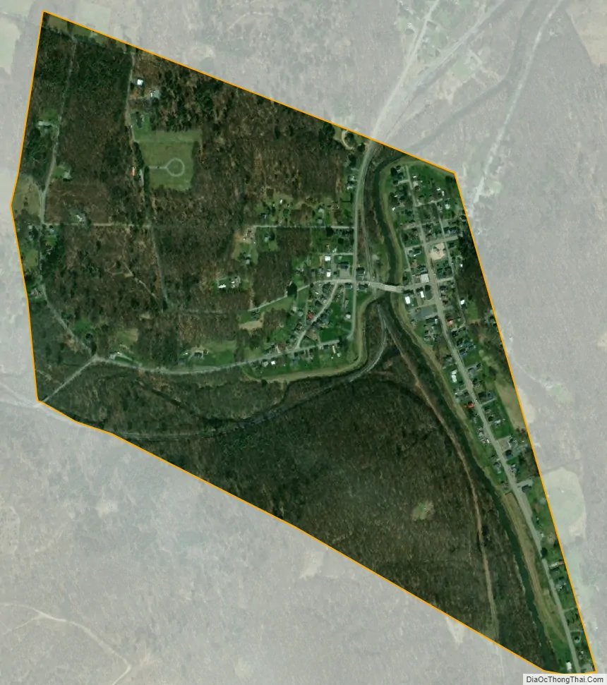
Cherry Tree city Satellite Map
Geography
Cherry Tree is situated mostly in a valley near the headwaters of West Branch of the Susquehanna River where the river is fed by Cush Cushion Creek.
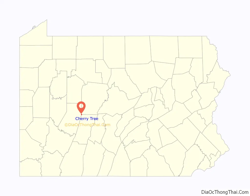
The borough is located at 40°43′35″N 78°48′27″W / 40.72639°N 78.80750°W / 40.72639; -78.80750 (40.726420, -78.807558) in the eastern corner of Indiana County where it intersects with Clearfield and Cambria Counties.
According to the United States Census Bureau, the borough has a total area of 0.5 square miles (1.3 km), all land.
See also
Map of Pennsylvania State and its subdivision:- Adams
- Allegheny
- Armstrong
- Beaver
- Bedford
- Berks
- Blair
- Bradford
- Bucks
- Butler
- Cambria
- Cameron
- Carbon
- Centre
- Chester
- Clarion
- Clearfield
- Clinton
- Columbia
- Crawford
- Cumberland
- Dauphin
- Delaware
- Elk
- Erie
- Fayette
- Forest
- Franklin
- Fulton
- Greene
- Huntingdon
- Indiana
- Jefferson
- Juniata
- Lackawanna
- Lancaster
- Lawrence
- Lebanon
- Lehigh
- Luzerne
- Lycoming
- Mc Kean
- Mercer
- Mifflin
- Monroe
- Montgomery
- Montour
- Northampton
- Northumberland
- Perry
- Philadelphia
- Pike
- Potter
- Schuylkill
- Snyder
- Somerset
- Sullivan
- Susquehanna
- Tioga
- Union
- Venango
- Warren
- Washington
- Wayne
- Westmoreland
- Wyoming
- York
- Alabama
- Alaska
- Arizona
- Arkansas
- California
- Colorado
- Connecticut
- Delaware
- District of Columbia
- Florida
- Georgia
- Hawaii
- Idaho
- Illinois
- Indiana
- Iowa
- Kansas
- Kentucky
- Louisiana
- Maine
- Maryland
- Massachusetts
- Michigan
- Minnesota
- Mississippi
- Missouri
- Montana
- Nebraska
- Nevada
- New Hampshire
- New Jersey
- New Mexico
- New York
- North Carolina
- North Dakota
- Ohio
- Oklahoma
- Oregon
- Pennsylvania
- Rhode Island
- South Carolina
- South Dakota
- Tennessee
- Texas
- Utah
- Vermont
- Virginia
- Washington
- West Virginia
- Wisconsin
- Wyoming