Coatesville is a city in Chester County, Pennsylvania, United States. The population was 13,350 at the 2020 census. Coatesville is approximately 39 miles west of Philadelphia. It developed along the Philadelphia and Lancaster Turnpike beginning in the late 18th century. It spans U.S. Route 30, the “Main Line” highway that runs west of Philadelphia.
Coatesville developed in the early 20th century with the growth of the Lukens Steel Company and other industry. Its population declined after industrial restructuring, which reduced these jobs. Lukens was bought by the Bethlehem Steel Corporation in 1997. In 2002, Bethlehem was bought by the then Ohio-based International Steel Group (ISG). Later, Mittal Steel bought ISG and merged with Arcelor Steel to form the ArcelorMittal company. In 2020, Cleveland-Cliffs acquired the United States operations of ArcelorMittal.
| Name: | Coatesville city |
|---|---|
| LSAD Code: | 25 |
| LSAD Description: | city (suffix) |
| State: | Pennsylvania |
| County: | Chester County |
| Incorporated: | 1915 |
| Elevation: | 331 ft (101 m) |
| Total Area: | 1.83 sq mi (4.73 km²) |
| Land Area: | 1.81 sq mi (4.68 km²) |
| Water Area: | 0.02 sq mi (0.05 km²) |
| Total Population: | 13,350 |
| Population Density: | 7,383.85/sq mi (2,850.18/km²) |
| ZIP code: | 19320 |
| Area code: | 610 and 484 |
| FIPS code: | 4214712 |
| Website: | coatesville.org |
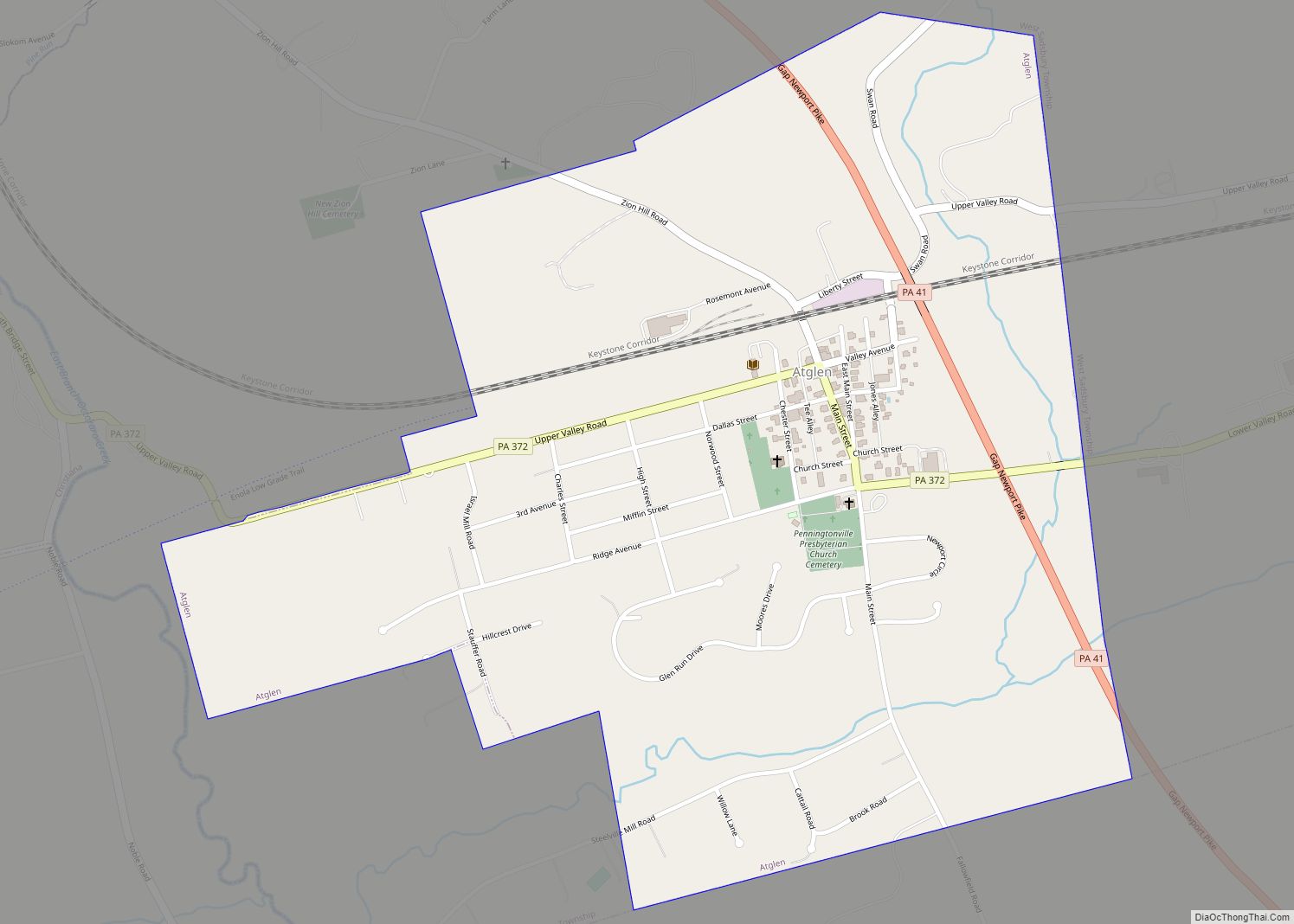
Online Interactive Map
Click on ![]() to view map in "full screen" mode.
to view map in "full screen" mode.
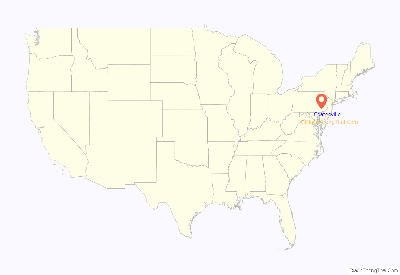
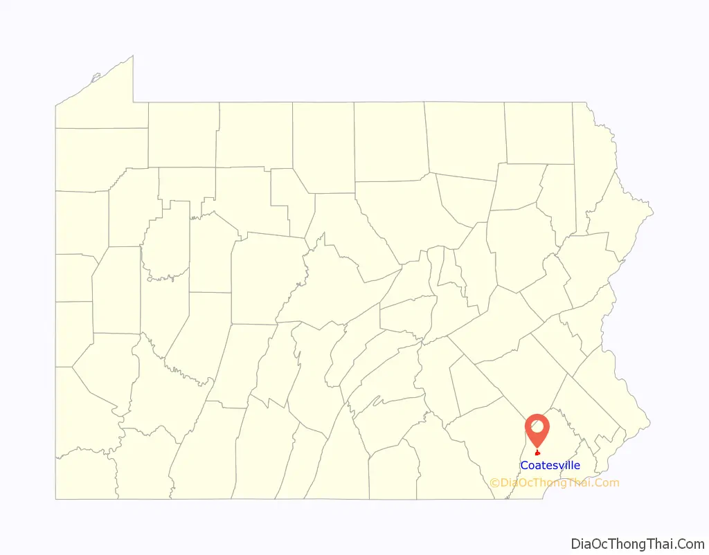
Coatesville location map. Where is Coatesville city?
History
Beginnings
Varying cultures of Native Americans lived in this area. The first known settlement in the area which would be known as Coatesville was a historic Lenape village built along the West Branch of the Brandywine River. This settlement was a post for fur trading with the earliest American settlers. The Brandywine River has featured prominently in the history of Coatesville.
William Fleming, originally from Scotland, is one of the earliest landowners on record. He built a log cabin in the area of Harmony Street and 5th Avenue and owned about 207 acres (0.84 km) of land bordering the Brandywine River.
Moses Coates, a prosperous farmer and the namesake of Coatesville, bought the cabin from Fleming’s son in 1787. With the economy rising in the years after the United States gained independence, Moses Coates’ son-in-law, Jesse Kersey, came up with a plan to develop the area by selling frontage on the recently completed Lancaster Turnpike which crossed through their land. The Lancaster Turnpike was the first toll road in the U.S., authorized in 1792 and completed in 1795. A tollgate was located within the present-day Coatesville city limits. Because Coatesville was located roughly halfway between Philadelphia and Lancaster on the turnpike, it became a popular stopping place.
Pierre Bizallion, a French fur trader, settled in the area in the early 18th century. He was said to serve as an interpreter between William Penn and Native American peoples. The Veterans Administration Hospital now occupies a large piece of the roughly 500 acres (2.0 km) of land that was once owned by Bizallion.
19th century
Before Coatesville became a city, the only one in Chester County, it was called Bridge-Town, after the two bridges crossing the Brandywine River. A village named “Midway”, named after its station owned by the Philadelphia and Columbia Railroad midway between Philadelphia and Lancaster, was formed in 1834 on the western bank of the Brandywine. The village of Midway and the village of Bridge-Town merged in 1867 to become the borough of Coatesville. Coatesville citizens voted to become a city in 1915.
Coatesville exploited the natural energy of the Brandywine River. Jesse Kersey, Moses Coates’ son-in-law, partnered with the ironmaster Isaac Pennock and purchased over 110 acres (0.45 km) of Moses Coates’ farm along both sides of the Brandywine River in 1810. They formed the Brandywine Iron Works and Nail Factory, the forerunner of Lukens Steel. Charles Lukens, MD, married Isaac Pennock’s daughter Rebecca in 1813. Following her husband’s death in 1825, Rebecca Lukens took over the operations of the mill, purchasing it from her mother. She directed operations through a period of turmoil and market panic, developing it into a prosperous mill. Rebecca Lukens was one of the first women to operate a major corporation in the United States.
20th century
As Lukens Steel grew so did Coatesville, eventually becoming known as the “Pittsburgh of the East.” By the beginning of the 20th century the population had grown to 6,000, attracting immigrants from Eastern and Southern Europe to its industrial jobs, as well as both black and white migrants from the rural South. Tensions rose in the city as the population rapidly became more diverse.
In August 1911, steelworker Zachariah Walker was lynched in Coatesville; he had left his wife and children in Virginia while seeking better work. This African-American man was accused of killing Deputy Constable/Coal and Iron Policeman Edgar Rice, a popular figure in town. Walker claimed self-defense and was hospitalized after his arrest. He was dragged from the hospital and burned to death in front of a mob of hundreds in a field south of the city. Fifteen men and teenage boys were indicted, but all were acquitted at trials. The lynching was the last in Pennsylvania and is said to have left a permanent stain on the city’s image.
Walker’s murder was investigated by the National Association for the Advancement of Colored People (NAACP), which called for an end to lynching nationwide. Pennsylvania passed a state anti-lynching law in 1923. But, even after passage of an anti-lynching House bill in the 1920s, no federal law was passed because of the power of the Democratic southern bloc in the Senate. At that time, it represented only white southerners; African Americans had been disfranchised in the South since the turn of the century.
Racial violence was spreading all across America during the Red Summer of 1919 and the local African-American community was on edge. On July 8, 1919, the black community of Coatesville formed a large armed protection group to prevent the rumoured lynching of a rape suspect. When the armed group surrounded the jail to prevent the attack, they learned that there was no suspect and no lynch mob.
In 1929, the Coatesville VA Medical Center was built with an original mission to provide neuropsychiatric care to veterans. In 2013, the Medical Center, with its distinctive architecture of Colonial Revival and Classical Revival, was listed on the National Register of Historic Places. The Medical Center now provides a range of health care services to more than 19,000 Veterans in Pennsylvania and Delaware.
The school system expanded to keep up and the religious community became more diverse, with Roman Catholic churches founded and Beth Israel Congregation, one of Chester County’s few synagogues. In 1932 there were a total of 22 churches of various denominations in the city.
After World War II the steel industry began a long decline, but in the 1960s Lukens Steel was still the largest employer in Chester County, with over 10,000 workers. It finally started to restructure due to industry changes, was sold several times, and its workers were reduced in number to 5,000 and eventually to 2,000.
21st century
Since the turn of the century, Coatesville has invested in redevelopment, encouraging private projects. It has torn down public housing and encouraged new single family and townhouse developments. A new Marriott Courtyard hotel, built along Route 82 on the outskirts of Coatesville, opened in May 2012.
The redevelopment plans have generated controversy. The city was involved in a 5-year eminent domain dispute with a local landowner in neighboring Valley Township. It was resolved without the need to seize the property, but displeasure with the events resulted in the city voters turning out four incumbent city councilpersons in the November 2005 general elections. Two of the four new councilpersons are ordained Pentecostal and Methodist ministers, respectively. The city council fired the city solicitor, and accepted the resignation of the city manager (who had negotiated with the Valley Township landowner). The assistant manager, police chief, and city treasurer also resigned.
A series of arsons took place in the city from 2007 to early 2009. A December 2008 fire at a Strode Avenue home resulted in the death of Irene Kempest, an 83-year-old World War II Holocaust survivor. A fire the following month on the 300 block of Fleetwood Street burned 17 row houses, causing $2 million in damage and leaving dozens of people homeless. By March 2009, police had arrested six suspects in the fires. A total of nearly 70 fires occurred during this period. On June 8, 2010 one man, pleading no-contest due to mental illness, was sentenced to a 60-year prison sentence for five of the fires, one of which resulted in Kempest’s death. Another man pleaded guilty to the Fleetwood Street fire and eight others, receiving a sentence of 12.5 to 25 years with an order to pay $2.5 million in restitution. Twenty of the nearly 70 fires over the two-year span remain unsolved.
In 1969, Lukens Steel forged steel beams for the World Trade Center during its construction in New York City. Some of these trident beams, known as “trees”, remained standing after the 9/11 Terrorist Attacks. Ten of the “trees” that remained were transported to Coatesville on April 15, 2010. They are to be used as a part of the proposed National Iron and Steel Heritage Museum.
Twenty-one sites including the Coatesville Historic District, Clement Atkinson Memorial Hospital, High Bridge, Abram Huston House and Carriage House, Lukens Historic District, Lukens Main Office Building, National Bank of Coatesville Building, Terracina, Carver Court, and Coatesville Veterans Affairs Medical Center are resources listed on the National Register of Historic Places.
Coatesville Road Map
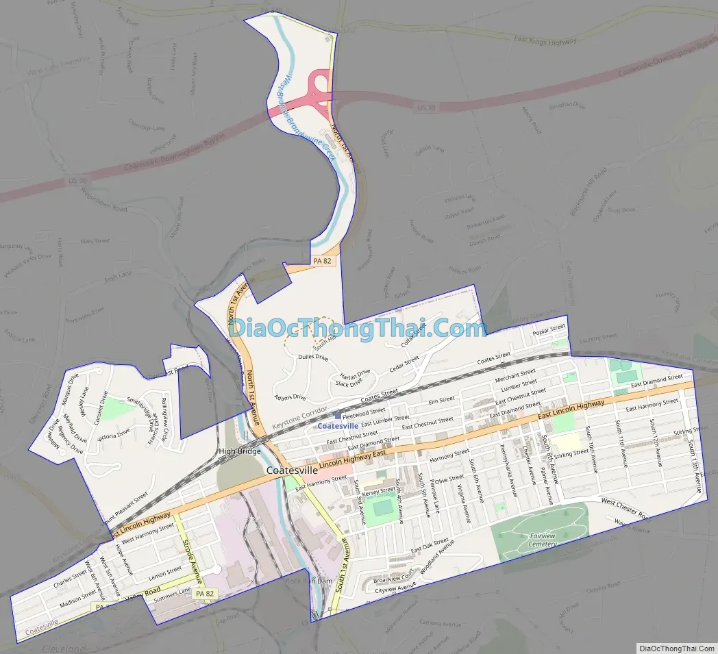
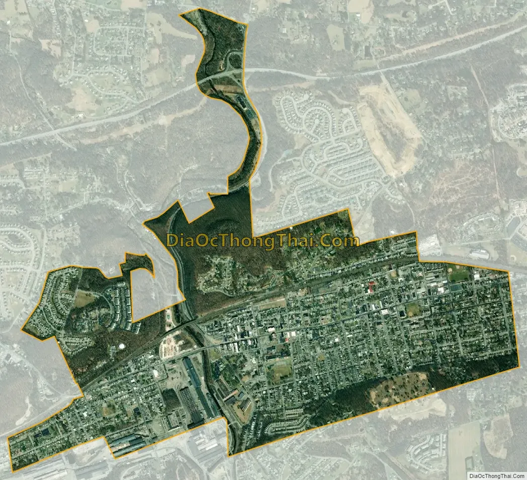
Coatesville city Satellite Map
Geography
According to the U.S. Census Bureau, the city has a total area of 1.9 square miles (4.9 km), of which 0.53% is water.
Climate
Coatesville has a typical Northeast climate with cold, snowy winters and hot humid summers. It has a hot-summer humid continental climate (Dfa) and the hardiness zone is 6b bordering 7a.
See also
Map of Pennsylvania State and its subdivision:- Adams
- Allegheny
- Armstrong
- Beaver
- Bedford
- Berks
- Blair
- Bradford
- Bucks
- Butler
- Cambria
- Cameron
- Carbon
- Centre
- Chester
- Clarion
- Clearfield
- Clinton
- Columbia
- Crawford
- Cumberland
- Dauphin
- Delaware
- Elk
- Erie
- Fayette
- Forest
- Franklin
- Fulton
- Greene
- Huntingdon
- Indiana
- Jefferson
- Juniata
- Lackawanna
- Lancaster
- Lawrence
- Lebanon
- Lehigh
- Luzerne
- Lycoming
- Mc Kean
- Mercer
- Mifflin
- Monroe
- Montgomery
- Montour
- Northampton
- Northumberland
- Perry
- Philadelphia
- Pike
- Potter
- Schuylkill
- Snyder
- Somerset
- Sullivan
- Susquehanna
- Tioga
- Union
- Venango
- Warren
- Washington
- Wayne
- Westmoreland
- Wyoming
- York
- Alabama
- Alaska
- Arizona
- Arkansas
- California
- Colorado
- Connecticut
- Delaware
- District of Columbia
- Florida
- Georgia
- Hawaii
- Idaho
- Illinois
- Indiana
- Iowa
- Kansas
- Kentucky
- Louisiana
- Maine
- Maryland
- Massachusetts
- Michigan
- Minnesota
- Mississippi
- Missouri
- Montana
- Nebraska
- Nevada
- New Hampshire
- New Jersey
- New Mexico
- New York
- North Carolina
- North Dakota
- Ohio
- Oklahoma
- Oregon
- Pennsylvania
- Rhode Island
- South Carolina
- South Dakota
- Tennessee
- Texas
- Utah
- Vermont
- Virginia
- Washington
- West Virginia
- Wisconsin
- Wyoming