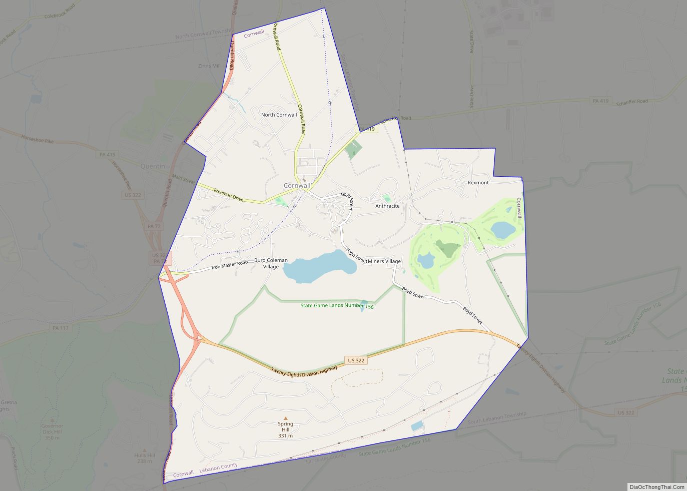
Cornwall is a borough in Lebanon County, Pennsylvania, United States. It is part of the Lebanon, PA Metropolitan Statistical Area. The population was 4,604 at the 2020 census.
| Name: | Cornwall borough |
|---|---|
| LSAD Code: | 21 |
| LSAD Description: | borough (suffix) |
| State: | Pennsylvania |
| County: | Lebanon County |
| Incorporated: | 1926 |
| Elevation: | 554 ft (169 m) |
| Total Area: | 9.76 sq mi (25.27 km²) |
| Land Area: | 9.70 sq mi (25.13 km²) |
| Water Area: | 0.05 sq mi (0.14 km²) |
| Total Population: | 4,604 |
| Population Density: | 474.49/sq mi (183.20/km²) |
| ZIP code: | 17016 |
| Area code: | 717 |
| FIPS code: | 4216256 |
| Website: | www.cornwall-pa.com |
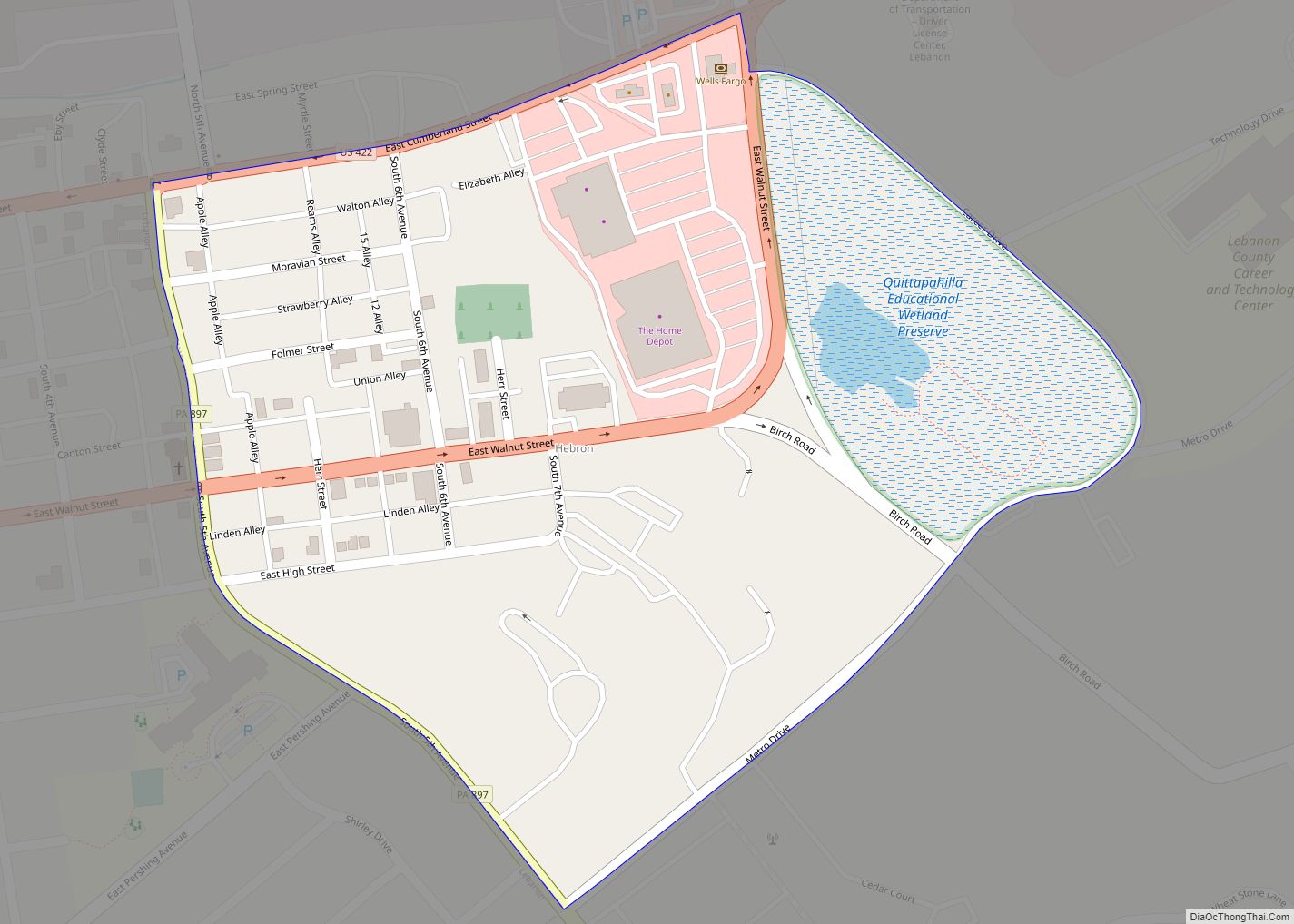
Online Interactive Map
Click on ![]() to view map in "full screen" mode.
to view map in "full screen" mode.
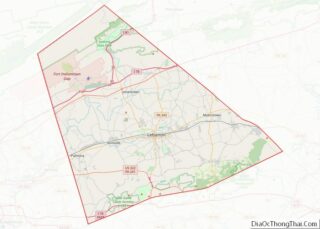
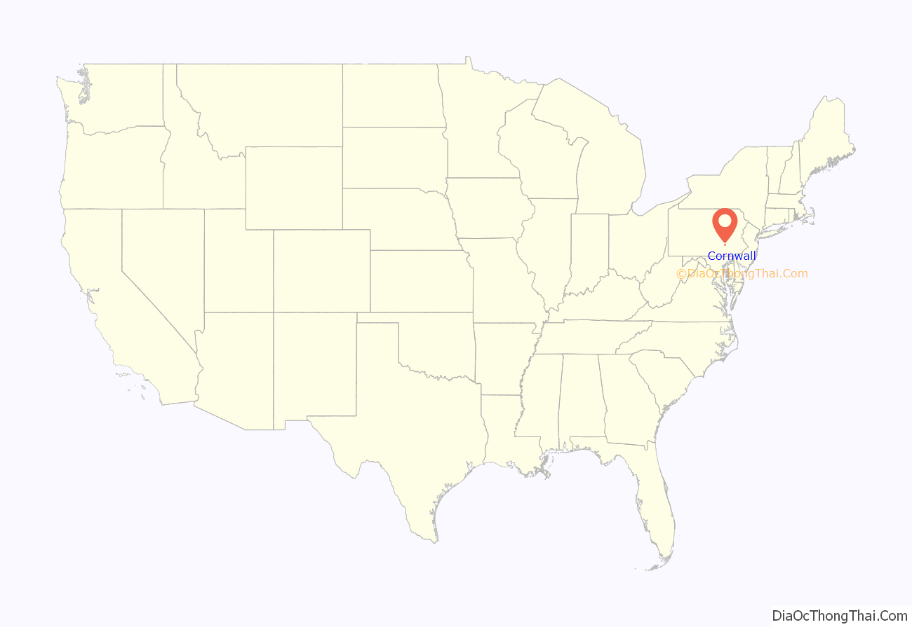
Cornwall location map. Where is Cornwall borough?
History
Cornwall was initially settled by Peter Grubb in 1734. Peter was a Chester County stonemason who came to, what was then Lancaster County, in search of high quality stone for quarrying. First building his house and then a store, he discovered magnetite iron ore nearby and decided to test its quality, he found the ore to be exceedingly pure. Grubb wrote to Philadelphia and in 1734 was granted a warrant to purchase 300 acres (1.2 km) of land. For three years Peter followed veins of ore until he found a large deposit that was easily accessible; however, this ore was not within the bounds of his property. So in 1737 he purchased an additional 142.5 acres (0.577 km) of land. In 1742 Peter built a cold blast furnace and named it Cornwall, after his father’s birthplace in England. The Cornwall Iron Mine was, at one time, the largest open-pit mining operation in the world. They were mined continuously until June 30, 1973, totaling 236 years of production.
Finding the necessary components nearby for smelting iron (water, limestone and timber for charcoal), Grubb built the Cornwall Iron Furnace and began production in 1742. The operation also included the Hopewell Forges on nearby Hammer Creek. Peter Grubb did not stay long to run the operation, but leased it out in 1745 for 20 years and returned to Wilmington, Delaware. In 1765 Peter’s sons Curtis and Peter Jr. took over the operation, and in 1798 it passed to Robert Coleman and his family. Cornwall Furnace was in production from 1742 until 1883, and appears today much as it was when production ended. In 1932 the Coleman family deeded the property to the Commonwealth of Pennsylvania and it is now a designated National Historic Landmark open to the public.
Eventually the whole town became known as Cornwall. It was incorporated as a borough on October 11, 1926 after having been a part of Lancaster County and for a while of Dauphin County. At the time it officially became a borough, it comprised six widely separated villages.
Alden Villa was added to the National Register of Historic Places in 2011.
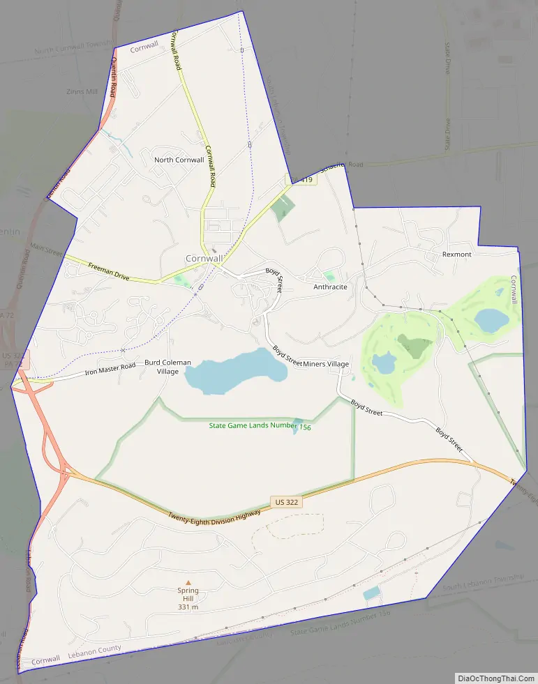
Cornwall Road Map
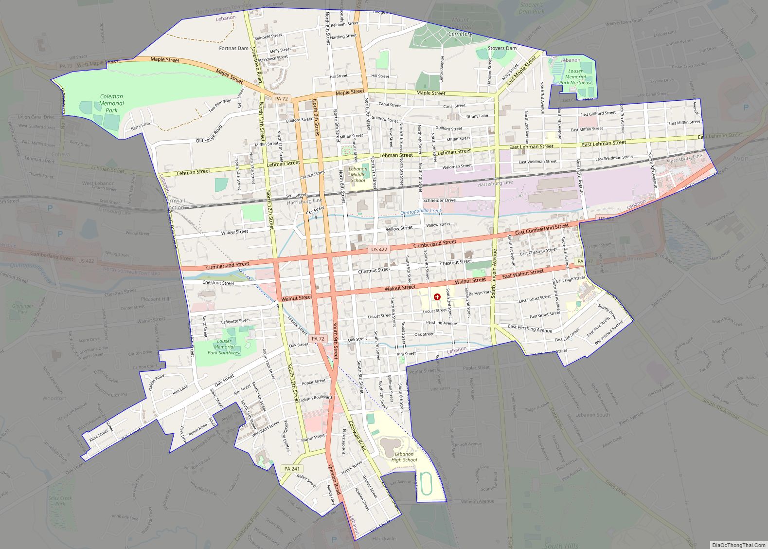
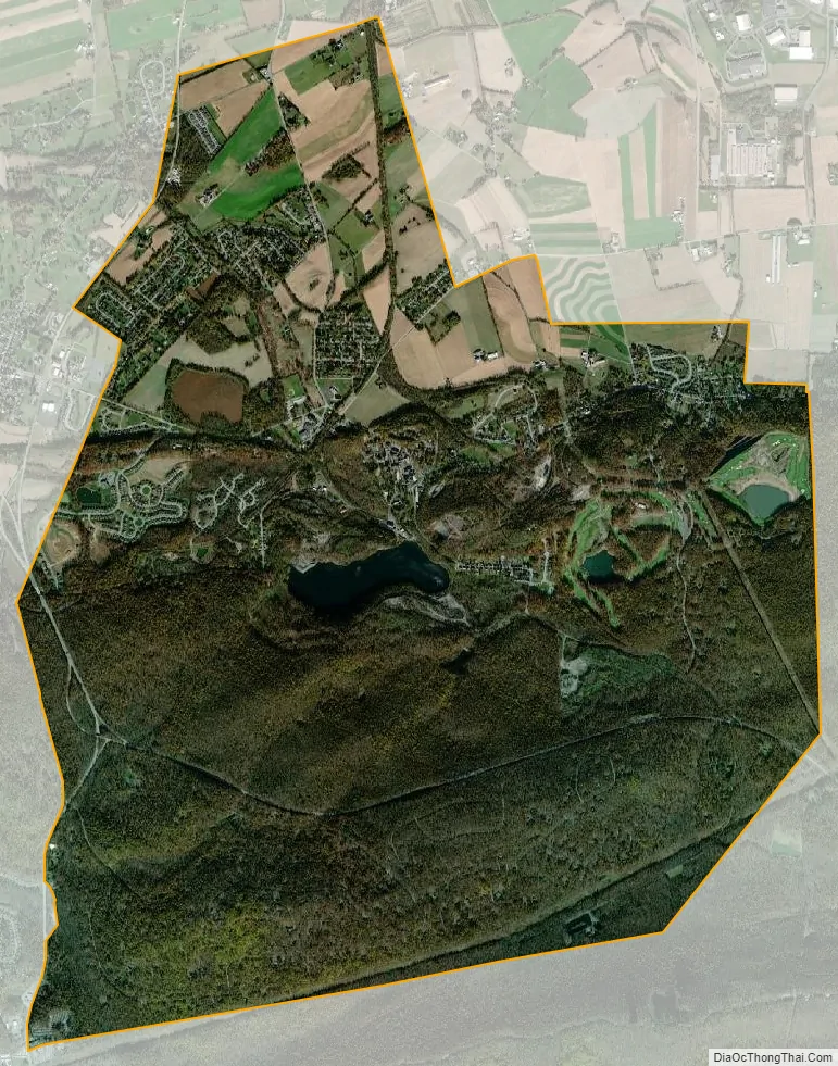
Cornwall city Satellite Map
Geography
Cornwall is located at 40°16′23″N 76°24′38″W / 40.27306°N 76.41056°W / 40.27306; -76.41056 (40.273192, -76.410667).
According to the United States Census Bureau, the borough has a total area of 9.9 square miles (26 km), of which 9.8 square miles (25 km) is land and 0.1 square miles (0.26 km) (1.11%) is water.
See also
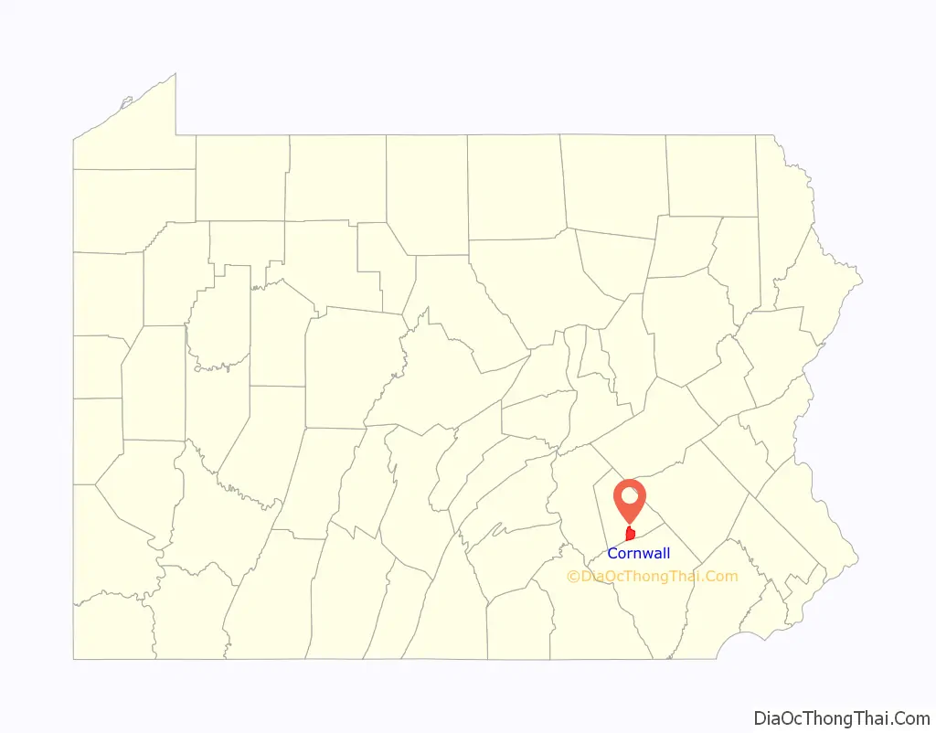
Map of Pennsylvania State and its subdivision:- Adams
- Allegheny
- Armstrong
- Beaver
- Bedford
- Berks
- Blair
- Bradford
- Bucks
- Butler
- Cambria
- Cameron
- Carbon
- Centre
- Chester
- Clarion
- Clearfield
- Clinton
- Columbia
- Crawford
- Cumberland
- Dauphin
- Delaware
- Elk
- Erie
- Fayette
- Forest
- Franklin
- Fulton
- Greene
- Huntingdon
- Indiana
- Jefferson
- Juniata
- Lackawanna
- Lancaster
- Lawrence
- Lebanon
- Lehigh
- Luzerne
- Lycoming
- Mc Kean
- Mercer
- Mifflin
- Monroe
- Montgomery
- Montour
- Northampton
- Northumberland
- Perry
- Philadelphia
- Pike
- Potter
- Schuylkill
- Snyder
- Somerset
- Sullivan
- Susquehanna
- Tioga
- Union
- Venango
- Warren
- Washington
- Wayne
- Westmoreland
- Wyoming
- York
- Alabama
- Alaska
- Arizona
- Arkansas
- California
- Colorado
- Connecticut
- Delaware
- District of Columbia
- Florida
- Georgia
- Hawaii
- Idaho
- Illinois
- Indiana
- Iowa
- Kansas
- Kentucky
- Louisiana
- Maine
- Maryland
- Massachusetts
- Michigan
- Minnesota
- Mississippi
- Missouri
- Montana
- Nebraska
- Nevada
- New Hampshire
- New Jersey
- New Mexico
- New York
- North Carolina
- North Dakota
- Ohio
- Oklahoma
- Oregon
- Pennsylvania
- Rhode Island
- South Carolina
- South Dakota
- Tennessee
- Texas
- Utah
- Vermont
- Virginia
- Washington
- West Virginia
- Wisconsin
- Wyoming