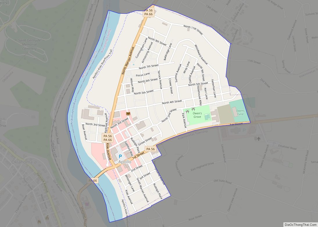
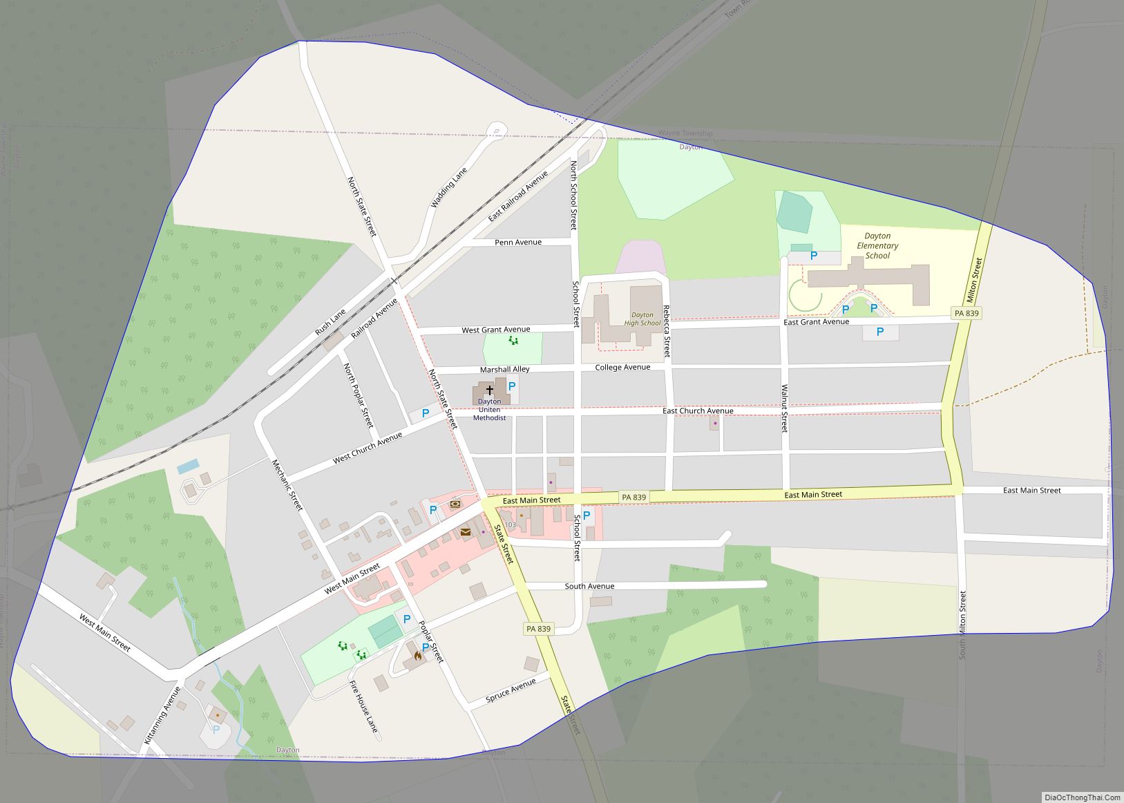
Dayton is a borough in Armstrong County, Pennsylvania, United States. The population was 549 at the 2020 census.
| Name: | Dayton borough |
|---|---|
| LSAD Code: | 21 |
| LSAD Description: | borough (suffix) |
| State: | Pennsylvania |
| County: | Armstrong County |
| Incorporated: | 1873 |
| Elevation: | 1,340 ft (410 m) |
| Total Area: | 0.38 sq mi (0.97 km²) |
| Land Area: | 0.38 sq mi (0.97 km²) |
| Water Area: | 0.00 sq mi (0.00 km²) |
| Total Population: | 549 |
| Population Density: | 1,460.11/sq mi (563.27/km²) |
| Area code: | 814 |
| FIPS code: | 4218400 |
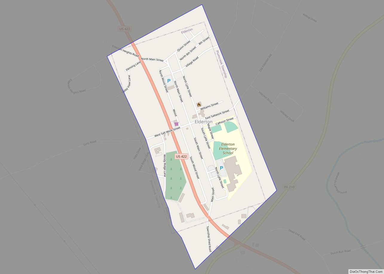
Online Interactive Map
Click on ![]() to view map in "full screen" mode.
to view map in "full screen" mode.
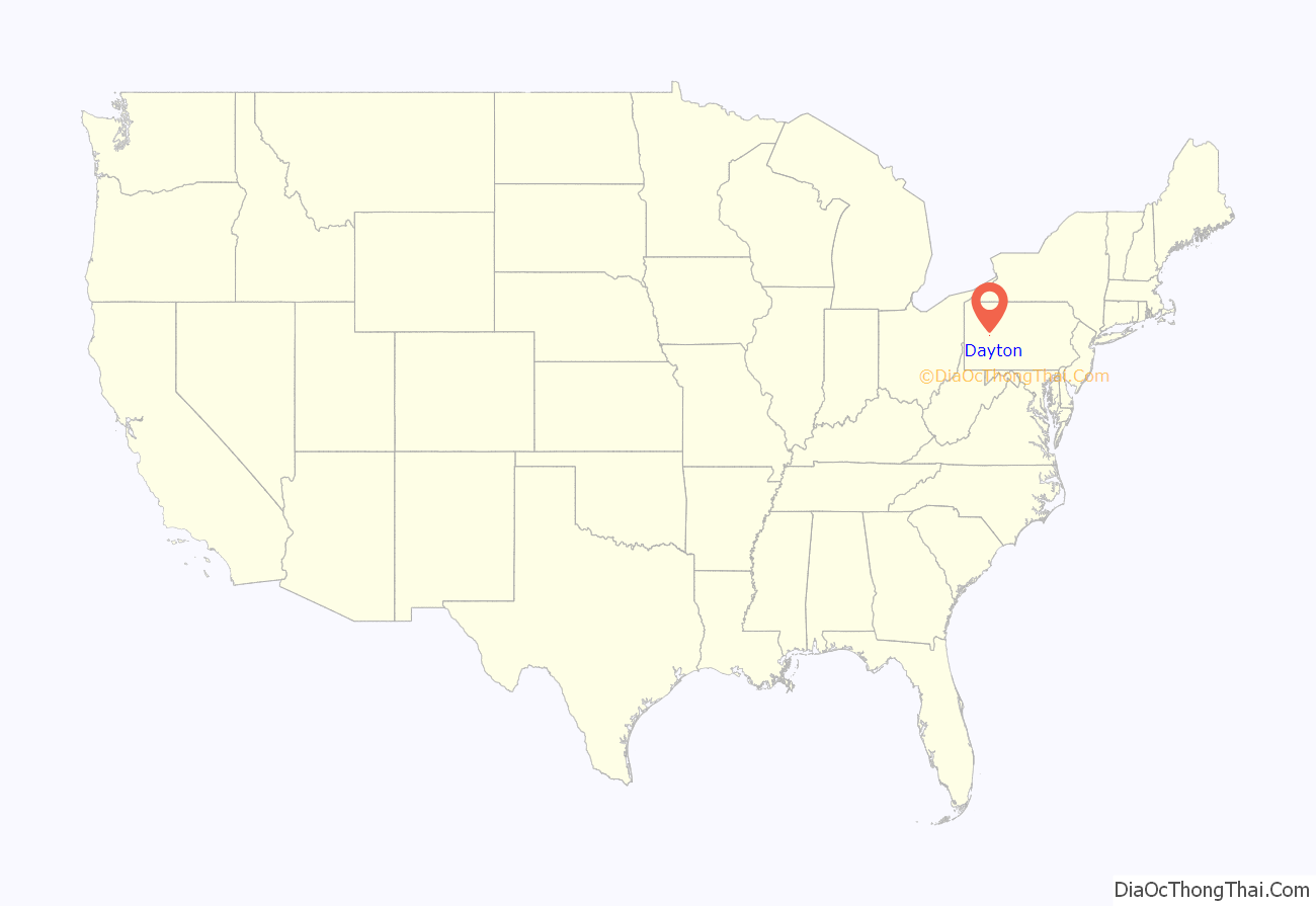
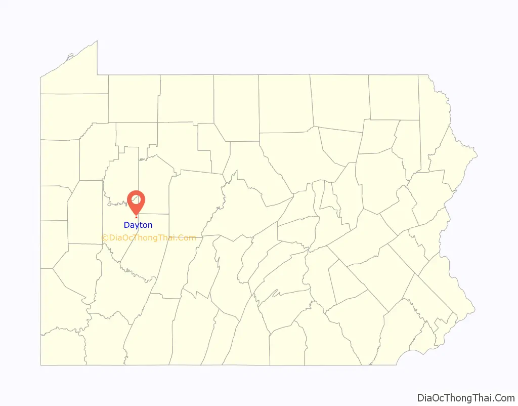
Dayton location map. Where is Dayton borough?
History
The Thomas Marshall House was listed on the National Register of Historic Places in 1976, and is home to the Dayton Area Local History Society.
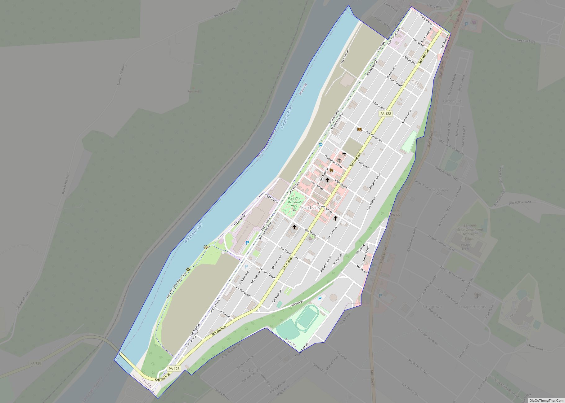
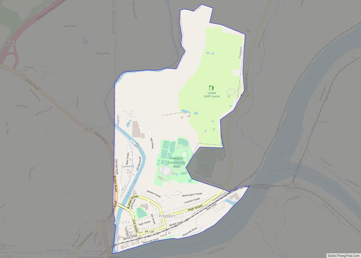
Dayton Road Map
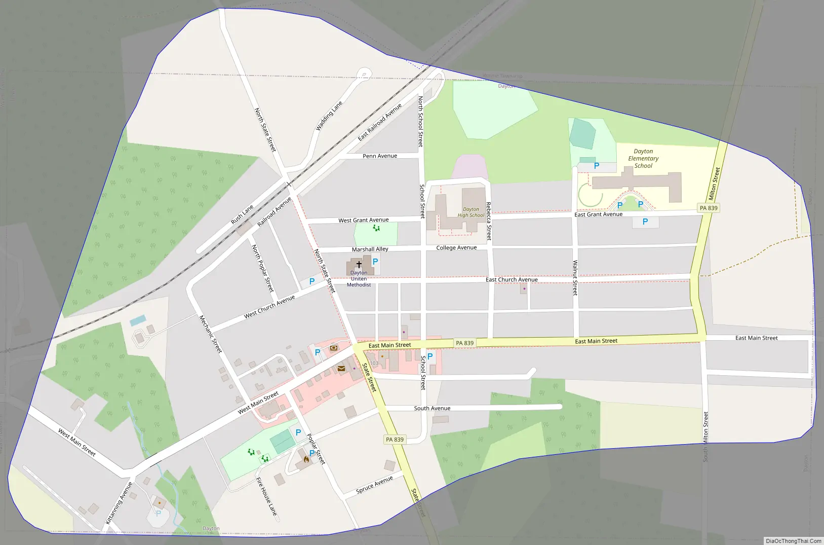
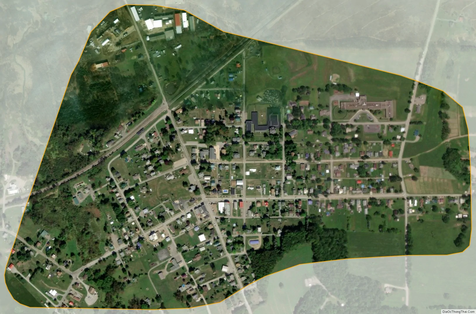
Dayton city Satellite Map
Geography
Dayton is located at 40°52′52″N 79°14′29″W / 40.88111°N 79.24139°W / 40.88111; -79.24139 (40.881095, -79.241526) in eastern Armstrong County. Pennsylvania Route 839 leads south 6 miles (10 km) to Pennsylvania Route 85 near NuMine and north 15 miles (24 km) to Pennsylvania Route 28 in South Bethlehem.
According to the United States Census Bureau, the borough has a total area of 0.39 square miles (1.0 km), all land.
See also
Map of Pennsylvania State and its subdivision:- Adams
- Allegheny
- Armstrong
- Beaver
- Bedford
- Berks
- Blair
- Bradford
- Bucks
- Butler
- Cambria
- Cameron
- Carbon
- Centre
- Chester
- Clarion
- Clearfield
- Clinton
- Columbia
- Crawford
- Cumberland
- Dauphin
- Delaware
- Elk
- Erie
- Fayette
- Forest
- Franklin
- Fulton
- Greene
- Huntingdon
- Indiana
- Jefferson
- Juniata
- Lackawanna
- Lancaster
- Lawrence
- Lebanon
- Lehigh
- Luzerne
- Lycoming
- Mc Kean
- Mercer
- Mifflin
- Monroe
- Montgomery
- Montour
- Northampton
- Northumberland
- Perry
- Philadelphia
- Pike
- Potter
- Schuylkill
- Snyder
- Somerset
- Sullivan
- Susquehanna
- Tioga
- Union
- Venango
- Warren
- Washington
- Wayne
- Westmoreland
- Wyoming
- York
- Alabama
- Alaska
- Arizona
- Arkansas
- California
- Colorado
- Connecticut
- Delaware
- District of Columbia
- Florida
- Georgia
- Hawaii
- Idaho
- Illinois
- Indiana
- Iowa
- Kansas
- Kentucky
- Louisiana
- Maine
- Maryland
- Massachusetts
- Michigan
- Minnesota
- Mississippi
- Missouri
- Montana
- Nebraska
- Nevada
- New Hampshire
- New Jersey
- New Mexico
- New York
- North Carolina
- North Dakota
- Ohio
- Oklahoma
- Oregon
- Pennsylvania
- Rhode Island
- South Carolina
- South Dakota
- Tennessee
- Texas
- Utah
- Vermont
- Virginia
- Washington
- West Virginia
- Wisconsin
- Wyoming