Downingtown is a borough in Chester County, Pennsylvania, United States, 33 miles (53 km) west of Philadelphia. As of the 2020 census, it had a population of 7,898. Downingtown was settled by European colonists in the early 18th century and has a number of historic buildings and structures.
| Name: | Downingtown borough |
|---|---|
| LSAD Code: | 21 |
| LSAD Description: | borough (suffix) |
| State: | Pennsylvania |
| County: | Chester County |
| Incorporated: | May 12, 1859 |
| Elevation: | 239 ft (73 m) |
| Total Area: | 2.22 sq mi (5.76 km²) |
| Land Area: | 2.19 sq mi (5.67 km²) |
| Water Area: | 0.04 sq mi (0.09 km²) |
| Total Population: | 7,892 |
| Population Density: | 3,606.95/sq mi (1,392.73/km²) |
| ZIP code: | 19335, 19372 |
| FIPS code: | 4219752 |
| Website: | www.downingtown.org |
Online Interactive Map
Click on ![]() to view map in "full screen" mode.
to view map in "full screen" mode.
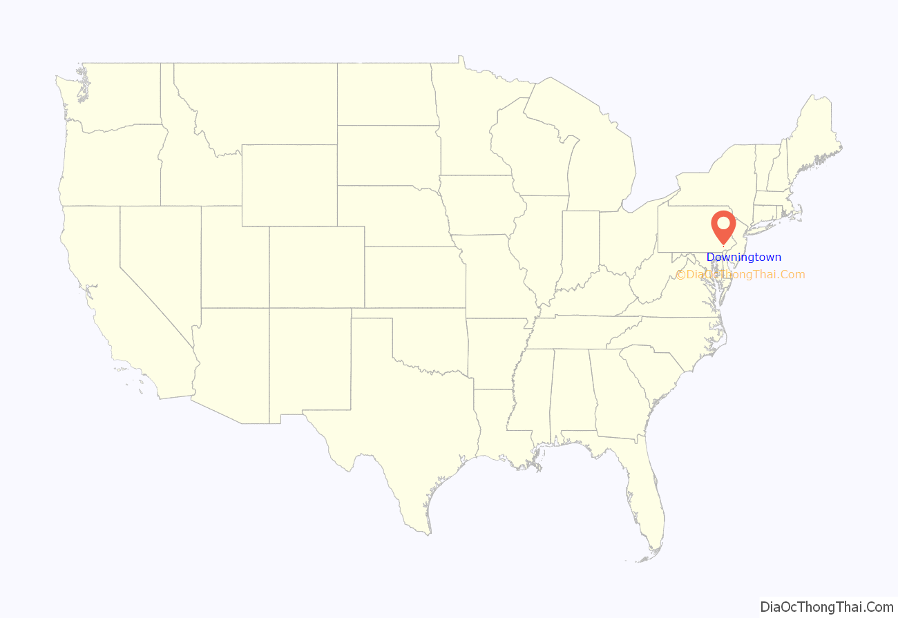
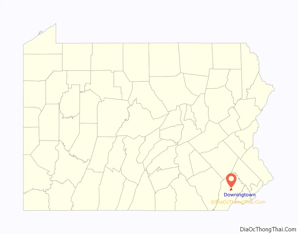
Downingtown location map. Where is Downingtown borough?
History
The town was originally named Milltown due to its number of mills along the East Branch Brandywine Creek, the first of which was founded by Daniel Butter. The Butter family also had paper mills in the area, and Frederick Bicking from Winterburg, Germany, was the patriarch of the Bicking paper families. Around the time of the American Revolution, Milltown became more commonly known as Downingtown after the prominent businessman Thomas Downing, a Quaker immigrant in 1717 from Bradninch, Devon, England, who owned a number of those mills. The town was officially named Downingtown in 1812.
The town is located along the Lincoln Highway (now part of U.S. Route 30), which runs from the East Coast to the West Coast. It was an early westward road in the wagon days as the Philadelphia and Lancaster Turnpike. The Lincoln Highway was the first paved road to cross the nation from the Atlantic to the Pacific Ocean. Construction of the Pennsylvania Turnpike started in the early 1940s and was completed in the early 1950s; it runs north of US 30, bypassing Downingtown.
Circa 1700, early English settlers built what has become known as the Downingtown Log House. In 1713, owner Joseph Hickman sold the 1+1⁄2-story, 21-foot, 9-inch × 25-foot structure to Thomas and Mary Moore. Thomas Moore moved from the Log House in 1729 and died in 1738.
Thomas Downing acquired the Log House in 1739. It remained in the Downing family until 1940, when Thomas W. Downing died and left it to the borough of Downingtown. The borough did some restoration work to the Downingtown Log House in 1947. It served as the home to the Downingtown Chamber of Commerce from 1950 until 1988. But the Log House was deteriorating as Route 30 had been built close to it. Located 18 inches (46 cm) below street level, the house suffered water damage due to runoff from Route 30 and vibration from traffic weakened the structure.
From 1988 until 1990, the Downingtown Historical Society relocated the house and did an extensive restoration with money raised for the project. It now sits approximately 70 feet (21 m) west of its original location, 22 feet (6.7 m) from the Route 30 sidewalk, and slightly above street level.
In 1904, John S. Trower and William A. Creditt, prominent black Philadelphians, founded the Downingtown Industrial and Agricultural School (DIAS) in Downingtown, to serve as an academic and vocational high school for African-American youths to prepare them for work. Creditt was pastor of the First African Baptist Church in Philadelphia, and Trower, a successful caterer and one of the wealthiest black businessmen in the nation, was a member of his congregation. Believing the North needed a school like the Tuskegee Institute, the men found land in Chester County and built the school on a 100-acre campus. They both served as principals until their respective deaths in 1921 (Creditt) and 1921. Originally a private, non-denominational school, in 1907 DIAS began to be state supported. Students were admitted from major northeastern cities. Among its trustees in the early decades was Adam Clayton Powell, Sr., pastor of Abyssinian Baptist Church in Harlem, New York. The school operated until 1993. A new facility was constructed on the property and opened in 2002 as the Chester County campus of the Delaware County Community College.
The city has initiated some widespread and continuing renovation in downtown, particularly to the streetscape; private owners have similarly renovated many commercial buildings. There has also been residential development on recovered industrial lands (brown fields) in the southeastern part of the borough. Downingtown is the location of some large regional and national businesses, including First National Bank of Chester County, and Victory Brewing Company, and formerly DNB First (acquired by S&T Bank in 2019).
President Lincoln’s funeral train passed through Downingtown. The famous Irish patriot and martyr Wolfe Tone briefly lived here.
The County Bridge No. 124, Downingtown Log House, East Lancaster Avenue Historic District, General Washington Inn, and Roger Hunt Mill are listed on the National Register of Historic Places.
Downingtown Road Map
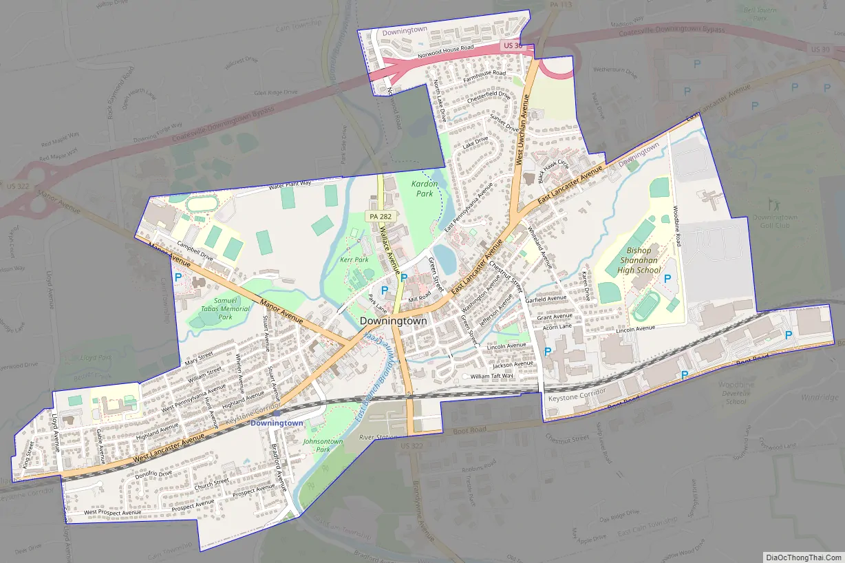
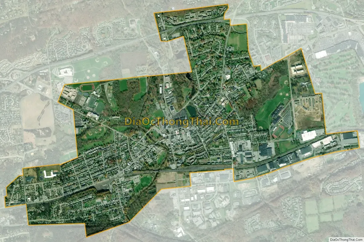
Downingtown city Satellite Map
Geography
Downingtown is located at 40°0′23″N 75°42′22″W / 40.00639°N 75.70611°W / 40.00639; -75.70611 (40.006406, −75.706239).
According to the United States Census Bureau, the borough has a total area of 2.2 square miles (5.7 km), all land.
See also
Map of Pennsylvania State and its subdivision:- Adams
- Allegheny
- Armstrong
- Beaver
- Bedford
- Berks
- Blair
- Bradford
- Bucks
- Butler
- Cambria
- Cameron
- Carbon
- Centre
- Chester
- Clarion
- Clearfield
- Clinton
- Columbia
- Crawford
- Cumberland
- Dauphin
- Delaware
- Elk
- Erie
- Fayette
- Forest
- Franklin
- Fulton
- Greene
- Huntingdon
- Indiana
- Jefferson
- Juniata
- Lackawanna
- Lancaster
- Lawrence
- Lebanon
- Lehigh
- Luzerne
- Lycoming
- Mc Kean
- Mercer
- Mifflin
- Monroe
- Montgomery
- Montour
- Northampton
- Northumberland
- Perry
- Philadelphia
- Pike
- Potter
- Schuylkill
- Snyder
- Somerset
- Sullivan
- Susquehanna
- Tioga
- Union
- Venango
- Warren
- Washington
- Wayne
- Westmoreland
- Wyoming
- York
- Alabama
- Alaska
- Arizona
- Arkansas
- California
- Colorado
- Connecticut
- Delaware
- District of Columbia
- Florida
- Georgia
- Hawaii
- Idaho
- Illinois
- Indiana
- Iowa
- Kansas
- Kentucky
- Louisiana
- Maine
- Maryland
- Massachusetts
- Michigan
- Minnesota
- Mississippi
- Missouri
- Montana
- Nebraska
- Nevada
- New Hampshire
- New Jersey
- New Mexico
- New York
- North Carolina
- North Dakota
- Ohio
- Oklahoma
- Oregon
- Pennsylvania
- Rhode Island
- South Carolina
- South Dakota
- Tennessee
- Texas
- Utah
- Vermont
- Virginia
- Washington
- West Virginia
- Wisconsin
- Wyoming